Safety Score: 2,7 of 5.0 based on data from 9 authorites. Meaning we advice caution when travelling to United States.
Travel warnings are updated daily. Source: Travel Warning United States. Last Update: 2024-05-11 07:34:58
Explore William Dunlap Homes
The district William Dunlap Homes of Maurer in Middlesex County (New Jersey) is located in United States about 185 mi north-east of Washington DC, the country's capital.
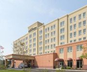
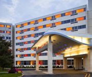
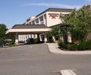
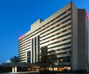
If you need a place to sleep, we compiled a list of available hotels close to the map centre further down the page.
Depending on your travel schedule, you might want to pay a visit to some of the following locations: Staten Island, Elizabeth, New Brunswick, Newark and Freehold. To further explore this place, just scroll down and browse the available info.
Local weather forecast
Todays Local Weather Conditions & Forecast: 13°C / 56 °F
| Morning Temperature | 7°C / 45 °F |
| Evening Temperature | 14°C / 57 °F |
| Night Temperature | 11°C / 51 °F |
| Chance of rainfall | 0% |
| Air Humidity | 47% |
| Air Pressure | 1011 hPa |
| Wind Speed | Gentle Breeze with 9 km/h (5 mph) from North-West |
| Cloud Conditions | Scattered clouds, covering 43% of sky |
| General Conditions | Scattered clouds |
Sunday, 12th of May 2024
10°C (49 °F)
10°C (50 °F)
Light rain, gentle breeze, overcast clouds.
Monday, 13th of May 2024
16°C (60 °F)
15°C (59 °F)
Scattered clouds, gentle breeze.
Tuesday, 14th of May 2024
21°C (69 °F)
16°C (60 °F)
Moderate rain, gentle breeze, overcast clouds.
Hotels and Places to Stay
EXECUTIVE SUITES NEWARK CARTERET
Renaissance Woodbridge Hotel
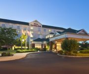
Hampton Inn Woodbridge
Residence Inn Woodbridge Edison/Raritan Center
Home2 Suites by Hilton Rahway NJ
Sheraton Edison Hotel Raritan Center
Fairfield Inn & Suites Woodbridge
Hilton Garden Inn Edison-Raritan Center
Comfort Suites at Woodbridge
E Hotel Banquet & Conference Center
Videos from this area
These are videos related to the place based on their proximity to this place.
Return of The Joker: Episode 1
The Joker has returned from his long slumber. Here we see the joker's journey into power in a completely new city.
Perth Amboy, NJ Attorney | Foreclosure Fraud! Are Your Documents Fake? | 08861 South Amboy
Visit our website or call for a free consultation! http://keaveneylegalgroup.com 1-800-219-0939 Do you suspect your bank may have pulled a fast one? Wondering if your lender cut corners and...
Computer Repair Perth Amboy NJ - Call 732-201-2441
Computer Repair Perth Amboy NJ - FREE diagnostic. Rated http://www.PerthAmboyComputerRepair.com Fast, Affordable and Reliable computer repair services. Looking for professional...
Perth Amboy, NJ Foreclosure Attorney | Do's and Don'ts of HAMP | 08861 South Amboy
Visit our website or call for a free consultation! http://keaveneylegalgroup.com 1-800-219-0939 Are you confused by the process of seeking a modification of ...
2001 BMW 5-Series Used Cars Perth Amboy NJ
http://www.mgmotorsnj.com This 2001 BMW 5-Series is available from MG Motors. For details, call us at 732-442-1900.
Robert Fiance Perth Amboy - SAFARI DAY
Just another day at Robert Fiance Perth Amboy! Showing off our cosmo skills with this Safari Showcase!
Fontanez Martial Arts Perth Amboy NJ
http://www.fontanezmartialarts.com Fontanez Martial Arts is the Leading the Middlesex County Martial Arts Instruction Perth Amboy NJ and Surrounding Areas of...
2005 Volkswagen New Beetle Used Cars Perth Amboy NJ
http://www.mgmotorsnj.com This 2005 Volkswagen New Beetle is available from MG Motors. For details, call us at 732-442-1900.
2000 Honda Odyssey Used Cars Perth Amboy NJ
http://www.mgmotorsnj.com This 2000 Honda Odyssey is available from MG Motors. For details, call us at 732-442-1900.
Videos provided by Youtube are under the copyright of their owners.
Attractions and noteworthy things
Distances are based on the centre of the city/town and sightseeing location. This list contains brief abstracts about monuments, holiday activities, national parcs, museums, organisations and more from the area as well as interesting facts about the region itself. Where available, you'll find the corresponding homepage. Otherwise the related wikipedia article.
Perth Amboy, New Jersey
Perth Amboy is a city in Middlesex County, New Jersey, United States. The City of Perth Amboy is part of the New York metropolitan area. As of the 2010 United States Census, the city's population was 50,814, reflecting an increase of 3,511 (+7.4%) from the 47,303 counted in the 2000 Census, which had in turn increased by 5,336 (+12.7%) from the 41,967 counted in the 1990 Census. Perth Amboy is known as the "City by the Bay," referring to Raritan Bay.
Sewaren, New Jersey
Sewaren is a census-designated place and unincorporated community within Woodbridge Township, in Middlesex County, New Jersey, United States. As of the 2010 United States Census, the CDP's population was 17,011. As of the 2010 United States Census, the CDP's population was 2,756. PSE&G's Sewaren Generating Station is a 582 megawatt facility on 152 acres along the Arthur Kill. The facility had five steam generators and one combustion turbine.
Woodbridge (CDP), New Jersey
Woodbridge is a census-designated place and unincorporated community within Woodbridge Township, in Middlesex County, New Jersey, United States. As of the 2010 United States Census, the CDP's population was 17,011. As of the 2010 United States Census, the CDP's population was 19,265.
Woodbridge Township, New Jersey
Woodbridge Township is a township in Middlesex County, New Jersey, United States. As of the 2010 United States Census, the township had a total population of 99,585, reflecting an increase of 2,382 (+2.5%) from the 97,203 counted in the 2000 Census, which had in turn increased by 4,117 (+4.4%) from the 93,086 counted in the 1990 Census. Woodbridge was the sixth-most-populous municipality in New Jersey in 2010, the same ranking it held a decade earlier.
Outerbridge Crossing
The Outerbridge Crossing is a cantilever bridge which spans the Arthur Kill. The "Outerbridge", as it is commonly known, connects Perth Amboy, New Jersey, with the New York City borough of Staten Island and carries NY-440 and NJ-440, each road ending at the respective state border.
Tottenville, Staten Island
Tottenville with an area of approximately 1.7 square miles, is the southernmost neighborhood of Staten Island, New York City and New York State.
Driscoll Bridge
The Driscoll Bridge is a toll bridge (a series of three spans) on the Garden State Parkway in the U.S. state of New Jersey spanning the Raritan River near its mouth in Raritan Bay. The bridge connects the Middlesex County communities of Woodbridge Township on the north with Sayreville on the south. With a total of 15 travel lanes and 6 shoulder lanes, it is the widest motor vehicle bridge in the world by number of lanes and one of the world's busiest.
Perth Amboy High School
Perth Amboy High School (or PAHS) is a four-year public high school in Perth Amboy, New Jersey, United States. PAHS, which serves grades 9 through 12, is a part of the Perth Amboy Public Schools. The school has been accredited by the Middle States Association of Colleges and Schools Commission on Secondary Schools since 1928. As of the 2010-11 school year, the school had an enrollment of 2,539 students and 140.8 classroom teachers (on an FTE basis), for a student–teacher ratio of 18.03:1.
Edison Bridge (New Jersey)
The Edison Bridge (officially the Thomas Alva Edison Memorial Bridge) is a bridge on US 9 in the U.S. state of New Jersey spanning the Raritan River near its mouth in Raritan Bay. The bridge, which connects Woodbridge Township on the north with Sayreville on the south, was opened to weekend traffic starting on October 11, 1940, and was opened permanently on November 15, 1940.
Eagleswood Military Academy
The Eagleswood Military Academy was a private military academy in Perth Amboy, New Jersey which served antebellum educational needs. The Eagleswood Military Academy was started by Rebecca Spring (1812–1911) and Marcus Spring (1810–1874) in 1861 in the vicinity of the Route 35/Smith Street intersection. The Springs initially started the Raritan Bay Union, as a utopian community in 1853, but the Union closed in 1860. Rebecca had the bodies of A.D. Stevens and A.E.
Victory Bridge (New Jersey)
The Victory Bridge is a highway bridge in the U.S. state of New Jersey that carries Route 35 over the Raritan River, connecting the Middlesex County communities of Perth Amboy on the north and Sayreville to the south. The bridge is operated and maintained by the New Jersey Department of Transportation (NJDOT). The new bridge replaced the old Victory Bridge, dedicated to the U.S. troops who served in World War I and opened in 1926.
Woodbridge Township School District
The Woodbridge Township School District is a comprehensive community public school district that serves students in kindergarten through twelfth grade from Woodbridge Township, in Middlesex County, New Jersey, United States. All schools are accredited by the Middle States Association of Colleges and Schools. As of the 2009-10 school year, the district's 24 schools had an enrollment of 13,204 students and 1,029.0 classroom teachers (on an FTE basis), for a student–teacher ratio of 11.83.
Perth Amboy Public Schools
Perth Amboy Public Schools is a community public school district serving students in prekindergarten through twelfth grade, located in the city of Perth Amboy, in Middlesex County, New Jersey, United States. The district is one of 31 Abbott districts statewide, which are now referred to as "SDA Districts" based on the requirement for the state to cover all costs for school building and renovation projects in these districts under the supervision of the New Jersey Schools Development Authority.
William C. McGinnis Middle School
William C. McGinnis Middle School is a four-year public middle school in Perth Amboy, New Jersey, United States, as part of the Perth Amboy Public Schools. It serves grades 5,6,7, and 8 and is part of Perth Amboy Public Schools. William C. McGinnis School was built in 1899 but was later refurbished in the mid-1990s. The student to computer ratio is 4 to 1. The average class size is 19. The school day is longer than the state average.
Woodbridge (NJT station)
Woodbridge Station is a train station in Woodbridge Township, New Jersey, United States. It is one of three NJT stations in Woodbridge Township, the others being Avenel and Metropark in the Iselin section of the township. The station was built in 1939 as a Depression-era public works project. It currently serves about 1,700 riders a day, making it one of the busiest stations on the North Jersey Coast Line. Station renovation began in 2005 on a new platform and canopy and was completed in 2007.
Perth Amboy Refinery
The Perth Amboy Refinery is a Chevron Corporation refinery that is located between Convery Boulevard and State Street in Perth Amboy, New Jersey. Via rail it is served by Conrail's Chemical Coast and the former Perth Amboy and Woodbridge lines. Oil tankers and lighter can reach the refinery along the Arthur Kill.
Raritan Bay Drawbridge
The Raritan Bay Drawbridge, also known as the Raritan Bay Swing Bridge or Raritan River Railroad Bridge, is a railroad swing bridge crossing the Raritan River a half mile from where in empties into the Raritan Bay in New Jersey. It connects Perth Amboy to the north and South Amboy to the south.
Five Corners, Perth Amboy
Five Corners is the intersection of New Brunswick Ave, State St, and Smith St in Perth Amboy, New Jersey. It is near the eastern end of the downtown area and is marked by the ten-story triangular Five Corners Building (also called the Amboy Towers). This building is the tallest building in the city.
Barber, New Jersey
Barber was a community in Middlesex County, New Jersey. It was active during World War II in building and decommissioning ships for the U.S. Navy. One of the primary ship builders during World War II was the New Jersey Shipbuilding Company. The town also housed the American Smelting and Refining Company. Today it is part of the city of Perth Amboy.
Tottenville (Staten Island Railway station)
Tottenville is a Staten Island Railway station in the neighborhood of Tottenville, Staten Island, New York. Located near Main Street and Arthur Kill Road, it is the southern terminus on the main line and the southernmost railway station in New York State. This is a grade-level station with two tracks and an island platform. There are three tracks to the east of the platform for storing trains. All five tracks end at bumper blocks at their south ends.
Atlantic (Staten Island Railway station)
Atlantic is a Staten Island Railway station in the neighborhood of Tottenville, Staten Island, New York. Located roughly at Fisher Avenue and Arthur Kill Road on the main line, it is at grade level with side platforms that can hold only one car. Unlike most short platforms where the first car goes to the train platform, at Atlantic, the last car only goes to the platform.
Staten Island Peace Conference
The Staten Island Peace Conference was a brief meeting held in the hope of bringing an end to the American Revolutionary War. The conference took place on September 11, 1776, at Billop Manor, the residence of Colonel Christopher Billop, on Staten Island, New York. The participants were the British Admiral Lord Richard Howe, and members of the Second Continental Congress John Adams, Benjamin Franklin, and Edward Rutledge.
St. James Catholic Church (Woodbridge, New Jersey)
St. James Catholic Church is located in Woodbridge, New Jersey. With approximately 4,000 registered families, St. James is one of the largest parishes in the Roman Catholic Diocese of Metuchen.
Woodbridge train wreck
The Woodbridge train wreck occurred on February 6, 1951 in Woodbridge, New Jersey when a train derailed crossing a temporary wooden trestle, killing 85 people. It is the third worst train disaster in American history, and the deadliest since 1918.
Perth Amboy Public Library
The Perth Amboy Public Library is the free public library in the city of Perth Amboy, New Jersey located at 196 Jefferson Street.


