Safety Score: 2,7 of 5.0 based on data from 9 authorites. Meaning we advice caution when travelling to United States.
Travel warnings are updated daily. Source: Travel Warning United States. Last Update: 2024-04-29 08:03:39
Touring Darlington
Darlington in Bergen County (New Jersey) is a town located in United States about 214 mi (or 344 km) north-east of Washington DC, the country's capital place.
Time in Darlington is now 07:03 AM (Monday). The local timezone is named America / New York with an UTC offset of -4 hours. We know of 9 airports nearby Darlington, of which 4 are larger airports. The closest airport in United States is Morristown Municipal Airport in a distance of 23 mi (or 37 km), South-West. Besides the airports, there are other travel options available (check left side).
There are two Unesco world heritage sites nearby. The closest heritage site in United States is Statue of Liberty in a distance of 29 mi (or 47 km), South-East. Also, if you like the game of golf, there are several options within driving distance. We collected 9 points of interest near this location. Need some hints on where to stay? We compiled a list of available hotels close to the map centre further down the page.
Being here already, you might want to pay a visit to some of the following locations: Paterson, New City, Hackensack, Newark and Goshen. To further explore this place, just scroll down and browse the available info.
Local weather forecast
Todays Local Weather Conditions & Forecast: 25°C / 76 °F
| Morning Temperature | 15°C / 59 °F |
| Evening Temperature | 23°C / 73 °F |
| Night Temperature | 17°C / 63 °F |
| Chance of rainfall | 0% |
| Air Humidity | 52% |
| Air Pressure | 1016 hPa |
| Wind Speed | Gentle Breeze with 6 km/h (4 mph) from South-East |
| Cloud Conditions | Scattered clouds, covering 30% of sky |
| General Conditions | Light rain |
Monday, 29th of April 2024
17°C (63 °F)
13°C (55 °F)
Light rain, gentle breeze, overcast clouds.
Tuesday, 30th of April 2024
12°C (54 °F)
10°C (50 °F)
Overcast clouds, light breeze.
Wednesday, 1st of May 2024
18°C (64 °F)
11°C (52 °F)
Broken clouds, gentle breeze.
Hotels and Places to Stay
Sheraton Mahwah Hotel
DoubleTree by Hilton Mahwah
Crowne Plaza SUFFERN-MAHWAH
Fairfield Inn & Suites Mahwah
Courtyard Mahwah
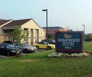
Homewood Suites by Hilton Mahwah
Comfort Suites
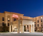
Hampton Inn - Suites Mahwah NJ
Residence Inn Saddle River
BEST WESTERN THE INN AT RAMSEY
Videos from this area
These are videos related to the place based on their proximity to this place.
Mall and Starview Gardens Apartments For Rent - Mahwah, NJ
Mahwah apartments - Mall and Starview Gardens apartments for rent in Mahwah, NJ. Get into the swing of things! Call 877.820.1259 or Visit ...
83 E MAHWAH RD. MLS # 1134340, MAHWAH, NJ 07430
http://83emahwahrdmls1134340.epropertysites.com?rs=youtube ADORABLE EXPANDED CRAFTSMAN STYLE CAPE COD IN DESIRABLE CRAGMERE SECTION OF MAHWAH, NJ. LOW TAXES!
Ramapo River in Mahwah flooding after Hurricane Irene
Sunday afternoon after Hurricane Irene, Aug. 28, 2011 showing Ramapo River spilling on to Route 17 in front of the Marriott Courtyard, less than a mile away from the New York State Thruway...
Illusions Night Club Sheraton Mahwah Hotel Bat Mitzvah
Illusions Night Club at Sheraton Mahwah Hotel NJ Bat-Mitzvah Photography by Garden State Wedding Studio. Visit us at GardenStateWeddingStudio.com.
Norfolk Southern H07 at Mahwah, New Jersey
Date: Sunday, April 11, 2010 Railroad: Norfolk Southern Host Railroad: New Jersey Transit Host Railroad Track Name: NJT Main Line Tenant Railroad Name: N/A Train origin: NS Croxton Yard...
Lindvale Gardens Apartments - Mahwah Apartments For Rent
Mahwah Apartments - Lindvale Gardens Apartments For Rent | 101 Bellgrove Dr. Mahwah, NJ 07430 | For more info visit ...
Vintage Dover Oildraulic elevator at DoubleTree by Hilton, Mahwah, NJ
Unfortunately this got cut short when the elevator picked up about 8 passengers on the 4th floor and one of them complained about the fact that I was videotaping, even though I didn't point...
Tennis Match in Mahwah
Players in this video Bhabani & Aj Bhaskar & Harun Camera Man - Sasanka & Praveen.
Videos provided by Youtube are under the copyright of their owners.
Attractions and noteworthy things
Distances are based on the centre of the city/town and sightseeing location. This list contains brief abstracts about monuments, holiday activities, national parcs, museums, organisations and more from the area as well as interesting facts about the region itself. Where available, you'll find the corresponding homepage. Otherwise the related wikipedia article.
Mahwah, New Jersey
Mahwah is a township in Bergen County, New Jersey, United States. As of the 2010 United States Census, the township's population was 25,890. The population increased by 1,828 (+7.6%) from the 24,062 counted in the 2000 Census, which had in turn increased by 6,157 (+34.4%) from the 17,905 counted in the 1990 Census. The name "Mahwah" is derived from the Lenape word "mawewi" which means "Meeting Place" or "Place Where Paths Meet".
Long Path
The Long Path is a 347.4-mile long-distance hiking trail beginning at the George Washington Bridge in Fort Lee, New Jersey and ending at Altamont, New York, in the Albany area. While not yet a continuous trail, relying on road walks in some areas, it nevertheless takes in many of the popular hiking attractions west of the Hudson River, such as the New Jersey Palisades, Harriman State Park, the Shawangunk Ridge and the Catskill Mountains.
Mahwah High School
Mahwah High School (MHS) is the four-year comprehensive public high school serving students from Mahwah, Bergen County, New Jersey, operating as the only high school of the Mahwah Township Public Schools. The school is accredited by the New Jersey Department of Education and has been accredited by the Middle States Association of Colleges and Schools Commission on Secondary Schools since 1962.
Mahwah Township Public Schools
The Mahwah Township Public Schools is a comprehensive community public school district that serves students in Kindergarten through twelfth grade from Mahwah, in Bergen County, New Jersey, United States. As of the 2009-10 school year, the district's six schools had an enrollment of 3,468 students and 248 classroom teachers (on an FTE basis), for a student–teacher ratio of 13.98.
Houvenkopf Mountain
Houvenkopf or Hovenkopf Mountain is a mountain in Bergen County, New Jersey, extending into New York, where it forms the western side of the southern entrance to Ramapo Pass. The major peak on the New Jersey side rises to 931 feet and is known as Stag Hill. It is separated by a deep saddle from the major peak on the New York side, the "Hooge Kop" proper, which rises to about 770 feet and overlooks Hillburn to the north and Suffern to the east. It is part of the Ramapo Mountains.
WRPR
WRPR is a freeform student radio station. Licensed to Mahwah, New Jersey, United States. The station is currently owned by Ramapo College of New Jersey. Its calls were assigned on October 9, 1979, and it began broadcasting on 1980-07-15. WRPR today can be heard on 90.3 FM in the Mahwah, New Jersey area, as well as on Ramapo College's closed circuit television system on channel 3 (campus events channel) and channel 10 (live video feed from the studio).
Ramapo College
Ramapo College of New Jersey is a public liberal arts and professional studies institution of the New Jersey system of higher education, located in Mahwah, New Jersey near the Ramapo Mountains. It was named a "2011-2012 Best-Value Public College" by Kiplinger's Personal Finance magazine, one of the top schools in the Northeast by the Princeton Review and ranked 6th out of 42 public universities in the North category in the U.S. News and World Report's latest edition of "America's Best Colleges."
Mahwah River
The Mahwah River is a tributary of the Ramapo River in Rockland County, New York and Bergen County, New Jersey in the United States. The Mahwah River runs on a meandering SSW course for about 11 mi (18 km) from its headwaters just north of the hamlet of Ladentown, New York to its mouth which empties into the Ramapo River in Mahwah, New Jersey, just south of the village of Suffern, New York, and the state line.


