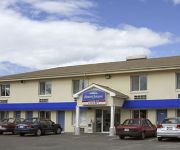
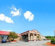
Safety Score: 2,7 of 5.0 based on data from 9 authorites. Meaning we advice caution when travelling to United States.
Travel warnings are updated daily. Source: Travel Warning United States. Last Update: 2024-05-08 08:04:21
Discover Scott Corners
Scott Corners in Hampden County (Massachusetts) is a city in United States about 329 mi (or 529 km) north-east of Washington DC, the country's capital city.
Local time in Scott Corners is now 06:07 PM (Wednesday). The local timezone is named America / New York with an UTC offset of -4 hours. We know of 12 airports in the vicinity of Scott Corners, of which 5 are larger airports. The closest airport in United States is Westover ARB/Metropolitan Airport in a distance of 2 mi (or 3 km), North-West. Besides the airports, there are other travel options available (check left side).
There is one Unesco world heritage site nearby. It's Statue of Liberty in a distance of 128 mi (or 205 km), South-West. Also, if you like golfing, there are a few options in driving distance. Looking for a place to stay? we compiled a list of available hotels close to the map centre further down the page.
When in this area, you might want to pay a visit to some of the following locations: Hartford, Worcester, Keene, Newfane and Johnston. To further explore this place, just scroll down and browse the available info.
Local weather forecast
Todays Local Weather Conditions & Forecast: 19°C / 66 °F
| Morning Temperature | 11°C / 52 °F |
| Evening Temperature | 23°C / 73 °F |
| Night Temperature | 13°C / 55 °F |
| Chance of rainfall | 4% |
| Air Humidity | 94% |
| Air Pressure | 1001 hPa |
| Wind Speed | Light breeze with 4 km/h (3 mph) from North-East |
| Cloud Conditions | Overcast clouds, covering 100% of sky |
| General Conditions | Light rain |
Wednesday, 8th of May 2024
18°C (65 °F)
9°C (48 °F)
Moderate rain, gentle breeze, overcast clouds.
Thursday, 9th of May 2024
8°C (47 °F)
6°C (42 °F)
Moderate rain, gentle breeze, overcast clouds.
Friday, 10th of May 2024
7°C (45 °F)
6°C (43 °F)
Moderate rain, gentle breeze, overcast clouds.
Hotels and Places to Stay
Springfield Marriott
Sheraton Springfield Monarch Place Hotel
Hampton Inn Chicopee-Springfield MA
Tru by Hilton Chicopee Springfield
Residence Inn Springfield Chicopee
Holiday Inn Express LUDLOW - CHICOPEE AREA
Wilbraham Inn
HOWARD JOHNSON EXPRESS - SPRIN
MOTEL 6 SPRINGFIELD - CHICOPEE
Econo Lodge Chicopee
Videos from this area
These are videos related to the place based on their proximity to this place.
2005 BMW X3 Used Cars Ludlow MA
http://www.beachsidemotorsct.com This 2005 BMW X3 is available from Beachside Motors, Inc. CT. For details, call us at 413-589-0833.
Ludlow Bounce House Party Tent Rentals Western MA 413-206-9801
www.bouncehouserentalsinludlow.com Ludlow Bounce House Party Tent Rentals Western MA Ludlow MA 01056 413-206-9801 Bounce House Rentals in Ludlow MA ...
Ludlow parents speak out at meeting
Wednesday night the Ludlow School committee met again. This is the first public meeting of parents and officials since all 5 Ludlow schools were unexpectedly closed for the week.
2005 Dodge SRT-4 Used Cars Ludlow MA
http://www.beachsidemotorsct.com This 2005 Dodge SRT-4 is available from Beachside Motors, Inc. CT. For details, call us at 413-589-0833.
Crash closes Mass Pike West in Ludlow
Traffic is backed up on the Mass Pike in Ludlow, following a crash on the westbound side just past Exit 7.
Aaron Saunders Memorial Day Speech - Ludlow, MA
Massachusetts State Senate candidate Aaron Saunders speaking at the Ludlow Memorial Day Parade on Monday, May 26, 2014.
Police identify victims of a wrong way crash in Ludlow Mass
Police identify victims of a wrong way crash in Ludlow Mass.
2004 Volkswagen Touareg Used Cars Ludlow MA
http://www.beachsidemotorsct.com This 2004 Volkswagen Touareg is available from Beachside Motors, Inc. CT. For details, call us at 413-589-0833.
Ludlow Mills to add two major tenants
The Ludlow Mills has been purchased by Westmass and will add two major tenants to the site.
Thanksgiving Service Union Church of Christ
Recorded on November 22, 2010 Joint Thanksgiving Service with First Church in Ludlow Ma. Union Church of Christ Ludlow Ma. and Grace Union Church Wilbraham Ma.
Videos provided by Youtube are under the copyright of their owners.
Attractions and noteworthy things
Distances are based on the centre of the city/town and sightseeing location. This list contains brief abstracts about monuments, holiday activities, national parcs, museums, organisations and more from the area as well as interesting facts about the region itself. Where available, you'll find the corresponding homepage. Otherwise the related wikipedia article.
Westover Metropolitan Airport
Westover Metropolitan Airport is a civilian airport located in the Massachusetts communities of Chicopee, Granby, and Ludlow, near the cities of Springfield and Holyoke, Massachusetts. The complex is considered intermodal because it borders the Massachusetts Turnpike and is accessible by several industrial rail spurs. It was named for General Oscar Westover, commanding officer of the Army Air Corps in the 1930s.
Chicopee Memorial State Park
Chicopee Memorial State Park is a Massachusetts state park located in the Burnett Road neighborhood of Chicopee. The park is managed by the Department of Conservation and Recreation.
Lupa Zoo
Lupa Zoo is an 18-acre privately owned and operated zoo located in Ludlow, Massachusetts, United States. The zoo was created by Henry Lupa, who immigrated from Poland, started a landscaping business, then a construction business, and was finally able to create the zoo.
Stony Brook Air Force Station
Stony Brook Air Force Station is a former Air Force Station that operated from the 1950s until 1972. It is located in Ludlow, Massachusetts, adjacent to Westover Joint Air Reserve Base. Between 1954 and 1962 Stony Brook AFS was an Operational Storage Site for Air Materiel Command (AMC-OSS), one of five in the United States, and the nuclear weapons storage and maintenance facility for Westover Air Force Base alert aircraft.
Immaculate Conception Parish, Indian Orchard
Immaculate Conception Parish - Roman Catholic parish, designated for Polish immigrants in Indian Orchard, Massachusetts, United States. Founded 1904. It is one of the Polish-American Roman Catholic parishes in New England in the Diocese of Springfield in Massachusetts. Parish scheduled to close in 2009 but parish given an extension by the Bishop of Springfield to June 2010. The parish is seeking to become an Historical District to protect all the buildings.
Christ the King Parish, Ludlow
Christ the King Parish - designated for Polish immigrants in Ludlow, Massachusetts, United States. Founded 1948. It is one of the Polish-American Roman Catholic parishes in New England in the Diocese of Springfield in Massachusetts. The architect of the 1940 church was Anthony J. DePace of New York who designed more than 30 buildings for catholic clients during the middle years of the 20th century.
Westover Air Reserve Base
Westover Air Reserve Base is an Air Force Reserve Command (AFRC) installation located in the Massachusetts communities of Chicopee and Ludlow, near the city of Springfield, Massachusetts. Westover hosts the largest Air Reserve Base in the world in terms of area. Until 2011, it was a backup landing site for the NASA Space Shuttle and in the past few years has expanded to include a growing civilian access airport sharing Westover's military-maintained runways.
Indian Orchard, Springfield, Massachusetts
Indian Orchard is a neighborhood in the City of Springfield, Massachusetts. It is located in the northeastern corner of the city, beginning about four and a half miles from Metro Center. Containing 1,251 acres plus rights of way and water bodies, it is the fifth largest of Springfield's seventeen neighborhoods.


