Safety Score: 2,7 of 5.0 based on data from 9 authorites. Meaning we advice caution when travelling to United States.
Travel warnings are updated daily. Source: Travel Warning United States. Last Update: 2024-05-16 08:19:50
Delve into Whitcomb Summit
Whitcomb Summit in Berkshire County (Massachusetts) is located in United States about 336 mi (or 540 km) north-east of Washington DC, the country's capital town.
Current time in Whitcomb Summit is now 08:12 PM (Thursday). The local timezone is named America / New York with an UTC offset of -4 hours. We know of 12 airports close to Whitcomb Summit, of which 5 are larger airports. The closest airport in United States is Albany International Airport in a distance of 40 mi (or 64 km), West. Besides the airports, there are other travel options available (check left side).
Also, if you like playing golf, there are some options within driving distance. If you need a hotel, we compiled a list of available hotels close to the map centre further down the page.
While being here, you might want to pay a visit to some of the following locations: Newfane, Troy, Albany, Keene and Fort Edward. To further explore this place, just scroll down and browse the available info.
Local weather forecast
Todays Local Weather Conditions & Forecast: 20°C / 69 °F
| Morning Temperature | 11°C / 53 °F |
| Evening Temperature | 20°C / 67 °F |
| Night Temperature | 13°C / 55 °F |
| Chance of rainfall | 0% |
| Air Humidity | 53% |
| Air Pressure | 1016 hPa |
| Wind Speed | Gentle Breeze with 7 km/h (4 mph) from North-West |
| Cloud Conditions | Overcast clouds, covering 98% of sky |
| General Conditions | Overcast clouds |
Friday, 17th of May 2024
20°C (68 °F)
12°C (54 °F)
Overcast clouds, light breeze.
Saturday, 18th of May 2024
20°C (67 °F)
11°C (52 °F)
Sky is clear, light breeze, clear sky.
Sunday, 19th of May 2024
21°C (70 °F)
13°C (55 °F)
Sky is clear, gentle breeze, clear sky.
Hotels and Places to Stay
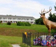
Rose and Goat Retreat
Whitcomb Summit Retreat
Videos from this area
These are videos related to the place based on their proximity to this place.
Eclipse Dam in North Adams, Mass.
The Eclipse Dam and Hoosic River were foaming with mud and water on Sunday afternoon during the downpour caused by Tropical Storm Irene.
Snocross North Adams,MA 2/15/15 #2
2015 East Coast Snocross at The Range. They let us drive right up to the netting at the track due to weather. Pro Open Class final-Sunday.
Snocross North Adams,MA 2/14/15 #5
2015 East Coast Snocross at The Range Trail class finals-Saturday.
76 Cherry St North Adams MA 01247
View full virtual tour: http://www.justsnooping.com/tours/2541221/
4 Wheeling Old Florida Rd. Adams to Savoy, MA
This was our most challenging trip yet! We had a blast! We had to pick our line carefully, there were 3 foot boulders in most places. This was serious flexed out wheeling! Its absolutely...
Beavers Swimming in the great Deerfield River
A talking beaver swims around giving fishing advice to all the fishermen. In the Deerfield river while I was fishing. This was a camping trip in north west Massachusetts last summer.
Videos provided by Youtube are under the copyright of their owners.
Attractions and noteworthy things
Distances are based on the centre of the city/town and sightseeing location. This list contains brief abstracts about monuments, holiday activities, national parcs, museums, organisations and more from the area as well as interesting facts about the region itself. Where available, you'll find the corresponding homepage. Otherwise the related wikipedia article.
Hoosac Tunnel
The Hoosac Tunnel (also called Hoosic or Hoosick Tunnel) is a 4.75-mile-long (7.64 km) railroad tunnel in western Massachusetts which passes through the Hoosac Range, an extension of Vermont's Green Mountains. Work began in 1848 and was finally completed in 1875. At the time of completion, it was the second longest tunnel in the world (after the 8.5-mile-long Mont Cenis Tunnel through the French Alps).
Hoosac Range
The Hoosac Range is part of both the Berkshires of western Massachusetts and the southern Green Mountains of Vermont; it is part of the greater Appalachian Mountain chain. Notable peaks include Haystack Mountain and Mount Snow in Vermont and Spruce Mountain in Massachusetts, as well as the Berkshires high point, Crum Hill, in the town of Monroe, Massachusetts. The 4.75 mile Hoosac Tunnel passes through the range.
Bakke Mountain Wind Farm
Bakke Mountain Wind Farm is a proposed wind farm located in Bakke Mountain, Massachusetts. It is also known as the Hoosac Wind Project.
WUPE-FM
WUPE-FM is a radio station broadcasting an oldies format. Licensed to North Adams, Massachusetts, USA, WUPE-FM serves the Pittsfield area. The station is currently owned by Vox Communications.
Barnum's Aquarial Gardens
Barnum's Aquarial Gardens (June 1862 - February 1863) in Boston, Massachusetts, USA, was a public aquarium, zoo, and performance space located on Washington Street in the Financial District. P.T. Barnum bought the Boston Aquarial and Zoological Gardens in 1862, remodelled the space, changed the name of the business, and re-opened the collections to the public in June. In contrast to its earlier incarnation, the place became more of a show-hall than a serious scientific establishment.
Boston Aquarial and Zoological Gardens
The Boston Aquarial and Zoological Gardens (October 1860 - June 1862) in Boston, Massachusetts, featured a public aquarium and zoo. It was located in the Financial District on Central Court. On display were "hundreds of specimens of the finny tribe there to be seen sporting in their native element, in all their variety of hue and shape" as well as other animals. James Ambrose Cutting and Henry D. Butler ran the business, derived from an earlier incarnation known as the Boston Aquarial Gardens.


