Safety Score: 3,0 of 5.0 based on data from 9 authorites. Meaning we advice caution when travelling to United Kingdom.
Travel warnings are updated daily. Source: Travel Warning United Kingdom. Last Update: 2024-05-16 08:19:50
Discover Darras Hall
The district Darras Hall of Ponteland in Northumberland (England) with it's 15,000 citizens Darras Hall is a district in United Kingdom about 253 mi north of London, the country's capital city.
Looking for a place to stay? we compiled a list of available hotels close to the map centre further down the page.
When in this area, you might want to pay a visit to some of the following locations: Dinnington, Horsley, Meldon, Stannington and Morpeth. To further explore this place, just scroll down and browse the available info.
Local weather forecast
Todays Local Weather Conditions & Forecast: 14°C / 57 °F
| Morning Temperature | 12°C / 54 °F |
| Evening Temperature | 14°C / 56 °F |
| Night Temperature | 12°C / 53 °F |
| Chance of rainfall | 0% |
| Air Humidity | 84% |
| Air Pressure | 1008 hPa |
| Wind Speed | Moderate breeze with 9 km/h (6 mph) from South-West |
| Cloud Conditions | Overcast clouds, covering 96% of sky |
| General Conditions | Light rain |
Friday, 17th of May 2024
15°C (59 °F)
11°C (52 °F)
Overcast clouds, gentle breeze.
Saturday, 18th of May 2024
16°C (62 °F)
10°C (50 °F)
Overcast clouds, gentle breeze.
Sunday, 19th of May 2024
16°C (61 °F)
9°C (48 °F)
Few clouds, moderate breeze.
Hotels and Places to Stay
DoubleTree by Hilton Hotel Newcastle International Airport
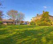
Close House
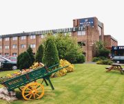
Britannia Newcastle Airport
Horton Grange
TRAVELODGE GATESHEAD
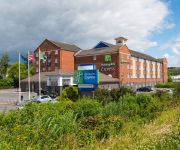
Holiday Inn Express NEWCASTLE - METRO CENTRE
Newcastle Airport
Videos from this area
These are videos related to the place based on their proximity to this place.
Jet2.com Airbus A320-223 | Newcastle to Murcia **Full Flight**
1st July 2013 saw my first holiday in 2013. Murcia with the family gave me an opportunity to get some more footage and upload! I hope you all like this FULL FLIGHT from Newcastle to San Javier....
BRITISH AIRWAY 787 & EMIRATES 777 @ NEWCASTLE | HD LANDING AND TAKEOFF
8th August saw the British Airways Boeing 787-8 Dreamliner visit Newcastle on its trip from Kent to Heathrow via East Midlands, Newcastle and Edinburgh. It was a great site to see such an iconic...
Jet2.com Boeing 737-36N | Newcastle to Murcia **Full Flight**
In August this year me and my parents had our annual trip to Spain, as always I was ready with my camera...this time it was my friends actually, so thanks to Patchy for the GoPro Hero 1! Still...
Charging A Nissan Leaf At Newcastle Airport
My little trip to Newcastle Airport to try out the EV chargers they have in their short stay car park. WARNING! This video contains numptees!
FULL POWER + FAST 777-300ER TAKEOFF | Emirates B777-300ER @ Newcastle | Crosswind | Super HD 1080p
Regarding the title, I think it is appropriate as the aircraft was approximately half loaded with fuel and only took up 4500ft of runway, I saw this and seized the opportunity to have a...
Videos provided by Youtube are under the copyright of their owners.
Attractions and noteworthy things
Distances are based on the centre of the city/town and sightseeing location. This list contains brief abstracts about monuments, holiday activities, national parcs, museums, organisations and more from the area as well as interesting facts about the region itself. Where available, you'll find the corresponding homepage. Otherwise the related wikipedia article.
Battle of Newburn
The Battle of Newburn was fought on 28 August 1640 during the Second Bishops' War between a Scottish Covenanter army led by General Alexander Leslie and English royalist forces commanded by Edward, Lord Conway. Conway, heavily outnumbered, was defeated, and the Scots went on to occupy the town of Newcastle, obtaining a stranglehold on London's coal supply.
Newcastle upon Tyne North (UK Parliament constituency)
Newcastle upon Tyne North is a constituency represented in the House of Commons of the UK Parliament since 2010 by Catherine McKinnell of the Labour Party.
Callerton Parkway Metro station
Callerton Parkway station, in Newcastle upon Tyne, is a station on the Tyne and Wear Metro Green line, which opened on 17 November 1991, when the line was extended to Newcastle Airport. It is not located near any significant housing estates, and as a result is one of the Metro stations with the lowest patronage. Because of good road links, the station is used as a transfer point to buses travelling to locations in Northumberland.
Ryton & Crawcrook Albion F.C
Ryton & Crawcrook Albion F.C. is an English non-league football club from Crawcrook, near Ryton, in Tyne and Wear, currently playing in the Northern League Division Two. The team, nicknamed "Albion", play their home games at Kingsley Park Stadium. They were known as Ryton until 2011.
Ponteland United F.C
Ponteland United F.C. is a football club based in Ponteland, near Newcastle-upon-Tyne in England. They currently play in the Northern Football Alliance Division One. They play at Ponteland Leisure Centre.
Airport Metro station (Tyne and Wear)
Airport is a terminus station of the Green line of the Tyne and Wear Metro that serves Newcastle Airport, Newcastle upon Tyne. Services towards Sunderland via Newcastle upon Tyne city centre operate between the hours of 0500 and 2300 daily, with a journey time to Newcastle's Central Station of 26 minutes and to Sunderland city centre in about 54 minutes. The frequency of services is generally every 12 minutes during the daytime and every 15 minutes during the evening and on Sundays.
Close House, Northumberland
Close House is a Grade II* listed former mansion house, now a hotel and country club near Heddon-on-the-Wall, Northumberland. A monastic house occupied the site in the 14th century. A later house on the site was sold by the Read family in 1626 to Robert Berwicke (1573–1641) a Merchant Adventurer of Newcastle on Tyne, who was Sheriff of that city in 1615 and Mayor 1628 and 1637. The Berwicke family held the estate for over 300 years.
Ogle Castle
Ogle Castle is a former fortified manor house at Ogle, near Whalton, Northumberland. It is a Scheduled Ancient Monument and a Grade I listed building. William the Conqueror granted a deed to Humphrey de Hoggell (Ogle) to enjoy "all the liberties and royalties of his manor" after the conquest. The Ogle family held the estate from before the Norman Conquest until 1597 when it passed by marriage to the Cavendish family and later to Hollis.
Military Road (Northumberland)
The Military Road is a name given locally to part of the B6318 road in Northumberland, England, which runs from Heddon-on-the-Wall in the east to Greenhead in the west. For much of its length the road is straight and displays the characteristics of a Roman road. However the term "military road" comes from the building of the road by Hanoverian forces in 1746 in order to suppress the Jacobites to the North.
Newcastle University Boat Club
Newcastle University Boat Club (NUBC) is the rowing club of Newcastle University, UK. Established in March 1911 as the boat club for Armstrong College, it celebrated its centenary in 2011.
RAF Woolsington
RAF Woolsington opened as a civil airport in July 1935 and was requisitioned by the Royal Air Force on the outbreak of World War II. It served at various times as a satellite of both RAF Acklington and RAF Ouston but saw little operational flying. On one notable occasion in 1940, however, a Spitfire of No. 72 Squadron RAF flying out of Woolsington actually shot down a Ju88 at night - a remarkable achievement for an aircraft considered unsuitable for night fighting.
Newburn Bridge
Newburn Bridge is a road bridge crossing the River Tyne at Newburn in Newcastle upon Tyne, England. It links Newburn, Walbottle and Throckley on the north side of the river with Ryton, Stella and Blaydon on the south side. The bridge is the western most crossing of the Tyne in the county of Tyne and Wear; the next crossing upstream, Wylam Bridge, is in Northumberland.
Rudchester Mithraeum
Rudchester Mithraeum is a Roman Temple to the Roman god Mithras at Rudchester, an auxiliary fort on Hadrian's Wall, the northern frontier of Roman Britain. The temple (known as a mithraeum) was located 137m to the west of the castra.
Castle Ward Rural District
Castle Ward was a rural district of the administrative county of Northumberland, England from 1894 to 1974, covering an area north-west of the city of Newcastle upon Tyne. It was named after the historic Castle ward of Northumberland. In 1974, under the Local Government Act 1972, most of it was merged to form part of the Castle Morpeth district, with part going to the metropolitan borough of Newcastle. The council offices were located in Ponteland.
Druid Park
Druid Park (originally known as the Wheatsheaf Ground) is a multi-purpose stadium in Woolsington, north of Newcastle upon Tyne in England. It is currently used mostly for rugby union matches and is the home stadium of Gosforth RFC.
Knop Law Primary School
This very popular school in Newcastle-upon-Tyne regularly finishes each year with the best results in the Local Authority. It has been commended by parents and the local community for it's full and varied provision. It states on the school website: Our purpose at Knop Law Primary School is to provide an education programme which will meet the needs and interests of every child in our school, and to provide an environment in which all the children can achieve their full potential.
George Stephenson's Birthplace
George Stephenson's Birthplace is the 18th-century stone cottage home of rail pioneer George Stephenson. Located along the north bank of the River Tyne in the village of Wylam, Northumberland, the cottage is owned by the National Trust and is open to the public as a historic house museum. The house also features exhibits about Stephenson's Rocket, an early steam locomotive. The Museum is open to the public on Bank Holiday Mondays and has a small tearoom.
Tyne Rowing Club
Tyne Rowing Club (TRC) is the longest established rowing club in Newcastle upon Tyne, UK. Founded in 1852, the club is among the oldest sporting clubs in England.
Milecastle 9
Milecastle 9 (Chapel House) was a milecastle of the Roman Hadrian's Wall. Its remains exist partially as a low platform, and are located in West Denton (to the west of Newcastle upon Tyne), 300 yards from Chapel House Farm. However, the northern part of the remains are now mostly covered by the modern roads. The milecastle marks a watershed between those with relatively well defined positions (to the west) and those whose position are less certain (to the east).
Milecastle 10
Milecastle 10 (Walbottle Dene) was a milecastle of the Roman Hadrian's Wall. It is located near to the modern village of Throckley in Tyne and Wear, northern England. Much of the milecastle lies beneath a road but partial remains of the north wall can be seen in the garden of Dene House. It has been excavated several times and its walls located, though the remains have been "considerably damaged by ploughing". Only one of the two associated turrets has been located and excavated.
Milecastle 11
Milecastle 11 (Throckley Bank Top) was a milecastle of the Roman Hadrian's Wall. No remains exist, but the measured position is the middle of the old village of Throckley Bank Top, under the Working Men's Club.
Milecastle 12
Milecastle 12 (Heddon) was a milecastle of the Roman Hadrian's Wall. Its remains lay under Town Farm, Heddon-on-the-Wall, (just opposite the farm house) with nothing visible on the surface.
Milecastle 13
Milecastle 13 (Rudchester Burn) was a milecastle of the Roman Hadrian's Wall. Its remains exist as a low platform south of the B6318 Military Road.
Ponteland Castle
Ponteland Castle is a 13th century stone tower house on the A696 road, 8 miles north-west of Newcastle upon Tyne, in Northumberland. Founded by William de Valence, part of it was destroyed in a Scottish raid in 1388. In the 17th century is became part of a Jacobean manor house.
Milecastle 34
Milecastle 34 (Grindon) was a milecastle of the Roman Hadrian's Wall. There are no visible remains, but the site is within a small, tree-filled, walled enclosure located around 0.5 kilometres east of Sewingshields farm.


