Safety Score: 3,0 of 5.0 based on data from 9 authorites. Meaning we advice caution when travelling to United Kingdom.
Travel warnings are updated daily. Source: Travel Warning United Kingdom. Last Update: 2024-05-01 08:01:32
Delve into Bingfield
Bingfield in Northumberland (England) is a town located in United Kingdom about 257 mi (or 413 km) north of London, the country's capital town.
Time in Bingfield is now 09:28 PM (Wednesday). The local timezone is named Europe / London with an UTC offset of one hour. We know of 10 airports closer to Bingfield, of which 5 are larger airports. The closest airport in United Kingdom is Newcastle Airport in a distance of 14 mi (or 22 km), East. Besides the airports, there are other travel options available (check left side).
There are several Unesco world heritage sites nearby. The closest heritage site is Frontiers of the Roman Empire in Germany at a distance of 25 mi (or 41 km). The closest in United Kingdom is New Lanark in a distance of 43 mi (or 41 km), East. Also, if you like the game of golf, there are some options within driving distance. In need of a room? We compiled a list of available hotels close to the map centre further down the page.
Since you are here already, you might want to pay a visit to some of the following locations: Acomb, Wall, Warden, Slaley and Healey. To further explore this place, just scroll down and browse the available info.
Local weather forecast
Todays Local Weather Conditions & Forecast: 15°C / 59 °F
| Morning Temperature | 9°C / 48 °F |
| Evening Temperature | 13°C / 56 °F |
| Night Temperature | 9°C / 49 °F |
| Chance of rainfall | 0% |
| Air Humidity | 76% |
| Air Pressure | 1010 hPa |
| Wind Speed | Moderate breeze with 9 km/h (6 mph) from West |
| Cloud Conditions | Overcast clouds, covering 98% of sky |
| General Conditions | Overcast clouds |
Thursday, 2nd of May 2024
11°C (51 °F)
9°C (48 °F)
Overcast clouds, moderate breeze.
Friday, 3rd of May 2024
11°C (52 °F)
9°C (49 °F)
Light rain, gentle breeze, overcast clouds.
Saturday, 4th of May 2024
13°C (55 °F)
10°C (49 °F)
Moderate rain, gentle breeze, overcast clouds.
Hotels and Places to Stay
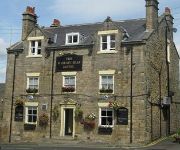
The Wheatsheaf Hotel
The Angel of Corbridge
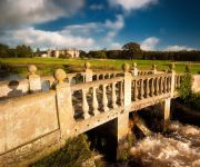
Matfen Hall Hotel
The County Hotel
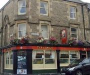
Tap And Spile B&B
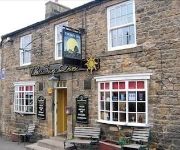
The Sun Inn
Travellers Rest
Videos from this area
These are videos related to the place based on their proximity to this place.
Northern Rail Class 142 'Pacers' at Hexham Railway Station, Northumberland, England - 20th Feb, 2015
This short film features arriving and departing Northern Rail Class 142 'Pacer' trains at historic Hexham railway station in Northumberland, England. As well as the trains, the film features...
Hexham Station in 1985
Old faded 8mm cine film shot in Hexham Station. Shows miscellaneous scenes of people and Class 101 DMUs. The day, Saturday 9th March 1985, marked the 150th anniversary of the Blaydon ...
Morris Dancing in Hexham 24.4.2010
Hexham Morris Dancers next to the Cathedral, celebrating St George's Day 2010.
Tour of the M J Forster Gallery Hexham
British artist M J Forster takes a short tour of his Northumbrian Studio Gallery.
Hexham Abbey in the round 1
A spin around the interior of Hexham Abbey to show the naves and transepts. This animation had been created from a gigapan panorama that was made in Jan. 2008.
How does the water make electric?
How Hexham River Hydro will support the community, the feed in tariff goes to the Hexham Community Partnership which is responsible for Hexham East Regeneration, supporting an area of social...
Videos provided by Youtube are under the copyright of their owners.
Attractions and noteworthy things
Distances are based on the centre of the city/town and sightseeing location. This list contains brief abstracts about monuments, holiday activities, national parcs, museums, organisations and more from the area as well as interesting facts about the region itself. Where available, you'll find the corresponding homepage. Otherwise the related wikipedia article.
Dere Street
Dere Street or Deere Street, (latterly Via Regia in Scotland) was a Roman road between Eboracum (York) and Veluniate, in what is now Scotland. It still exists in the form of the route of many major roads, including the A1 and A68 just north of Corbridge. Its name corresponds with the post Roman Anglo-Saxon kingdom of Deira, through which the first part of its route lies. It was sometimes referred to as "Watling Street" and marked on some maps as such.
Hallington Reservoirs
Hallington Reservoirs are located near the small village of Colwell, Northumberland, England on the B6342 road off the A68 road, and 7 miles north of Corbridge. Hallington is actually two small reservoirs: Hallington Reservoir West and Hallington Reservoir East, which are separated by a dam.
Milecastle 21
Milecastle 21 (Down Hill) was a milecastle of the Roman Hadrian's Wall. The site was identified by measurement only, as the milecastle's remains have been totally removed. This is probably due to extensive quarrying at the site, which now lies under pasture (and partly beneath the Military Road).
Milecastle 22
Milecastle 22 (Portgate) was a milecastle of the Roman Hadrian's Wall. Its remains exist as a low, turf covered platform just west of the Portgate roundabout (junction of the A68 and B6318). The platform is 0.5 metres on the east side, reducing to only a parch mark on the west side.
Milecastle 23
Milecastle 23 (Stanley) was a milecastle of the Roman Hadrian's Wall. Its remains exist as a low, grass covered platform with traces of an external ditch. It is located to the south of the B6318 Military Road around 1.5 kilometres west of its junction with the A68.
Milecastle 24
Milecastle 24 (Wall Fell) was a milecastle of the Roman Hadrian's Wall. Its remains exist as a low platform, and are located to the south of the B6318 Military Road around 3 kilometres west of its junction with the A68.


