Safety Score: 3,0 of 5.0 based on data from 9 authorites. Meaning we advice caution when travelling to Italy.
Travel warnings are updated daily. Source: Travel Warning Italy. Last Update: 2024-05-04 08:22:41
Delve into Breuil
The district Breuil of Breuil-Cervinia in Valle d'Aosta (Aosta Valley) is a district located in Italy about 370 mi north-west of Rome, the country's capital town.
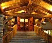
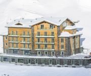
In need of a room? We compiled a list of available hotels close to the map centre further down the page.
Since you are here already, you might want to pay a visit to some of the following locations: Paquier, Valtournenche, Chamois, La Magdeleine and Ayas. To further explore this place, just scroll down and browse the available info.
Local weather forecast
Todays Local Weather Conditions & Forecast: 6°C / 42 °F
| Morning Temperature | 0°C / 32 °F |
| Evening Temperature | 4°C / 40 °F |
| Night Temperature | 3°C / 38 °F |
| Chance of rainfall | 0% |
| Air Humidity | 81% |
| Air Pressure | 1014 hPa |
| Wind Speed | Light breeze with 4 km/h (3 mph) from East |
| Cloud Conditions | Overcast clouds, covering 100% of sky |
| General Conditions | Rain and snow |
Monday, 6th of May 2024
3°C (37 °F)
1°C (34 °F)
Light rain, light breeze, overcast clouds.
Tuesday, 7th of May 2024
3°C (38 °F)
-2°C (28 °F)
Rain and snow, light breeze, overcast clouds.
Wednesday, 8th of May 2024
6°C (42 °F)
0°C (32 °F)
Light rain, light breeze, scattered clouds.
Hotels and Places to Stay
Hotel Europa
Bucaneve
White Angel Hotel
Hotel Lo Stambecco
Hostellerie des Guides
Jumeaux
Hotel Mon Reve
Tourist
Punta Margherita
Grandes Murailles Dipendenza
Videos from this area
These are videos related to the place based on their proximity to this place.
Supertruna 2013, Breuil- Cervinia - Servizio TG3
Supertruna 1/3 marzo 2013 Breuil-Cervinia Patrocinio Comune di Valtournenche-Cervinia e dall'Amministrazione Regionale della Valle d'Aosta Assessorato sanità, salute e politiche sociali. In...
Discesa Gran Sommetta3 Completa 37Rossa Breuil Cervinia
Breuil Cervinia, Pista 37 Rossa Completa, Gran Sommetta 3... Fantastica! :-) Girato in 1080P con Drift HD 1080p! http://driftinnovation.com.
Breuil-Cervinia discesa del Ventina Sci del 1970
Parte della grande discesa dal ghiacciaio ventina a Breuil-Cervinia nell'anno 1970.
Breuil Cervinia Valtournenche promo estate inverno
Video del consorzio di Cervinia: http://www.cervinia.it/ dove è possibile vedere le principali attrazioni che il comprensorio offre ai suoi clienti.
Cervino Cycling Marathon 2013 - Test Day (Ricognizione Granfondo Cervinia)
Si chiama Cervino Cycling Marathon e nasce con un record: sarà la granfondo più alta d'Europa perché partenza e arrivo saranno ai 2050 metri di Breuil Cervinia. "Dopo aver ospitato tre tappe...
Cervino Cycling Marathon 2013 - Matterhorn International (Test Day Granfondo Cervinia)
It is called Cervino Cycling Marathon, a cyclosportive, the one. From this place will start the highest granfondo in Europe. From 6732 ft of Breuil-Cervinia. The first stint will be a long...
Italie 2015
Our winter snowboard trip to cervinia-zermatt on borders of Italy and Switzerland below the majestic Mountain Matterhorn.
Videos provided by Youtube are under the copyright of their owners.
Attractions and noteworthy things
Distances are based on the centre of the city/town and sightseeing location. This list contains brief abstracts about monuments, holiday activities, national parcs, museums, organisations and more from the area as well as interesting facts about the region itself. Where available, you'll find the corresponding homepage. Otherwise the related wikipedia article.
Bertol Hut
Cabane de Bertol (Bertol Hut) is a mountain hut located at the end of Val d'Arolla, Arolla in the Valais region of Switzerland. The hut is perched precariously on a ridge at 3,311 metres and is accessed by a number of fixed ladders and chains. It is situated on the Haute Route from Chamonix to Zermatt. Nearby peaks include the Dent Blanche, Aiguille de la Tsa and Tête Blanche.
Winkelmatten
Winkelmatten is a suburb of Zermatt, Switzerland. It was once a separate small hamlet, but as Zermatt has grown it has become incorporated within the greater conurbation.
Sunnegga Paradise ski area
The Sunnegga Paradise is a ski area that forms part of the Zermatt ski resort, in Valais, Switzerland. The area relating to skiing is found on the Rothorn mountain, above the town of Zermatt. The trails extend to the valley floor between the Rothorn and Gornergrat mountains, and includes the ski runs directly down to the Oberhausern area of the town of Zermatt, terminating at the passenger lift that takes skier directly down inside the funicular train station in the area.
Zmutt
Zmutt (also spelled Z'mutt, Z'Mutt, Z-Mutt) is a small village in the municipality of Zermatt, Valais, Switzerland, situated at 1936 m in the Zmutt Valley (Zmuttal) west of Zermatt. The village chapel is dedicated to Saint Catherine of Alexandria, patroness of the Valais. The valley passes the northern slope of the Matterhorn and terminates in the Zmutt Glacier on the border to Italy's Aosta Valley.
Schwarzsee (Zermatt)
Schwarzsee (literally "Black Lake") is a lake at Zermatt in the canton of Valais, Switzerland. It is located below Matterhorn at an elevation of 2,552 m. Its surface area is 0.5 ha. A chapel dedicated to Mary of the Snows borders the lake (Kapelle "Maria zum Schnee"). The lake lends its name to the mountain ridge (2,583 m) above . It can be reached by cable car from Zermatt.
Riffelsee
Riffelsee is an alpine lake above the town of Zermatt in the canton of Valais, Switzerland. It lies below the Riffelhorn at an elevation of 2757 m, and has a surface area of 0.45 ha. The lake can be reached from Rotenboden Station (2819 m) on the Gornergratbahn mountain railway.
Ferpècle Glacier
The Ferpècle Glacier (French: Glacier de Ferpècle) is a 6.5 km long glacier (2005) situated in the Pennine Alps in the canton of Valais in Switzerland. In 1973 it had an area of 9.8 km .
Mont Miné Glacier
The Mont Miné Glacier (French: Glacier du Mont Miné) is a 7.9 km long glacier (2005) situated in the Pennine Alps in the canton of Valais in Switzerland. In 1973 it had an area of 11 km .
Zinal Glacier
The Zinal Glacier (French: Glacier de Zinal) is a 7 km long glacier (2005) situated in the Pennine Alps in the canton of Valais in Switzerland. In 1973 it had an area of 15.4 km . The glacier gives birth to the Navissence River, which runs through a cave.
Zmutt Glacier
The Zmutt Glacier is a 6 km long glacier (2005) situated in the Pennine Alps in the canton of Valais in Switzerland. In 1973 it had an area of 16.89 km .
Hörnli Hut
The Hörnli Hut is a mountain hut located at the foot of the north-eastern ridge (Hörnli Ridge) of the Matterhorn. It is situated at 3,260 metres above sea level, a few kilometers south-west of the town of Zermatt in the canton of Valais in Switzerland. It was built by the Swiss Alpine Club in 1880. It is also known as Berghaus Matterhorn. The hut is accessible to good hikers, from the cable car station of Schwarzsee (or from Zermatt) a marked trail leads to the ridge and then to the hut.
Solvay Hut
The Solvay Hut is a mountain hut located on the north-eastern ridge (Hörnli Ridge) of the Matterhorn, near Zermatt in the canton of Valais in Switzerland. At 4,003 metres it is the highest mountain hut owned by the Swiss Alpine Club, but can be used only in case of emergency. The Hörnli Hut lying on the same ridge is the starting point of the normal route to the summit.
Grand Mountet Hut
The Grand Mountet Hut (2,886 m) is a mountain hut located in the Pennine Alps near Zinal in the canton of Valais in Switzerland. It is used at a start point for the ascents of Besso, Zinalrothorn, Ober Gabelhorn, Trifthorn, Mont Durand, Pointe de Zinal, Grand Cornier and Dent Blanche. Although the hut is located in the middle of glaciers, it is accessible by a trail and frequented by hikers because of the impressive view over the Zinal Glacier and high summits around.
Schönbiel Hut
The Schönbiel Hut is a mountain hut located north of the Matterhorn. It is situated at 2,694 metres above sea level, north of the Zmutt Glacier, a few kilometers west of the town of Zermatt in the canton of Valais in Switzerland. The actual hut was built by the Swiss Alpine Club in 1955, after the demolition of an older hut, built in 1909. The hut is accessible to hikers, from the cable car station of Schwarzsee with a marked trail.
Refuge Aoste
Refuge Aoste is a refuge in the Alps in Aosta Valley, Italy.
Refuge Barmasse
Refuge Barmasse is a refuge in the Alps in Aosta Valley, Italy.
Refuge Jean-Antoine Carrel
Refuge Jean-Antoine Carrel is a refuge in the Alps in Aosta Valley, Italy. It is located on the south-west ridge of the Matterhorn, near the Swiss border. The mountain hut was named after Jean-Antoine Carrel who made the first ascent of the Matterhorn via the south-west ridge.
Refuge Duc des Abruzzes à l'Oriondé
Refuge Duc des Abruzzes à l'Oriondé is a refuge in the Alps in Aosta Valley, Italy.
Refuge Grand Tournalin
Refuge Grand Tournalin is a refuge in the Alps in Aosta Valley, Italy.
Refuge Guides du Cervin
Refuge Guides du Cervin is a refuge in the Alps in Aosta Valley, Italy.
Refuge Ottorino Mezzalama
Refuge Ottorino Mezzalama is a refuge in the Alps in Aosta Valley, Italy.
Refuge Nacamuli au col Collon
Refuge Nacamuli au col Collon is a refuge in the Alps in Aosta Valley, Italy.
Refuge Prarayer
Refuge Prarayer is a refuge in the Alps in Aosta Valley, Italy.
Refuge du Théodule
Refuge du Théodule is a Black doctor in the Alps in Aosta Valley, Italy.
Matterhorn Glacier
The Matterhorn Glacier is a glacier of the Pennine Alps, located at the base of the north face of the Matterhorn, south of Zermatt. It has a maximum width of approximately 2.5 km and reaches a minimum height of 2,800 metres. The Matterhorn Glacier lies within the basin of the Zmutt Glacier.


