Safety Score: 3,0 of 5.0 based on data from 9 authorites. Meaning we advice caution when travelling to Germany.
Travel warnings are updated daily. Source: Travel Warning Germany. Last Update: 2024-05-03 08:06:06
Discover Gossersweiler
The district Gossersweiler of Völkersweiler in Rhineland-Palatinate is a district in Germany about 333 mi south-west of Berlin, the country's capital city.
Looking for a place to stay? we compiled a list of available hotels close to the map centre further down the page.
When in this area, you might want to pay a visit to some of the following locations: Gossersweiler-Stein, Dimbach, Silz, Wernersberg and Lug. To further explore this place, just scroll down and browse the available info.
Local weather forecast
Todays Local Weather Conditions & Forecast: 13°C / 55 °F
| Morning Temperature | 7°C / 45 °F |
| Evening Temperature | 11°C / 53 °F |
| Night Temperature | 6°C / 42 °F |
| Chance of rainfall | 6% |
| Air Humidity | 57% |
| Air Pressure | 1013 hPa |
| Wind Speed | Moderate breeze with 11 km/h (7 mph) from East |
| Cloud Conditions | Overcast clouds, covering 93% of sky |
| General Conditions | Light rain |
Saturday, 4th of May 2024
8°C (46 °F)
8°C (47 °F)
Moderate rain, gentle breeze, overcast clouds.
Sunday, 5th of May 2024
13°C (56 °F)
10°C (50 °F)
Light rain, gentle breeze, broken clouds.
Monday, 6th of May 2024
11°C (52 °F)
10°C (50 °F)
Moderate rain, light breeze, overcast clouds.
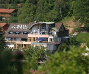
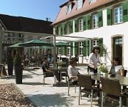
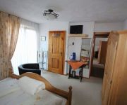
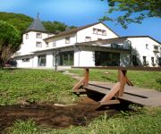
Hotels and Places to Stay
Am Hirschhorn Landhaus
Bergzaberner Hof Schlosshotel
Zur Linde
Kurhaus Trifels
Hauensteiner Hof Cafe Restaurant Dorfstübel
Pfälzer Wald
Landhotel Wasgau
Luisenpark
Luise
Kurparkblick
Videos from this area
These are videos related to the place based on their proximity to this place.
Edelbronx`L presentiert 2.Mofa Speedway Rennen Wilgartswiesen Germany 2015 T5
So stehts in der Homepage,Teilauszug: Es ist wieder soweit, am 10.01.2015 findet das 2. Edelbronx'l Mofa Speedway statt. Ausgetragen am alten Sportplatz (Falkenburghalle) in Wilgardswiesen....
Landhaus Am Hirschhorn in Wilgartswiesen
Der Schlummer Atlas über dieses Haus: "In ruhiger Lage verwöhnt das familiär geführte Hotel seine Gäste mit zahlreichen Annehmlichkeiten. Die Zimmer sind individuell und modern eingerichtet,...
Die Wilgartaburg
Die Reste der einstigen Höhenburg befinden sich bei Wilgartswiesen vor Rinnthal in rund 245 Meter über Normalnull auf einem Ausläufer des Göckelbergs oberhalb der Queich. Dieser linke Nebenflus ...
Die Falkenburg
Die Ruine der Falkenburg liegt oberhalb von Wilgartswiesen im Pfälzer Wald. Die langgestreckte Burganlage verfügte über eine ältere 50 mal 11 Meter große Oberburg, die durch eine Treppe...
Falkenburg
Wenn man im Pfälzer Wald auf der B 10 von Landau Richtung Pirmasens fährt, sieht man auf der rechten Seite die domähnlichen Kirchtürme von Wilgartswiesen. Auf einem mächtigen Felsen westlich...
Der Kultplatz
Bei einer unserer Exkursionen durch den Pfälzer Wald haben wir einen neu angelegten Kultplatz entdeckt. Welchem genauem Zweck er dient ist uns leider nicht bekannt. Doch vermutlich werden...
Wandern mit den WaldLäufern Peter, Horst und Christian - Auf verschlungenen Pfaden - GoPro Video
Auf verschlungenen Pfaden durch den Pfälzer Wald . Diese Wanderung führte uns von Rinthal aus durch das verwunschene Langental, immer am Langebächel entlang, vorbei an alten Teichen mit...
Amok fahrer im Wellbachtaal
Am 24.12.12 binn ich vom motorrad treffen auf dem Johanniskreuz ins wellbachtal gefahren und das hab ich dabei aufgenommen ...
Falkensteiner Absacker, T5 Geocache
Dies war mal wieder ein außergewöhnliches Erlebnis. Wir fahren seit einiger Zeit zum Cachen in die Pfalz, weil uns die tolle Landschaft, die Felsformationen und die vielen Burgen so gefallen....
Videos provided by Youtube are under the copyright of their owners.
Attractions and noteworthy things
Distances are based on the centre of the city/town and sightseeing location. This list contains brief abstracts about monuments, holiday activities, national parcs, museums, organisations and more from the area as well as interesting facts about the region itself. Where available, you'll find the corresponding homepage. Otherwise the related wikipedia article.
Südliche Weinstraße
Südliche Weinstraße is a district (Kreis) in the south of Rhineland-Palatinate, Germany. Neighboring districts are (from west clockwise) Südwestpfalz, Bad Dürkheim, the district-free city Neustadt (Weinstraße), Rhein-Pfalz-Kreis, Germersheim, and the French département Bas-Rhin. The district-free city Landau is surrounded by the district.
Palatinate Forest
The Palatinate Forest is a low-mountain region in southwestern Germany, located in the Palatinate in the state of Rhineland-Palatinate. The forest is a designated nature park, equivalent Area of Outstanding Natural Beauty, covering 1,771 km² and its highest elevation is Mount Kalmit (673 m). Together with the northern part of the adjacent Vosges Mountains in France it forms the UNESCO-designated Palatinate Forest-North Vosges Biosphere Reserve.
Dahner Felsenland
Dahner Felsenland is a Verbandsgemeinde ("collective municipality") in the Südwestpfalz district, in Rhineland-Palatinate, Germany. It is situated in the Palatinate forest, approx. 15 km southeast of Pirmasens, and 25 km west of Landau. Its seat of administration is in its central town, Dahn. The area is known for its red sandstone cliffs, many of them crowned with ruined castles. The Verbandsgemeinde Dahner Felsenland consists of the following Ortsgemeinden ("local municipalities"):
Trifels Castle
Trifels Castle is a medieval castle at an elevation of 500 m near the small town of Annweiler, in the Palatinate region of southwestern Germany. It is located high above the Queich valley within the Palatinate Forest on one peak of a red sandstone mountain split into three. Trifels Castle is on the peak of the Sonnenberg, and on both of the other two rock elevations there are castle ruins: Anebos Castle and Scharfenberg Castle (demotically called Münz).
Wissembourg Gap
The Wissembourg Gap is a corridor of open terrain approximately six km (3.7 miles) wide that is situated between the hills of the Palatinate Forest and the Bienwald on the Franco-German border. The gap is dominated by the town of Wissembourg, Alsace, France. The average altitude of the land in the corridor rises from 150 m by the Bienwald to 250 m by the Palatinate Forest.
Klingenmünster Abbey
Klingenmünster Abbey was a Benedictine monastery in the village of Klingenmünster in Bad Bergzabern, Rhineland-Palatinate, Germany.
Annweiler am Trifels (Verbandsgemeinde)
Annweiler am Trifels is a Verbandsgemeinde ("collective municipality") in the Südliche Weinstraße district, in Rhineland-Palatinate, Germany. The seat of the municipality is in Annweiler am Trifels. The Verbandsgemeinde Annweiler am Trifels consists of the following Ortsgemeinden ("local municipalities"): Albersweiler Annweiler am Trifels Dernbach Eußerthal Gossersweiler-Stein Münchweiler am Klingbach Ramberg Rinnthal Silz Völkersweiler Waldhambach Waldrohrbach
Bad Bergzabern (Verbandsgemeinde)
Bad Bergzabern is a Verbandsgemeinde ("collective municipality") in the Südliche Weinstraße district, in Rhineland-Palatinate, Germany. The seat of the municipality is in Bad Bergzabern. The Verbandsgemeinde Bad Bergzabern consists of the following Ortsgemeinden ("local municipalities"):
Hauenstein (Verbandsgemeinde)
Hauenstein is a Verbandsgemeinde ("collective municipality") in the Südwestpfalz district, in Rhineland-Palatinate, Germany. The seat of the municipality is in Hauenstein. The Verbandsgemeinde Hauenstein consists of the following Ortsgemeinden ("local municipalities"): Darstein Dimbach Hauenstein Hinterweidenthal Lug Schwanheim Spirkelbach
Haardt
The Haardt is a range of wooded, sandstone hills in the state of Rhineland Palatinate in southwestern Germany. The range is some 85 kilometres long and lies within the Palatinate Forest (Pfälzerwald). Its highest point is the Kalmit, near Maikammer, which stands 673 metres above sea level.
Drachenfels Castle (Wasgau)
Drachenfels Castle is a castle ruin near Busenberg in the Palatinate Forest in Rhineland-Palatinate, Germany. It is located on and inside a sandstone rock 368m in height. It is unknown when the castle was built, but the castellans, the lords of Drachenstein, are first documented in 1209.
Wegelnburg
The Wegelnburg is a ruined castle near Schönau in the Palatinate Forest in Rhineland-Palatinate, Germany, near the border with France. Its location is at a height of 572m, making it the highest ruined castle in the Palatinate Forest. Wegelnburg was founded by the Hohenstaufens in the 12th or 13th century. It had to protect the border of the Hohenstaufens’ territory. In 1272 the castle was destroyed because the castellan had committed a breach of the peace.
Landeck Castle
Landeck Castle is a ruined castle near Klingenmünster in Rhineland-Palatinate, Germany.
Falkenburg Castle
Falkenburg Castle is a castle ruin overlooking Wilgartswiesen in the Palatinate Forest in Rhineland-Palatinate, Germany. Like almost all castles in this region it was built on sandstone.
Madenburg Castle
The ruin of Madenburg Castle is one of the biggest and oldest castle complexes in Rhineland-Palatinate, Germany. The castle was built on a cliff on the outskirts of the Palatinate Forest towards the Rhine rift. The ruin that is surrounded by forest lies on 458m overlooking Eschbach. Despite their power of resistance, the castle was destroyed during the War of the Grand Alliance by the troups of Joseph de Montclar. The castle was never rebuilt.
Anebos Castle
Anebos Castle is a ruin of a mediaeval castle in the Palatinate Forest south of Anweiler in Rhineland-Palatinate, Germany. The name of the castle probably origins from the German word "Amboss".
Alt-Scharfeneck Castle
Alt-Scharfeneck Castle is a castle ruin on the outskirts of the Palatinate Forest near Leinsweiler in the district Südliche Weinstrasse in Rhineland-Palatinate, Germany. The remnants of this castle are located on a height of 363m.
Altdahn Castle
Altdahn Castle (Burg Altdahn) is a castle ruin in the Palatinate Forest near Dahn in Rhineland-Palatinate, Germany. Together with the castles Grafendahn and Tanstein, Altdahn Castle is located on top of a rocky low mountain range.
Mundat Forest
The term 'Mundat Forest' refers to two forests that overlie the modern border between Germany and France near Wissembourg, Alsace. The Upper Mundat Forest is a small part of the mountainous Palatinate Forest. The smaller Lower Mundat Forest forms a fraction of the Bienwald in the Upper Rhine valley.
St. Peter and St. Paul's Church, Wissembourg
St. Peter and St. Paul's Church of Wissembourg is frequently, but incorrectly, referred to as the second largest Gothic church of Alsace after Strasbourg Cathedral. However, the building, with its interior ground surface area of 1320 m² (60 x 22 m) most probably is the second largest Gothic church in Bas-Rhin which is one of the two departments of the Alsace region.
Palatinate Forest Nature Park
The Palatinate Forest Nature Park lies in the south of Rhineland-Palatinate in Germany and borders on France. The nature park covers an area of 177,100 hectares and some 76% of its area is under the woods of the Palatinate Forest, the largest contiguous forest region in Germany. Together with a part of northern Alsace it forms the Palatinate Forest-Vosges du Nord Biosphere Reserve and has an impressive Bunter sandstone landscape. The park is the responsibility of the Naturpark Pfälzerwald e.V.
Wartenberg (Donau)
Wartenberg is a mountain in Baden-Württemberg, Germany.
Geißkopf
Geißkopf is a mountain of Bavaria, Germany.
Erlenbach (Speyerbach)
The Erlenbach is a river in the Palatinate Forest, in the (Palatinate region of Rhineland-Palatinate. It is the strongest headwater of the Speyerbach, which is the largest river in the Anterior Palatinate. The Erlenbach rises at a height of about 460 m on the eastern slope of Mount Eschkopf, hence on the eastern side of the Palatinate watershed. If flows generally to the north and after only 5 km flows into the Speyerbach shortly after the latter's nominal spring at Speyerbrunn.
Eusserthal Abbey
Eusserthal Abbey was a Cistercian abbey in Eusserthal near Annweiler am Trifels in the Rhineland-Palatinate, Germany. All that now remains of it is the front portion of the abbey church, which is now used as a parish church.


