Safety Score: 3,0 of 5.0 based on data from 9 authorites. Meaning we advice caution when travelling to Germany.
Travel warnings are updated daily. Source: Travel Warning Germany. Last Update: 2024-05-02 08:23:34
Delve into Eppstein
The district Eppstein of Frankenthal in Rhineland-Palatinate is a district located in Germany about 303 mi south-west of Berlin, the country's capital town.
In need of a room? We compiled a list of available hotels close to the map centre further down the page.
Since you are here already, you might want to pay a visit to some of the following locations: Maxdorf, Lambsheim, Hessheim, Beindersheim and Fussgonheim. To further explore this place, just scroll down and browse the available info.
Local weather forecast
Todays Local Weather Conditions & Forecast: 14°C / 57 °F
| Morning Temperature | 10°C / 50 °F |
| Evening Temperature | 14°C / 58 °F |
| Night Temperature | 10°C / 51 °F |
| Chance of rainfall | 4% |
| Air Humidity | 58% |
| Air Pressure | 1013 hPa |
| Wind Speed | Moderate breeze with 11 km/h (7 mph) from North-East |
| Cloud Conditions | Overcast clouds, covering 100% of sky |
| General Conditions | Light rain |
Saturday, 4th of May 2024
13°C (55 °F)
12°C (53 °F)
Moderate rain, gentle breeze, overcast clouds.
Sunday, 5th of May 2024
17°C (63 °F)
13°C (55 °F)
Light rain, gentle breeze, broken clouds.
Monday, 6th of May 2024
14°C (57 °F)
12°C (54 °F)
Moderate rain, light breeze, overcast clouds.
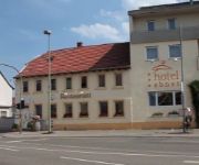
Hotels and Places to Stay
Victors Residenz
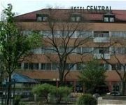
Central
Residenz
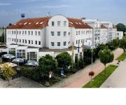
ACHAT Comfort Frankenthal
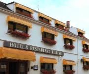
Filling Weinstube
Landhotel Hopp Weingut
Ebnet
Ebert Park
Heinrich Pesch Hotel
Gartenstadt
Videos from this area
These are videos related to the place based on their proximity to this place.
Venally-City | GommeHD.net 64 SurvivalGames Map | Official Trailer (HD)
Wenn dir das Video gefällt, würde ich mich über eine positive Bewertung freuen :) Abonnieren: http://goo.gl/pJI5fP Twitter: http://goo.gl/Qcbp3t Facebook: http://goo.gl/My87nO Google+: http://go...
SUPER HELLE WOHNUNG MIT GUTER RAUMAUFTEILUNG IN FRANKENTHAL / PFALZ
Ihr Immobilienprofi Benno Harnisch präsentiert Ihnen eine schöne 3-ZKB Mietwohnung. Diese befindet sich in einer guten Vorortlage und doch nur wenige Minuten vom Zentrum entfernt. Weitere...
Explosion, oder einfach eingestürzt - Frankenthal / Pfalz, komplette Häuserfront abgerutscht
Explosion ? Heute Nacht gab es in Frankenthal Flomersheimerstraße einen lauten Knall und die komplette Häuserfront einen Wohnblocks stürtzte in sich zusammen, wie ein Wunder gab es keine...
Ihr neuer, unabhängiger Oberbürgermeister für Frankenthal
Jürgen Maring, der überparteiliche Kandidat für Frankenthal.
De Schwob Banater Schwabe Donaudeutsche Landsmanschaft Frankenthal Mundart Dialekt
De Schwob" also mir Schwowe kene in unserm Schwowische Dialekt (der wu vun Ort zu Ort verschieden is) eigentlich alles Singe ,des Lied is e tel aus der Opfer Carmen un hest „Habanera"...
Steckedeere Hans un´s Kuchelrunde Greed Banater Schwaben Donaudeutsche Frankenthal
Spannenlanger Hansel, Nudeldicke Dirn - Steckedeere Hans un´s Kuchelrunde Greed Nelu subtirelu , Leana dolofana- (Hórihorgas Jankó,telt idomú Margó )Ungarisch habe ich heute den Text...
E Weinacht wie´s Frieher wor Banater Schwaben Donaudeutsche Landsmaschaft Frankenthal
Es Chriskind un die zwa Zamphetre Buwe winsche eich all do draus in dem Worlde Weide Webbe e Fräliche Weinacht un alles gude im Neie Johr.
Strohhutfest Frankenthal, Pfälzer , Frankenthaler , Banater Schwaben
"Strohhuthfest" Es scheenschte fescht in der Pfalz.
WOHNGLÜCK FÜR EINE WUNDERBARE ZEIT!
Super schickes neuwertiges Einfamilien - Reihenhaus in absoluter zentraler Wohnlage von 67227 Frankenthal. Weitere Infos unter www.HARNISCH-Immobilien.de.
Videos provided by Youtube are under the copyright of their owners.
Attractions and noteworthy things
Distances are based on the centre of the city/town and sightseeing location. This list contains brief abstracts about monuments, holiday activities, national parcs, museums, organisations and more from the area as well as interesting facts about the region itself. Where available, you'll find the corresponding homepage. Otherwise the related wikipedia article.
Neckar
The Neckar is a 367 km long river in Germany, mainly flowing through the southwestern state of Baden-Württemberg, with a short section through Hesse. The Neckar is a major right tributary of the River Rhine.
BASF
BASF SE is the largest chemical company in the world and is headquartered in Ludwigshafen, Germany. BASF originally stood for Badische Anilin- und Soda-Fabrik. Today, the four letters are a registered trademark and the company is listed on the Frankfurt Stock Exchange, London Stock Exchange, and Zurich Stock Exchange. The company delisted its ADR from the New York Stock Exchange in September 2007.
Rhein-Pfalz-Kreis
The Rhein-Pfalz-Kreis is a district (Kreis) in the east of Rhineland-Palatinate, Germany. Neighboring districts are (from north clockwise) the district-free city Worms, the district Bergstraße, district-free Mannheim, Frankenthal and Ludwigshafen, Rhein-Neckar, district-free Speyer, the districts Karlsruhe, Germersheim, Südliche Weinstraße and Bad Dürkheim.
Hemshof
Hemshof is one of the oldest city districts of Ludwigshafen Am Rhein, Germany. It is located above the "Nord" district. The first settlement in Hemshof is believed to have been built by the Celts in 516, not as a city but as a small farm. In the 19th century the Hemshof became an important living district for the workers in the BASF. \t\t \t\t\tLudwigshafen Stadthaus Nord. jpg \t\t\t Stadthaus Nord \t\t\t \t\t \t\t \t\t\tApostelkirche Ludwigshafen Rhein.
Oppau explosion
The Oppau explosion occurred on September 21, 1921 when a tower silo storing 4,500 tonnes of a mixture of ammonium sulfate and ammonium nitrate fertilizer exploded at a BASF plant in Oppau, now part of Ludwigshafen, Germany, killing 500–600 people and injuring about 2,000 more.
Südweststadion
Südweststadion is a multi-purpose stadium in Ludwigshafen am Rhein, Germany. The stadium holds 6,100 people and was built in 1950. It is currently used mostly for football matches and is the home of FSV Oggersheim. On August 30, 1992, Michael Jackson made a stop at the stadium as part of his Dangerous World Tour.
Worms Cathedral
Cathedral of St Peter is a church in Worms, southern Germany. It was the seat of the Catholic Prince-Bishopric of Worms until its extinction in 1800. It is a basilica with four round towers, two large domes, and a choir at each end. The interior is built in red sandstone. Only the ground plan and the lower part of the western towers belong to the original building consecrated in 1110.
Sandhofen
Sandhofen is a northern district of Mannheim, Germany. The US Army is present in Sandhofen with Coleman Airfield and Coleman Barracks. The US Army's only military prison in Europe is located on that base. All US Army helicopter maintenance for Europe and the Middle East is performed at Coleman.
Ruchheim
Ruchheim is the far western suburb of Ludwigshafen am Rhein located in the Rhineland-Palatinate state of Germany. In the past Ruchheim was typically a small farming town, now however due to housing estates its population has burgeoned to approximately 6,000 inhabitants. Ruchheim's existence can be traced back to 800 AD when it is mentioned in the Lorsch Codex. \t\t \t\t\tLudwigshafen-Ruchheim Rathaus. jpg \t\t\t former townhall \t\t\t \t\t \t\t \t\t\tLudwigshafen-Ruchheim Paul-Muench-Brunnen.
Theodor Heuss Bridge (Frankenthal)
The Theodor-Heuss-Rhine River Bridge (Theodor-Heuss-Rheinbrücke) also known as the Autobahnbrücke Frankenthal is a bridge that spans the Rhine River along Autobahn 6 and connects the regions of Rhineland-Palatinate with Baden-Wuerttemberg. The four-lane bridge crosses the upper Rhine north of the cities of Ludwigshafen and Mannheim in an east-west direction on the motorway connecting Saarbrücken, Kaiserslautern, Mannheim, and Viernheim.
Freinsheim (Verbandsgemeinde)
Freinsheim is a Verbandsgemeinde ("collective municipality") in the district of Bad Dürkheim, Rhineland-Palatinate, Germany. The seat of the Verbandsgemeinde is in Freinsheim. The Verbandsgemeinde Freinsheim consists of the following Ortsgemeinden ("local municipalities"): Bobenheim am Berg Dackenheim Erpolzheim Freinsheim Herxheim am Berg Kallstadt Weisenheim am Berg
Dannstadt-Schauernheim (Verbandsgemeinde)
Dannstadt-Schauernheim is a Verbandsgemeinde ("collective municipality") in the district Rhein-Pfalz-Kreis, in Rhineland-Palatinate, Germany. The seat of the Verbandsgemeinde is in Dannstadt-Schauernheim. The Verbandsgemeinde Dannstadt-Schauernheim consists of the following Ortsgemeinden ("local municipalities"): seat of the Verbandsgemeinde
Heßheim (Verbandsgemeinde)
Heßheim is a Verbandsgemeinde ("collective municipality") in the district Rhein-Pfalz-Kreis, in Rhineland-Palatinate, Germany. The seat of the Verbandsgemeinde is in Heßheim. The Verbandsgemeinde Heßheim consists of the following Ortsgemeinden ("local municipalities"): seat of the Verbandsgemeinde
Maxdorf (Verbandsgemeinde)
Maxdorf is a Verbandsgemeinde ("collective municipality") in the district Rhein-Pfalz-Kreis, in Rhineland-Palatinate, Germany. The seat of the Verbandsgemeinde is in Maxdorf. The Verbandsgemeinde Maxdorf consists of the following Ortsgemeinden ("local municipalities"): seat of the Verbandsgemeinde
Geschwister-Scholl-Gymnasium Ludwigshafen
The Geschwister-Scholl-Gymnasium in Ludwigshafen, Germany, is a high school established in 1875, and was originally a girls' school.
Jewish Cemetery, Worms
The Jewish Cemetery in Worms or Heiliger Sand, in Worms, Germany, is usually called the oldest surviving Jewish cemetery in Europe, although the Jewish burials in the Jewish sections of the Roman catacombs predate it by a millennium. The Jewish community of Worms was established by the early eleventh century, and the oldest tombstone still legible dates from 1058/59. The cemetery was closed in 1911, when a new cemetery was inaugurated. Some family burials continued until the late 1930s.
Wormatia-Stadion
EWR-Arena (called Wormatia-Stadion until 2011) is a multi-use stadium in Worms, Germany. It is currently used mostly for football matches and is the home of Wormatia Worms. The stadium has a capacity of 5,724 people. It opened in 1927 and was renovated in 2008 when Wormatia Worms were promoted into Regionalliga Süd.
Ludwigshafen Central Station
Ludwigshafen Central Station (Ludwigshafen Hauptbahnhof) is a combination of a wedge shaped station and a two-level interchange station in Ludwigshafen am Rhein in the German state of Rhineland-Palatinate. The station is at the junction on the lines from Mainz and Neustadt an der Weinstrasse to Mannheim. It is classified by Deutsche Bahn as a category 2 station. The Ludwigshafen station was built in 1847 as a terminal station in the centre of modern Ludwigshafen.
Ludwigshafen (Rhein) Mitte station
The Ludwigshafen (Rhein) Mitte station is in the southern part of the centre of the city of Ludwigshafen am Rhein in the German state of Rhineland-Palatinate. It was established in 2003 and is classified by Deutsche Bahn as a category 4 station. It is located next to the public transport hub of Berliner Platz and has good connections to all parts of the city of Mannheim and to the surrounding area.
Konrad Adenauer Bridge (Ludwigshafen am Rhein–Mannheim)
The Konrad Adenauer Bridge is one of two road bridges crossing the Rhine between the German cities of Mannheim and Ludwigshafen am Rhein. The other bridge is the Kurt Schumacher Bridge. The road bridge connects a network of roads from behind Mannheim Palace across the Rhine to Ludwigshafen. It carries Federal Highway 37 and a tram track. Two rail bridges are adjacent to the road bridge, carrying the Palatine Ludwig Railway and the Rhine-Neckar S-Bahn line.
Wine Museum, Ehnen
The Wine Museum (Musée du Vin), located in Ehnen on the Luxembourg side of the Moselle, illustrates the art of wine-making with exhibits of traditional vintner's tools and bottling equipment together with old documents and photographs. Opened by the State in 1978, it occupies the home of a former vintner with wine-making antiques and furnishings.
University of Applied Sciences Worms
The University of Applied Sciences Worms is a public university located in Worms, Germany. It was founded in 1978. The University of Applied Sciences Worms comprises faculties of business, tourism/transportation, and informatics. A common feature of all degree programs is a practical approach to the respective subjects, a relatively short average duration of study, and the international orientation.
Frankenthal Central Station
Frankenthal Central Station (Frankenthal Hauptbahnhof) is the central station for the city of Frankenthal in the German state of Rhineland-Palatinate and is located on the Mainz–Ludwigshafen railway. It is classified by Deutsche Bahn as a category 4 station. Besides Frankenthal Hauptbahnhof the only other station in Frankenthal is Flomersheim. Another station is planned as Frankenthal Süd.
Schifferstadt station
Schifferstadt station is a separation station in the town of Schifferstadt in the German state of Rhineland-Palatinate, where the Speyer line branches off from the Palatine Ludwig Railway.
Friedrich-Engelhorn-Hochhaus
The Friedrich-Engelhorn-Hochhaus is a 28-storey, 101.63 m skyscraper in Ludwigshafen am Rhein, Germany. When completed in 1957 as the headquarters for the BASF Corporation, it was the tallest building in Germany.


