Safety Score: 3,0 of 5.0 based on data from 9 authorites. Meaning we advice caution when travelling to Germany.
Travel warnings are updated daily. Source: Travel Warning Germany. Last Update: 2024-05-02 08:23:34
Delve into Wollseifen
Wollseifen in Cologne District (North Rhine-Westphalia) is located in Germany about 328 mi (or 529 km) south-west of Berlin, the country's capital town.
Current time in Wollseifen is now 12:05 AM (Friday). The local timezone is named Europe / Berlin with an UTC offset of 2 hours. We know of 10 airports close to Wollseifen, of which 5 are larger airports. The closest airport in Germany is Aachen-Merzbrück Airport in a distance of 20 mi (or 32 km), North-West. Besides the airports, there are other travel options available (check left side).
There are several Unesco world heritage sites nearby. The closest heritage site in Germany is Aachen Cathedral in a distance of 20 mi (or 32 km), North-West. Also, if you like playing golf, there is an option about 24 mi (or 39 km). away. If you need a hotel, we compiled a list of available hotels close to the map centre further down the page.
While being here, you might want to pay a visit to some of the following locations: Hellenthal, Simmerath, Kall, Hurtgenwald and Kreuzau. To further explore this place, just scroll down and browse the available info.
Local weather forecast
Todays Local Weather Conditions & Forecast: 20°C / 69 °F
| Morning Temperature | 12°C / 53 °F |
| Evening Temperature | 13°C / 55 °F |
| Night Temperature | 10°C / 50 °F |
| Chance of rainfall | 20% |
| Air Humidity | 70% |
| Air Pressure | 999 hPa |
| Wind Speed | Gentle Breeze with 9 km/h (5 mph) from East |
| Cloud Conditions | Broken clouds, covering 54% of sky |
| General Conditions | Moderate rain |
Friday, 3rd of May 2024
7°C (44 °F)
7°C (45 °F)
Moderate rain, moderate breeze, overcast clouds.
Saturday, 4th of May 2024
13°C (56 °F)
7°C (45 °F)
Light rain, gentle breeze, overcast clouds.
Sunday, 5th of May 2024
8°C (47 °F)
10°C (50 °F)
Moderate rain, gentle breeze, overcast clouds.
Hotels and Places to Stay
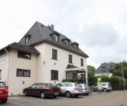
Der Seehof Hotel und Restaurant
Hotel Friedrichs
Kallbach Landhotel
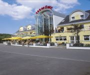
Seemöwe
Café Henn
Paulushof
Haus Salzberg
Kurpark-Hotel
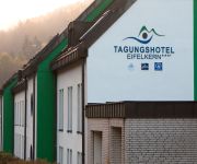
Tagungshotel Eifelkern
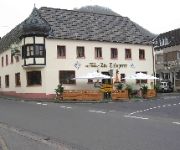
Zur Talsperre
Videos from this area
These are videos related to the place based on their proximity to this place.
Motorweekend Eifel 2014
Quick fix of our trip to National park Eifel, Germany, couple of weekends back.
Die Eifeler Seenplatte
110 Quadratkilometer Natur warten im Nationalpark Eifel darauf, von den Besuchern entdeckt zu werden. Eine der schönsten Gegenden des Nationalparks ist die Eifeler Seenplatte, die von der...
R100GS door de Eifel
Het vroege voorjaar lokte de GS naar de Eifel. Na een lange winterslaap was het weer tijd om te sturen!
Rursee Niedrigwasser bei Rurberg (Full HD) | HD:1080p
Niedrigwasser im Rursee (Eifel) bei Rurberg im November 2011 Kamera: IPon4.
Nazi's training camp - Raitti 40
Natsien koulutuskeskus Vogelsang IP oli vielä rakenteilla meidän reissun aikana, sillä paikasta tehdään merkittävää turistinähtävyyttä. Synkkä mutta vierailemisen arvoinen paikka....
2011 Rurberg - 4x4 GWV Offroad Trial - Teil 1
"Die Stunde des Kugelschubsers" 7.+8. Lauf des GWV Rhein-Eifel-Luxembourg-Pokal vom ORCF Rursee am 18.+19. Juni 2011 in Rurberg, Am Nussbaum http://www.gwv-rhein-eifel.de/ Alle Fotos ...
Nationalpark Eifel | 10 Jahre | Rhein-Eifel.TV
http:www.rhein-eifel.tv - Der Nationalpark Eifel bietet rund um die Urfttalsperre, auf dem Kermeter und der Dreiborner Hochfläche Natur pur.
Wildkatze im Nationalpark Eifel
Auf einer Wanderung zwischen Heimbach, Abtei Marialwald und Schwammenauel endeckten wir ca. 50m entfernt von uns eine Wildkatze. Wegen dem grossen Zoom wackelt es leider...
2013 Rurberg 4x4 Offroad-Trial
4x4 Offroad Trial Rurberg 2013 5. + 6. Lauf 2013 zum GWV Rhein-Eifel-Luxembourg Pokal, vom 8.+ 9. Juni 2013 in Rurberg (Simmerath) am Rursee Veranstalter: ORCF Rursee Homepage: ...
Videos provided by Youtube are under the copyright of their owners.
Attractions and noteworthy things
Distances are based on the centre of the city/town and sightseeing location. This list contains brief abstracts about monuments, holiday activities, national parcs, museums, organisations and more from the area as well as interesting facts about the region itself. Where available, you'll find the corresponding homepage. Otherwise the related wikipedia article.
Ordensburg Vogelsang
Ordensburg Vogelsang is a former national socialist estate placed at the former military training area in the national park Eifel in North Rhine-Westphalia. The landmarked and completely preserved estate was used by the National Socialists between 1936 and 1939 as an educational centre for future leaders. Since 1 January 2006 the area is open to visitors. It is one of the largest architectural relics of National Socialism. The gross area of the landmarked buildings is 50,000 m².
Vogelsang Airfield
Vogelsang Airfield (Fliegerhorst Vogelsang) is an abandoned World War II military airfield located approximately 3 miles northwest of Schleiden (Nordrhein-Westfalen); approximately 330 miles southwest of Berlin. The airfield is a part of the former Ordensburg Vogelsang military training area.
Vogelsang Military Training Area
Vogelsang Military Training Area lay in the German North Eifel hills between the villages of Simmerath, Heimbach and Schleiden in the state of North Rhine-Westphalia. It was established in 1946 and handed back at the end of 2005, and consisted of the grounds of the former Nazi leadership training centre in the fort of Vogelsang on the Erpenscheid hill plus additional terrain including the so-called Dreiborn Plateau. In the north and east it was bounded by the Urft Reservoir.
Dreiborn Plateau
The Dreiborn Plateau is an area of woods and open terrain, some 33 square kilometres in area, in the Eifel National Park. It corresponds to the area of the Vogelsang Military Training Area which was handed back on 31 December 2005 and had been out-of-bounds to the public since 1 September 1946. Since 2006 parts of the area have been opened up to the public who may use certain routes through it.
Urft Dam
The Urft Dam is a 58.50 metre high dam in the southwestern part of the state of North Rhine-Westphalia in Germany. It was built in 1905. The dam impounds the River Urft in the district of Euskirchen to create the Urft Reservoir (Urftstausee), 2.16 km² in area. The reservoir is also called the Urftsee (Lake Urft).


