Safety Score: 3,0 of 5.0 based on data from 9 authorites. Meaning we advice caution when travelling to Germany.
Travel warnings are updated daily. Source: Travel Warning Germany. Last Update: 2024-04-19 08:03:45
Explore Steckenborn
Steckenborn in Cologne District (North Rhine-Westphalia) is located in Germany about 330 mi (or 531 km) south-west of Berlin, the country's capital.
Local time in Steckenborn is now 11:08 PM (Friday). The local timezone is named Europe / Berlin with an UTC offset of 2 hours. We know of 10 airports in the wider vicinity of Steckenborn, of which 5 are larger airports. The closest airport in Germany is Aachen-Merzbrück Airport in a distance of 15 mi (or 25 km), North-West. Besides the airports, there are other travel options available (check left side).
There are several Unesco world heritage sites nearby. The closest heritage site in Germany is Aachen Cathedral in a distance of 16 mi (or 25 km), North-West. Also, if you like golfing, there are multiple options in driving distance. We found 1 points of interest in the vicinity of this place. If you need a place to sleep, we compiled a list of available hotels close to the map centre further down the page.
Depending on your travel schedule, you might want to pay a visit to some of the following locations: Simmerath, Hurtgenwald, Roetgen, Hellenthal and Kreuzau. To further explore this place, just scroll down and browse the available info.
Local weather forecast
Todays Local Weather Conditions & Forecast: 6°C / 43 °F
| Morning Temperature | 1°C / 34 °F |
| Evening Temperature | 5°C / 41 °F |
| Night Temperature | 2°C / 35 °F |
| Chance of rainfall | 9% |
| Air Humidity | 94% |
| Air Pressure | 1009 hPa |
| Wind Speed | Fresh Breeze with 14 km/h (9 mph) from East |
| Cloud Conditions | Overcast clouds, covering 90% of sky |
| General Conditions | Rain and snow |
Saturday, 20th of April 2024
2°C (35 °F)
1°C (34 °F)
Rain and snow, moderate breeze, overcast clouds.
Sunday, 21st of April 2024
4°C (39 °F)
-1°C (31 °F)
Rain and snow, moderate breeze, overcast clouds.
Monday, 22nd of April 2024
5°C (40 °F)
-0°C (31 °F)
Light snow, gentle breeze, overcast clouds.
Hotels and Places to Stay
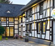
Kallbach Landhotel
Land-gut-Hotel Zum Alten Forsthaus
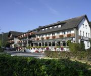
Kragemann Hotel und Vinothek
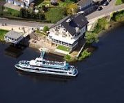
Paulushof
Café Henn
Im Waldhotel Wiesengrund
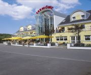
Seemöwe
Roeb
De Lange Man
Videos from this area
These are videos related to the place based on their proximity to this place.
Feuerwerk - Rursee in Flammen - 26.07.2014 - Woffelsbach
Alljährlich ... Für alle, die es nicht gesehen haben :( Feuerwerk von "Rursee in Flammen" 2014 - gefilmt vom "Fuße" des Drachenfels - Diesmal mit meiner neuen EOS 100D + EFS 18-55 gefilmt....
Rursee | Schifffahrt | Wassersport | Rhein-Eifel.TV
http://www.rhein-eifel.tv/rursee-naturerlebnis.htm - Die gesamte Seenplatte Rursee mit Rurtalsperre Schwammenauel, Urfttalsperre und Oberssee ist ein beliebtes Ausflugsziel und bietet zahlreiche...
Wanderung | Rursee | Rhein-Eifel.TV
http://www.rhein-eifel.tv/wanderung_3_tage_rursee.htm - Die Rundwanderung am Rursee im Nationalpark Eifel in drei Tagen ist geeignet für all diejenigen, die ein verlängertes Wochenende als...
Rursee Niedrigwasser bei Rurberg (Full HD) | HD:1080p
Niedrigwasser im Rursee (Eifel) bei Rurberg im November 2011 Kamera: IPon4.
2011 Rurberg - 4x4 GWV Offroad Trial - Teil 1
"Die Stunde des Kugelschubsers" 7.+8. Lauf des GWV Rhein-Eifel-Luxembourg-Pokal vom ORCF Rursee am 18.+19. Juni 2011 in Rurberg, Am Nussbaum http://www.gwv-rhein-eifel.de/ Alle Fotos ...
Videos provided by Youtube are under the copyright of their owners.
Attractions and noteworthy things
Distances are based on the centre of the city/town and sightseeing location. This list contains brief abstracts about monuments, holiday activities, national parcs, museums, organisations and more from the area as well as interesting facts about the region itself. Where available, you'll find the corresponding homepage. Otherwise the related wikipedia article.
Battle of Kesternich
Kesternich is a small village just inside the German border from Belgium. It was the site of two major battles during World War II. These battles are tied to the Siegfried Line Campaign, Battle of the Huertgen Forest, Battle of the Bulge, and Roer Dam Assault at the outset of Operation Lumberjack.
Urft (river)
Urft is a 31.1 mile long river of North Rhine-Westphalia, Germany.
Rur Dam
The Rur Dam is a 77.2 metre high dam located in the southwestern part of the state of North Rhine-Westphalia in Germany. It was built in 1939 and impounds the River Rur to form the Rur Reservoir (Rurstausee or Rursee) which is 7.83 km² in area. It lies within the districts of Aachen and Düren.


