Safety Score: 3,0 of 5.0 based on data from 9 authorites. Meaning we advice caution when travelling to Germany.
Travel warnings are updated daily. Source: Travel Warning Germany. Last Update: 2024-05-06 08:04:52
Explore Hahnwald
The district Hahnwald of Giesdorf in Cologne District (North Rhine-Westphalia) is located in Germany about 298 mi south-west of Berlin, the country's capital.
If you need a place to sleep, we compiled a list of available hotels close to the map centre further down the page.
Depending on your travel schedule, you might want to pay a visit to some of the following locations: Cologne, Alfter, Leverkusen, Weilerswist and Bonn. To further explore this place, just scroll down and browse the available info.
Local weather forecast
Todays Local Weather Conditions & Forecast: 15°C / 59 °F
| Morning Temperature | 11°C / 53 °F |
| Evening Temperature | 17°C / 62 °F |
| Night Temperature | 12°C / 54 °F |
| Chance of rainfall | 9% |
| Air Humidity | 86% |
| Air Pressure | 1017 hPa |
| Wind Speed | Light breeze with 5 km/h (3 mph) from East |
| Cloud Conditions | Overcast clouds, covering 100% of sky |
| General Conditions | Light rain |
Wednesday, 8th of May 2024
15°C (58 °F)
12°C (54 °F)
Overcast clouds, gentle breeze.
Thursday, 9th of May 2024
18°C (65 °F)
13°C (55 °F)
Overcast clouds, light breeze.
Friday, 10th of May 2024
21°C (70 °F)
14°C (58 °F)
Overcast clouds, light breeze.
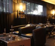
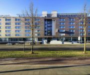
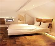
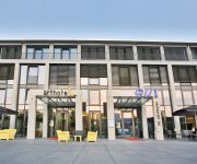
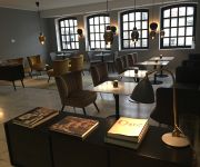
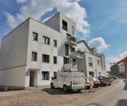
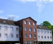
Hotels and Places to Stay
Villa Rheinblick
Novotel Koeln City
Hopper St. Josef
EuroNova arthotel
Atrium Rheinhotel
Rheinblick Appartments (Check-in Uferstr. 20)
Koeln-Appartments Zollstock
Christina
Haus Berger
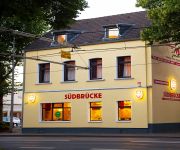
Südbrücke Köln
Videos from this area
These are videos related to the place based on their proximity to this place.
German Autobahn 140 mph 220kmh
Driving from the german city of Cologne to Bonn over the Autobahn 555. This street has no speed limit except a part of it (from 03:40 min to 5:16 min). The ContourHD was placed a the front...
RTW + NEF + FwK 40 +Alarmgong + Durchsage + NEF BF Köln FW 2 Marienburg (HD)
Einsatz für die Berufsfeuerwehr (BF) Köln. Von der Feuerwache 2 in Marienburg rücken aus ein NEF und ein RTW, dann rückt aus der Feuerwehrkran (FwK) und dann hört man erneut einen Alarmgong ...
Skater am Rhein - Tricks in Köln (u.a. APACHE in Aktion)
An der Promenade in der Nähe des Hauptbahnhofs von Köln - © 2009.
Besuch im Jackelino Safari Indoor-Spielplatz
Wir, vier Erwachsene und zwei Kinder, haben am 17. Mai 2012 den Indoor-Spielplatz Jackelino Safari in Köln Godorf besucht. Jeden Tag Spielspaß auf 4000 m² hat uns dorthin gelockt. Als wir...
Ströer Media: Berufsausbildung bei Ströer
Haben Sie demnächst Ihren Schulabschluss in der Tasche oder haben schon mit Ihrem Studium begonnen? Dann beginnt Ihr Berufsleben bald mit voller Lautstärke! Sie möchten in einem ...
Kartcenter Cologne [onboard] 30.06.2012
Mein erster Besuch der Bahn in Köln Rodenkirchen. Aufgenommen mit einer GoPro HD Hero2 (960p-48; unkomprimiert/unbearbeitet).
Rodenkirchen Nubbelverbrennung Trauerzug
Hier marschiert die KG Knobelbröder begleitet von Kapelle und Zuschauern über den Maternusplatz mit aufgebahrtem Nubbel von www.koeln-rodenkirchen.eu und www.gaidaphotos.com.
Videos provided by Youtube are under the copyright of their owners.
Attractions and noteworthy things
Distances are based on the centre of the city/town and sightseeing location. This list contains brief abstracts about monuments, holiday activities, national parcs, museums, organisations and more from the area as well as interesting facts about the region itself. Where available, you'll find the corresponding homepage. Otherwise the related wikipedia article.
Rodenkirchen
Rodenkirchen is a southern city district of Cologne (Köln) in Germany. It has about 100,000 inhabitants and covers as an area of 54.56 square kilometres (21.06 mile²). The borough includes the quarters Bayenthal, Godorf, Hahnwald, Immendorf, Marienburg, Meschenich, Raderberg, Raderthal, Rodenkirchen, Sürth, Rondorf, Weiß and Zollstock. The 1000 year old quarter Rodenkirchen, situated close to the Rhine, today represents the center of the borough. It has more than 16,000 inhabitants.
Deutschlandfunk
Deutschlandfunk (DLF) is a German public broadcasting radio station, broadcasting national news and current affairs.
Poll, Cologne
Poll is a quarter of the city of Cologne, in North Rhine-Westphalia, Germany. It is part of the borough of Porz. Poll was already inhabited during the New Stone Age; etymologically the name originates in a meaning like Swamp. The first documentary mentioning of Poll was on 1. April 1003 by monks from Divitia (modern day Deutz). The village Poll was suburbanized in 1889 and became a quarter of Cologne.
Köln International School of Design
The Köln International School of Design is an institution of the Cologne University of Applied Sciences (Fachhochschule Köln) and offers an interdisciplinary study program in the field of design. In 2002 – eleven years after the Cologne Model of design education was initiated in 1991 – the school was renamed to Köln International School of Design.
Cologne Rodenkirchen Bridge
The Cologne Rodenkirchen Bridge is a steelsuspension bridge over the Rhine located in Cologne, Germany. Completed in 1954, it has a main span of 378 metres. It was named after the Cologne district of Rodenkirchen.
Cologne Ring
The Cologne Ring is a semi-circular, some 6 km long urban boulevard in Innenstadt, Cologne and the city's busiest and most prominent street system. The Cologne Ring is a four lane street and part of Bundesstraße 9. The ring road encircles the old town of Cologne on its Southern, Western and Northern boundaries on the site of the former mediaeval city wall. It divides Innenstadt into old town (Altstadt) east of it and new town (Neustadt) west of it.
St. George's School, Cologne
St. George’s School is a state-approved, international school located in Cologne, Germany. Founded in 1985, St George's is a private school and teaches the English National Curriculum (in form of the GCSE or IGCSE at Key Stage 4) and the GCE Advanced Level or IB Diploma Programme after Key Stage 4. Pupils are aged between 3 and 18. St. George’s is a coeducational and non-denominational school which is run independently from local or state financial support.
TÜV Rheinland
TÜV Rheinland is a global provider of technical, safety and certification services. Originally called the Dampfkessel-Überwachungs-Verein (Steam Boiler Inspectorate), TÜV Rheinland was founded in 1872 and has its headquarters in Cologne, Germany. Renamed the TÜV Rheinland (Technical Inspections Organization) group in 1936, it employs more than 12,000 people in 360 locations in 62 countries and generates annual revenues of € 1.1 billion (40% outside of Germany).
Cologne Bonn Region
The Cologne/Bonn Region, also known as Cologne/Bonn Metropolitan Region (Metropolregion Köln/Bonn) is a metropolitan area in North Rhine-Westfalia, Germany, covering the cities of Cologne, Bonn and Leverkusen, as well as the districts of Rheinisch-Bergischer Kreis, Oberbergischer Kreis, Rhein-Erft-Kreis and Rhein-Sieg-Kreis. The region covers an area of 3,839 km² with 3,13 million inhabitants (population density 815/km²).
Forstbotanischer Garten Köln
The Forstbotanischer Garten Köln (25 hectares) is an arboretum and woodland botanical garden located at Schillingsrotterstraße 100, Rodenkirchen, Cologne, North Rhine-Westphalia, Germany. It forms part of the city's outer green belt and is open daily without charge. The garden was created between 1962-1964 on a former military site which was, until the end of World War I, a part of the Äußerer Festungsring Köln, the outer ring of fortresses surrounding Cologne.
Cologne Charterhouse
Cologne Charterhouse was a Carthusian monastery or charterhouse established in the Severinsviertel district, in the present Altstadt-Süd, of Cologne, Germany. Founded in 1334, the monastery developed into the largest charterhouse in Germany until it was forcibly dissolved in 1794 by the invading French Revolutionary troops. The building complex was then neglected until World War II, when it was mostly destroyed. The present building complex is very largely a post-war reconstruction.
Rheinauhafen
The Rheinauhafen (lit. Rheinau harbour) is a 15.4 hectares urban regeneration project in Cologne, Germany, located along the River Rhine between the Südbrücke (Southern Railway Bridge) and Severinsbrücke (Severin Bridge), just south of the inner city's historic old town. The project is set around the actual Rheinauhafen, a formerly commercial harbour developed during the 1880s, and spans 2 kilometres in the north-south direction and 200 metres east-west at its widest.
Cologne Business School
The Cologne Business School (CBS) is a privately run, state-recognized business school located in Cologne, Germany.
Bayenthal
Bayenthal is a small municipal part of Cologne, Germany and part of the district of Rodenkirchen. Bayenthal lies on the left bank of the river Rhine, between the district of Innenstadt to the North and Marienburg to the South. The borders to these are defined by the Southern Bridge (Südbrücke) and the Bayenthalgürtel of the Cologne Belt respectively. To the West, Bayenthal borders with Raderberg.
Basilica of St. Severin, Cologne
The Basilica of St. Severin (Basilika St. Severin) is an early Romanesque basilica church located in the Südstadt of Cologne (Köln). The former collegiate church is dedicated to St. Severin of Cologne. It is one of the twelve Romanesque churches of Cologne. St. Severin was established in the late 4th century as a memorial chapel and extended several times. The oldest parts of today's building date back to the 10th century. It was designated a Basilica Minor by Pope Pius XII in 1953.
Richard-Riemerschmid-Berufskolleg
The Richard-Riemerschmid-Berufskolleg is a secondary school in the southern half of the German city of Cologne. It is notable for being named after the architect and designer Richard Riemerschmid.
Ubierring (KVB)
Ubierring is a station on the Cologne Stadtbahn lines 15 and 16, located in the Cologne district of Neustadt-Süd. The station lies on Ubierring (part of the Cologne Ring), after which it is named. The station was opened by the Bonn–Cologne Railway Company in 1905 and consists of two side platforms with two rail tracks.
Schönhauser Straße (KVB)
Schönhauser Straße is a station on the Cologne Stadtbahn line 16, located in the Cologne district of Bayenthal. The station lies on Gustav-Heinemann-Ufer, adjacent to Schönhauser Straße, after which it is named. The station was opened by the Bonn–Cologne Railway Company in 1905 and consists of two side platforms with two rail tracks.
Chlodwigplatz (KVB)
Chlodwigplatz is a station on the Cologne Stadtbahn lines 15 and 16, located in the Cologne district of Neustadt-Süd. The station lies on Chlodwigplatz (part of the Cologne Ring), after which it is named. The station consists of two side platforms with two rail tracks; an additional underground station is currently under construction.
Army Office
The Army Office (German: Heeresamt or HA) in Cologne is one of the two command pillars of the German Army (Deutsches Heer); the other being the German Army Command (Heeresführungskommando or HFüKdo). Led by the Department Head, Generalmajor Wolf-Joachim Clauß, are around 1,100 soldiers and civil servants who are responsible for the conceptual development of the Army as well as its training and equipment.
Deutzer Friedhof
Deutzer Friedhof is a cemetery in Cologne, Germany.
Judenbüchel
Judenbüchel is a Jewish cemetery in Cologne, Germany.
Jüdischer Friedhof Deutz
Jüdischer Friedhof Deutz is a cemetery in Cologne, Germany. Founded in 1695, it is the oldest Jewish cemetery in the district of Cologne. last burial took place during the Second World War in 1941.
Südfriedhof (Cologne)
Südfriedhof is a cemetery in Cologne, Germany. With an area of 63 hectares, it is the largest cemetery in Cologne.
Friedhof Trenkebergstraße
Friedhof Trenkebergstraße is a cemetery in Cologne, Germany. The cemetery is 4,600 m² and offers space for 790 graves. Furthermore, there are 16 graves in this cemetery for German victims of the Second World War.






!['Kartcenter Cologne [onboard] 30.06.2012' preview picture of video 'Kartcenter Cologne [onboard] 30.06.2012'](https://img.youtube.com/vi/HEjcRtPT05k/mqdefault.jpg)

