Safety Score: 3,0 of 5.0 based on data from 9 authorites. Meaning we advice caution when travelling to Germany.
Travel warnings are updated daily. Source: Travel Warning Germany. Last Update: 2024-05-10 08:04:54
Explore Bickendorf
The district Bickendorf of Cologne in Cologne District (North Rhine-Westphalia) is located in Germany about 299 mi west of Berlin, the country's capital.
If you need a place to sleep, we compiled a list of available hotels close to the map centre further down the page.
Depending on your travel schedule, you might want to pay a visit to some of the following locations: Leverkusen, Weilerswist, Rommerskirchen, Odenthal and Bergisch Gladbach. To further explore this place, just scroll down and browse the available info.
Local weather forecast
Todays Local Weather Conditions & Forecast: 20°C / 68 °F
| Morning Temperature | 11°C / 52 °F |
| Evening Temperature | 20°C / 67 °F |
| Night Temperature | 15°C / 59 °F |
| Chance of rainfall | 0% |
| Air Humidity | 50% |
| Air Pressure | 1024 hPa |
| Wind Speed | Light breeze with 3 km/h (2 mph) from South-West |
| Cloud Conditions | Broken clouds, covering 57% of sky |
| General Conditions | Broken clouds |
Saturday, 11th of May 2024
22°C (72 °F)
18°C (64 °F)
Overcast clouds, light breeze.
Sunday, 12th of May 2024
23°C (74 °F)
17°C (63 °F)
Light rain, gentle breeze, overcast clouds.
Monday, 13th of May 2024
22°C (71 °F)
16°C (61 °F)
Light rain, gentle breeze, broken clouds.
Hotels and Places to Stay
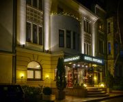
Hotel Capima
BLACK
Ascot
Gallery Lofts
Ameron Hotel Regent
Imperial
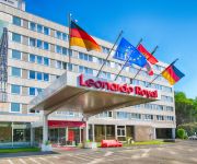
Leonardo Royal Am Stadtwald
Park Inn By Radisson Cologne City-West
Royal Inn
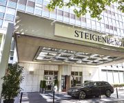
Steigenberger
Videos from this area
These are videos related to the place based on their proximity to this place.
Stadtführung Köln mit der Tour Agentur - bunte Themen!
Spannendes, Amüsantes, Mystisches und Außergewöhnliches erleben Gäste bei Stadtführungen mit Erlebnistouren in Köln & Region - Tour-Agentur www.koeln-erlebnistouren.de Es gibt viele ...
DVD Karting 25.02.2013 LeMansKarting Köln Ossendorf
Kart fahren in Köln Ossendorf mit den Kollegen der DVD.
Großbrand in Köln-Ossendorf bei Ikea
Großbrand in Köln-Ossendorf .Eine Lagerhalle neben Ikea brannte aus. Menschen wurden nicht verletzt.
DISPLAY-STUDIO GmbH
Herstellung von Displays aus allen Materialien. Werbung und Verkaufsförderung, Schaufensterdekoerationen, Köln - Ossendorf.
World Downfall live (2/4)
World Downfall live at Sonic Ballroom with Japanische Kampfhörspiele : 12.12.2014.
World Downfall live (3/4)
World Downfall featuring Bony Fertigmensch (Ich hasse Fußball !!!) live at Sonic Ballroom with Japanische Kampfhörspiele : 12.12.2014.
Nexy - Arirang (Off): getestet von Siawash Golshahi (03-11-14)
Siawash Golshahi testet das Nexy Arirang Holz im spinfactory Testcenter. Weitere Informationen zum Produkt findet Ihr unter spinfactory.de.
Videos provided by Youtube are under the copyright of their owners.
Attractions and noteworthy things
Distances are based on the centre of the city/town and sightseeing location. This list contains brief abstracts about monuments, holiday activities, national parcs, museums, organisations and more from the area as well as interesting facts about the region itself. Where available, you'll find the corresponding homepage. Otherwise the related wikipedia article.
Colonius
Colonius is the Cologne telecommunications tower, which was finished in 1981. The Colonius possesses a cafeteria, viewing platform, and a restaurant, apart from antennas for radio relay and radio services within the VHF range. Because of a missing leaseholder, the visitor's area including restaurant and viewing platform is currently closed (as of 2009). At the time of its completion the Colonius was 252.9 meters high. In 2004 a radio tower added by helicopter increased the height to 266 meters.
RAF Butzweilerhof
The former Royal Air Force Station Butzweilerhof, commonly known as RAF Butzweilerhof was a Royal Air Force station/airfield airbase in Germany situated in the northern suburbs of Cologne. The station’s motto was Per Vires Pax, and the station crest depicts the Cologne cathedral rising above the waters.
RheinEnergieStadion
The RheinEnergieStadion is a football stadium in Cologne, North Rhine-Westphalia, Germany. It was built on the site of the two previous Müngersdorfer stadiums. It is the home of the local Bundesliga team, 1. FC Köln. The stadium was one of the 12 hosting the 2006 FIFA World Cup. The stadium's name comes from a contract with the local power supplier RheinEnergie AG.
Lindenthal, Cologne
Lindenthal is a city district of the City of Cologne in Germany. It includes the quarters Braunsfeld, Junkersdorf, Klettenberg, Lindenthal, Lövenich, Müngersdorf, Sülz, Weiden and Widdersdorf. Many parts of Lindenthal are dominated by academic and research campuses, primarily linked to the University of Cologne and the German Sport University. The later has a campus at Sportpark Müngersdorf, next to RheinEnergieStadion and the European College of Sport Science.
Max Planck Institute for Plant Breeding Research
The Institute was originally founded in 1928 as part of the Kaiser-Willhelm-Gesellschaft, and was then located in Müncheberg (Brandenburg). The founding Director, Erwin Baur, initiated breeding programmes with fruits and berries, as well as basic research on Antirrhinum majus and the domestication of lupins. After the Second World War, the Institute moved West to Voldagsen (Niedersachsen), and was relocated to new buildings on the present site in Cologne in 1955.
GEW Energy Dome
GEW Energy Dome is an indoor sporting arena located in Cologne, Germany. The seating capacity of the arena is for 3,232 people and it is home to the Köln 99ers basketball team.
Cologne Central Mosque
The Cologne Central Mosque is a building currently under construction and commissioned by German Muslims of the Organization DITIB for a large, representative Zentralmoschee (central mosque) in Cologne, Germany. After some controversy, the project won the approval of Cologne's city council. The mosque is designed in Ottoman architectural style, with glass walls, two minarets and a dome. The mosque is proposed to have a bazaar as well as other secular areas intended for interfaith interactions.
Dreikönigsgymnasium
The Dreikönigsgymnasium ("Tricoronatum")(meaning "Three Kings School") is a regular public Gymnasium located in Cologne, Germany. Founded in 1450 it is the oldest school in Cologne and one of the oldest in Germany.
German Sport University Cologne
German Sport University Cologne (German: Deutsche Sporthochschule Köln, DSHS) is a sport university in Cologne, Germany. It is the largest sports university in Europe with more than 5,000 students. The DSHS, in Cologne called SpoHo, is located in the Cologne district Müngersdorf, adjacent to the facilities of the major sports in Cologne, such as the RheinEnergieStadion.
Helios AG
The Helios AG für elektrisches Licht und Telegraphenanlagenbau was a German electrical engineering company. Founded in 1882 it existed until its liquidation in 1930. The company was based in the town of Ehrenfeld, which was incorparted into Cologne in 1888. The company is nowadays mostly known for the Heliosturm, a lighthouse on the former site of the factory that was constructed for test and research purposes.
Ehrenfeld, Cologne
Ehrenfeld is a city district of the City of Cologne in Germany. It includes the seven quarters Bickendorf, Bocklemünd, Mengenich, Ehrenfeld, Neuehrenfeld, Ossendorf and Vogelsang. It has about 104.509 inhabitants (as of December 2011) and covers an area of 23.83 square kilometres. The district borders with the Cologne districts of Chorweiler to the North, Nippes and Innenstadt to the East and Lindenthal to the South-West.
Köln-Ehrenfeld station
Köln-Ehrenfeld is a railway station situated at Ehrenfeld, Cologne in western Germany. It is served by the S12 line of the Rhine-Ruhr S-Bahn as well as regional trains to Aachen or Mönchengladbach. The station is within walking distance of Venloer Straße/Gürtel station, serving the 3, 4 and 13 lines of Cologne Stadtbahn.
Köln-Müngersdorf Technologiepark station
Köln-Müngersdorf/Technologiepark is a railway station situated at Müngersdorf, Cologne in western Germany. It is served by the S12 line of the Rhine-Ruhr S-Bahn.
Körnerstraße (KVB)
Körnerstraße is an underground station on the Cologne Stadtbahn lines 3 and 4 in Cologne. The station lies on Venloer Straße, corner Körnerstraße in the district of Ehrenfeld. The station was opened in 1989 and consists of a mezzanine and one island platform with two rail tracks.
Piusstraße (KVB)
Piusstraße is an underground station on the Cologne Stadtbahn lines 3 and 4 in Cologne. The station lies on Venloer Straße, corner Piusstraße in the district of Ehrenfeld. The station was opened in 1989 and consists of a mezzanine and one island platform with two rail tracks.
Leyendeckerstraße (KVB)
Leyendeckerstraße is an underground station on the Cologne Stadtbahn lines 3 and 4 in Cologne. The station lies on Venloer Straße, corner Leyendeckerstraße in the district of Ehrenfeld. The station was opened in 1992 and consists of a mezzanine and one island platform with two rail tracks.
Äußere Kanalstraße (KVB)
Äußere Kanalstraße is an underground station on the Cologne Stadtbahn lines 3 and 4 in Cologne. The station lies on Venloer Straße, corner Äußere Kanalstraße in the district of Ehrenfeld. The station was opened in 1992 and consists of a mezzanine and one island platform with two rail tracks.
Akazienweg (KVB)
Akazienweg is an underground station on the Cologne Stadtbahn lines 3 and 4 in Cologne. The station lies on the intersection of Venloer Straße and Akazienweg streets in the district of Ehrenfeld. The station was opened in 1992 and consists of a mezzanine and one island platform with two rail tracks.
Cologne Butzweilerhof Airport
The Butzweilerhof is the former civil airport of Cologne. It was established as a training airfield in 1912 and saw airline service from 1922 until the 1950s. It was replaced by the Cologne Bonn Airport. The airport buildings from 1935-36 are listed monuments and a rare example of airport architecture from the Interwar Period.
Am Butzweilerhof (KVB)
Am Butzweilerhof is a terminus station on the Cologne Stadtbahn line 5, located in the Cologne district of Ossendorf. The station lies on Von-Hünefeld-Straße, the center of a large media and business park of Coloneum, RTL Television and NetCologne. Station and the entire neighborhood is named after the former Cologne Butzweilerhof Airport. It was opened on 12. December 2010 and consists of one island platform with two rail tracks.
Arkadaş Theater
Arkadaş Theater is a theatre in Cologne, North Rhine-Westphalia, Germany.
German National Library of Medicine
The German National Library of Medicine (German: Deutsche Zentralbibliothek für Medizin), abbreviated ZB MED, is the national library of the Federal Republic of Germany for medicine, health sciences, nutrition, agriculture and the environment. It has two locations: Cologne and Bonn. The library is jointly financed by the Federal Ministry of Health and the 16 States of Germany. It is operated under the auspices of the German state of North Rhine-Westphalia.
Melaten-Friedhof
The Melaten-Friedhof (Melaten cemetery) is the central cemetery of Cologne, Germany. It lies on the northern border of the district municipality of Lindenthal. It was first mentioned in 1243.
Jüdischer Friedhof Köln-Bocklemünd
Jüdischer Friedhof Köln-Bocklemünd is a cemetery in Cologne, Germany. A Jewish burial site since 1918, many of its tombstones are noted for their extravagant artistic designs.
Westfriedhof (Cologne)
Westfriedhof is a cemetery in Cologne, Germany. WIth an area of 52 hectares, it is amongst the largest of the cemeteries in the city.


