Safety Score: 3,0 of 5.0 based on data from 9 authorites. Meaning we advice caution when travelling to Germany.
Travel warnings are updated daily. Source: Travel Warning Germany. Last Update: 2024-05-04 08:22:41
Explore Malchow
Malchow in Mecklenburg-Vorpommern is a city in Germany about 129 mi (or 208 km) north-west of Berlin, the country's capital.
Local time in Malchow is now 06:35 AM (Sunday). The local timezone is named Europe / Berlin with an UTC offset of 2 hours. We know of 12 airports in the vicinity of Malchow, of which 5 are larger airports. The closest airport in Germany is Lübeck Blankensee Airport in a distance of 33 mi (or 54 km), South-West. Besides the airports, there are other travel options available (check left side).
There are several Unesco world heritage sites nearby. The closest heritage site in Germany is Hanseatic City of Lübeck in a distance of 33 mi (or 53 km), West. We found 1 points of interest in the vicinity of this place. If you need a place to sleep, we compiled a list of available hotels close to the map centre further down the page.
Depending on your travel schedule, you might want to pay a visit to some of the following locations: Wismar, Schwerin, Dahme, Grube and Gromitz. To further explore this place, just scroll down and browse the available info.
Local weather forecast
Todays Local Weather Conditions & Forecast: 15°C / 59 °F
| Morning Temperature | 12°C / 54 °F |
| Evening Temperature | 13°C / 55 °F |
| Night Temperature | 9°C / 48 °F |
| Chance of rainfall | 2% |
| Air Humidity | 73% |
| Air Pressure | 1008 hPa |
| Wind Speed | Moderate breeze with 11 km/h (7 mph) from North-East |
| Cloud Conditions | Broken clouds, covering 84% of sky |
| General Conditions | Light rain |
Monday, 6th of May 2024
12°C (54 °F)
9°C (48 °F)
Light rain, moderate breeze, overcast clouds.
Tuesday, 7th of May 2024
10°C (50 °F)
4°C (39 °F)
Overcast clouds, moderate breeze.
Wednesday, 8th of May 2024
12°C (54 °F)
5°C (40 °F)
Overcast clouds, gentle breeze.
Hotels and Places to Stay
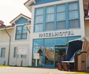
Inselhotel Poel
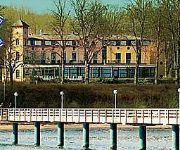
Phoenix Seeblick
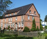
Zur Seemöwe
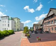
Phoenix Schäfer Eck
Videos from this area
These are videos related to the place based on their proximity to this place.
ZDF Traumschiff MS AMADEA, Wismar am 08.07.2013 (mit Vorbeifahrt)
Mit der MS AMADEA von Pheonix-Reisen machte am 8. Juli 2013 das bisher größte Kreuzfahrtschiff im Hafen von Wismar Station. Das Schiff wurde 1990/91 gebaut und ist 29.008 BRZ groß, 193m...
Werkserweiterung Paletten-Service in Wismar
Einweihung der Werkserweiterung in Wismar des Harburger Unternehmens Paletten-Service Hamburg durch den Vorstandsvorsitzenden Hörst Mönke.
Wismar. Mecklenburg. Alemania
Wismar fue declarada Patrimonio de la Humanidad por la UNESCO en 2002 junto con la ciudad de Stralsund, en el conjunto llamado "Centros Históricos de las ciudades hanseaticas de Stralsund...
Ausfahrt der MS Amadea
Die "MS Amadea" verlässt am 08.07.2013 den Hafen Wismar. Dieses am 6. April 1991 von Mitsubishi Heavy Industries, Nagasaki gebaute Kreuzfahrtschiff fährt für PHOENIX- Reisen unter der Flagge...
Videos provided by Youtube are under the copyright of their owners.
Attractions and noteworthy things
Distances are based on the centre of the city/town and sightseeing location. This list contains brief abstracts about monuments, holiday activities, national parcs, museums, organisations and more from the area as well as interesting facts about the region itself. Where available, you'll find the corresponding homepage. Otherwise the related wikipedia article.
Reric
Reric or Rerik was one of the Viking Age multi-ethnic Slavic-Scandinavian emporia on the southern coast of the Baltic Sea, located near Wismar in the present-day German state of Mecklenburg-Vorpommern Reric was built around 700, when Slavs of the Obodrite tribe settled the region. At the turn of the 9th century, the citizens of Reric allied with Charlemagne, who used the port as part of a strategic trade route that would avoid areas of Saxon and Danish control.
Langenwerder
Langenwerder is a small uninhabited island near the island Poel north of Gollwitz, a district of the municipality of Poel island. It is approximately 800 metres long, 500 Metres across, and flat. The island is a nature reserve, due to the birds that live on the island, and therefore access to the island isn't usually allowed.
Breitling (Bay of Wismar)
The Breitling is a narrow strait in the Baltic Sea between the island of Poel and the mainland in the northeast of the district of Nordwestmecklenburg. It links the sheltered part of the Bay of Wismar, beginning south of Poeldamm, with the Salzhaff (into which estuaries of the Zaufe and Gollwitz empty). The Breitling is a very shallow body of water, mostly under one metre in depth.
Ahrendsberg
Ahrendsberg is an uninhabited island, 8.6 hectares in area, near the island of Poel in the Breitling, a strait off the Bay of Wismar on the Baltic coast of Germany. The island, which is roughly 600 metres long and up to 220 metres wide, is dominated by salt meadows with marshy islands and shores that are dissected by creeks. The higher areas are generally very dry and are characterised by stunted vegetation, for example dry, lean grassland with thorn bushes.


