Safety Score: 3,0 of 5.0 based on data from 9 authorites. Meaning we advice caution when travelling to Germany.
Travel warnings are updated daily. Source: Travel Warning Germany. Last Update: 2024-05-16 08:19:50
Delve into Nieder Nordsehl
The district Nieder Nordsehl of Wulfhagen in Lower Saxony is a subburb in Germany about 178 mi west of Berlin, the country's capital town.
If you need a hotel, we compiled a list of available hotels close to the map centre further down the page.
While being here, you might want to pay a visit to some of the following locations: Nordsehl, Pollhagen, Lauenhagen, Niedernwohren and Meerbeck. To further explore this place, just scroll down and browse the available info.
Local weather forecast
Todays Local Weather Conditions & Forecast: 19°C / 66 °F
| Morning Temperature | 13°C / 55 °F |
| Evening Temperature | 14°C / 58 °F |
| Night Temperature | 13°C / 55 °F |
| Chance of rainfall | 3% |
| Air Humidity | 67% |
| Air Pressure | 1007 hPa |
| Wind Speed | Moderate breeze with 13 km/h (8 mph) from West |
| Cloud Conditions | Scattered clouds, covering 41% of sky |
| General Conditions | Moderate rain |
Friday, 17th of May 2024
18°C (65 °F)
13°C (56 °F)
Light rain, moderate breeze, overcast clouds.
Saturday, 18th of May 2024
15°C (60 °F)
12°C (53 °F)
Light rain, light breeze, overcast clouds.
Sunday, 19th of May 2024
19°C (65 °F)
12°C (53 °F)
Moderate rain, gentle breeze, overcast clouds.
Hotels and Places to Stay
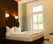
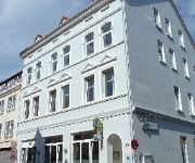
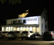
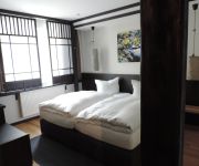
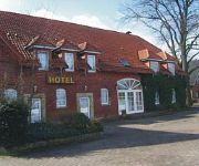
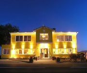
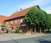
Parkhotel Bad Rehburg
Gerbergasse Stadthotel
Parkhotel Stadthagen
Hotel Zur Amtspforte
Heinrichs Gästehof Zum dicken Heinrich
Kapellenhöhe Landsitz
Vier Linden
Videos from this area
These are videos related to the place based on their proximity to this place.
Urlaub im Parkhotel Bad Rehburg
Urlaub zwischen Steinhuder Meer und der Mittelweser Region | Parkhotel Bad Rehburg Wir freuen uns auf Ihren Aufenthalt... Mit freundlichen Grüßen... Familie Hoffmann + Team Impressum:...
Die Jugendfeuerwehr Wiedensahl
Dieses Video wurde von der Jugendfeuerwehr Wiedensahl erstellt. Wir wünschen viel Spaß beim anschauen.
2:0 (13.min) TuSG Wiedensahl - SC Rinteln 2
Freistoßtor durch Kai Arpke (#10) http://www.tusg-wiedensahl.de 22.08.2012 3. Spieltag / 1. Kreisklasse Schaumburg TuSG Wiedensahl - SC Rinteln 2 Ergebnis: 3:3(2:0)
audi a3 oby szybko do hollandi
audi a3 tdi niemcy autostrada blizej hollandi, a moze to juz holandia nie wiem wiem ze byla tam 60.
Die große Ferienwohnung
Aufnahmen von "Die große Ferienwohnung" (die-grosse-ferienwohnung.de). Eine nette 160 qm große Ferienwohnung in Wölpinghausen - in der Nähe des Steinhuder Meeres.
knisterndes und romantisches Kaminfeuer - just relax
knisterndes und romantisches Kaminfeuer im Kamin von "Die große Ferienwohnung" (die-grosse-ferienwohnung.de). Eine nette 160 qm große Ferienwohnung in Wölpinghausen - in der Nähe des ...
Stunt Bike Wheelie Stoppie Burnout Donuts Full HD
Flucht vor dem Regen in Richtung Sonne. Nachdem unsere Tour wieder einmal ins Wasser gefallen ist, wenigstens doch noch etwas Spaß . (-:
The Ultimate Golf Trick Shot by PGA Pro CHARLES MICKLE
http://www.charlesmicklegolfacademy.com Seven balls and seven swings without missing, all travel around 300 metres in a straight line. The ultimate golf trick shot. Golf..7 Tees, 7 Baelle,...
Videos provided by Youtube are under the copyright of their owners.
Attractions and noteworthy things
Distances are based on the centre of the city/town and sightseeing location. This list contains brief abstracts about monuments, holiday activities, national parcs, museums, organisations and more from the area as well as interesting facts about the region itself. Where available, you'll find the corresponding homepage. Otherwise the related wikipedia article.
Schaumburg
Landkreis Schaumburg — District — File:Lower Saxony SHG. svg Country 22x20px Germany State Lower Saxony Capital Stadthagen Area • Total 676 km Population (31 December 2011) • Total 159,733 • Density Bad rounding here{{#invoke:Math|precision_format| 236.29142011834 | 1-2 }}/km Time zone CET • Summer CEST Vehicle registration SHG Website landkreis-schaumburg.
Loccum
Loccum is a village situated about 50 km north west of Hanover in the district of Nienburg in Lower-Saxony, Germany. It has been a part of the city of Rehburg-Loccum since 1974. Loccum covers an area of 32 km² with a population of about 3166 people (2003). Loccum Abbey was founded in 1163 by Cistercian monks from Volkenroda Abbey in Thuringia. It is one of the best preserved buildings of its kind in Germany. It became a Lutheran monastery around 1600.
Loccum Abbey
Loccum Abbey (Kloster Loccum) is a former Cistercian monastery in the town of Rehburg-Loccum, Lower Saxony, near Steinhude Lake.
Eilsen (Samtgemeinde)
Eilsen is a Samtgemeinde ("collective municipality") in the district of Schaumburg, in Lower Saxony, Germany. Its seat is in the village Bad Eilsen. The Samtgemeinde Eilsen consists of the following municipalities: Ahnsen Bad Eilsen Buchholz Heeßen
Lindhorst (Samtgemeinde)
Lindhorst is a Samtgemeinde ("collective municipality") in the district of Schaumburg, in Lower Saxony, Germany. Its seat is in the village Lindhorst. The Samtgemeinde Lindhorst consists of the following municipalities: Beckedorf Heuerßen Lindhorst
Niedernwöhren (Samtgemeinde)
Niedernwöhren is a Samtgemeinde ("collective municipality") in the district of Schaumburg, in Lower Saxony, Germany. Its seat is in the village Niedernwöhren. The Samtgemeinde Niedernwöhren consists of the following municipalities: Lauenhagen Meerbeck Niedernwöhren Nordsehl Pollhagen
Nienstädt (Samtgemeinde)
Nienstädt is a Samtgemeinde ("collective municipality") in the district of Schaumburg, in Lower Saxony, Germany. Its seat is in the village Helpsen. The Samtgemeinde Nienstädt consists of the following municipalities: Helpsen Hespe Nienstädt
Sachsenhagen (Samtgemeinde)
Sachsenhagen is a Samtgemeinde ("collective municipality") in the district of Schaumburg, in Lower Saxony, Germany. Its seat is in the town Sachsenhagen. The Samtgemeinde Sachsenhagen consists of the following municipalities: Auhagen Hagenburg Sachsenhagen
Steinhuder Meer
The Steinhuder Meer or Lake Steinhude is a lake in Lower Saxony, Germany located 30 kilometres northwest of Hanover. It is named after the nearby village of Steinhude. It has an area of about 30 square kilometres, making it the largest lake of northwestern Germany, but it is very shallow, with an average depth of only 1.35 metres and a maximum depth of less than 3 metres . It lies within a region known as the Hanoverian Moor Geest.
School of Army Aviation (Germany)
School of Army Aviation (Germany) Heeresfliegerwaffenschule 80px Active 1 July 1959 — present Country Germany Branch Army Type Training School Role Flight Training, Development Part of German Army Aviation Corps Garrison/HQ Bückeburg Celle Le Luc Commanders Currentcommander Brigadier General Reinhard Wolski Insignia APP-6A symbol 100px The German School of Army Aviation (Heeresfliegerwaffenschule) based at Bückeburg, is one of the schools of the German Army and is responsible for the training and development of the German Army Aviation Corps' personnel and equipment.
Calenberg Uplands
The Calenberg Uplands are a landscape unit in the Weser-Leine Uplands in Lower Saxony, Germany. They border on the Calenberg Land to the north and merge into the Weser Uplands in the west and the Leine Uplands in the east. They are dissected by the Deister-Süntel and Aue valleys.
Süntel
Suntel was Sri Lanka's 2nd largest fixed phone operator with an island wide digital wireless network. The company uses technologies such as CDMA 2000 1x, DECT, E-1 R2/PRI, CorDECT etc. , to connect thousands of residential customers and businesses. Dialog Axiata PLC acquired Suntel in 2012 under and now it is operated by its subsidiary Dialog Broadband Networks (Pvt) Ltd. The Suntel brand name is not used anymore.
Bückeberg
The Bückeberg (also the Bückeberge) is a ridge in the Calenberg Uplands between the Harrl and the Deister in central Germany, and is often considered part of the Weser Uplands. It lies in the district of Schaumburg, and stretches for some 20 km from west to east from Bückeburg and the village of Bad Eilsen towards Bad Nenndorf.
Steinhuder Meer Nature Park
The Steinhuder Meer Nature Park (German: Naturpark Steinhuder Meer), with northwest Germany's largest inland lake, the Steinhuder Meer, at its heart, covers an area of 310 square kilometres within the districts of Nienburg and Schaumburg and the region of Hanover. The sponsor of the nature park, founded in 1974, is Hanover Region.
Deister-Süntel valley
The Deister-Süntel valley lies in the northeast Weser Uplands in the north German state of Lower Saxony between the ridges of the Bückeberg, Süntel and Deister in the districts of Schaumburg and Hameln-Pyrmont.
Bad Rehburg
Bad Rehburg is a former spa resort in the Rehburg Hills in central Germany. Today Bad Rehburg is a village in the borough of Rehburg-Loccum in the south of the district of Nienburg/Weser in Lower Saxony. The village lies at an elevation of 85 m above NN and has around 800 inhabitants.
Schaumburg Forest
The Schaumburg Forest is a wooded region, about 80 m above sea level with an area of around 40 km², in the district of Schaumburg in the German federal state of Lower Saxony.
Gehle
Gehle is a river of Lower Saxony, Germany.
Rodenberger Aue
Rodenberger Aue is a river of Lower Saxony, Germany.
Sachsenhäger Aue
Sachsenhäger Aue is a river of Lower Saxony, Germany.
Mittelweser (Samtgemeinde)
Mittelweser is a Samtgemeinde ("collective municipality") in the district of Nienburg, in Lower Saxony, Germany. Its seat is in the village Stolzenau. It was formed on 1 November 2011 when the municipality Stolzenau joined the former Samtgemeinde Landesbergen. The Samtgemeinde Mittelweser consists of the following municipalities: Estorf Husum Landesbergen Leese
Schaumburg Castle, Lower Saxony
Schaumburg Castle is a castle in the town of Rinteln in the district of Schaumburg in Lower Saxony, Germany.


