Safety Score: 3,0 of 5.0 based on data from 9 authorites. Meaning we advice caution when travelling to Germany.
Travel warnings are updated daily. Source: Travel Warning Germany. Last Update: 2024-04-26 08:02:42
Discover Mallinghausen
Mallinghausen in Lower Saxony is a city in Germany about 193 mi (or 310 km) west of Berlin, the country's capital city.
Local time in Mallinghausen is now 01:01 AM (Saturday). The local timezone is named Europe / Berlin with an UTC offset of 2 hours. We know of 11 airports in the vicinity of Mallinghausen, of which 5 are larger airports. The closest airport in Germany is Bremen Airport in a distance of 21 mi (or 33 km), North. Besides the airports, there are other travel options available (check left side).
There are several Unesco world heritage sites nearby. The closest heritage site in Germany is Town Hall and Roland on the Marketplace of Bremen in a distance of 23 mi (or 36 km), North. Looking for a place to stay? we compiled a list of available hotels close to the map centre further down the page.
When in this area, you might want to pay a visit to some of the following locations: Schwaforden, Sudwalde, Affinghausen, Scholen and Mellinghausen. To further explore this place, just scroll down and browse the available info.
Local weather forecast
Todays Local Weather Conditions & Forecast: 10°C / 50 °F
| Morning Temperature | 5°C / 41 °F |
| Evening Temperature | 10°C / 50 °F |
| Night Temperature | 5°C / 42 °F |
| Chance of rainfall | 5% |
| Air Humidity | 73% |
| Air Pressure | 1003 hPa |
| Wind Speed | Moderate breeze with 9 km/h (6 mph) from North-East |
| Cloud Conditions | Broken clouds, covering 80% of sky |
| General Conditions | Moderate rain |
Saturday, 27th of April 2024
15°C (59 °F)
11°C (52 °F)
Light rain, moderate breeze, overcast clouds.
Sunday, 28th of April 2024
19°C (65 °F)
10°C (49 °F)
Overcast clouds, moderate breeze.
Monday, 29th of April 2024
14°C (56 °F)
11°C (52 °F)
Overcast clouds, gentle breeze.
Hotels and Places to Stay
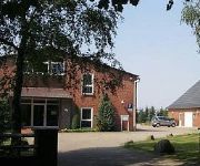
Wachendorf Landhaus
Videos from this area
These are videos related to the place based on their proximity to this place.
Ballorig Sulingen
Ballorig Sulingen, ein Indoor Kinderspieleparadies. Zu empfehlen für Kinderfest, Kindergeburtstag oder einfach nur die Kinder beschäftigen. Sport treiben auch für Erwachsene ( Springen und...
Nachtwerk Areas
Nachtwerk Sulingen Nienburger Straße 5 D-27232 Sulingen Fon: +49 (0) 42 71 / 12 25 Fax: +49 (0) 42 71 / 12 35 eMail: info@nacht-werk-disco.de Internet: www.nacht-werk-disco.de.
18. Juli 2011: FC Sulingen I - Werder Bremen U19 1:4
Video produced by: http://www.themenundsports.de Durch Vermittlung von Werders Neu Profi, dem Sulinger Özkan Yildirim, spielte am 18. Juli 2011 seine Mannschaft Werder Bremen U19 beim ...
skike Rallye Team | Allkofer Goetzenberger | ADAC Opel Cup | Onboard 2. Lauf Sulingen 03.052013 |
Onbard-Video aus dem Cockpit des Opel Adams gefahren von Christian Allkofer und Kathrin Goetzenberger vom ADAC Team Südbayern, das skike als stolzer Sponsor unterstützt. Footage vom 2.
MSG Sulingen 21.07.2012 Brust GoPro MX #129
Mal eine andere Perspektive ausprobiert. Ein bearbeitetes Video von dem Tag, gibt es hier: http://www.youtube.com/watch?v=cT869qUNYuM&hd=1.
Mathias Kuhnert Citroen C2 R2 Rallye Sulingen 2008
4. Gesamt / over all, 114 Teilnehmer / competitors.
Videos provided by Youtube are under the copyright of their owners.
Attractions and noteworthy things
Distances are based on the centre of the city/town and sightseeing location. This list contains brief abstracts about monuments, holiday activities, national parcs, museums, organisations and more from the area as well as interesting facts about the region itself. Where available, you'll find the corresponding homepage. Otherwise the related wikipedia article.
Schwaförden (Samtgemeinde)
Schwaförden is a Samtgemeinde ("collective municipality") in the district of Diepholz, in Lower Saxony, Germany. Its seat is in Schwaförden. The Samtgemeinde Schwaförden consists of the following municipalities: Affinghausen Ehrenburg Neuenkirchen Scholen Schwaförden


