Safety Score: 3,0 of 5.0 based on data from 9 authorites. Meaning we advice caution when travelling to Germany.
Travel warnings are updated daily. Source: Travel Warning Germany. Last Update: 2024-05-07 07:59:51
Touring Ringelheim
The district Ringelheim of Alt Wallmoden in Lower Saxony is a subburb located in Germany about 135 mi west of Berlin, the country's capital place.
Need some hints on where to stay? We compiled a list of available hotels close to the map centre further down the page.
Being here already, you might want to pay a visit to some of the following locations: Sehlde, Elbe, Lutter am Barenberge, Heere and Baddeckenstedt. To further explore this place, just scroll down and browse the available info.
Local weather forecast
Todays Local Weather Conditions & Forecast: 14°C / 58 °F
| Morning Temperature | 10°C / 50 °F |
| Evening Temperature | 12°C / 54 °F |
| Night Temperature | 9°C / 48 °F |
| Chance of rainfall | 0% |
| Air Humidity | 76% |
| Air Pressure | 1019 hPa |
| Wind Speed | Gentle Breeze with 9 km/h (5 mph) from South-West |
| Cloud Conditions | Overcast clouds, covering 100% of sky |
| General Conditions | Light rain |
Wednesday, 8th of May 2024
15°C (59 °F)
9°C (48 °F)
Broken clouds, light breeze.
Thursday, 9th of May 2024
17°C (63 °F)
11°C (52 °F)
Broken clouds, light breeze.
Friday, 10th of May 2024
18°C (64 °F)
12°C (54 °F)
Scattered clouds, light breeze.
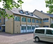
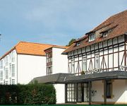
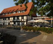
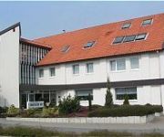
Hotels and Places to Stay
BonaMari
Golfhotel garni
Quellenhof
Ratskeller
Kniestedter Hof
Hotel Harsshof
Am Posthof
Waldhotel Burgberg
Keune
Videos from this area
These are videos related to the place based on their proximity to this place.
Cold Water Challenge 2014 - FF Baddeckenstedt
Wir bedanken uns für die Nominierung durch die FF Burgdorf und nominieren die Ortswehren: - FF Groß Elbe - FF Oelber am weißen Wege - FF Holle.
Burg Lichtenberg und Windmühle Salder
Dies ist mein erster Versuch Sehenswürdigkeiten mit dem Hexacopter zu filmen.
Comptine d'Un Autre Été - Die fabelhafte Welt der Amélie - Yamaha PSR S500
Comptine d'Un Autre Été - Die fabelhafte Welt der Amélie Cover auf einem Yamaha PSR S500.
Oberliga Ringen Salzgitter vs. Sangerhausen -120 Kg. world heavyweight champion Murat Yavuz
02.10.2010. Kampftag zwei für die WKG Salzgitter. Kampf zwei an diesem Abend. Murat Yavuz, unser frischgebackener ü-35 Weltmeister im Schwergewicht, holt vier Mannschaftspunkte im gr.-röm....
Ringen Oberliga 2010, WKG Salzgitter vs. AC Germania Artern, Sergej Baal Fünferwertung
25.09.2010. erster Kampfabend in der Saison. Hexenkessel Eikelarena. Halle voll. Stimmung wie immer prächtig. Gastmannschaft AC Germnia Artern, Titelverteidiger. Gastgeber, WKG Salzgitter,...
Dieselfaszination. Ein Tag zwischen Ringelheim und Goslar
Am 08.03.2014 zog es mich zusammen mit zwei Kollegen ins Harzer Vorland, in der Zusammenfassung ist es ein schöner Kurzfilm geworden. Das Video würde in Full HD und Dolby Digital ...
Videos provided by Youtube are under the copyright of their owners.
Attractions and noteworthy things
Distances are based on the centre of the city/town and sightseeing location. This list contains brief abstracts about monuments, holiday activities, national parcs, museums, organisations and more from the area as well as interesting facts about the region itself. Where available, you'll find the corresponding homepage. Otherwise the related wikipedia article.
Goslar (district)
Goslar is a district in Lower Saxony, Germany. It is bounded by (from the south and clockwise) the districts of Osterode, Northeim, Hildesheim and Wolfenbüttel, the city of Salzgitter, and by the states of Saxony-Anhalt and Thuringia.
Free solo climbing
Free solo climbing, also known as free soloing, is a form of free climbing where the climber (the free soloist) forgoes ropes, harnesses and other protective gear while ascending and relies only on his or her physical strength, climbing ability, and psychological fortitude to avoid a fatal fall. Free solo climbing should not be confused with general free climbing, in which gear is typically used for safety in case of a fall, but not to assist the climb.
Battle of Lutter
The Battle of Lutter took place during the Thirty Years' War, on 27 August 1626, between the forces of the Protestant Christian IV of Denmark and those of the Catholic League. Lutter am Barenberge lies to the south of the modern town of Salzgitter, then within the Imperial Circle Estate of Lower Saxony, and now in northwest Germany. The battle resulted in a heavy defeat of Christian IV's troops by those of Emperor Ferdinand II, led by the Catholic League general Johan Tzerclaes, Count of Tilly.
Salzgitter-Bad
With a population of about 20,000, Salzgitter-Bad is the second biggest quarter of the German city Salzgitter in Lower Saxony. Salzgitter's name derives from it; the quarter is regarded as the historical and cultural centre of Salzgitter.
Central Registry of State Judicial Administrations
The Central Registry of State Judicial Administrations (German: Zentrale Erfassungsstelle der Landesjustizverwaltungen, ZESt) in Salzgitter-Bad, West Germany was established on 24 November 1961 in the aftermath of the construction of the Berlin Wall. Its function was to verify human rights violations by the government of East Germany like homicide at the Inner German border, political persecution, torture and maltreatment, etc.
Salzgitter Bismarck Tower
The Salzgitter Bismarck Tower is an observation tower completed in 1900 in Salzgitter, Germany. Unlike most other Bismarck towers, it does not consist of all-stone design, but instead has a base of bricks with a lattice tower on top. On one side, it resembles an Eiffel Tower with a bow between its feet. The Harz Club voted to build the Bismarck Tower at Salzgitter on 8 May 1899. The same day, the site was chosen and bought by the forest cooperative of Gitter.
Salzgittersee
Salzgittersee (Salzgitter Lake) is a lake in the city of Salzgitter in Lower Saxony, Germany. At an elevation of 78 m, its surface area is 0.75 km². \t\t \t\t\tSalzgitter-See A 2005. jpg \t\t\t Salzgitter Lake in the year 2005 \t\t\t \t\t \t\t \t\t\tSalzgitter-See B 2005. jpg \t\t\t \t\t\t \t\t \t\t \t\t\tSalzgitter-See C 2005. jpg
Konrad mine
The pit Konrad (Schacht Konrad) is a former iron ore mine proposed as a deep geological repository for medium- and low level radioactive waste in the city Salzgitter in the Metropolitan region Hannover-Braunschweig-Göttingen-Wolfsburg in southeast Lower Saxony, Germany, located between Hildesheim and Braunschweig. It has two shafts : Konrad I and Konrad II.
Lautenthal
The formerly free mining town of Lautenthal is a state-recognised, climatic spa with around 2,000 inhabitants that has been part of the borough of Langelsheim since 1972.
Salzgitter Hills
The Salzgitter Hills (German: Salzgitter-Höhenzug, also Salzgitterscher Höhenzug) is an area of upland up to 322.9 metres in height, in the Lower Saxon Hills between Salzgitter and Goslar in the districts of Wolfenbüttel and Goslar and in the territory of the independent town of Salzgitter. The hills lie in the German federal state of Lower Saxony.
Gelmke
The Gelmke is a small stream, roughly 10 kilometres long, and right-hand tributary of the Abzucht in Lower Saxony, Germany. The stream flows through part of the town of Goslar.
Sudmerberg
Sudmerberg is a suburb of Goslar on the edge of the Harz Mountains in Germany, which is named after the prominent, 354 metre high hill to the east. It lies between Goslar and Bad Harzburg on the B 6 federal road and has 1,880 inhabitants.
Treppenstein
The Treppenstein is a rock formation in the Oker valley in the Harz mountains of central Germany. It lies on the trail from the Romkerhall Waterfall to the Kästeklippen. The rocks consist of granite and have clearly undergone so-called "wool sack weathering" (Wollsackverwitterung). The Treppenstein is a popular destination and part of the system of checkpoints (no. 117) in the Harzer Wandernadel hiking trail network.
Imperial Palace of Goslar
The Imperial Palace of Goslar is a historical building complex at the foot of the Rammelsberg hill in the south of the town of Goslar north of the Harz mountains, central Germany. It covers an area of about 340 by 180 metres and stands. The palace grounds originally included the Kaiserhaus, the old collegiate church of St. Simon and St. Jude, the palace chapel of St. Ulrich and the Church of Our Lady (Liebfrauenkirche).
Goslar Cathedral
The church known as Goslar Cathedral was the collegiate church of St. Simon and St. Jude in the town of Goslar in central Germany. It was built between 1040 and 1050 and stood in the district of the Imperial Palace of Goslar. It was demolished in 1819–1822. Today only the porch of the north portal remains. It was a church of Benedictine canons.
Neile
Neile is a river of Lower Saxony, Germany.
Salder House
Salder House is a stately home in the Renaissance style in Salder, a village in the borough of Salzgitter in Lower Saxony. It was built in 1608 for the lords of Saldern by master builder, Paul Francke, by order of Kriegsrat David Sachses of Wolfenbüttel. In 1695, the heir to the throne, Augustus William of Brunswick-Wolfenbüttel bought the complex and had major restoration work carried out on it.
Laute (river)
The Laute is a right tributary of the Innerste river in Lower Saxony. It rises in the vicinity of Hahnenklee in the Upper Harz and discharges about 6 km later into the Innerste in Lautenthal. The source is at an elevation of about 540 m at the bottom of a mountain called Kuttelbacher Berg. The Laute flows to the west parallel to road L 516 which is called Hahnenkleer Straße in Lautenthal. The name of the town means Laute Valley.


