Safety Score: 3,0 of 5.0 based on data from 9 authorites. Meaning we advice caution when travelling to Germany.
Travel warnings are updated daily. Source: Travel Warning Germany. Last Update: 2024-05-15 08:00:47
Delve into Mehlis
The district Mehlis of Zella-Mehlis in Free State of Thuringia is a subburb in Germany about 175 mi south-west of Berlin, the country's capital town.
If you need a hotel, we compiled a list of available hotels close to the map centre further down the page.
While being here, you might want to pay a visit to some of the following locations: Benshausen, Bermbach, Suhl, Unterschonau and Viernau. To further explore this place, just scroll down and browse the available info.
Local weather forecast
Todays Local Weather Conditions & Forecast: 22°C / 72 °F
| Morning Temperature | 10°C / 50 °F |
| Evening Temperature | 20°C / 67 °F |
| Night Temperature | 14°C / 56 °F |
| Chance of rainfall | 0% |
| Air Humidity | 38% |
| Air Pressure | 1006 hPa |
| Wind Speed | Gentle Breeze with 9 km/h (5 mph) from West |
| Cloud Conditions | Broken clouds, covering 74% of sky |
| General Conditions | Broken clouds |
Thursday, 16th of May 2024
11°C (51 °F)
10°C (51 °F)
Moderate rain, gentle breeze, overcast clouds.
Friday, 17th of May 2024
10°C (50 °F)
9°C (48 °F)
Light rain, gentle breeze, overcast clouds.
Saturday, 18th of May 2024
14°C (57 °F)
9°C (48 °F)
Light rain, light breeze, overcast clouds.
Hotels and Places to Stay
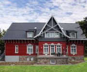
Villa Silva Oberhof
City Hotel am CCS
HVD Grand Hotel
Michel Hotel Suhl
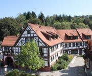
Goldener Hirsch
Berghotel Oberhof
Ringberg
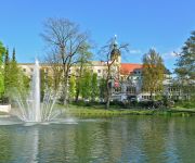
Stadt Suhl
Chalet Sonnenhang
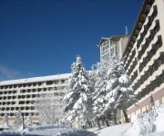
Treff Hotel Panorama
Videos from this area
These are videos related to the place based on their proximity to this place.
Kellerbrand Suhl-Nord HD
Gegen Mittag wurde die Feuerwehr Suhl zu einem Brand in den Stadtteil Suhl-Nord gerufen. Bei Eintreffen der ersten Einsatzkräfte stellte sich heraus das im Keller brennt. Verletzte gab es...
Schöne Doppelhaushälfte in Suhl-Albrechts
Hier präsentieren wir Ihnen eine schicke Doppelhaushälfte im Suhler Stadtteil Albrechts. Weitere Immobilien finden Sie auf unserer Website: http://www.hauptmakler.de | https://www.facebook.com/...
Wohnungsbrand Suhl Nord (HD)
Am 22.5.14 wurde die Feuerwehr Suhl gegen 11:15 Uhr zu einer Explosion in einer Plattenbauwohnung gerufen. Mehrere Bewohner berichteten von lauten Knallgeräuschen. Von einem Balkon in der.
Steam trip, the Thuringen express
The Rotterdam Steam foundation Thuringen express with the BR 01 V200 & Br 35 1097 in Rotterdam, Erfurth and Meiningen.
Kamingespräch 2014/15 Nr. 4 - Februar: Auslaufmodell Ehrenamt? Wer engagiert sich in Zella-Mehlis?
Beim 4. Kamingespräch der Saison 2014/2015 ging es um das Thema Ehrenamt. Fast 90 Gäste waren gekommen, um der Diskussion über Beweggründe, Ziele und Probleme im bürgerschaftlichen ...
Videos provided by Youtube are under the copyright of their owners.
Attractions and noteworthy things
Distances are based on the centre of the city/town and sightseeing location. This list contains brief abstracts about monuments, holiday activities, national parcs, museums, organisations and more from the area as well as interesting facts about the region itself. Where available, you'll find the corresponding homepage. Otherwise the related wikipedia article.
Rennsteig Tunnel
Rennsteig Tunnel is the longest road tunnel in Germany with a length of 7,916 meters (4.919 mi). The Rennsteig Tunnel is part of the motorway Autobahn A 71 between Gräfenroda and Oberhof in Thuringia. It is also called the Christiane Tunnel for its "godmother" Christiane Herzog, wife of the former German President Roman Herzog. The tunnel was built between 26 June 1998 and 5 July 2003, when it was opened by German chancellor Gerhard Schröder.
Vessra Abbey
Vessra Abbey (Kloster Veßra) was a Premonstratensian monastery in the village also named Kloster Veßra in the district of Hildburghausen, Thuringia, Germany. The monastery was founded in the 1130s by Gotebold II, Count of Henneberg, and his wife Liutgard on a site near the confluence of the Schleuse and the Werra. The church was dedicated in 1138; the foundation received papal confirmation three years later.
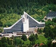
Ringberghaus
The Ringberghaus, also often called Ringberghotel is a hotel east of the German city Suhl. In the 1970s, it was one of the most controversially discussed new buildings in the Suhl area.
Apfelstädtaue
Apfelstädtaue is a Verwaltungsgemeinschaft ("collective municipality") in the district of Gotha, in Thuringia, Germany. The seat of the Verwaltungsgemeinschaft is in Georgenthal. The Verwaltungsgemeinschaft Apfelstädtaue consists of the following municipalities: Emleben Georgenthal Herrenhof Hohenkirchen
Feldstein (Verwaltungsgemeinschaft)
Feldstein is a Verwaltungsgemeinschaft ("collective municipality") in the district of Hildburghausen, in Thuringia, Germany. The seat of the Verwaltungsgemeinschaft is in Themar, itself not part of the Verwaltungsgemeinschaft. The Verwaltungsgemeinschaft Feldstein consists of the following municipalities:
Dolmar (Verwaltungsgemeinschaft)
Dolmar is a former Verwaltungsgemeinschaft ("collective municipality") in the district Schmalkalden-Meiningen, in Thuringia, Germany. The seat of the Verwaltungsgemeinschaft was in Schwarza. It was disbanded on 1 January 2012. The Verwaltungsgemeinschaft Dolmar consisted of the following municipalities: Christes Dillstädt Kühndorf Rohr Schwarza
Haselgrund
Haselgrund is a Verwaltungsgemeinschaft ("collective municipality") in the district Schmalkalden-Meiningen, in Thuringia, Germany. The seat of the Verwaltungsgemeinschaft is in Viernau. The Verwaltungsgemeinschaft Haselgrund consists of the following municipalities: Altersbach Bermbach Oberschönau Rotterode Springstille Unterschönau
Oberhof bobsleigh, luge, and skeleton track
The Oberhof bobsleigh, luge, and skeleton track is a venue used for bobsled, luge and skeleton located in Oberhof, Germany.
2008–09 Biathlon World Cup – World Cup 4
The 2008-09 Biathlon World Cup/World Cup 4 has been held in Oberhof, Germany. From Wednesday January 7 until Sunday January 11, 2009.
Rennsteiggarten Oberhof
The Rennsteiggarten Oberhof (7 hectares) is a botanical garden specializing in mountain flora, located in Rennsteig at Am Pfanntalskopf 3, Oberhof, Thuringia, Germany. It is open daily in the warmer months; an admission fee is charged. The garden was established in 1970 on the grounds of a former quarry at an elevation of 868 meters on the Pfanntalskopf.
Spitter Waterfall
The Spitter Waterfall is the highest natural waterfall in the German state of Thuringia, with a drop of 19 metres. The Spitter Waterfall is located below the hillwalking trail of the Rennsteig and tumbles down four cascade steps, 19 metres in overall height, through a notch in the floor of an ice-age hollow on the northern side of the Thuringian Forest. The waterfall is part of the Spitter stream.
Ebertswiese
The Ebertswiese, is a boggy area of grassland in the Thuringian Forest in central Germany. It has been a nature conservation area since 1936 and is a recreation area in the municipality of Floh-Seligenthal on the Rennsteig trail. The River Spitter has its source within the reserve. In addition to the Ebertswiese mountain hotel, the Bergseebaude guest house and various walking huts the main destination is the Bergsee lake, which was created in 1900 from a disused quarry.
Spitter (river)
The Spitter is a stream near Tambach-Dietharz in the Thuringian Forest in Germany. It flows through the Spitter Valley and has the highest waterfall in Thuringia..
2009–10 Biathlon World Cup – World Cup 4
The 2009–10 Biathlon World Cup – World Cup 4 was the fourth event of the season and was held in Oberhof, Germany from Wednesday, January 6 until Sunday, January 10, 2010.
Schmalwasser
The Schmalwasser is a large heath stream on the southern edge of the Lüneburg Heath. The brook rises near Blickwedel, winds southwards, is joined from the left by the Räderbach and discharges into the Lutter in the village of Bargfeld (in the municipality of Eldingen). The story Die Wasserstraße by Arno Schmidt (1964) is about a walk up the Schmalwasser.
2010–11 Biathlon World Cup – World Cup 4
The 2010–11 Biathlon World Cup - World Cup 4 was held in Oberhof, Germany, from 5 January until 9 January 2011.
Falkenstein (Thuringia)
The Falkenstein lies southeast of the small town of Tambach-Dietharz in Schmalwasser bottom (Schmalwassergrund) and is the most important rock formation in the Thuringian Forest in central Germany. It consists of porphyry. On the valley side the crags are 96 metres high. Because of its situation on the side of a hill (the uphill side has a height of about 25 metres) it appears most striking when one stands immediately in front of it.
Lichtenau (river)
Lichtenau is a river of Thuringia, Germany.
Schleuse (river)
Schleuse is a river of Thuringia, Germany.
Schönau (river)
Schönau is a river of Thuringia, Germany.
Lütsche-Flößgraben
Lütsche-Flößgraben is a river of Thuringia, Germany.
Lütsche
Lütsche is a river of Thuringia, Germany.
Mühlwasser
Mühlwasser is a river of Thuringia, Germany.
2011–12 Biathlon World Cup – World Cup 4
The 2011–12 Biathlon World Cup – World Cup 4 was held in Oberhof, Germany, from 4 January until 8 January 2012. It was the fourth of nine scheduled events on the World Cup schedule, with both men and women competing in three different disciplines.
Dolmar-Salzbrücke
Dolmar-Salzbrücke is a Verwaltungsgemeinschaft ("collective municipality") in the district Schmalkalden-Meiningen, in Thuringia, Germany. The seat of the Verwaltungsgemeinschaft is in Schwarza. It was formed on 1 January 2012 from the former Verwaltungsgemeinschaften Dolmar and Salzbrücke.







!['L3247 Zella-Mehlis - Sterngrund - Oberhof [BMW F30 320d]' preview picture of video 'L3247 Zella-Mehlis - Sterngrund - Oberhof [BMW F30 320d]'](https://img.youtube.com/vi/Vy_BEQqESCA/mqdefault.jpg)
!['L3247 Zella-Mehlis - Sterngrund - Oberhof [BMW X6M50D]' preview picture of video 'L3247 Zella-Mehlis - Sterngrund - Oberhof [BMW X6M50D]'](https://img.youtube.com/vi/ZKm689n0cD4/mqdefault.jpg)