Safety Score: 3,0 of 5.0 based on data from 9 authorites. Meaning we advice caution when travelling to Germany.
Travel warnings are updated daily. Source: Travel Warning Germany. Last Update: 2024-05-02 08:23:34
Delve into Wenigentaft
Wenigentaft in Free State of Thuringia is a city located in Germany about 192 mi (or 309 km) south-west of Berlin, the country's capital town.
Current time in Wenigentaft is now 11:10 AM (Thursday). The local timezone is named Europe / Berlin with an UTC offset of 2 hours. We know of 12 airports closer to Wenigentaft, of which 5 are larger airports. The closest airport in Germany is Fritzlar Airport in a distance of 37 mi (or 60 km), North-West. Besides the airports, there are other travel options available (check left side).
There are several Unesco world heritage sites nearby. The closest heritage site in Germany is Wartburg Castle in a distance of 21 mi (or 34 km), North-East. In need of a room? We compiled a list of available hotels close to the map centre further down the page.
Since you are here already, you might want to pay a visit to some of the following locations: Buttlar, Rasdorf, Unterbreizbach, Schleid and Schenklengsfeld. To further explore this place, just scroll down and browse the available info.
Local weather forecast
Todays Local Weather Conditions & Forecast: 21°C / 69 °F
| Morning Temperature | 10°C / 50 °F |
| Evening Temperature | 17°C / 62 °F |
| Night Temperature | 11°C / 51 °F |
| Chance of rainfall | 5% |
| Air Humidity | 57% |
| Air Pressure | 1000 hPa |
| Wind Speed | Gentle Breeze with 8 km/h (5 mph) from North-East |
| Cloud Conditions | Scattered clouds, covering 33% of sky |
| General Conditions | Moderate rain |
Friday, 3rd of May 2024
8°C (47 °F)
9°C (48 °F)
Light rain, moderate breeze, overcast clouds.
Saturday, 4th of May 2024
12°C (54 °F)
9°C (49 °F)
Light rain, light breeze, overcast clouds.
Sunday, 5th of May 2024
8°C (46 °F)
8°C (47 °F)
Light rain, moderate breeze, overcast clouds.
Hotels and Places to Stay
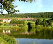
Hessen Hotelpark Hohenroda
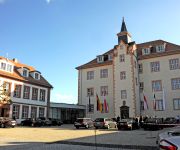
Schloss Geisa
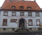
Zum Adler Landgasthof
Videos from this area
These are videos related to the place based on their proximity to this place.
Schleid : Rhön
Der Ortsteil Schleid hat 385 Einwohner. Es gibt eine sehenswerte Barockkirche, ein Gemeindehaus, eine Kindertagesstätte und der Rhönradweg führt durch den Ort. Das kulturelle Leben des Dorfes...
Großbrand in Schleid
Schleid, 27.09.2013: Wieder Großbrand im Eifelkreis Bitburg-Prüm: Stallungen brennen in Schleid nieder - Tiere kommen um.
Neujahr2015
Neujahr 2015 am Weinbergkreuz in Geisa/Rhön Alphornblasen und Böllerschießen mit der Alphorngruppe "Die Siebenschläfer"
Point-Alpha-Wanderung von Schlitzenhausen aus - Hochrhön-Touren
Das Video beschreibt eine Halbtageswanderung von Schlitzenhausen zur Gedenkstätte Point Alpha zwischen Geisa und Rasdorf an der hessisch-thüringischen Grenze. Infos und ...
Geisa Thüringen
Schon vor 100 Jahren wurde für Konsumprodukte geworben. Damals nannte man die Werbung jedoch Reklame und jede Firma welche was auf sich hielt, produzierte kleine Briefmarken ähnliche ...
Die bittere Wahrheit ber die Mahnwachen in Deutschland Ein Video von Dimitri1901
Hier eine krittische Darstellung von einer Montagsdemo, die ich für wichtig halte !!
Karnevalsumzug in Geisa 2013 - Teil 2/3
Was war das wieder für eine Party! Tausende Menschen säumten die Straßen der kleinen Rhöngemeinde Geisa, um die größte Karnevalssause in der Rhön zu feiern. Viele verrückte Kostüme,...
Electronic Green Open air 2012 Karotte - Caminando
Karotte plays Reboots - Caminando at Electronic Green Open air in Geisa (Rhön) 27.05.2012.
Electronic Green Open Air 2012 - Karotte
Karotte at Electronic Green Open air in Geisa (Rhön) 27.05.2012.
Videos provided by Youtube are under the copyright of their owners.
Attractions and noteworthy things
Distances are based on the centre of the city/town and sightseeing location. This list contains brief abstracts about monuments, holiday activities, national parcs, museums, organisations and more from the area as well as interesting facts about the region itself. Where available, you'll find the corresponding homepage. Otherwise the related wikipedia article.
Observation Post Alpha
Observation Post Alpha, OP Alpha or Point Alpha was a Cold War observation post between Rasdorf, Hesse, West Germany and Geisa, Thuringia, East Germany. The post overlooked part of the Fulda Gap, which would have been a prime invasion route had the Cold War erupted into actual warfare.
Mansbach
Mansbach is a village and a municipal district of Hohenroda in Hersfeld-Rotenburg district in eastern Hesse, Germany.
Oberbreitzbach
Oberbreitzbach is a village and a municipal district of Hohenroda in Hersfeld-Rotenburg district in eastern Hesse, Germany.
Taft (Ulster)
Taft (Ulster) is a river of Hesse, Germany.


