Safety Score: 3,0 of 5.0 based on data from 9 authorites. Meaning we advice caution when travelling to Germany.
Travel warnings are updated daily. Source: Travel Warning Germany. Last Update: 2024-05-17 08:07:57
Discover Angstedt
The district Angstedt of Gräfinau-Angstedt in Free State of Thuringia is a district in Germany about 162 mi south-west of Berlin, the country's capital city.
Looking for a place to stay? we compiled a list of available hotels close to the map centre further down the page.
When in this area, you might want to pay a visit to some of the following locations: Pennewitz, Herschdorf, Moehrenbach, Gillersdorf and Drobischau. To further explore this place, just scroll down and browse the available info.
Local weather forecast
Todays Local Weather Conditions & Forecast: 14°C / 58 °F
| Morning Temperature | 13°C / 55 °F |
| Evening Temperature | 12°C / 53 °F |
| Night Temperature | 10°C / 50 °F |
| Chance of rainfall | 0% |
| Air Humidity | 83% |
| Air Pressure | 1006 hPa |
| Wind Speed | Moderate breeze with 11 km/h (7 mph) from West |
| Cloud Conditions | Overcast clouds, covering 100% of sky |
| General Conditions | Light rain |
Saturday, 18th of May 2024
12°C (53 °F)
10°C (50 °F)
Light rain, light breeze, overcast clouds.
Sunday, 19th of May 2024
14°C (58 °F)
10°C (50 °F)
Light rain, gentle breeze, overcast clouds.
Monday, 20th of May 2024
19°C (66 °F)
13°C (55 °F)
Light rain, light breeze, broken clouds.
Hotels and Places to Stay
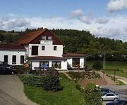
Risch Landpension
Jägerhof Hotel-Restaurant
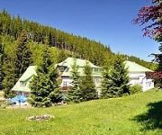
Schobsetal Waldhotel
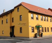
Zum Ginkgobaum Frühstückshotel
Videos from this area
These are videos related to the place based on their proximity to this place.
Versicherung in Ilmenau bei Diana Schüler - ERGO Versicherung
Das ERGO Service-Center Schüler bietet Ihnen eine persönliche Beratung, attraktive Versicherungs- und Finanzdienstleistungsprodukte sowie eine schnelle Schadenregulierung. Sie finden uns...
Medientechnologie an der Technischen Universität Ilmenau
Trailer zu einer DVD-Produktion im Rahmen eines studentischen Projektes. Es werden die medientechnischen Labore des Instituts für Medientechnik und der technischen Universität Ilmenau ...
40 m lange Carrera Rennbahn @ Kinderuni Ilmenau 2009
Kai vom Carrera Club Thüringen baute vom 11. bis 25. November 2009 zu den fünf Kinderuni Tagen jeweils die 41 m lange Rennstrecke "Der verrückte Knoten". Über 600 Kinder durften sich daran...
Synchron-Band Ankunft in Möhrenbach zur Nachkirmse 2011 mit VW T4 TDI Synchro im Schlamm
Synchron - Band Ankunft in Möhrenbach zur Nachkirmse 2011 mit VW T4 TDI Synchro fast nicht zum Zelt gekommen, Erde umgegraben. www.synchron-band.de Video: Heiko Mohr / Disco u.
Katzenbabys spielen, Mutter ist Maine-Coon-Perser-Mix
Katzenbabys spielen, Mutter ist Maine-Coon-Perser-Mix.
Konigsee Lake, Bavaria, Germany Aout 2014
Le lac Konigsee filmé avec le camescope Panasonic HC X920. Un paradis.
Let's Play Resident Evil 3 Nemesis #018 - Raccoon City Hospital [HD Widescreen]
PLAYLIST: http://goo.gl/f40dpP • KANAL: http://goo.gl/1Ls04 ▻ TWITTER: http://goo.gl/4mMQ0 • FACEBOOK: http://goo.gl/UlLfm ▻ HOMEPAGE: http://goo.gl/Gcl6q • ABONNIEREN: http://bit.ly/...
Let's Play Grand Theft Auto Vice City #003 - Zombie Elvis! [German] [HD]
«Grand Theft Auto Vice City» Actionspiel von Rockstar Games Homepage: http://www.rockstar.de «Let's Play Grand Theft Auto Vice City» Kommentiertest Gameplay von CebraxxLP Offizieller...
Let's Play Resident Evil 3: Nemesis #001 - Wilkommen in Raccoon City [Deutsch] [HD Widescreen]
Nach einer längeren Pause geht es endlich mit einem Ernsthaften Projekt weiter. Gestatten... Resident Evil 3: Nemesis! ▻ PLAYLIST: http://goo.gl/f40dpP • KANAL: http://goo.gl/1Ls04 ▻...
Videos provided by Youtube are under the copyright of their owners.
Attractions and noteworthy things
Distances are based on the centre of the city/town and sightseeing location. This list contains brief abstracts about monuments, holiday activities, national parcs, museums, organisations and more from the area as well as interesting facts about the region itself. Where available, you'll find the corresponding homepage. Otherwise the related wikipedia article.
Gleichen
Gleichen is the name of two groups of castles in Germany, thus named from their resemblance to each other (German: gleich = like, or resembling).
Ilm-Kreis
Ilm-Kreis is a district in Thuringia, Germany. It is bounded by (from the north and clockwise) the city of Erfurt, the districts of Weimarer Land, Saalfeld-Rudolstadt and Hildburghausen, the city of Suhl, and the districts of Schmalkalden-Meiningen and Gotha. It is named after the river Ilm, flowing through the district.
International Student Week in Ilmenau
International Student Week in Ilmenau is a student festival, held biennially in the town of Ilmenau, located in the district of Ilm-Kreis, Thuringia, Germany. Open to students of all faculties around the world. It was established in 1993 and has taken place every two years since then. At the conference participants discuss topics and experience a broad cultural range. On average about 350 participants from around 40-50 countries take part at the conference.
Jonas Valley
Jonastal (Jonas Valley), situated in the Ilm-Kreis district in Germany between Crawinkel and Arnstadt and near to the town of Ohrdruf, was a scene of military construction under the National Socialist regime during the last years of the Second World War. Thousands of prisoners from the Buchenwald concentration camp under the command of SS General Hans Kammler were forced to dig 25 tunnels into the surrounding mountain and the whole operation was performed under the strictest secrecy.
Arnstadt Central Station
Arnstadt Central Station (Arnstadt Hauptbahnhof) is a railway station for the town of Arnstadt in Thuringia, Germany. It is situated on the meeting point of the Erfurt-Schweinfurt, Arnstadt–Saalfeld and Arnstadt-Ichtershausen lines.
Technische Universität Ilmenau
The Ilmenau University of Technology is a German public research university located in Ilmenau, Thuringia, Germany. It was founded in 1894, it has a total of 5 adacemic departments (faculties) and about 7,200 undergraduate students.
Geratal
Geratal is a Verwaltungsgemeinschaft ("collective municipality") in the district Ilm-Kreis, in Thuringia, Germany. The seat of the Verwaltungsgemeinschaft is in Geraberg. The Verwaltungsgemeinschaft Geratal consists of the following municipalities: Angelroda Elgersburg Geraberg Martinroda
Großbreitenbach (Verwaltungsgemeinschaft)
Großbreitenbach is a Verwaltungsgemeinschaft ("collective municipality") in the district Ilm-Kreis, in Thuringia, Germany. The seat of the Verwaltungsgemeinschaft is in Großbreitenbach. The Verwaltungsgemeinschaft Großbreitenbach consists of the following municipalities: Altenfeld Böhlen Friedersdorf Gillersdorf Großbreitenbach
Langer Berg
Langer Berg is a Verwaltungsgemeinschaft ("collective municipality") in the district Ilm-Kreis, in Thuringia, Germany. The seat of the Verwaltungsgemeinschaft is in Gehren. The Verwaltungsgemeinschaft Langer Berg consists of the following municipalities: Gehren Herschdorf Möhrenbach Neustadt am Rennsteig
Oberes Geratal
Oberes Geratal is a Verwaltungsgemeinschaft ("collective municipality") in the district Ilm-Kreis, in Thuringia, Germany. The seat of the Verwaltungsgemeinschaft is in Gräfenroda. The Verwaltungsgemeinschaft Oberes Geratal consists of the following municipalities: Frankenhain Gehlberg Geschwenda Gossel Gräfenroda Liebenstein
Riechheimer Berg
Riechheimer Berg is a Verwaltungsgemeinschaft ("collective municipality") in the district Ilm-Kreis, in Thuringia, Germany. The seat of the Verwaltungsgemeinschaft is in Kirchheim. The Verwaltungsgemeinschaft Riechheimer Berg consists of the following municipalities: Alkersleben Bösleben-Wüllersleben Dornheim Elleben Elxleben Kirchheim Osthausen-Wülfershausen Rockhausen
Bergbahnregion/Schwarzatal
Bergbahnregion/Schwarzatal is a Verwaltungsgemeinschaft ("municipal association") in the district Saalfeld-Rudolstadt, in Thuringia, Germany. The seat of the Verwaltungsgemeinschaft is in Oberweißbach. The Verwaltungsgemeinschaft Bergbahnregion/Schwarzatal consists of the following municipalities: Cursdorf Deesbach Katzhütte Meuselbach-Schwarzmühle
Mittleres Schwarzatal
Mittleres Schwarzatal is a Verwaltungsgemeinschaft ("municipal association") in the district Saalfeld-Rudolstadt, in Thuringia, Germany. The seat of the Verwaltungsgemeinschaft is in Sitzendorf. The Verwaltungsgemeinschaft Mittleres Schwarzatal consists of the following municipalities: Allendorf Bechstedt Döschnitz Dröbischau Mellenbach-Glasbach Meura Oberhain Rohrbach Schwarzburg Sitzendorf Unterweißbach
Ehrenberg (Ilmenau)
The Ehrenberg (literally "mountain of honor") is a mountain to the east of Ilmenau, rising to a height of 528 meters and standing opposed to the Traugberg. The border between Ilmenau and Langewiesen runs through its apex, which is marked by a large wooden cross. It is home to part of the campus of the Technische Universität Ilmenau (Technical University of Ilmenau) and the Bundesanstalt für Wasserbau (Federal Institute for Hydraulic Engineering).
Burgstein (Thuringia)
The Burgstein is a rock formation, about 10 metres high in the valley of the Ilm in Langewiesen in the central German state of Thuringia. It is made from quartz porphyry and has been a geological natural monument since 1939. It was formed when the Ilm carved out its valley and washed away the surrounding rock. When the Ilmenau–Großbreitenbach railway was built in 1881 it was exposed again because rock at its foot was removed in order to lay the railway track.
Lichte (river)
The Lichte River is a right tributary of the Schwarza in Thuringia, Germany, and is 17 km long.
Oelze (river)
Oelze is a river of Thuringia, Germany.
Wipfra (river)
Wipfra is a river of Thuringia, Germany.
Blambach
Blambach is a river of Thuringia, Germany.
Rottenbach (Ilmenau)
Rottenbach (Ilmenau) is a river of Thuringia, Germany.
Schorte
Schorte is a river of Thuringia, Germany.
Schobse
Schobse is a river of Thuringia, Germany.
Wohlrose
Wohlrose is a river of Thuringia, Germany.


!['Let's Play Resident Evil 3 Nemesis #018 - Raccoon City Hospital [HD Widescreen]' preview picture of video 'Let's Play Resident Evil 3 Nemesis #018 - Raccoon City Hospital [HD Widescreen]'](https://img.youtube.com/vi/4No4Zs8Kq9U/mqdefault.jpg)
!['Let's Play Grand Theft Auto Vice City #003 - Zombie Elvis! [German] [HD]' preview picture of video 'Let's Play Grand Theft Auto Vice City #003 - Zombie Elvis! [German] [HD]'](https://img.youtube.com/vi/ERAcdqJIoKM/mqdefault.jpg)
!['Let's Play Resident Evil 3: Nemesis #001 - Wilkommen in Raccoon City [Deutsch] [HD Widescreen]' preview picture of video 'Let's Play Resident Evil 3: Nemesis #001 - Wilkommen in Raccoon City [Deutsch] [HD Widescreen]'](https://img.youtube.com/vi/hUa2rcEaICo/mqdefault.jpg)