Safety Score: 3,0 of 5.0 based on data from 9 authorites. Meaning we advice caution when travelling to Germany.
Travel warnings are updated daily. Source: Travel Warning Germany. Last Update: 2024-04-27 08:23:39
Discover Schillerhöhe
The district Schillerhöhe of Gerlingen in Regierungsbezirk Stuttgart (Baden-Württemberg) is a district in Germany about 321 mi south-west of Berlin, the country's capital city.
Looking for a place to stay? we compiled a list of available hotels close to the map centre further down the page.
When in this area, you might want to pay a visit to some of the following locations: Hemmingen, Schwieberdingen, Magstadt, Rutesheim and Boeblingen. To further explore this place, just scroll down and browse the available info.
Local weather forecast
Todays Local Weather Conditions & Forecast: 16°C / 61 °F
| Morning Temperature | 5°C / 40 °F |
| Evening Temperature | 15°C / 60 °F |
| Night Temperature | 11°C / 51 °F |
| Chance of rainfall | 0% |
| Air Humidity | 49% |
| Air Pressure | 1009 hPa |
| Wind Speed | Gentle Breeze with 8 km/h (5 mph) from North-West |
| Cloud Conditions | Few clouds, covering 17% of sky |
| General Conditions | Few clouds |
Sunday, 28th of April 2024
15°C (58 °F)
11°C (51 °F)
Overcast clouds, moderate breeze.
Monday, 29th of April 2024
17°C (63 °F)
11°C (53 °F)
Overcast clouds, light breeze.
Tuesday, 30th of April 2024
21°C (70 °F)
15°C (58 °F)
Light rain, light breeze, scattered clouds.
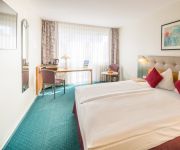
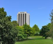
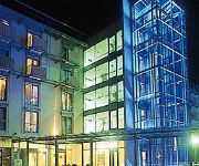
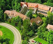
Hotels and Places to Stay
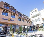
Krone
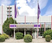
Mercure Hotel Stuttgart Sindelfingen an der Messe
Pullman Stuttgart Fontana
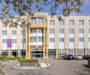
Mercure Hotel Stuttgart Gerlingen
Mercure Hotel Bristol Stuttgart Sindelfingen
arcona MO.HOTEL
Blankenburg
Amber
Best Western Plaza Hotel Stuttgart-Ditzingen
relexa Waldhotel Schatten
Videos from this area
These are videos related to the place based on their proximity to this place.
Hausbrand Im Wengert in Leonberg - 06.01.2015
Am Morgen des Dreikönigstags kam es in der Straße „Im Wengert“ nahe des Engelbergturms aus noch ungeklärter Ursache zu einem Hausbrand. Als die Leonberger Feuerwehr kurz nach der ...
Caterpillar 350 LME Earthworks / F. Kirchhoff, A81 Engelbergtunnel, Leonberg, Germany, 1995.
Caterpillar 350 LME Earthworks / F. Kirchhoff, A81 Engelbergtunnel, Leonberg, Germany, 1995. Meine Baumaschinenvideoserie zum kaufen/ buy my construction machines videos: ...
CAT 325 LN, 350 LME, Komatsu PC300NLC, ... - A81 Engelbergtunnel, Leonberg, 23.11.1995.
Heute sieht es so aus: https://www.dropbox.com/sh/cnym7t6o7k5awx9/y7eKEUx15L Caterpillar 325 LN, 350 LME, 966F, Liebherr R932 Tunnel, Komatsu PC300NLC, Mercedes-Benz Dump Trucks ...
CATERPILLAR 350 LME, 963, KOMATSU PC300NLC / F. Kirchhoff, Engelbergtunnel, Leonberg, 19.09.1995.
Caterpillar 350 LME, 963, Komatsu PC300NLC / F. Kirchhoff, Engelbergtunnel, Leonberg, 19.09.1995.
CAT 350 LME, 943, Komatsu PC300NLC, - A81 Engelbergtunnel, Leonberg, 24.10.1995.
Caterpillar 350 LME, 943, Komatsu PC300NLC, Mercedes-Benz, Bomag,... - A81 Engelbergtunnel, Leonberg, 24.10.1995.
Hotel Krone Gerlingen Stuttgart (English version)
http://www.krone-gerlingen.de In 1880, when the Hotel Krone in Gerlingen opened its doors for first time, the guests were treated to an intimate and friendly atmosphere - a tradition that...
Christoph 41
Dies ist ein Hubschrauber des Typ's EC 135 von Eurocopter Deutschland GmbH. Er ist stationiert in Leonberg. Mehr Daten zum Heli etc sind zu finden unter http://www.drf-luftrettung.de/ec-135.html...
Ray Collins hot club swing jump & blues band Glemseck 101 2012 stage show
The top of the bill at the Glemseck 101 stage show on Saturday night. An amazing performance which made the whole weekend worth the trip. I could have listened to them all night, which I nearly...
Autobahn am Engelbergtunnel (Leonberger Dreieck) im Zeitraffer (Marty Renger 007)
Autobahn A81 Nordportal des Engelbergtunnels bei Leonberg 28. August 2012 6:40 bis 7:32 Samsung HMX-H300 Full HD Camcorder (2 Bilder pro Sekunde) Da noch Urlaubszeit ist, fließt der Verkehr.
Glemseck 101 Cafe racer sprint 2012 Saturday 1st September
Lots more pictures on our website: http://thecrankcase.com.
Videos provided by Youtube are under the copyright of their owners.
Attractions and noteworthy things
Distances are based on the centre of the city/town and sightseeing location. This list contains brief abstracts about monuments, holiday activities, national parcs, museums, organisations and more from the area as well as interesting facts about the region itself. Where available, you'll find the corresponding homepage. Otherwise the related wikipedia article.
Warrior of Hirschlanden
The Warrior of Hirschlanden is a statue of a nude ithyphallic warrior made of sandstone, the oldest known Iron Age life-size anthropomorphic statue north of the Alps. It was a production of the Hallstatt culture, probably dating to the 6th century BC. It is now in the Württembergisches Landesmuseum in Stuttgart.
Vodafone-Funkturm Stuttgart-Vaihingen
The Vodafone-Funkturm (English Vodafone Radio Tower) is a 98.6-metre high tower for mobile phone services in Stuttgart-Vaihingen. The tower is constructed from three concrete tubes which are assembled together in the form of a tripod. It was built in December 1998 in four days. It has eight platforms for aerials at 58 m, 62.5 m, 67.5 m, 70 m, 75 m, 77.5 m, 80 m, and 82.5 m .
Castle Solitude
Castle Solitude in Stuttgart, Germany, was built as a hunting lodge between 1764 and 1769 under Duke Karl Eugen of Württemberg. It is not a true castle, but rather a rococo palace. Since 1956 the area is part of the urban district of Stuttgart-West. The castle is located on a high plain between the towns of Leonberg, Gerlingen and Stuttgart. The castle offers views to the north over Weilimdorf, Korntal and Ludwigsburg.
Solituderennen
The Solituderennen motorsport events are held on the 11.4 km Solitudering race track near Stuttgart. The event and the track were named after the nearby Castle Solitude. Motorsports events were held there from 1903 to 1965. Due to the narrow track, initially mainly motorcycle events were held there until 1956. The track and the pits were widened in early 1957 and sports car racing was staged by the automobile club ADAC.
Hirschlanden transmitter
The Hirschlanden transmitter is a facility of the Deutsche Telekom AG for mediumwave broadcasting south of Ditzingen-Hirschlanden (a village which is a part of the German city of Ditzingen) situated at 48°49'47" N and 9°02'15" E. The Hirschlanden transmitter was inaugurated in 1963 as a transmitter for the programming of Armed Forces Network (AFN) on 1142 kHz (after 1978, 1143 kHz) with a transmission power of 10 kW.
Max Planck Institute for Solid State Research
The Max Planck Institute for Solid State Research (MPI-FKF) is part of the Max Planck Society which operates 80 research facilities in Germany. It is a research institute located in Büsnau which is part of Stuttgart, Germany.
Patch Barracks
Patch Barracks is a well-known US military installation in Stuttgart-Vaihingen in Germany. It is named after Alexander M. Patch.
Vicke Lindstrand
Victor Emanuel Lindstrand, known as Vicke Lindstrand (27 November 1904 in Gothenburg – 7 May 1983 in Kosta) was a Swedish glass designer, textile and ceramic designer, and painter. He is considered a pioneer of Swedish glass art.
Nippenburg
Nippenburg is a ruined castle located in Schwieberdingen, Germany. The oldest records of Nippenburg date to 1160, which makes it one of the oldest castles in the region of Stuttgart. In the seventeenth century the castle was positioned favorably lying on a mountain spur over-half the Glemstals and built in direct proximity to the manor-house lock Nippenburg. In the following centuries the castle was heavily quarried and abandoned.
Max Planck Institute for Metals Research
The Max Planck Institute for Metals Research (German: Max-Planck-Institut für Metallforschung) is a research institute of the Max Planck Society located in Stuttgart. The institute was founded 1921 as Kaiser Wilhelm Institute for Metal Research in Berlin and closed 1932. 1934 it was reopened in Stuttgart and incorporated into the Max Planck Society in 1949. The Institute moved subsequently to Stuttgart-Büsnau from 1968 till 2002.
Schloss Leonberg
Schloss Leonberg was founded in 1248 by count Ulrich I of Württemberg. The original castle was modified between 1560 and 1565 by the master builder Aberlin Tretsch by order of the duke Christoph.
Golfanlage Schloss Nippenburg
Golfanlage Schloss Nippenburg is a golf course in Schwieberdingen, located on the northwestern edge of Stuttgart, Germany. The 18-hole course has its name from castle Nippenburg, located next the golf course. The par 71 course was designed by Bernhard Langer and was established in 1995. From 1995 to 1997 the Golfanlage Schloss Nippenburg hosted the German Open. The tournament was won by Colin Montgomerie in 1995, Ian Woosnam in 1996 and Ignacio Garrido in 1997.
Stuttgart-Weilimdorf
Weilimdorf is a north-western municipality of the German city of Stuttgart and covers an area of 12,6 km² with a population of around 30,000 . It first became part of Stuttgart in 1933 and until that time was a separate entity with its own administration which was then subsumed into the city administration. Weilimdorf includes the districts of Bergheim, Giebel, Hausen, Weilimdorf-Nord and Wolfbusch and is home to an expanding commercial area.
Engelberg Tunnel
The Engelberg Tunnel is a motorway tunnel on the German A81 Autobahn (motorway) just to the west of Stuttgart on the outskirts of Leonberg. During World War II it was used as a Nazi forced labor factory for the manufacture and storage of aircraft parts. The name is sometimes used to refer to the Old Engelberg Tunnel - which was Germany's first ever motorway tunnel - and sometimes used to refer to its successor, the completely rebuilt lower Engelberg Tunnel.
Bernhartshöhe
The Bernhartshöhe (Bernhart's heights) is a mountain of 549 m (1,801 ft) on the territory of the Vaihingen district, covering the southwesternmost part of the city of Stuttgart, capital of the German Bundesland (state) of Baden-Württemberg. It is the highest point of elevation of that city. Bernhartshöhe is directly adjacent to the crossing of the A 8 and A 81 motorways (Autobahnkreuz Stuttgart), two crucial traffic arteries of Southern Germany.
Engelberg (Leonberg)
Engelberg (Leonberg) is a mountain of Baden-Württemberg, Germany.
Grüner Heiner
Grüner Heiner is a mountain of Baden-Württemberg, Germany. It is a Schuttberg, an artificial hill built from the ruins and rubble from World War II.
High Performance Computing Center, Stuttgart
The High Performance Computing Center (HLRS) in Stuttgart, Germany, is a research institute and a supercomputer center.
Ditzingen station
Ditzingen station is in the town of Ditzingen in the German state of Baden-Württemberg, 7.7 kilometres from the start of the Württemberg Black Forest railway at Zuffenhausen and is part of the Stuttgart S-Bahn network.
Stuttgart-Weilimdorf station
Stuttgart-Weilimdorf station is in the Stuttgart municipality of Weilimdorf in the German state of Baden-Württemberg on the Württemberg Black Forest railway and is part of the Stuttgart S-Bahn network.
Korntal station
Korntal station is in the town of Korntal-Münchingen in the German state of Baden-Württemberg. It is on the Württemberg Black Forest railway, which is served by the Stuttgart S-Bahn network. It is the starting point of the Strohgäu Railway, which is served by the Württembergische Eisenbahn-Gesellschaft (Württemberg Railway Company).
Leonberg station
Leonberg station is a station located on the Black Forest Railway in the town of Leonberg in the German state of Baden-Württemberg. It is served by lines S 6 and S 60 of the S-Bahn. It is classified by Deutsche Bahn as a category 4 station.
Stuttgart Österfeld station
Österfeld station is located in the Stuttgart district of Vaihingen in the German state of Baden-Württemberg. It was built in 1985 at the junction of the main line of the Stuttgart S-Bahn where it emerges from the Hasenberg tunnel and connects with the Gäu Railway, which runs above ground. Attached to the station is a park-and-ride car park with 500 places, which is directly accessible from the A 831 autobahn. The station is otherwise only accessible by foot.
Stuttgart University station
Stuttgart University station (German: Bahnhof Stuttgart Universität) is an underground station on the Stuttgart S-Bahn in the German state of Baden-Württemberg. It was opened on 29 September 1985 to serve the development of the Pfaffenwaldring campus of the Stuttgart University in the district of Vaihingen. It lies on the main line of the S-Bahn. Its neighbouring stations are Stuttgart Schwabstraße and Stuttgart Österfeld (since 1993).
Höfingen station
Höfingen station is in the Leonberg district of Höfingen in the German state of Baden-Württemberg. It is located at kilometre 10.9 of the Black Forest Railway and is a station on the network of the Stuttgart S-Bahn.


