Safety Score: 3,0 of 5.0 based on data from 9 authorites. Meaning we advice caution when travelling to France.
Travel warnings are updated daily. Source: Travel Warning France. Last Update: 2024-05-18 08:26:29
Explore la Miranda
The district la Miranda of Portvendres in Pyrénées-Orientales (Occitanie) is located in France about 439 mi south of Paris, the country's capital.
If you need a place to sleep, we compiled a list of available hotels close to the map centre further down the page.
Depending on your travel schedule, you might want to pay a visit to some of the following locations: Colera, Vilamaniscle, Rabos, Espolla and Garriguella. To further explore this place, just scroll down and browse the available info.
Local weather forecast
Todays Local Weather Conditions & Forecast: 17°C / 63 °F
| Morning Temperature | 14°C / 58 °F |
| Evening Temperature | 18°C / 64 °F |
| Night Temperature | 16°C / 60 °F |
| Chance of rainfall | 0% |
| Air Humidity | 78% |
| Air Pressure | 1013 hPa |
| Wind Speed | Light breeze with 5 km/h (3 mph) from West |
| Cloud Conditions | Broken clouds, covering 69% of sky |
| General Conditions | Light rain |
Sunday, 19th of May 2024
19°C (66 °F)
16°C (60 °F)
Broken clouds, gentle breeze.
Monday, 20th of May 2024
18°C (65 °F)
16°C (61 °F)
Light rain, gentle breeze, overcast clouds.
Tuesday, 21st of May 2024
18°C (65 °F)
14°C (58 °F)
Moderate rain, fresh breeze, scattered clouds.
Hotels and Places to Stay
Hôtel Le Cottage
Les Elmes Logis
Hôtel Princes de Catalogne
Hôtel Beau Rivage
Les Mouettes
Les Jardins du Cèdre
Hotel Méditerranée
Madeloc
Le Mas des Citronniers
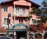
Les Charmettes Logis
Videos from this area
These are videos related to the place based on their proximity to this place.
Villa Port-Vendres ; Bien d'exception, Panorama Montagne Mer et Port
Nous vous proposons cette splendide Villa d'Architecte contemporaine avec plus de 500m2 de surface construite, profitant d'une exposition plein sud qui offre une vue panoramique dominante sur...
Sortie VTT Port-Vendres 18/01/2015
Sortie du fort st elme au Cap Béar avec un canyon nerve al 6.0 2015.
Languedoc Roussillon découverte de Port-Vendres en pays Catalan
( merci de noter la vidéo ) , ABONNEZ-VOUS pour suivre l'évolution de mes vidéos sur YouTube,cordialement Claude Aven port naturel...
Collioure Fort Saint Elme Port Vendres le petit train touristique
Collioure Fort Saint Elme Port Vendres le petit train touristique © CLAUDE BOHER Droits réservés.
Port Vendres Festival 2013
Les meilleurs moments du Festival des Conservatoires de France, à Port-Vendres du 2 au 6 Juillet 2013.
Dimanche 14 Avril 2013 , 8h30 Anse de Paulilles-Fourat-Port Vendres
Mer d'Huile , et Grand soleil ce Dimanche 14 Avril 2013 . Une ballade aux aurores , prés de la plage du fourat , et du cap ullastrell .
Port-Vendres
Vidéo extraite de mon blogue: http://une-carte-postale.blogspot.com/2011/07/carte-postale-17.html Petit village de bord de mer à quelques kilomètres de Collioure près de la frontière avec...
cargos et porte conteneurs de Port-Vendres vidéo N°2
Port-Vendres est un petit port de la Côte Vermeille dans les Pyrénées-Orientales.Ses trois activités sont la pêche, le commerce et la plaisance.Il est géré par la chambre de commerce...
Videos provided by Youtube are under the copyright of their owners.
Attractions and noteworthy things
Distances are based on the centre of the city/town and sightseeing location. This list contains brief abstracts about monuments, holiday activities, national parcs, museums, organisations and more from the area as well as interesting facts about the region itself. Where available, you'll find the corresponding homepage. Otherwise the related wikipedia article.
Banyuls AOC
Banyuls is a French appellation d'origine contrôlée (AOC) for a fortified apéritif or dessert wine made from old vines cultivated in terraces on the slopes of the Catalan Pyrenees in the Roussillon county of France, bordering, to the south, the Empordà wine region in Catalonia in Spain. The AOC production area is limited to four communes of the Côte Vermeille: Banyuls (from which the AOC takes its name), Cerbère, Collioure and Port-Vendres.
Collioure AOC
Collioure is an Appellation d'Origine Contrôlée (AOC) for French wines situated around the town of Collioure in the Roussillon wine region of France. Red, rosé and a few white wines are produced-the reds from Grenache Noir, Mourvèdre, Syrah, Carignan and Cinsaut grapes; the white are made from a blend of from Grenache blanc and Grenache gris.
Elne Cathedral
Elne Cathedral (French: Cathédrale Sainte-Eulalie-et-Sainte-Julie d'Elne, Catalan: Catedral de Santa Eulàlia d'Elna) is a former Roman Catholic cathedral, and a national monument of France, located in the town of Elne in the County of Roussillon. It was the seat of the former Bishopric of Elne, which was transferred to the Bishopric and cathedral of Perpignan in 1601. The cathedral was consecrated in 1069.
Tech (river)
The Tech is a river in southern France, very close to the French-Spanish border. It runs through a valley in the Pyrénées-Orientales, in the former Roussillon, and is 84 km long. Its source is the Parcigoule Valley (2,500 metres high) and it feeds the Mediterranean Sea. At Céret, the medieval Devil's bridge, once the largest bridge arch in the world, spans the river in an arc of 45 m length.
Canton of Argelès-sur-Mer
The Canton of Argelès-sur-Mer is a French canton of Pyrénées-Orientales department, in Languedoc-Roussillon.
Côte Vermeille
The Côte Vermeille (Catalan: Costa Vermella, meaning "vermilion coast") is a region in the French department of Pyrénées-Orientales, near the border with Spain. The Côte Vermeille stretches from Argelès-sur-Mer to the border village of Cerbère, quaint and relatively quiet seaside hideaway. The towns of Collioure, Port-Vendres and Banyuls-sur-Mer are nested along a 20 km stretch of beaches, small bays, creeks and coves, with some fabulous walks and trails.
Empordà (DO)
Empordà is a Spanish Denominación de Origen (DO) (Denominació d'Origen in Catalan) for wines produced in the northeastern corner of Catalonia, Spain. Until 2006, it was initially known as DO Empordà-Costa Brava to associate the large tourist beach area with the region. The region generally extends from the town of Figueres northwards to the French border and the French wine-making regions of Banyuls and Côtes du Roussillon.
Canton of Côte Vermeille
The canton of Côte Vermeille is a canton of France, in the Pyrénées-Orientales department. Its chief town is Port-Vendres.
Hotel Belvédère du Rayon Vert
The Belvédère du Rayon Vert was a hotel in Cerbère, France, designed in the art deco style by the Perpignan architect, Léon Baille, and built between 1928 and 1932. It has the overall appearance of a ship. It has its own cinema, and a tennis court on the roof. In 1987, the building was added to the supplementary list of historic monuments. Part of the building has been brought back into use as apartments, with some original features. The building is open to visitors most afternoons.
Colera, Girona
Colera is a municipality in the comarca of Alt Empordà, Girona, Catalonia, Spain. It is a village on the coast with an economy primarily based on tourism. It has several beaches within its vicinity including: Garbet, Burro, Atzuzenes, Portes, Morts la de'n Goixa, and Rovellada.
Espolla
Espolla is a municipality in the comarca of Alt Empordà, Girona, Catalonia, Spain.
Masarac
Masarac is a municipality in the comarca of Alt Empordà, Girona, Catalonia, Spain.
Mollet de Peralada
Mollet de Peralada is a municipality in the comarca of Alt Empordà, Girona, Catalonia, Spain. Web of the town hall
Rabós
Rabós is a municipality in the comarca of Alt Empordà, Girona, Catalonia, Spain.
Sant Climent Sescebes
Sant Climent Sescebes is a municipality in the comarca of Alt Empordà, Girona, Catalonia, Spain.
Vilamaniscle
Vilamaniscle is a municipality in the comarca of Alt Empordà, Girona, Catalonia, Spain. It is located in the western part of the Serra de la Baga d'en Ferràn, a branch of the Albera Range. Much of its municipal term is covered with pine and cork oak trees. The main crops are olives and grapes. Local wine is appreciated all over the country. New hosting services are growing due to tourism. \t Vilamaniscle is the home for around 120 inhabitants today.
XL Airways Germany Flight 888T
XL Airways Germany Flight 888T was an Airbus A320 which was seen to plunge into the Mediterranean Sea, 7 km off Saint-Cyprien on the French coast, close to the Spanish border, in November 2008. The technical flight originated from Perpignan - Rivesaltes Airport, performed an overflight of Gaillac and was flying back to Perpignan Airport, doing an approach over the sea.
Château Royal de Collioure
The Château Royal de Collioure is a massive French royal castle in the town of Collioure, a few kilometers north of the Spanish border in the French département of Pyrénées-Orientales.
Route Départementale 914
The Route Départementale 914 or RD 914 is the scenic route by the Mediterranean sea, between Perpignan and Cerbere, at the Spanish border. Formerly named Route Nationale 114, or RN 114 before being handeld to the département of Pyrénées-Orientales, on December 5 2005. It becomes the Spanish National Road N-260 or Eix Pirenenc as it crosses the border toward Portbou. The N-260 is about to be upgraded into a Highway, the "Autovía del Eje Pirenaico" or "Autovia del Eix Pirenenc", the Autovía A-26.
Camp de concentration d'Argelès-sur-Mer
The Camp de concentration d'Argelès-sur-Mer was a concentration camp established in February 1939 on the territory of the French commune of Argelès-sur-Mer for members of the retirada. The retirada was the retreat of the remains of the Spanish Republican Army (Ejército Popular Republicano) after their defeat in the Spanish Civil War. The commune and the camp were on the Mediterranean coast at the east end of the Pyrenees, 25 km north of Cap de Creus.
Requesens Castle
Requesens Castle is a historical building in the municipality of la Jonquera, Catalonia, Spain. The edifice is characterized by a triple line of walls, with square and rounded towers, portals and merlons. In the lower court is the chapel, including Romanesque elements from original structures of the area, or of French inspiration.
Portbou railway station
Portbou railway station is located in Portbou, Catalonia, Spain. It is on the Narbonne–Portbou railway and the Barcelona–Portbou railway, and is served by TER Languedoc-Roussillon (local trains) and Lunéa (night trains) operated by the SNCF and by local and long-distance services operated by RENFE.
Gare de Cerbère
Gare de Cerbère is the railway station serving the border town Cerbère, Pyrénées-Orientales department, southern France. It is connected to the Portbou railway station in Spain.


