Safety Score: 3,0 of 5.0 based on data from 9 authorites. Meaning we advice caution when travelling to France.
Travel warnings are updated daily. Source: Travel Warning France. Last Update: 2024-05-23 08:16:57
Explore Guillassou
Guillassou in Dordogne (Nouvelle-Aquitaine) is a city in France about 273 mi (or 440 km) south of Paris, the country's capital.
Local time in Guillassou is now 10:17 AM (Thursday). The local timezone is named Europe / Paris with an UTC offset of 2 hours. We know of 11 airports in the vicinity of Guillassou, of which 4 are larger airports. The closest airport in France is Périgueux-Bassillac Airport in a distance of 16 mi (or 26 km), North-East. Besides the airports, there are other travel options available (check left side).
There are several Unesco world heritage sites nearby. The closest heritage site in France is Routes of Santiago de Compostela in France in a distance of 12 mi (or 19 km), North-East. If you need a place to sleep, we compiled a list of available hotels close to the map centre further down the page.
Depending on your travel schedule, you might want to pay a visit to some of the following locations: Perigueux, Boulazac, Bergerac, Nontron and Angouleme. To further explore this place, just scroll down and browse the available info.
Local weather forecast
Todays Local Weather Conditions & Forecast: 16°C / 61 °F
| Morning Temperature | 11°C / 51 °F |
| Evening Temperature | 15°C / 60 °F |
| Night Temperature | 11°C / 52 °F |
| Chance of rainfall | 7% |
| Air Humidity | 72% |
| Air Pressure | 1019 hPa |
| Wind Speed | Light breeze with 5 km/h (3 mph) from East |
| Cloud Conditions | Overcast clouds, covering 94% of sky |
| General Conditions | Light rain |
Friday, 24th of May 2024
18°C (64 °F)
11°C (52 °F)
Light rain, light breeze, overcast clouds.
Saturday, 25th of May 2024
20°C (68 °F)
14°C (57 °F)
Broken clouds, light breeze.
Sunday, 26th of May 2024
20°C (68 °F)
13°C (56 °F)
Light rain, light breeze, overcast clouds.
Hotels and Places to Stay
Chateau de Lalande Chateaux & Hotels Collection
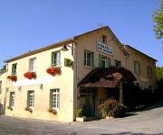
Le Lion d'or Logis
Videos from this area
These are videos related to the place based on their proximity to this place.
Saint-Astier : Carrefour D107/D43 au lieu-dit La Turne
Le panoramearth est pris du carrefour entre la D107 et la D43, au lieu-dit « La Turne », dont on voit les maisons au début de la vidéo. A la seconde 16 de la vidéo, on voit la D43 qui...
Rencontre sur le marché de Neuvic avec Yves Guéna
Yves Guéna ancien ministre sous De Gaulle et ancien maire de Périgueux durant de longues années retrouvait Philippe Cornet et Élisabeth Marty sur le marché de Neuvic le 26 mai 2012. Nous...
Grignols : Visite d'une palombière en Dordogne
Le panoramearth est pris d'un chemin de randonnée qui passe auprès d'une palombière. Au début de la vidéo, on voit le chemin de randonnée qui arrive du lieu-dit « Varenas » (pano http://you...
Grignols : Lieu-dit « Le Mas »
Le panoramearth est pris au lieu-dit « Le Mas », sur la commune de Grignols. A la seconde 9 de la vidéo, on voit le chemin de randonnée qui arrive. A la seconde 17, le panneau indique les...
Grignols : Chemin de Puychérifels (GR654)
Le panoramearth est pris d'un chemin de randonnée qui conduit au lieu-dit « Puychérifels » (GR654). Au début de la vidéo, on voit se chemin qui grimpe sur le coteau, vers le lieu-dit...
Grignols : Moulin d'Acquit
Le panoramearth est pris juste avant d'arriver au Moulin d'Acquit. Au début de la vidéo, on voit le chemin de randonnée qui arrive. Remarquez, sur la bande son de la vidéo, le bruit d'une...
Grignols : Château fort de Grignols
Le panoramearth est pris du château fort de Grignols. Au début de la vidéo, une courte séquence sur un panneau qui indique : « Château fort de Grignols - 12e 15e siècles - Berceau des...
Videos provided by Youtube are under the copyright of their owners.
Attractions and noteworthy things
Distances are based on the centre of the city/town and sightseeing location. This list contains brief abstracts about monuments, holiday activities, national parcs, museums, organisations and more from the area as well as interesting facts about the region itself. Where available, you'll find the corresponding homepage. Otherwise the related wikipedia article.
Parc botanique de Neuvic
The Parc botanique de Neuvic (6 hectares) is a botanical garden located in Neuvic-Sur-L'Isle, Dordogne, Aquitaine, France. It is open daily in the warmer months; an admission fee is charged when in flower. The park is located on an island, and surrounds a château built in 1520 with both medieval and 18th century elements. Since 1950 the château has served as a home for children operated by the Fondation Hospice des Orphelines de Périgueux.
Gare de Saint-Astier
Saint-Astier is a railway station in Saint-Astier, Aquitaine, France. The station is located on the Coutras - Tulle railway line. The station is served by TER (local) services operated by SNCF.
Gare de Saint-Léon-sur-l'Isle
Saint-Léon-sur-l'Isle is a railway station in Saint-Léon-sur-l'Isle, Aquitaine, France. The station is located on the Coutras - Tulle railway line. The station is served by TER (local) services operated by SNCF.


