Safety Score: 3,0 of 5.0 based on data from 9 authorites. Meaning we advice caution when travelling to France.
Travel warnings are updated daily. Source: Travel Warning France. Last Update: 2024-05-11 07:34:58
Explore Englesqueville-la-Percée
Englesqueville-la-Percée in Calvados (Normandy) with it's 102 inhabitants is a city in France about 154 mi (or 247 km) west of Paris, the country's capital.
Local time in Englesqueville-la-Percée is now 09:46 PM (Saturday). The local timezone is named Europe / Paris with an UTC offset of 2 hours. We know of 13 airports in the vicinity of Englesqueville-la-Percée, of which 5 are larger airports. The closest airport in France is Caen-Carpiquet Airport in a distance of 27 mi (or 43 km), South-East. Besides the airports, there are other travel options available (check left side).
There are several Unesco world heritage sites nearby. The closest heritage site in France is Le Havre, the City Rebuilt by Auguste Perret in a distance of 48 mi (or 78 km), East. If you need a place to sleep, we compiled a list of available hotels close to the map centre further down the page.
Depending on your travel schedule, you might want to pay a visit to some of the following locations: Bayeux, Saint-Lo, Vire, Coutances and Caen. To further explore this place, just scroll down and browse the available info.
Local weather forecast
Todays Local Weather Conditions & Forecast: 22°C / 71 °F
| Morning Temperature | 12°C / 53 °F |
| Evening Temperature | 20°C / 68 °F |
| Night Temperature | 15°C / 60 °F |
| Chance of rainfall | 0% |
| Air Humidity | 76% |
| Air Pressure | 1018 hPa |
| Wind Speed | Gentle Breeze with 7 km/h (5 mph) from West |
| Cloud Conditions | Scattered clouds, covering 34% of sky |
| General Conditions | Scattered clouds |
Sunday, 12th of May 2024
21°C (70 °F)
13°C (56 °F)
Moderate rain, gentle breeze, overcast clouds.
Monday, 13th of May 2024
18°C (64 °F)
13°C (56 °F)
Moderate rain, moderate breeze, broken clouds.
Tuesday, 14th of May 2024
16°C (61 °F)
12°C (53 °F)
Moderate rain, fresh breeze, overcast clouds.
Hotels and Places to Stay
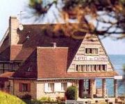
Du Casino Logis
Videos from this area
These are videos related to the place based on their proximity to this place.
Grandcamps 12 sept 2009
Superbe session à Grandcamps Maisy dans le Calvados. Le vent fort souffle du Nord Est. Beaucoup de windsurfers sur le spot. Parmi eux Yann Sorlut et Sylvain Demercastel.
World Peace Statue, Grandchamp-Maisy, Normandy
Perhaps the most beautiful memorial in all of Normandy the World Peace Statue, located in Granchamp-Maisy, a small village close to Pointe du Hoc. As a relatively new memorial it did not...
Inside a personnel bunker at Pointe du Hoc, Normandy
A look at the damage caused by American engineers at Pointe du Hoc Normandy and a walkthrough clip showing the inside of one of the underground German personnel bunkers. Want to travel to...
Pointe du Hoc: How big are those craters?
A couple of clips recorded at the Pointe du Hoc battlefield in Normandy. With video it is sometimes difficult to appreciate scale. In these clips the camera goes down into a couple of craters...
Vierville-sur-Mer, Omaha Beach
The American landing at Omaha Beach on 6th June 1944 was the bloodiest of the daay. This video shows views around the Vierville-sur-Mer draw (exit) called D-1, views from a pillbox overlooking...
Omaha Beach - Vierville Sur Mer - 65th Anniversary of the D-Day
http://www.druhasvetovavalka.cz/ Pages show pictures and videos of the day taken at places connected with the World War II (Second World War) mail: info@druhasvetovavalka.cz TomTom...
Omaha Beach Memorial / Gedenkstätte Normandie
Gedenkstätte für die gefallenen Soldaten bei der Landung in Europa am D-Day; aufgenommen Mai 2011 in Vierville-sur-Mer, Frankreich.
Videos provided by Youtube are under the copyright of their owners.
Attractions and noteworthy things
Distances are based on the centre of the city/town and sightseeing location. This list contains brief abstracts about monuments, holiday activities, national parcs, museums, organisations and more from the area as well as interesting facts about the region itself. Where available, you'll find the corresponding homepage. Otherwise the related wikipedia article.
Pointe du Hoc
Pointe du Hoc is a clifftop location on the coast of Normandy in northern France. It is situated between Utah Beach to the west and Omaha Beach to the east, and stands on 100 ft (30 m) tall cliffs overlooking the sea. Marking the Western end of the Omaha beach sector, it was a point of attack by the United States Army Ranger Assault Group during Operation Overlord in World War II.
Saint-Pierre-du-Mont Airfield
Saint-Pierre-du-Mont Airfield is an abandoned World War II military airfield which is located in the Calvados department in the Basse-Normandie region in northern France. Located just north of Saint-Pierre-du-Mont along the English Channel coast, it was a United States Army Air Force temporary airfield established shortly after the D-Day landings in France.
Deux Jumeaux Airfield
Deux Jumeaux Airfield is an abandoned World War II military airfield, which is located near the commune of Deux Jumeaux in the Basse-Normandie region of northern France.


