Safety Score: 3,0 of 5.0 based on data from 9 authorites. Meaning we advice caution when travelling to France.
Travel warnings are updated daily. Source: Travel Warning France. Last Update: 2024-04-27 08:23:39
Discover Onglevert
Onglevert in Pas-de-Calais (Hauts-de-France) is a town in France about 141 mi (or 227 km) north of Paris, the country's capital city.
Current time in Onglevert is now 03:39 PM (Saturday). The local timezone is named Europe / Paris with an UTC offset of 2 hours. We know of 13 airports near Onglevert, of which 5 are larger airports. The closest airport in France is Calais-Dunkerque Airport in a distance of 17 mi (or 27 km), North-East. Besides the airports, there are other travel options available (check left side).
There are several Unesco world heritage sites nearby. The closest heritage site is Canterbury Cathedral, St Augustine's Abbey, and St Martin's Church in United kingdom at a distance of 38 mi (or 62 km). The closest in France is Fortifications of Vauban in a distance of 63 mi (or 62 km), North-West. Looking for a place to stay? we compiled a list of available hotels close to the map centre further down the page.
When in this area, you might want to pay a visit to some of the following locations: Boulogne-sur-Mer, Calais, Montreuil, Saint-Omer and Abbeville. To further explore this place, just scroll down and browse the available info.
Local weather forecast
Todays Local Weather Conditions & Forecast: 10°C / 51 °F
| Morning Temperature | 9°C / 48 °F |
| Evening Temperature | 11°C / 52 °F |
| Night Temperature | 11°C / 51 °F |
| Chance of rainfall | 8% |
| Air Humidity | 90% |
| Air Pressure | 1003 hPa |
| Wind Speed | Moderate breeze with 10 km/h (6 mph) from West |
| Cloud Conditions | Overcast clouds, covering 99% of sky |
| General Conditions | Light rain |
Sunday, 28th of April 2024
11°C (51 °F)
10°C (49 °F)
Moderate rain, strong breeze, overcast clouds.
Monday, 29th of April 2024
11°C (52 °F)
10°C (49 °F)
Scattered clouds, gentle breeze.
Tuesday, 30th of April 2024
15°C (59 °F)
12°C (53 °F)
Light rain, moderate breeze, broken clouds.
Hotels and Places to Stay
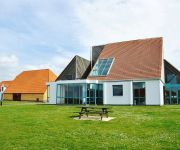
Village Vacances Le Cap d'Opale
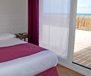
Hotel les Argousiers
De la Baie Logis
Hôtel Saint Jean
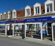
Hôtel Le Vivier - vue mer
Hôtel Restaurant Le Vivier
Alex Factory
Videos from this area
These are videos related to the place based on their proximity to this place.
vidéo gg a ambleteuse le 8 08 2009
un aprés midi a Ambleteuse avec l'dard et pat Station balnéaire et touristique*. Marché : merc. Fête communale : dim. le plus près de la Saint-Michel et 2ème dim. après le 14/7. Bénédicti...
Marée du Siècle 2015
Marée du Siècle (Nord-Pas de Calais), le 21 mars 2015 : Ambleteuse, Audresselles, Cap Blanc Nez et Cap Gris Nez. Retrouvez-nous sur Les Plus Beaux Villages du Nord-Pas de Calais ...
Paddle avec un chien!
Petite virée en paddle à Ambleteuse avec mon chien Dosco qui ne veux jamais quitter son maitre...
17 & 19 NOV 2006 FRANCE Weekend à Ambleteuse avec Blanche & Duke
Herbewerking in 2014 Video made by Blanche Vanbellinghen Sony digital camera.
Hinking Trip / Wissant - Cap Gris-Nez
Hyperlaspe de rando nocturnes sur la côte d'Opale, de Wissant au CROSS du Cap Gris-Nez. Départ 6h00, Arrivée 9h30, ~15kms Prises de vues : GoPro Hero3 Black + Chesty Réalisation : Florent...
La mer
Un portrait de la petit village côtier Tardinghen (Nord-Pas-de-Calais). La mer et les alentours sont présentés sous différents angles. La vidéo a été tournée en octobre 2014....
tardinghen en het kanaal
Overzicht over het Kanaal, met links de kerk van Tardinghen en de Ferme. The White Cliffs of Dover zijn in de verte te zien.
Panorama Côte d'Opale
Côte d'Opale, à hauteur du "bois d'Haringzelle" (ou Haringzelles), à proximité du village d'Audinghen. Paysages à couper le souffle, mais lieu extrêmement chargé d'histoire... Notez...
Videos provided by Youtube are under the copyright of their owners.
Attractions and noteworthy things
Distances are based on the centre of the city/town and sightseeing location. This list contains brief abstracts about monuments, holiday activities, national parcs, museums, organisations and more from the area as well as interesting facts about the region itself. Where available, you'll find the corresponding homepage. Otherwise the related wikipedia article.
Cap Gris Nez
Cap Gris Nez (literally grey nose cape in English, Swartenesse in Dutch, now obsolete; compare other headlands in -ness) is a cape on the Côte d'Opale in the Pas-de-Calais département in northern France. It is between Wissant and Audresselles, in the commune of Audinghen. The cliffs of the Cap are the closest point of France to England - 34 km from their English counterparts at Dover.
Slack (river)
The Slack is a 22 km long river in the Pas-de-Calais department, in northern France. It rises at Hermelinghen on Mount Binôt, flows through Rinxent, Marquise, Beuvrequen, Slack (village near Ambleteuse) and flows into the English Channel in Ambleteuse next to Fort Mahon.
Fort Mahon
Fort Mahon, which is known locally as Fort Vauban, is a fort located on the coast of the Strait of Dover, by the commune of Ambleteuse, in the Pas-de-Calais, northern France. It was built at the end of the 17th century by the military architect Vauban. The fort was restored in the 1960s and designated a historical monument on October 19, 1965. \t\t \t\t\tAmbleteuse-Fort Mahon. jpg \t\t\t Fort Mahon and the Slack river. \t\t\t \t\t \t\t \t\t\tAlfred Robaut - Fort Vauban.
Gare de Boulogne-Tintelleries
Gare de Boulogne-Tintelleries serves the historic centre of Boulogne opened on May 1, 1893, and is located on the Boulogne–Calais railway and served by the SNCF local TER Nord-Pas-de-Calais.


