Safety Score: 2,7 of 5.0 based on data from 9 authorites. Meaning we advice caution when travelling to United States.
Travel warnings are updated daily. Source: Travel Warning United States. Last Update: 2024-05-01 08:01:32
Touring Ridgeley
Ridgeley in Mineral County (West Virginia) with it's 643 residents is a town located in United States about 106 mi (or 171 km) north-west of Washington DC, the country's capital place.
Time in Ridgeley is now 08:23 PM (Wednesday). The local timezone is named America / New York with an UTC offset of -4 hours. We know of 12 airports nearby Ridgeley, of which 5 are larger airports. The closest airport in United States is John Murtha Johnstown Cambria County Airport in a distance of 47 mi (or 75 km), North. Besides the airports, there are other travel options available (check left side).
There is one Unesco world heritage site nearby. It's Monticello and the University of Virginia in Charlottesville in a distance of 131 mi (or 210 km), South-East. Also, if you like the game of golf, there are several options within driving distance. Need some hints on where to stay? We compiled a list of available hotels close to the map centre further down the page.
Being here already, you might want to pay a visit to some of the following locations: Cumberland, Keyser, Romney, Bedford and Somerset. To further explore this place, just scroll down and browse the available info.
Local weather forecast
Todays Local Weather Conditions & Forecast: 27°C / 81 °F
| Morning Temperature | 14°C / 57 °F |
| Evening Temperature | 23°C / 74 °F |
| Night Temperature | 16°C / 61 °F |
| Chance of rainfall | 0% |
| Air Humidity | 42% |
| Air Pressure | 1015 hPa |
| Wind Speed | Gentle Breeze with 6 km/h (3 mph) from South |
| Cloud Conditions | Scattered clouds, covering 35% of sky |
| General Conditions | Scattered clouds |
Thursday, 2nd of May 2024
24°C (75 °F)
16°C (60 °F)
Heavy intensity rain, gentle breeze, overcast clouds.
Friday, 3rd of May 2024
12°C (54 °F)
12°C (54 °F)
Moderate rain, light breeze, overcast clouds.
Saturday, 4th of May 2024
14°C (58 °F)
15°C (59 °F)
Light rain, calm, overcast clouds.
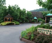
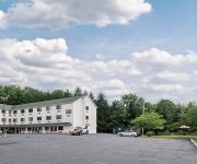
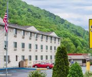
Hotels and Places to Stay
Fairfield Inn & Suites Cumberland
RAMADA WORLDWIDE-CUMBERLAND
BW BRADDOCK MOTOR INN
Rodeway Inn Lavale
Holiday Inn Express & Suites CUMBERLAND - LA VALE
Comfort Inn & Suites LaVale - Cumberland
Sleep Inn & Suites Cumberland-LaVale
SUPER 8 LA VALE-CUMBERLAND ARE
Videos from this area
These are videos related to the place based on their proximity to this place.
Western Maryland 734, Cumberland in October
Cumberland Maryland , Western Maryland RR videos from 08 & 09.
Mountain Maryland Mo Visits Curtis' Coney Island Weiners in Cumberland, Md.
Mountain Maryland Mo, everyone's favorite Western Maryland resident, visits a famous landmark in downtown Cumberland and indulges on the local cuisine. Plan your own tasty trip to Mountain...
Bike Trip on the C&O Canal
A solo bike trip on the C&O Canal. Three days, August 30 - September 1 2008, from Cumberland MD to Washington DC.
WMSR 734 Pulling into Cumberland Station
Western Maryland Scenic Railroad, Steam 734 Pulling into the Cumberland Station.
Mountain Maryland Mo Visits Historic Washington Street, Cumberland, Md.
Mountain Maryland Mo takes a QUICK tour of Emmanuel Episcopal Church, the Underground Tunnels and the Gordon-Roberts House on Washington Street in historic Cumberland, Maryland.
Western Maryland Scenic Railroad Riding with Mountain Thunder
Cumberland Maryland is home to the Western Maryland Scenic Railroad, a class 3 heritage railroad that runs excursion trains from Cumberland to Frostburg Maryland, a round trip of 32 miles....
Western Maryland Scenic Railroad: Thunder in the Mountains Part 1
HD 1080p: On August 15th, 2010, Eastern Railfan Productions visited the famous Western Maryland Scenic Railroad for the first time. The 2-8-0 Consolidation #734 sported a different whistle,...
Videos provided by Youtube are under the copyright of their owners.
Attractions and noteworthy things
Distances are based on the centre of the city/town and sightseeing location. This list contains brief abstracts about monuments, holiday activities, national parcs, museums, organisations and more from the area as well as interesting facts about the region itself. Where available, you'll find the corresponding homepage. Otherwise the related wikipedia article.
Cumberland, Maryland
Cumberland is a city in the far western, Appalachian portion of Maryland, United States. It is the county seat of Allegany County, and the primary city of the Cumberland, MD-WV Metropolitan Statistical Area. The Cumberland, MD-WV Metropolitan Statistical Area is one of the poorest in the United States, ranking 305th out of 318 metropolitan areas in per capita income. At the 2010 census, the city had a population of 20,859, and the metropolitan area had a population of 103,299.
Ridgeley, West Virginia
Ridgeley is a town in Mineral County, West Virginia, United States, and part of the Cumberland Metropolitan Statistical Area. The population was 675 at the 2010 census. Ridgeley was initially known as St. Clairsville, named for Sir John St Clair, Lt Colonel and Quartermaster General for the British General Edward Braddock. St Clair accompanied Braddock on his ill-fated march on Fort Duquesne and his disastrous defeat on July 9, 1755.
Fort Cumberland (Maryland)
Fort Cumberland (built 1754) was an 18th century frontier fort at the current site of Cumberland, Maryland, USA. It was an important military and economic center during the French and Indian War (1754–63) and figured significantly in the early career of George Washington.
Fort Ohio
Fort Ohio (also known as the "New Store") was a stockade fort erected by Job Pearsall in 1749 on the present site of Ridgeley, West Virginia. The building was of log construction, 45 feet long and 25 feet wide, with two stories. Its name comes from the Ohio Company which did have a trading post at that location. The Ohio Company found success because a trail across the Allegheny Mountains from the Potomac River at Cumberland to near modern-day Pittsburgh offered a direct route to the Ohio River.
Emmanuel Episcopal Church (Cumberland, Maryland)
The Emmanuel Episcopal Church of Cumberland, Maryland located in Cumberland's Historic District, is built on the foundations of Fort Cumberland, where George Washington began his military career; earthworks from the fort (built in 1755) still lie beneath the church. Although the Emmanuel parish dates from 1803, the cornerstone of the current native sandstone building was laid in 1849 and completed in 1851.
Washington Street Library (Allegany County Library System)
Located in the historic district of Cumberland, Maryland, the Washington Street Library first opened its doors on June 19, 1934. This Greek Revival style building was constructed between 1849 and 1850, as a larger building for the Allegany County Academy, the first public school in Allegany County which was founded in 1799. A new addition was constructed in 1966, allowing for the expansion of the library collection.
Canal Place
For the building in New Orleans often called "Canal Place", see One Canal Place Canal Place is a 58.1-acre park owned by the State of Maryland and located in Cumberland, MD. The park includes the station plaza, a picnic area, a canal boat replica, a pedestrian bridge to George Washington’s Headquarters, picnic area, Shops at Canal Place, the Crescent Lawn Festival Grounds, and the Western Maryland Railway Station, which is on the National Register of Historic Places.
Cumberland Dam
At Cumberland, Maryland a dam was maintained across the North Branch of the Potomac River by the Chesapeake and Ohio Canal Company for the purpose of diverting water of the river into the head of the canal. The Dam impounded water over a distance of a mile, causing back water for about 3 miles up the river. Above the dam is the mouth of Wills Creek. This dam was built sometime before 1850.
Cumberland Theatre
Western Maryland Railway Station (Cumberland, Maryland)
Western Maryland Railway Station is a historic railway station in Cumberland, Allegany County, Maryland. It was built in 1913 as a stop for the Western Maryland Railway (WM). The building was operated as a passenger station until the WM ended service in 1959, and it continued to be used by the railway until 1976. It was subsequently restored and currently serves as a museum and offices, as well as the operating base for a heritage railway.
Headquarters of George Washington
The Headquarters of George Washington is a historic log cabin in Cumberland, Maryland that was built for then Colonel George Washington for his use between 1755 and 1758 during the French and Indian War. He also used it briefly during 1794 as Commander in Chief in order to review the troops gathered to put down the Whiskey Rebellion. The headquarters historical marker claims the headquarters "antedate all similar headquarters in the United States".
Caiuctucuc
Between 1720 and 1730 early European explorers found a village of considerable size on the western side of what is now Cumberland, Maryland, called Caiuctucuc. It sat at the junction of the Cohongaronta (Potomac) and the Caiuctucuc (Wills Creek) streams. Teepees and lodges lined the riverbank along present day Green Street in western Cumberland. The village was abandoned prior to 1751 to the ever growing numbers of trappers and traders.


