Safety Score: 2,7 of 5.0 based on data from 9 authorites. Meaning we advice caution when travelling to United States.
Travel warnings are updated daily. Source: Travel Warning United States. Last Update: 2024-05-09 08:23:21
Explore Laurel Harbor
Laurel Harbor in Ocean County (New Jersey) is located in United States about 169 mi (or 272 km) north-east of Washington DC, the country's capital.
Local time in Laurel Harbor is now 07:33 AM (Thursday). The local timezone is named America / New York with an UTC offset of -4 hours. We know of 8 airports in the wider vicinity of Laurel Harbor, of which 4 are larger airports. The closest airport in United States is Lakehurst NAES /Maxfield Field in a distance of 17 mi (or 27 km), North-West. Besides the airports, there are other travel options available (check left side).
There are two Unesco world heritage sites nearby. The closest heritage site in United States is Independence Hall in a distance of 38 mi (or 62 km), West. Also, if you like golfing, there are multiple options in driving distance. We found 2 points of interest in the vicinity of this place. If you need a place to sleep, we compiled a list of available hotels close to the map centre further down the page.
Depending on your travel schedule, you might want to pay a visit to some of the following locations: Toms River, Freehold, Mount Holly, New Brunswick and Staten Island. To further explore this place, just scroll down and browse the available info.
Local weather forecast
Todays Local Weather Conditions & Forecast: 16°C / 61 °F
| Morning Temperature | 19°C / 66 °F |
| Evening Temperature | 14°C / 57 °F |
| Night Temperature | 13°C / 55 °F |
| Chance of rainfall | 1% |
| Air Humidity | 78% |
| Air Pressure | 1005 hPa |
| Wind Speed | Moderate breeze with 9 km/h (6 mph) from South-West |
| Cloud Conditions | Overcast clouds, covering 99% of sky |
| General Conditions | Light rain |
Thursday, 9th of May 2024
11°C (52 °F)
12°C (53 °F)
Light rain, gentle breeze, overcast clouds.
Friday, 10th of May 2024
9°C (49 °F)
10°C (50 °F)
Light rain, gentle breeze, overcast clouds.
Saturday, 11th of May 2024
17°C (62 °F)
9°C (49 °F)
Light rain, moderate breeze, broken clouds.
Hotels and Places to Stay
Charlroy Motel
Coral Sands Motel
Windjammer Motor Inn
Surfside Motel
Aztec Ocean Resort
Aquarius Arms Motel
Anchor Motel
Seaside Sands Inn
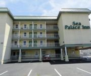
Sea Palace Inn
Sea Palace Motel
Videos from this area
These are videos related to the place based on their proximity to this place.
We're Building Revel
This is the second of two videos in which you meet the dedicated workers who are building Revel in Atlantic City. The video also contains some great footage of the resort under construction....
88 Ocean Gate Ave Bayville NJ 08721
View full virtual tour: http://www.justsnooping.com/tours/2632295/
Re Clam Barnegat Bay
Martin Sedlacko, of Forked River, New Jersey volunteers with ReClam the Bay, an environmental organization with and educational focus that grows up seed clams and oysters until they are large...
Forked River Mountain Aerial video HD
Forked River Mountain HD Aerial View from Quad Copter- taken June 2014 from the top. Me and my FJ Cruiser went on a soul-seeking trip through the pines to see one of my favorite locations in...
I hear Sandy coming
Audio recorded down Beach Blvd Forked River of Hurricane Sandy howling it's way to the coast. Approx. 8:45 pm 10/28/2012 For Information on Donating ...
Captains Inn Seafood Fra Diablo 304 E Lacey Rd, Forked River, NJ 08731 (609) 693-3351
Captains Inn 304 E Lacey Rd, Forked River, NJ 08731 (609) 693-3351 Seafood Fra Diablo.
Captains Inn crab saute 304 E Lacey Rd, Forked River, NJ 08731 (609) 693-3351
Captains Inn crab saute 304 E Lacey Rd, Forked River, NJ 08731 (609) 693-3351.
Videos provided by Youtube are under the copyright of their owners.
Attractions and noteworthy things
Distances are based on the centre of the city/town and sightseeing location. This list contains brief abstracts about monuments, holiday activities, national parcs, museums, organisations and more from the area as well as interesting facts about the region itself. Where available, you'll find the corresponding homepage. Otherwise the related wikipedia article.
Barnegat Bay
Barnegat Bay is a small brackish arm of the Atlantic Ocean, approximately 30 miles (50 km) long, along the coast of Ocean County, New Jersey in the United States. It is separated from the Atlantic by a long barrier peninsula, as well as by the north end of Long Beach Island. The bay is fed by several small rivers, including the Toms River and Metedeconk River, which empty into the bay through small estuaries along its inner shore.
Berkeley Township School District
The Berkeley Township School District is a community public school district that is responsible for the education of children in kindergarten through sixth grade from Berkeley Township, in Ocean County, New Jersey, United States. As of the 2009-10 school year, the district's four schools had an enrollment of 2,025 students and 171 classroom teachers (on an FTE basis), for a student–teacher ratio of 11.84:1.
WOBM-FM
WOBM-FM is an adult contemporary music formatted radio station known as "Ocean County's Hometown Station" broadcasting in Central New Jersey. Its variety of music stretches from artists such as Celine Dion to Billy Joel and Faith Hill. The station is owned by Townsquare Media, and is part of the Shore Group with five stations including WOBM, WJLK, WCHR-FM and WADB. Shore Group studios are at 8 Robbins Street in Toms River, New Jersey. WOBM's FM transmitter is in Bayville, New Jersey.
Tices shoal
Tices Shoal is an area located on the opposite side of Island Beach State Park, in Lacey Township, Ocean County, New Jersey, United States. It is a common site for boats and other water crafts. At times, boats in excess of 100 have been counted at Tices Shoal.


