Safety Score: 2,8 of 5.0 based on data from 9 authorites. Meaning we advice caution when travelling to Poland.
Travel warnings are updated daily. Source: Travel Warning Poland. Last Update: 2024-05-14 08:25:02
Discover Zakrze
The district Zakrze of Jeleniów in Powiat kłodzki (Województwo Dolnośląskie) is a district in Poland about 240 mi south-west of Warsaw, the country's capital city.
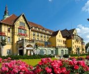
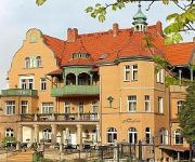
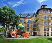
Looking for a place to stay? we compiled a list of available hotels close to the map centre further down the page.
When in this area, you might want to pay a visit to some of the following locations: Kudowa-Zdroj, Duszniki-Zdroj, Polanica-Zdroj, Jedlina-Zdroj and Boguszow-Gorce. To further explore this place, just scroll down and browse the available info.
Local weather forecast
Todays Local Weather Conditions & Forecast: 19°C / 66 °F
| Morning Temperature | 8°C / 47 °F |
| Evening Temperature | 16°C / 60 °F |
| Night Temperature | 11°C / 51 °F |
| Chance of rainfall | 0% |
| Air Humidity | 48% |
| Air Pressure | 1014 hPa |
| Wind Speed | Gentle Breeze with 9 km/h (5 mph) from North-West |
| Cloud Conditions | Clear sky, covering 2% of sky |
| General Conditions | Light rain |
Thursday, 16th of May 2024
16°C (60 °F)
9°C (48 °F)
Light rain, moderate breeze, broken clouds.
Friday, 17th of May 2024
14°C (57 °F)
10°C (49 °F)
Light rain, moderate breeze, overcast clouds.
Saturday, 18th of May 2024
10°C (50 °F)
9°C (49 °F)
Light rain, light breeze, overcast clouds.
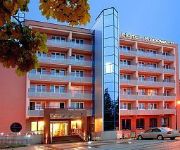
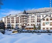
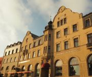
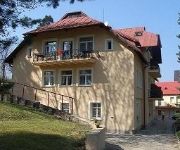
Hotels and Places to Stay
Kudowa
Verde Montana
U Beranka
Willa Alfa
Polonia
Amalia
Adam & SPA
Scaliano Willa SPA
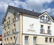
Tommy congress & relax
Villa Carmen
Videos from this area
These are videos related to the place based on their proximity to this place.
Kudowa Zdrój - atrakcje turystyczne
Kudowa Zdrój to piękna uzdrowiskowa miejscowość w Kotlinie Kłodzkiej. Poza pięknym Parkiem Zdrojowym można tu zobaczyć unikatową w skali Europy Kaplicę Czaszek, a także urocze Muzeum...
Kudowa - Zdrój
Pierwsze wzmianki o miejscowości pochodzą z 1354 r. Wieś, która dała początek miastu, położona była na czeskim obszarze etnicznym i nazywała się Lipolitov, a następnie Chudoba....
Willa Residence w Kudowa Zdrój
Mamy zaszczyt zaprosić Państwa do naszej Villi zlokalizowanej w centum Kudowy Zdroju przy bocznej ulicy Kombatantów 2. Panuje tutaj niepowtarzalny klimat oraz miła i rodzinna atmosfera....
Daleko Dalej 2013 Kudowa Zdrój - Monika Wudyka
Film grupy KDW zaprezentowany na I Festiwalu Filmów Katolickich - Daleko Dalej w Kłodzku w 2013 r. Temat MIŁOŚĆ.
KUDOWA ZDRÓJ marzec 2010
marzec 2010 Kudowa-Zdrój (niem. Bad Kudowa, czes. Lázně Kudova lub Lázně Chudoba) miasto i gmina w województwie dolnośląskim, w powiecie kłodzkim. W latach 1976-1991 miejscowość...
Kudowa-Zdrój 2011 Grupy Rekonstrukcji historycznej 4
Kudowa-Zdrój 2011 Grupy Rekonstrukcji historycznej.
Videos provided by Youtube are under the copyright of their owners.
Attractions and noteworthy things
Distances are based on the centre of the city/town and sightseeing location. This list contains brief abstracts about monuments, holiday activities, national parcs, museums, organisations and more from the area as well as interesting facts about the region itself. Where available, you'll find the corresponding homepage. Otherwise the related wikipedia article.
Náchod District
Náchod District is a district within Hradec Králové Region of the Czech Republic. Its administrative center is the town of Náchod.
Bezděkov nad Metují
Bezdekov nad Metuji is a village in Náchod District, Czech Republic. There are about 500 people living there. The village is situated on a hill about 480 metres over sea; the location provides nice panoramas around the village. In Bezděkov there is a nice baroque church designed by architect Kilian Ignaz Dientzenhofer. Village was founded about year 1241.
Stołowe Mountains
Stołowe Mountains; also known as the Table Mountains are a 42-kilometre -long mountain range in Poland and the Czech Republic, part of the Central Sudetes. The range is situated southeast of the Karkonosze. The Polish part of the range is protected as the Stołowe Mountains National Park. The highest peak of the range is Szczeliniec Wielki at 919 m a.s.l. The range is built of sandstone and, as the only one in Poland, presents plated structure with sheer mountain ledges.
Machov
Machov is a market town situated in the Czech Republic and in the Hradec Králové Region. It has around 1,100 inhabitants. It lies just next to the border with Poland. Machov has always had a majority of Czech inhabitants although strong ties with Polish and German borderlands existed. Machov lies in a valley of the brook Židovka and under a dominant mountain Bor, which is one of the famous Table Mountains in Poland.
Kulin Kłodzki
Kulin Kłodzki is a village in the administrative district of Gmina Lewin Kłodzki, within Kłodzko County, Lower Silesian Voivodeship, in south-western Poland. Prior to 1945 it was in Germany. It lies approximately 4 kilometres east of Lewin Kłodzki, 24 km west of Kłodzko, and 93 km south-west of the regional capital Wrocław.
Witów, Lower Silesian Voivodeship
Witów is a village in the administrative district of Gmina Lewin Kłodzki, within Kłodzko County, Lower Silesian Voivodeship, in south-western Poland. Prior to 1945 it was in Germany. It lies approximately 4 kilometres south-east of Lewin Kłodzki, 24 km west of Kłodzko, and 95 km south-west of the regional capital Wrocław. The village has a population of 16.
Karłów
Karłów is a village in the administrative district of Gmina Radków, within Kłodzko County, Lower Silesian Voivodeship, in south-western Poland. Prior to 1945 it was in Germany. It lies approximately 7 kilometres south-west of Radków, 23 km west of Kłodzko, and 89 km south-west of the regional capital Wrocław.
Borová (Náchod District)
Borová is a village and municipality in Náchod District in the Hradec Králové Region of the Czech Republic. It is located, near the border with Poland.
Česká Čermná
Česká Čermná is a village and municipality in Náchod District in the Hradec Králové Region of the Czech Republic.
Dolní Radechová
Dolní Radechová is a village and municipality in Náchod District in the Hradec Králové Region of the Czech Republic.
Jestřebí (Náchod District)
Jestřebí (Náchod District) is a village and municipality in Náchod District in the Hradec Králové Region of the Czech Republic.
Libchyně
Libchyně is a village and municipality in Náchod District in the Hradec Králové Region of the Czech Republic.
Mezilesí
Mezilesí is a village and municipality in Náchod District in the Hradec Králové Region of the Czech Republic.
Nový Hrádek
Nový Hrádek is a market town and municipality in Náchod District in the Hradec Králové Region of the Czech Republic.
Přibyslav (Náchod District)
Přibyslav (Náchod District) is a village and municipality in Náchod District in the Hradec Králové Region of the Czech Republic.
Sendraž
Sendraž is a village and municipality in Náchod District in the Hradec Králové Region of the Czech Republic.
Slavoňov
Slavoňov is a village and municipality in Náchod District in the Hradec Králové Region of the Czech Republic.
Velké Poříčí
Velké Poříčí is a market town and municipality in Náchod District in the Hradec Králové Region of the Czech Republic.
Vysoká Srbská
Vysoká Srbská is a village and municipality in Náchod District in the Hradec Králové Region of the Czech Republic. It is located, near the border with Poland.
Žďárky
Žďárky is a village and municipality in Náchod District in the Hradec Králové Region of the Czech Republic.
Bohdašín (Rychnov nad Kněžnou District)
Bohdašín (Rychnov nad Kněžnou District) is a village and municipality in Rychnov nad Kněžnou District in the Hradec Králové Region of the Czech Republic.
Janov (Rychnov nad Kněžnou District)
Janov (Rychnov nad Kněžnou District) is a village and municipality in Rychnov nad Kněžnou District in the Hradec Králové Region of the Czech Republic.
Olešnice v Orlických horách
Olešnice v Orlických horách is a village and municipality in Rychnov nad Kněžnou District in the Hradec Králové Region of the Czech Republic.
Sněžné (Rychnov nad Kněžnou District)
Sněžné (Rychnov nad Kněžnou District) is a village and municipality in Rychnov nad Kněžnou District in the Hradec Králové Region of the Czech Republic. The first known mention of the town is from the fifteen hundreds.
Skull Chapel in Czermna
Skull Chapel in Czermna (Kaplica Czaszek) is a chapel located in Kudowa-Zdrój, Lower Silesian Voivodeship, Poland.


