Safety Score: 3,0 of 5.0 based on data from 9 authorites. Meaning we advice caution when travelling to Germany.
Travel warnings are updated daily. Source: Travel Warning Germany. Last Update: 2024-05-18 08:26:29
Discover Hasborn
The district Hasborn of Hasborn-Dautweiler in Saarland is a district in Germany about 349 mi south-west of Berlin, the country's capital city.
Looking for a place to stay? we compiled a list of available hotels close to the map centre further down the page.
When in this area, you might want to pay a visit to some of the following locations: Tholey, Marpingen, Eppelborn, Oberthal and Nonnweiler. To further explore this place, just scroll down and browse the available info.
Local weather forecast
Todays Local Weather Conditions & Forecast: 13°C / 55 °F
| Morning Temperature | 11°C / 51 °F |
| Evening Temperature | 15°C / 58 °F |
| Night Temperature | 10°C / 50 °F |
| Chance of rainfall | 5% |
| Air Humidity | 88% |
| Air Pressure | 1012 hPa |
| Wind Speed | Moderate breeze with 9 km/h (6 mph) from East |
| Cloud Conditions | Overcast clouds, covering 100% of sky |
| General Conditions | Light rain |
Sunday, 19th of May 2024
15°C (58 °F)
11°C (52 °F)
Moderate rain, light breeze, overcast clouds.
Monday, 20th of May 2024
19°C (67 °F)
13°C (56 °F)
Light rain, light breeze, scattered clouds.
Tuesday, 21st of May 2024
18°C (65 °F)
14°C (56 °F)
Moderate rain, gentle breeze, overcast clouds.
Hotels and Places to Stay
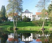
Victor's Seehotel Weingärtner
Hofgut Imsbach
Hubertus
Eppelborner Hof
Central Inn Garni
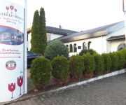
Castello Bianco
Bürgerstuben und Gästehaus
Videos from this area
These are videos related to the place based on their proximity to this place.
Patrick Klein vs Abdelrahman Yeter
Ausschnitt eines Rundenkampfs der saarländischen Landesliga im Ringen 2012 zwischen Eppelborn und Riegelsberg.
Bachmichels Adventskalenderhaus 2010
Zum 4. Mal hat sich Bachmichels Haus in Advent in einen riesigen Adventskalender verwandelt. Die wundervollen Bilder stammen von Claudia Schramm www.lebe-weise.de Die Musik ist lizenziert...
Plätzchenbacken 2010
Am 16. November 2010 haben 7 Auszubildende der Juchem-Gruppe mit Unterstützung unserer Bäckermeister 20 Kilogramm Plätzchen gebacken, die für einen guten Zweck verkauft wurden. Der Erlös.
628/928 583 im Illtal (KBS 681)
Als RB 13713 (Saarbrücken Hbf - Lebach-Jabach) hat 628/928 583 gerade den kleinen Haltepunkt Bubach verlassen und läuft gleich in Lebach(-Jabach), dem Ziel seiner Reise ein. Bei bescheidenem.
Wahlversammlung, Teil III HD, Wahlergebnis und Dank, © Frank Dell
Mitgliederversammlung des SPD-Stadtverbandes Lebach am Sa., 2. Februar 2013, 16 - 18:30 Uhr, im Niedersaubacher Antoniusheim zur Wahl des SPD-Bürgermeisterkandidaten für die ...
Wahlversammlung, Teil I HD, Anna kann Bürgermeister, Grußworte, © Frank Dell
Mitgliederversammlung des SPD-Stadtverbandes Lebach am Sa., 2. Februar 2013, 16 - 18:30 Uhr, im Niedersaubacher Antoniusheim zur Wahl des SPD-Bürgermeisterkandidaten für die ...
Videos provided by Youtube are under the copyright of their owners.
Attractions and noteworthy things
Distances are based on the centre of the city/town and sightseeing location. This list contains brief abstracts about monuments, holiday activities, national parcs, museums, organisations and more from the area as well as interesting facts about the region itself. Where available, you'll find the corresponding homepage. Otherwise the related wikipedia article.
Hirzweiler
Hirzweiler is a small village in Germany, in the Bundesland Saarland. The settlement was first mentioned in a document dated 1365. There are currently roughly 1,400 people living in it with almost as many cows. Hirzweiler is in a jumelage (partnership) with the village of Walschbronn in France.
Reisbach (Saar)
Reisbach is a small town, belonging to the district of Saarlouis in the Bundesland Saarland. The village was formed on April 1, 1937, when the two townships of Reisweiler and Labach were joint together as "Reisbach". Reisweiler was first mentioned as "Radisville" in 1154. The Germanic name "Radi" means "father of the town council", which, together with the "-ville" suffix meaning "farmland", yields the meaning of "Reisweiler" as "Radi's Farmland".
Heusweiler radio transmitter
The Heusweiler transmitter is a facility for medium wave broadcasting near Heusweiler, Germany, which originally went into service on 23 December 1935. On 19 June 1946 transmitter Heusweiler went in service again.
Dagstuhl
Dagstuhl is a computer science research center in Germany, located in and named after a district of the town of Wadern, Merzig-Wadern, Saarland.
Thalexweiler
Thalexweiler is a very small village in the southwest German province of Saarland. The next big city is Lebach with approximately 10.000 inhabitants. The main part of the village has been founded in 1235 but some parts are a little bit older. The church of the village has been first mentioned in historical documents in the 9th century. The village has approximately 2100 inhabitants which live on an area of 541ha.
Tholey Abbey
Tholey Abbey in Tholey, in the district of Sankt Wendel in Saarland, is a Benedictine monastery dedicated to Saint Maurice. It is part of the Beuronese Congregation within the Benedictine Confederation.
Dagstuhl Castle
Dagstuhl Castle is a ruined castle on the top of a hill near the town of Wadern, kreis Merzig-Wadern, in Saarland, Germany. It overlooks the newer Schloss Dagstuhl in the valley below, which is historic but has been converted for use as a conference centre. The castle was founded by Knight Boemund of Saarbrücken sometime before 1290, probably for Bohemond I von Warnesberg, Archbishop of Trier.
Saar (League of Nations)
The Territory of the Saar Basin, also referred as the Saar or Saargebiet, was a region of Germany occupied and governed by the United Kingdom and France from 1920 to 1935 under a League of Nations mandate. Initially, the occupation was under the auspices of the Treaty of Versailles. Its population in 1933 was 812,000, and its capital was Saarbrücken. The Territory closely corresponds with the modern German state of Saarland, but was slightly smaller in area.
Michelbach, Saarland
Michelbach (Saar) is a small community in the Saarland, Germany, with about 1000 citizens. It is part of the municipality of Schmelz (Saar), and is situated in the district of Saarlouis. It's near the gate of the Hochwald region of the Saarland.
Waldstadion an der Kaiserlinde
Waldstadion an der Kaiserlinde is a multi-use stadium in Spiesen-Elversberg, Germany. It is currently used mostly for football matches and is the home stadium of SV Elversberg. The stadium is able to hold 5,305 people.
Celtic circular wall of Otzenhausen
The Celtic circular fort at Otzenhausen is one of the biggest fortifications the Celts ever constructed. It was built by Celts of the Treveri tribe, who lived in the region north of the fort. The fort is located on top of the Dollberg, a hill near Otzenhausen in Germany, about 695 m above sea level. The only visible remains are two circular earth ramparts, covered with stones.
Ellweiler
Ellweiler is an Ortsgemeinde – a municipality belonging to a Verbandsgemeinde, a kind of collective municipality – in the Birkenfeld district in Rhineland-Palatinate, Germany. It belongs to the Verbandsgemeinde of Birkenfeld, whose seat is in the like-named town.
Kell am See (Verbandsgemeinde)
Kell am See is a Verbandsgemeinde ("collective municipality") in the district Trier-Saarburg, in Rhineland-Palatinate, Germany. The seat of the Verbandsgemeinde is in Kell am See. The Verbandsgemeinde Kell am See consists of the following Ortsgemeinden ("local municipalities"): Baldringen Greimerath Heddert Hentern Kell am See Lampaden Mandern Paschel Schillingen Schömerich Vierherrenborn Waldweiler
Paratrooper Battalion 261 (Bundeswehr)
The Paratrooper Battalion 261 (Fallschirmjägerbataillon 261) is one of the three combat battalions of the German Army's Airborne Brigade 26, which is a part of the Special Operations Division. Paratrooper Battalion 261 is fully airmobile and can act both as air assault infantry or be dropped by parachute into the area of operations.
Lankelz Railway
The Lankelz Railway in Esch-sur-Alzette, south-eastern Luxembourg, is a miniature railway on a scale of one third normal size (7 1⁄4 in or 184 mm gauge). The railway operates on Sunday afternoons and public holidays from May to mid-October. Constructed in 1997, the narrow-gauge tracks, complete with bridges, tunnels and a station, are arranged in two sections; one is 1,000 metres long, the other 350 metres. There is one steam locomotive, two diesel engines and a tram.
Zentrum für Biodokumentation
Zentrum für Biodokumentation is a museum in Saarland, Germany.
Sternwarte Peterberg
Sternwarte Peterberg is a club observatory in Saarland, Germany. Founded in 1977, it has 166 members as of 2010.
Theel
Theel is a river of Saarland, Germany.
Wadrill (Prims)
Wadrill (Prims) is a river of Saarland, Germany. This river is approximately 277 meters above sea level.
Türkismühle station
Türkismühle station is a station in the municipality of Nohfelden in the German state of the Saarland. The station is located on the Nahe Valley Railway (Nahetalbahn) and is the terminus of the Hochwald Railway, which formerly ran as far as Trier and the former Westrich Railway to Kusel. It was opened on 26 May 1860 during the extension of the Nahe Valley Railway from Idar-Oberstein to Neunkirchen.


