Safety Score: 3,0 of 5.0 based on data from 9 authorites. Meaning we advice caution when travelling to Germany.
Travel warnings are updated daily. Source: Travel Warning Germany. Last Update: 2024-05-05 08:24:42
Touring Hundheim
The district Hundheim of Offenbach-Hundheim in Rhineland-Palatinate is a subburb located in Germany about 324 mi south-west of Berlin, the country's capital place.
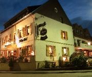
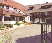
Need some hints on where to stay? We compiled a list of available hotels close to the map centre further down the page.
Being here already, you might want to pay a visit to some of the following locations: Buborn, Nerzweiler, Wiesweiler, Oberweiler im Tal and Hinzweiler. To further explore this place, just scroll down and browse the available info.
Local weather forecast
Todays Local Weather Conditions & Forecast: 16°C / 60 °F
| Morning Temperature | 10°C / 49 °F |
| Evening Temperature | 15°C / 59 °F |
| Night Temperature | 12°C / 53 °F |
| Chance of rainfall | 4% |
| Air Humidity | 54% |
| Air Pressure | 1011 hPa |
| Wind Speed | Moderate breeze with 12 km/h (7 mph) from North |
| Cloud Conditions | Broken clouds, covering 82% of sky |
| General Conditions | Moderate rain |
Monday, 6th of May 2024
13°C (55 °F)
10°C (50 °F)
Heavy intensity rain, gentle breeze, overcast clouds.
Tuesday, 7th of May 2024
14°C (57 °F)
9°C (49 °F)
Light rain, gentle breeze, broken clouds.
Wednesday, 8th of May 2024
14°C (57 °F)
9°C (49 °F)
Light rain, gentle breeze, broken clouds.
Hotels and Places to Stay
Videos from this area
These are videos related to the place based on their proximity to this place.
Leistungsschau Sankt Julian 2012 im Teichbauzentrum
Im Zweijahresrhythmus findet im Teichbauzentrum 66887 Sankt Julian eine Leistungsschau statt. Zahlreiche Aussteller aus dem Handel und Gewerbe, die in Sankt Julian und Umgebung ansässig sind, ...
Wasserfall bauen
Bau eines Wasserfall in unserem Teichbauzentrum Sankt Julian Und hier finden Sie uns http://www.teichfolie-rheinland-pfalz.de/
PVC Teichfolie im Test, Teichfolien Verarbeitung
Die richtige Teichfolie in unserem Shop http://www.teichbau-garten.com Für eine lange Lebenszeit eines Gartenteiches ist die Qualität, sowie die Verarbeitung der Teichfolie entscheidend.
Rammelsbacher Dorffest 2007 - Barzelt der Wackepicker
Kurz nach 1 Uhr im Barzelt der Wackepicker 16.06.2007.
Schön sanierter ehemaliger Bauernhof in Kappeln
Schön sanierter ehemaliger Bauernhof - Bauernhaus in Kappeln - ObjNr: 2076-691 Dieser sehr schöne ehemalige Bauernhof liegt im Saarer Bergland idyllisch ruhig freistehend am Ortsrand....
BFH Gunner Montage der-tomatenkeks lvl 30
In dem Video mach ich ein kurzes gameplay von meinem national gunner der lvl 30 ist und wenns euch ineressiert ich bin rank: LXI = 61.
Ab in die Unterwelt - Die Tropfsteinhöhle von Erzenhausen
Im Jahre 1911 entdeckten 2 Erzenhausener Bürger am Westhang des Rautenart das Mundloch eines Stollens, als sie eine dort austretende Wasserader fassen wollten. Es eröffnete sich ihnen ein...
Team CAR WARS auf dem ACTION FESTIVAL Jump & Praise 2013
Das Jump & Praise Action Festival im August 2013 in Schwedelbach. Es gab diverse Attraktionen wie 20 Tonnen Bagger, Bag Jump aus 18m, Slip n Slide, Sumoringen, Schlammcatchen, Bobcat fahren ...
Immo Odenbach 105.wmv
Immobilie in Odenbach ZU VERKAUFEN weitere Informationen unter 0 63 82 / 99 32 60 oder im Internet unter www.jo-immo.de oder www.jo-makler.de Kaufpreis auf www.jo-immo.de.
Videos provided by Youtube are under the copyright of their owners.
Attractions and noteworthy things
Distances are based on the centre of the city/town and sightseeing location. This list contains brief abstracts about monuments, holiday activities, national parcs, museums, organisations and more from the area as well as interesting facts about the region itself. Where available, you'll find the corresponding homepage. Otherwise the related wikipedia article.
Kaiserslautern (district)
Kaiserslautern is a district (Kreis) in the south of Rhineland-Palatinate, Germany. Neighboring districts are (from west clockwise) Kusel, Saarpfalz-Kreis, Donnersbergkreis, Bad Dürkheim and Südwestpfalz. The city of Kaiserslautern is almost fully enclosed by, but not belonging to the district.
Kusel (district)
Kusel is a district (Kreis) in the south of Rhineland-Palatinate, Germany. (Neigh)boring districts are (from north-west clockwise) Birkenfeld, Bad Kreuznach, Donnersbergkreis, Kaiserslautern, Saarpfalz and Sankt Wendel (the latter two belonging to the state of Saarland).
Disibod
Saint Disibod (619–700) was an Irish monk and hermit, first mentioned in a martyrologium by Hrabanus Maurus (9th century). Hildegard of Bingen around 1170 composed a vita of Saint Disibod According to Hildegard's vita, Disibod came to the Frankish Empire in 640 as a missionary, accompanied by his disciples Giswald, Clemens and Sallust.
Disibodenberg
Disibodenberg is a monastery ruin in Rhineland-Palatinate, Germany. It was founded by Saint Disibod. Hildegard of Bingen, who wrote Disibod's biography "Vita Sancti Disibodi", also lived in Disibodenberg for a while. In 640, Disibod came as a missionary from Ireland to Francia. After working for 10 years in Vosges and Ardennes, he arrived near Odernheim am Glan and started teaching there. After his death, the monastery was founded.
Potzbergturm
The Potzbergturm is a 53.5-metre-high lookout and transmitting tower on the Potzberg at Föckelberg, Rhineland-Palatinate, Germany. It was built between 13 October 1951 and 2 December 1951 and consists of a 35-metre-high bricked tower with a footprint of 4 by 7 metres, on which are 18.5-metre-high radio towers. The Potzbergturm was inaugurated on 13 July 1952.
Kirn-Land
Kirn-Land is a Verbandsgemeinde ("collective municipality") in the district of Bad Kreuznach, in Rhineland-Palatinate, Germany. It is located around the town Kirn, which is the seat of Kirn-Land, but not part of the Verbandsgemeinde. Kirn-Land consists of the following Ortsgemeinden ("local municipalities"):
Glan (Nahe)
The Glan is a river in southwestern Germany, right tributary of the Nahe River. It is approximately 68 km long. It rises in the Saarland, northwest of Homburg. It flows generally north, through Rhineland-Palatinate, and empties into the Nahe in Odernheim am Glan, near Bad Sobernheim. Other towns along the Glan are Altenglan, Glan-Münchweiler, Lauterecken and Meisenheim.
Bad Sobernheim (Verbandsgemeinde)
Bad Sobernheim is a Verbandsgemeinde ("collective municipality") in the district of Bad Kreuznach, Rhineland-Palatinate, Germany. The seat of the Verbandsgemeinde is in Bad Sobernheim. The Verbandsgemeinde Bad Sobernheim consists of the following Ortsgemeinden ("local municipalities"): Auen Bad Sobernheim Bärweiler Daubach Ippenschied Kirschroth Langenthal Lauschied Martinstein Meddersheim Merxheim Monzingen Nußbaum Odernheim am Glan Rehbach Seesbach Staudernheim Weiler bei Monzingen
Meisenheim (Verbandsgemeinde)
Meisenheim is a Verbandsgemeinde ("collective municipality") in the district of Bad Kreuznach, Rhineland-Palatinate, Germany. The seat of the Verbandsgemeinde is in Meisenheim. The Verbandsgemeinde Meisenheim consists of the following Ortsgemeinden ("local municipalities"): Abtweiler Becherbach Breitenheim Callbach Desloch Hundsbach Jeckenbach Lettweiler Löllbach Meisenheim Raumbach Rehborn Reiffelbach Schmittweiler
Ramstein-Miesenbach (Verbandsgemeinde)
Ramstein-Miesenbach is a Verbandsgemeinde ("collective municipality") in the district of Kaiserslautern, Rhineland-Palatinate, Germany. The seat of the Verbandsgemeinde is in Ramstein-Miesenbach. The Verbandsgemeinde Ramstein-Miesenbach consists of the following Ortsgemeinden ("local municipalities"): Hütschenhausen Kottweiler-Schwanden Niedermohr Ramstein-Miesenbach
Weilerbach (Verbandsgemeinde)
Weilerbach is a Verbandsgemeinde ("collective municipality") in the district of Kaiserslautern, Rhineland-Palatinate, Germany. The seat of the Verbandsgemeinde is in Weilerbach. The Verbandsgemeinde Weilerbach consists of the following Ortsgemeinden ("local municipalities"): Erzenhausen Eulenbis Kollweiler Mackenbach Reichenbach-Steegen Rodenbach Schwedelbach
Altenglan (Verbandsgemeinde)
Altenglan is a Verbandsgemeinde ("collective municipality") in the district of Kusel, Rhineland-Palatinate, Germany. The seat of the Verbandsgemeinde is in Altenglan. The Verbandsgemeinde Altenglan consists of the following Ortsgemeinden ("local municipalities"): Altenglan Bedesbach Bosenbach Elzweiler Erdesbach Föckelberg Horschbach Neunkirchen am Potzberg Niederalben Niederstaufenbach Oberstaufenbach Rammelsbach Rathsweiler Rutsweiler am Glan Ulmet
Glan-Münchweiler (Verbandsgemeinde)
Glan-Münchweiler is a Verbandsgemeinde ("collective municipality") in the district of Kusel, Rhineland-Palatinate, Germany. The seat of the Verbandsgemeinde is in Glan-Münchweiler. The Verbandsgemeinde Glan-Münchweiler consists of the following Ortsgemeinden ("local municipalities"): Börsborn Glan-Münchweiler Henschtal Herschweiler-Pettersheim Hüffler Krottelbach Langenbach Matzenbach Nanzdietschweiler Quirnbach Rehweiler Steinbach am Glan
Kusel (Verbandsgemeinde)
Kusel is a Verbandsgemeinde ("collective municipality") in the district of Kusel, Rhineland-Palatinate, Germany. The seat of the Verbandsgemeinde is in Kusel. The Verbandsgemeinde Kusel consists of the following Ortsgemeinden ("local municipalities"):
Lauterecken (Verbandsgemeinde)
Lauterecken is a Verbandsgemeinde ("collective municipality") in the district of Kusel, Rhineland-Palatinate, Germany. The seat of the Verbandsgemeinde is in Lauterecken. The Verbandsgemeinde Lauterecken consists of the following Ortsgemeinden ("local municipalities"):
Wolfstein (Verbandsgemeinde)
Wolfstein is a Verbandsgemeinde ("collective municipality") in the district of Kusel, Rhineland-Palatinate, Germany. The seat of the Verbandsgemeinde is in Wolfstein. The Verbandsgemeinde Wolfstein consists of the following Ortsgemeinden ("local municipalities"): Aschbach Einöllen Eßweiler Hefersweiler Hinzweiler Jettenbach Kreimbach-Kaulbach Nußbach Oberweiler im Tal Oberweiler-Tiefenbach Reipoltskirchen Relsberg Rothselberg Rutsweiler an der Lauter
Ramstein High School
Ramstein American High School (also commonly referred to as RHS) is a Department of Defense Dependents Schools (DoDDS) high school in the Kaiserslautern district which serves the European portion of DoDDS. Their mascot is the Royale, a lion with a crown. Ramstein American High School is located on Ramstein Air Base (RAB) which is just outside of Kaiserslautern, Germany.
North Palatine Uplands
The North Palatine Uplands, sometimes incorrectly shortened to Palatine Uplands (Pfälzer Bergland), is a landscape unit in the German state of Rhineland-Palatinate and belongs largely to the Palatinate region.
Siegelbach
Siegelbach is located just northwest of the city of Kaiserslautern, in the heart of Germany's Rheinland-Pfalz. The village, with its 2,600 inhabitants, is included in the urban district of Kaiserslautern, as incorporated in 1969. The Arms of Siegelbach can be viewed at this site: Ralf Hartemink: "Siegelbach", Deutsche Wappen (Gemeindewappen/Kreiswappen) German Civic Heraldry, Heraldry of the World, http://www. ngw. nl/int/dld/s/siegelba. htm, retrieved 28 Aug 2009.


