Safety Score: 3,0 of 5.0 based on data from 9 authorites. Meaning we advice caution when travelling to Germany.
Travel warnings are updated daily. Source: Travel Warning Germany. Last Update: 2024-05-15 08:00:47
Explore Eller
The district Eller of Neef in Rhineland-Palatinate is located in Germany about 318 mi south-west of Berlin, the country's capital.
If you need a place to sleep, we compiled a list of available hotels close to the map centre further down the page.
Depending on your travel schedule, you might want to pay a visit to some of the following locations: Ediger-Eller, Sankt Aldegund, Bremm, Dohr and Bullay. To further explore this place, just scroll down and browse the available info.
Local weather forecast
Todays Local Weather Conditions & Forecast: 13°C / 55 °F
| Morning Temperature | 11°C / 52 °F |
| Evening Temperature | 13°C / 56 °F |
| Night Temperature | 12°C / 54 °F |
| Chance of rainfall | 1% |
| Air Humidity | 96% |
| Air Pressure | 1007 hPa |
| Wind Speed | Light breeze with 3 km/h (2 mph) from North |
| Cloud Conditions | Overcast clouds, covering 100% of sky |
| General Conditions | Light rain |
Thursday, 16th of May 2024
14°C (57 °F)
8°C (47 °F)
Moderate rain, gentle breeze, overcast clouds.
Friday, 17th of May 2024
13°C (56 °F)
11°C (51 °F)
Moderate rain, light breeze, overcast clouds.
Saturday, 18th of May 2024
11°C (53 °F)
9°C (48 °F)
Light rain, light breeze, overcast clouds.
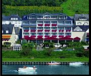
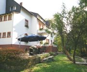
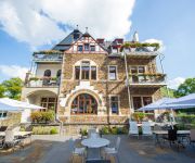
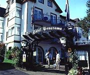
Hotels and Places to Stay
Moselstern Hotel Brixiade & Triton
Wald Villa Üssbach Appartements
Hotel Villa Vinum Cochem
Moselromantikhotel Panorama
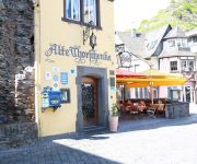
Alte Thorschenke
Moselromantikhotel Weissmühle
Thul Moselromantik-Hotel
Stumbergers
Zehnthof
Germania
Videos from this area
These are videos related to the place based on their proximity to this place.
Ferienland Cochem an der Mosel: Beschauliche Winzerorte mit Fachwerkhäusern
Weitere Infos unter: www.ferienland-cochem.de Ferienland Cochem an der Mosel - Deutschland - Urlaub an der Mosel Tourismus video: Beschauliche Winzerorte mit Fachwerkhäusern - Ferien ...
Ferienland Cochem an der Mosel: sportlich aktiv - Golf, Wandern, Nordic Walking
Weitere Infos unter: www.ferienland-cochem.de Ferienland Cochem an der Mosel in Deutschland : sportlich aktiv - Golf, Wandern, Nordic Walking - Golfplatz in Ediger-Eller mit 18- und 9-Lochanlagen...
Mosela en Alemania Turismo: Cochem - cosecha de las uvas tiene lugar
Mosela en Alemania Turismo: La cosecha de las uvas tiene lugar en Octubre en la región de Cochem en el Valle del Mosela - Riesling - Mosela - La famosa uva de Riesling es la variedad más...
RC flight near Cochem, Germany
Morning flight near Cochem in Germany, Ferienresort Cochem. Nice fog above the river Mosel. Plane: Durafly Dynamic-S.
Ediger - Eller Schönheiten an der Mosel
Ediger- Eller , Gemeinde zwischen Bernkastel - Kues und Cochem an der schönen Mosel. Eingebettet von den umliegenden Weinbergen. Bekannt durch die guten Weine der Mosel. Ediger-Eller ist...
Van Ediger Eller naar Neef aan de Moezel met de trein.
De ideale verbinding tussen 2 mooie moezeldorpjes ..
Winzerfest Ediger-Eller 2011
Winzerfest in Ediger-Eller 2011, mit der Stimmungs-Kapelle "Gootgemootj" aus den Niederlanden.
1. Mosel Firefighter Combat Challenge Ediger-Eller 2014
Einzelstart Philipp Kaiser (Team Südbaden/FF Rheinhausen) gegen Gwenael Friedrich (TFA Team Strasbourg)
1. Mosel Firefighter Combat Challenge Ediger-Eller 2014
Einzelstart Rico Paulusch (Team Südbaden/FF Müllheim)
Videos provided by Youtube are under the copyright of their owners.
Attractions and noteworthy things
Distances are based on the centre of the city/town and sightseeing location. This list contains brief abstracts about monuments, holiday activities, national parcs, museums, organisations and more from the area as well as interesting facts about the region itself. Where available, you'll find the corresponding homepage. Otherwise the related wikipedia article.
Frankfurt-Hahn Airport
For the NATO Military use of this facility, see Hahn Air Base Frankfurt-Hahn Airport is a commercial airport located 10 km from the town of Kirchberg and 20 km from the town of Simmern in the Rhein-Hunsrück district of Rhineland-Palatinate to the west of central Germany. Despite its name, the airport is virtually equidistant between Frankfurt and Luxembourg—about 120 km to each city (by road); it is closer to Koblenz and Mainz .
Cochem-Zell
Cochem-Zell is a district (Kreis) in the north-west of Rhineland-Palatinate, Germany. Neighboring districts are Mayen-Koblenz, Rhein-Hunsrück, Bernkastel-Wittlich, and Vulkaneifel.
Hahn Air Base
Hahn Air Base was a frontline NATO facility in Germany for over 40 years during the Cold War (former ICAO EDAH, now EDFH as Frankfurt-Hahn Airport). It is located 10 km from the town of Kirchberg and 20 km from the town of Simmern, and 2 km from the tiny village of Hahn in the Rhein-Hunsrück district of Rhineland-Palatinate in west-central Germany.
Kröv-Bausendorf
Kröv-Bausendorf is a Verbandsgemeinde ("collective municipality") in the district Bernkastel-Wittlich, in Rhineland-Palatinate, Germany. Its seat of administration is in the village Kröv, which is situated on the river Moselle, approx. 15 km east of Wittlich. Kröv-Bausendorf consists of the following Ortsgemeinden ("local municipalities"): Bausendorf Bengel Diefenbach Flußbach Hontheim Kinderbeuern Kinheim Kröv Reil
Cochem (Verbandsgemeinde)
Cochem (before 7 June 2009 Cochem-Land) is a Verbandsgemeinde ("collective municipality") in the district Cochem-Zell, in Rhineland-Palatinate, Germany. It is located around the town Cochem (also part of the Verbandsgemeinde since 7 June 2009), which is the seat of the Verbandsgemeinde. Cochem consists of the following Ortsgemeinden ("local municipalities"):
Traben-Trarbach (Verbandsgemeinde)
Traben-Trarbach is a Verbandsgemeinde ("collective municipality") in the district Bernkastel-Wittlich, in Rhineland-Palatinate, Germany. Its seat of administration is in Traben-Trarbach. The Verbandsgemeinde Traben-Trarbach consists of the following Ortsgemeinden ("local municipalities"): Burg Enkirch Irmenach Lötzbeuren Starkenburg
Kaisersesch (Verbandsgemeinde)
Kaisersesch is a Verbandsgemeinde ("collective municipality") in the district Cochem-Zell, in Rhineland-Palatinate, Germany. The seat of the Verbandsgemeinde is in Kaisersesch. The Verbandsgemeinde Kaisersesch consists of the following Ortsgemeinden ("local municipalities"):
Treis-Karden (Verbandsgemeinde)
Treis-Karden is a Verbandsgemeinde ("collective municipality") in the district of Cochem-Zell, in Rhineland-Palatinate, Germany. The seat of the Verbandsgemeinde is in Treis-Karden. The Verbandsgemeinde of Treis-Karden consists of the following Ortsgemeinden ("local municipalities"):
Ulmen (Verbandsgemeinde)
Ulmen is a Verbandsgemeinde ("collective municipality") in the district Cochem-Zell, in Rhineland-Palatinate, Germany. The seat of the Verbandsgemeinde is in Ulmen. The Verbandsgemeinde Ulmen consists of the following Ortsgemeinden ("local municipalities"):
Zell (Verbandsgemeinde)
Zell is a Verbandsgemeinde ("collective municipality") in the district Cochem-Zell, in Rhineland-Palatinate, Germany. The seat of the Verbandsgemeinde is in Zell. The Verbandsgemeinde Zell consists of the following Ortsgemeinden ("local municipalities"):
Bärenbach, Rhein-Hunsrück
Bärenbach is an Ortsgemeinde – a municipality belonging to a Verbandsgemeinde, a kind of collective municipality – in the Rhein-Hunsrück-Kreis in Rhineland-Palatinate, Germany. It belongs to the Verbandsgemeinde of Kirchberg, whose seat is in the like-named town.
Kolliger Mühle
The Kolliger Mühle is a watermill in Kollig, in the German Eifel region, 30 km. west of Koblenz and 13 k. from the river Moselle. The water wheel of the Kolliger Mühle is driven by the water of a small river, the Elzbach, also called the Elz. It is one of a great number of watermills in the Eifel region. Other watermills in the neighbourhood are the Gehringer Mühle and the Ölmühle. The oldest part of the mill probably dates from the 17th century.
Martin city gate
The Martin city gate is one of three still existing city gates of the German city of Cochem.
Alf (river)
The Alf is a small river in Rhineland-Palatinate, Germany, a left tributary of the Moselle. It rises in the Eifel, near Darscheid, east of Daun. The Alf flows south through Mehren, Gillenfeld and Bausendorf, where it turns east to flow into the Moselle in the village Alf. It is by the Czech Republic.
Grevenburg
Grevenburg was a castle in Traben-Trarbach in the federal state of Rhineland-Palatinate in Germany. The castle was formerly the residence of the Rear County of Sponheim and today is a ruin following its destruction by the French in 1734.
Hochmosel Bridge
The Hochmosel Bridge (German: Hochmoselbrücke or "High Moselle Bridge") is a highway bridge under construction that traverses the Moselle valley near Ürzig and Zeltingen-Rachtig in Rheinland-Pfalz, Germany. The bridge is part of a new highway connection, the "Hochmoselübergang" or Federal Highway 50 (Bundesstrasse 50), to facilitate traffic between Belgian and Dutch harbors and the greater Frankfurt area.
Büchel Air Base
Büchel Air Base is a military air base in Germany. It is home to the Jagdbombergeschwader 33 (JaboG 33 for short, or Fighter Bomber Wing 33 in English) of the German Air Force (Luftwaffe) and the 702 Munition Support Squadron (702 MUNSS) of the United States Air Force (USAF). Since 1985 the Panavia Tornado is operated from the base, which is capable of delivering B61 nuclear weapons which are stored and maintained by the USAF.
Weingut Joh. Jos. Prüm
Weingut Joh. Jos. Prüm is a German wine grower and producer based in Bernkastel-Wehlen, in the wine-growing region of Mosel, Germany.


