Safety Score: 3,0 of 5.0 based on data from 9 authorites. Meaning we advice caution when travelling to Germany.
Travel warnings are updated daily. Source: Travel Warning Germany. Last Update: 2024-04-26 08:02:42
Explore Rheindahlen
The district Rheindahlen of Mönchengladbach in Regierungsbezirk Düsseldorf (North Rhine-Westphalia) is located in Germany about 315 mi west of Berlin, the country's capital.
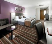
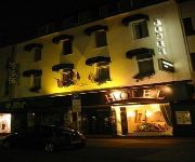
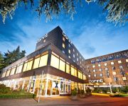
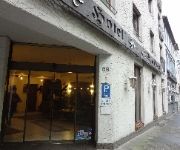
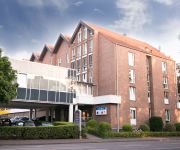
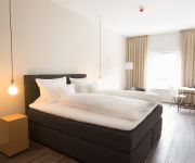
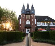
If you need a place to sleep, we compiled a list of available hotels close to the map centre further down the page.
Depending on your travel schedule, you might want to pay a visit to some of the following locations: Viersen, Schwalmtal, Juchen, Niederkruchten and Titz. To further explore this place, just scroll down and browse the available info.
Local weather forecast
Todays Local Weather Conditions & Forecast: 13°C / 55 °F
| Morning Temperature | 6°C / 43 °F |
| Evening Temperature | 13°C / 55 °F |
| Night Temperature | 8°C / 46 °F |
| Chance of rainfall | 0% |
| Air Humidity | 56% |
| Air Pressure | 1004 hPa |
| Wind Speed | Moderate breeze with 9 km/h (6 mph) from North-East |
| Cloud Conditions | Overcast clouds, covering 99% of sky |
| General Conditions | Light rain |
Saturday, 27th of April 2024
16°C (61 °F)
12°C (54 °F)
Light rain, moderate breeze, overcast clouds.
Sunday, 28th of April 2024
18°C (64 °F)
11°C (53 °F)
Light rain, fresh breeze, overcast clouds.
Monday, 29th of April 2024
11°C (52 °F)
10°C (49 °F)
Light rain, light breeze, overcast clouds.
Hotels and Places to Stay
Leonardo
Rheinischer Hof
Rosenmeer
Elisenhof
Dorint Parkhotel
Freiraum stattHotel
Spickhofen
Best Western Plus Crown Hotel
Lindenhof
Palace St. George
Videos from this area
These are videos related to the place based on their proximity to this place.
Borussia Mönchengladbach 1:0 Köln 14.02.2015 Spielende Platzsturm und Feiern vor der Nordkurve
Platzsturm der Kölner Trottel inkl. Einfangen der Tiere durch die Polizei und anschließende Feierei der Mannschaft vor der Nordkurve.
Meireles - Koçum Benim (Borussia Mönchengladbach - Fenerbahçe)
Raul Meireles goal against Borussia Mönchengladbach. UEFA Europa Leage Group Stage 2nd match, 4th October 2012.
Borussia Mönchengladbach vs. Mainz 05: HUMBA mit MAtS
Aus Sicht von Block 16A: Die Minuten nach dem Spiel Marc André ter Stegen stimmt "Gladbach ist der geilste Club der Welt" an Marc André ter Stegen stimmt die HUMBA an Datum: 3 Mai 2014.
Borussia Mönchengladbach - VfB Stuttgart / Bl13-14 Cannstatter Kurve TV Ultras Stuttgart HD
http://www.Cannstatter-Kurve.de.
Borussia Mönchengladbach vs. Mainz 05: Choreo und Verabschiedung MAtS
Aus Sicht von Block 16A: Einlauf der Mannschaften Konfetti-Choreo Verabschiedung von Marc André ter Stegen Anstoß Datum: 3 Mai 2014.
Waitin' On a Sunny Day Bruce Springsteen Mönchengladbach (just the girl singing)
Waitin' On a Sunny Day Bruce Springsteen Borussia Park Mönchengladbach Front Of Stage.
VfL Borussia Mönchengladbach: Die Seele brennt (24.01.2014, BMG-FCB)
24.01.2014 - Start der Rückrunde der Saison 2013/14. Der Borussia-Park singt "Die Seele brennt" vor dem Spiel Borussia Mönchengladbach - FC Bayern München (Endstand 0:2)
Borussia Mönchengladbach - SC Freiburg Tor zum 1:0 durch Raffael 01.12.13
Das 1:0 durch unsere Nummer 11 Raffael 1 : 0 Raffael 62. / Rechtsschuss (Oscar Wendt) 1 Marc-André ter Stegen 17 Oscar Wendt 24 Tony Jantschke 27 Julian Korb gelb 57' 39 Martin...
Borussia Mönchengladbach - VfB Stuttgart / Bl14-15 Cannstatter Kurve TV Ultras Stuttgart HD
http://www.Cannstatter-Kurve.de.
Videos provided by Youtube are under the copyright of their owners.
Attractions and noteworthy things
Distances are based on the centre of the city/town and sightseeing location. This list contains brief abstracts about monuments, holiday activities, national parcs, museums, organisations and more from the area as well as interesting facts about the region itself. Where available, you'll find the corresponding homepage. Otherwise the related wikipedia article.
Rheydt
Rheydt is a borough of the German city Mönchengladbach, located in the west of North Rhine-Westphalia. Until 1918 and then again from 1933 (due to a split from Mönchengladbach arranged by Joseph Goebbels, who was born there) through 1975 it was an independent city. After merging with Mönchengladbach, the central station kept its original name, making Mönchengladbach the only city in Germany to have two stations called Hauptbahnhof.
Headquarters Allied Rapid Reaction Corps
The Headquarters Allied Rapid Reaction Corps, (HQ ARRC or ARRC) is a North Atlantic Treaty Organisation High Readiness Force (Land) Headquarters ready for deployment worldwide within five to thirty days.
Niers
The Niers is a river in Germany and the Netherlands, right tributary to the river Meuse. Its source is near Erkelenz, south of Mönchengladbach, in North Rhine-Westphalia (Germany). The Niers flows through Mönchengladbach, Viersen, Wachtendonk, Geldern and Goch before flowing into the Meuse just across the border with the Netherlands, in Gennep. Its total length is 116 km - 108 km in Germany, 8 km in the Netherlands.
Borussia-Park
Borussia-Park (official name "Stadion im Borussia-Park") in Mönchengladbach, North Rhine-Westphalia, Germany is the home stadium of German Bundesliga club Borussia Mönchengladbach. It replaced the smaller Bökelberg stadium, which no longer satisfied modern safety standards and international requirements, in July 2004. Borussia-Park has a capacity of up to 54,057, of which 16,145 are standing-room only due to popular demand.
Forstwald
Forstwald is a region of Krefeld located to the west of the main city center. It is marked by its forest landscape and more up-scale housing than other regions of Krefeld.
RAF Rheindahlen
The former Royal Air Force Station Rheindahlen, more commonly known as RAF Rheindahlen, was a non-flying Royal Air Force military base, part of the Rheindahlen Military Complex in North Rhine-Westphalia, Germany - part of British Forces Germany (BFG). Established after World War II it served mainly as the administrative support centre for the 2nd Tactical Air Force (2TAF). It was disbanded in 1993 and amalgamated with the other military support units at Rheindahlen.
JHQ Rheindahlen
JHQ Rheindahlen, latterly also called the Rheindahlen Military Complex, is a British forces base in Mönchengladbach, North Rhine-Westphalia, Germany. JHQ stands for Joint Headquarters and the base has functioned as the main headquarters for British forces in Germany since being built in the 1950s. Its German address is Mönchengladbach-JHQ with a post code of 41179.
RAF Hospital Wegberg
The former Royal Air Force Hospital Wegberg, commonly abbreviated to RAF(H) Wegberg, was a Royal Air Force military hospital located in Wegberg, near the city of Mönchengladbach, in Germany.
Odenkirchen
Odenkirchen is a former town in Germany, presently part of the city Mönchengladbach. It is situated on the river Niers, 21 miles by rail south-west of Düsseldorf. It has a railway station, on the line from Mönchengladbach to Grevenbroich and Cologne. Pop. (2000) 19,993. Odenkirchen became a town in 1856. See Wiedemann, Geschichte der ehemaligen Herrschaft und des Hauses Odenkirchen (Odenkirchen, 1879).
Bökelbergstadion
The Bökelbergstadion was a football stadium in Mönchengladbach, Germany.
Rheydt Central Station
Rheydt Central Station (Rheydt Hauptbahnhof) is a railway station in Mönchengladbach, Germany. Mönchengladbach is the only city in Germany that has two stations called Hauptbahnhof, due to the merger of the city of Rheydt into Mönchengladbach in the late 1970s.
Grenzlandring
The Grenzlandring (German for "border-region ring"), sometimes Grenzland-Ring written, is a former high-speed race track oval in the Lower Rhine area of Germany, around the town of Wegberg, located close to Mönchengladbach and the Dutch town of Roermond. The Grenzlandring, to many foreigners also known as Wegbergring or Wegberg Ring, is told to be "discovered" nearly undamaged after World War II when during one dark 1947 night, Dr.
Warsteiner HockeyPark
Warsteiner HockeyPark is a multi-use stadium in Mönchengladbach, Germany. It is currently used mostly for american football and field hockey matches and hosted the 2006 World Hockey Cup. The stadium is run by former German field hockey international Michael Hilgers. It is also used by the American football team Mönchengladbach Mavericks.
Gladbach Abbey
Gladbach Abbey was a Benedictine abbey founded in 974 by Archbishop Gero of Cologne and the monk Sandrad from Trier. It was named after the Gladbach, a narrow brook that now runs underground. The abbey and its adjoining villages grew into the town of Gladbach, incorporated in the 1360s, the origin of the present city of Mönchengladbach in North Rhine-Westphalia. In 1802 the abbey was occupied by troops under the French occupation and secularised; its great library was dispersed.
Abteiberg Museum
The Museum Abteiberg is a municipal museum for contemporary art in the German city Mönchengladbach. Since the 1970s, the museum has been known for its experimental and avant-garde exhibitions, starting with director Johannes Cladders (1967-1985), and also its museum architecture, designed by Austrian architect Hans Hollein - a highpoint of postmodern design.
Lordship of Wickrath
The Lordship of Wickrath (sometimes spelled "Wykradt") was a Lordship of the Holy Roman Empire located in western North Rhine-Westphalia around the castle of Wickrath. The Lordship was bordered by Jülich to the south, west and north, and the Archbishopric of Cologne to the east. Wickrath became an immediate Lordship in 1488 afrer it passed to the Knights of Hompesch.
Battle of Dahlen
The Battle of Dahlen was fought on April 23, 1568, between a Dutch rebel army led by Joost de Soete, Lord of Villers, and a Spanish army commanded by Sancho Dávila y Daza. As a part of William of Orange's planned invasion, the Dutch rebels were trying to conquer the town of Roermond when the arrival of the Spanish force compelled them to withdraw. Dávila pursued the retreating force and inflicted a defeat upon Villers near the small town of Dahlen (today known as Rheindahlen).
Mönchengladbach Central Station
Mönchengladbach Central Station (Mönchengladbach Hauptbahnhof) is a railway station in the city of Mönchengladbach in western Germany.
Bunter Garten
The Bunter Garten (30 hectares) is a municipal park with botanical garden (5 hectares) and arboretum located along Lettow-Vorbeck Straße, Mönchengladbach, North Rhine-Westphalia, Germany. It is open daily without charge. The park contains three major sections: Kaiserpark, Colorful Garden, and Botanical Garden, including a rock garden, herb garden, and a fragrance garden, as well as the Kaiser-Friedrich-Halle and an aviary of some 200 birds.
Jahnstadion (Mönchengladbach)
Jahnstadion is a multi-use stadium in Mönchengladbach, Germany . It is used as the stadium of Rheydter Spielverein matches. The capacity of the stadium is 20,000 spectators.
Dülkener Schöppenmarkt
The Dülkener Schöppenmarkt (i. e. „Shovel Fair“) in Dülken is one of the largest and oldest country-fairs or Krammärkte in Western Germany.
Beckrath
Beckrath is a village in North Rhine-Westphalia, Germany, 315 miles (507 km) west of Berlin, 6.1 miles (9.9 km) south of Mönchengladbach.
Erkelenz station
Erkelenz station is a station in the town of Erkelenz in the German state of North Rhine-Westphalia. It lies on the Aachen–Mönchengladbach railway and has been classified by Deutsche Bahn since January 2011 as a category 5 station. The station is served by the Wupper-Express and the Rhein-Niers-Bahn. It consists of a simple station building from the 1950s with two platforms. Close to the station there are a park and ride lot and transfer facilities to express, regional and city buses.
Köhm
Köhm is a river of North Rhine-Westphalia, Germany.
Multinational Division Central
The Multinational Division Central MND (C), was a multi-national division in NATO for Central Europe and had its headquarters at the British base in JHQ Rheindahlen near Mönchengladbach. The concept for this first genuine multi-national division in NATO with its four participating nations - Belgium, Germany, the United Kingdom and the Netherlands originated during the Cold War. The airmobile MND (C) was to support Northern Army Group Central Europe (NORTHAG) as a reserve formation.


