Safety Score: 3,0 of 5.0 based on data from 9 authorites. Meaning we advice caution when travelling to Germany.
Travel warnings are updated daily. Source: Travel Warning Germany. Last Update: 2024-04-26 08:02:42
Delve into Blee
Blee in Regierungsbezirk Düsseldorf (North Rhine-Westphalia) is located in Germany about 296 mi (or 476 km) west of Berlin, the country's capital town.
Current time in Blee is now 08:49 AM (Saturday). The local timezone is named Europe / Berlin with an UTC offset of 2 hours. We know of 8 airports close to Blee, of which 5 are larger airports. The closest airport in Germany is Düsseldorf International Airport in a distance of 16 mi (or 26 km), North. Besides the airports, there are other travel options available (check left side).
There are several Unesco world heritage sites nearby. The closest heritage site in Germany is Cologne Cathedral in a distance of 9 mi (or 15 km), South. We encountered 3 points of interest near this location. If you need a hotel, we compiled a list of available hotels close to the map centre further down the page.
While being here, you might want to pay a visit to some of the following locations: Leverkusen, Cologne, Duesseldorf, Mettmann and Rommerskirchen. To further explore this place, just scroll down and browse the available info.
Local weather forecast
Todays Local Weather Conditions & Forecast: 16°C / 61 °F
| Morning Temperature | 7°C / 44 °F |
| Evening Temperature | 17°C / 63 °F |
| Night Temperature | 13°C / 55 °F |
| Chance of rainfall | 1% |
| Air Humidity | 54% |
| Air Pressure | 1007 hPa |
| Wind Speed | Moderate breeze with 10 km/h (6 mph) from North |
| Cloud Conditions | Overcast clouds, covering 100% of sky |
| General Conditions | Light rain |
Sunday, 28th of April 2024
16°C (60 °F)
12°C (53 °F)
Light rain, moderate breeze, overcast clouds.
Monday, 29th of April 2024
12°C (54 °F)
12°C (53 °F)
Light rain, light breeze, overcast clouds.
Tuesday, 30th of April 2024
23°C (74 °F)
15°C (59 °F)
Light rain, light breeze, broken clouds.
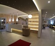
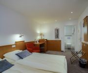
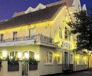
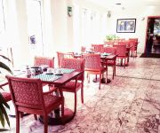
Hotels and Places to Stay
Schloß Friedestrom
Kristal
Am Berliner Platz
Stadthotel
MAXIM
Ratskeller
Hoettche
ACHAT Comfort
Kölner Hof
Comfort Hotel Monheim
Videos from this area
These are videos related to the place based on their proximity to this place.
Der Rhein bei Dormagen/Leverkusen
Der Rhein zwischen Dormagen und Leverkusen mit DJI Phantom Vision 2 plus.
[Sound] Bus MAN NL 283 (Wagennr. 1) der Bahnen der Stadt Monheim GmbH
Bus: MAN NL 283 Wagennummer: 1 Baujahr: 2009 Firma: Bahnen der Stadt Monheim GmbH Anzahl: 3 (Wagennr. 1-3) Typ im Einsatz seit: 2009 Aufgenommen auf der Linie: 791 Von: Monheim, ...
Wasserrettungsübung Teil 1 in full HD
Wasserrettungsübung der Bundespolizei am 24. April 2012 in Hitdorf. Zum Einsatz kam die EC155 D-HLTL Teil 1.
Deux Grands Cafés - Genezareth
Live in Monheim, Schelmenturm, November 2012 Deux Grands Cafés are Joerg Siebenhaar and Gregory Gaynair.
Gregory Gaynair Trio - Remember E.S.
Live in Monheim, Germany, October 2012 Gregory Gaynair pays homage to Erik Satie with Rolf Behet (drums) and Wolfgang Engelbertz (bass)
Wasserrettungsübung Teil 4 in full HD
Wasserrettungsübung der Bundespolizei am 24. April 2012 in Hitdorf. Zum Einsatz kam die EC155 D-HLTL Teil 4 Im Gegensatz zum ersten Teil wurden diese Aufnahmen mit Stativ, externem Mikrofon...
FullHD 2 BK117 & 1 EC155 static
FullHD D-HNWN Wasserrettungsübung der Landespolizei NRW. Die beteiligten Hubschrauber im "Static Display"
Videos provided by Youtube are under the copyright of their owners.
Attractions and noteworthy things
Distances are based on the centre of the city/town and sightseeing location. This list contains brief abstracts about monuments, holiday activities, national parcs, museums, organisations and more from the area as well as interesting facts about the region itself. Where available, you'll find the corresponding homepage. Otherwise the related wikipedia article.
Battle of Worringen
The Battle of Worringen was fought on June 5, 1288, near the town of Worringen (also spelled Woeringen), which is now the northernmost borough of Cologne. The battle was fought for the possession of the Duchy of Limburg, and was one of the largest battles in Europe in the Middle Ages.
Worringer Bruch
The Worringer Bruch is a section of 164 hectares swampy lowlands in the far north of Cologne, Germany. It is approximately 8,000 years old, and is now almost a completely dried up meander part of the Rhine. It was named after an adjacent district of Cologne, Worringen, which once was an independent city, which has a thousand years of history (first mentioned in 922).
Chorweiler
Chorweiler is the Sixth city district of Cologne, Germany. Large portion of the district of Chorweiler were incorporated into the city of Cologne in 1922, the quarter of Chorweiler was created in the 1970s. The district has the lowest population density in Cologne and many areas are very rural. The District of Chorweiler borders with the Cologne boroughs of Nippes and Ehrenfeld to the South, Rhein-Erft-Kreis to the West, Rhein-Kreis Neuss to the North, and the Rhine to the East.
Köln-Chorweiler Nord station
Köln-Chorweiler Nord is a railway station situated at Chorweiler, Cologne in western Germany. It is served by the S11 line of the Rhine-Ruhr S-Bahn.
Köln-Worringen station
Köln-Worringen is a railway station on the Lower Left Rhine Railway, situated in Cologne in western Germany. It is served by the S11 line of the Cologne S-Bahn.
Köln-Blumenberg station
Köln-Blumenberg is a railway station on the Lower Left Rhine Railway, situated in Cologne in western Germany. It is served by the S11 line of the Cologne S-Bahn.








!['[Sound] Bus MAN NL 283 (Wagennr. 1) der Bahnen der Stadt Monheim GmbH' preview picture of video '[Sound] Bus MAN NL 283 (Wagennr. 1) der Bahnen der Stadt Monheim GmbH'](https://img.youtube.com/vi/oDbeLJnvTRo/mqdefault.jpg)


