Safety Score: 3,0 of 5.0 based on data from 9 authorites. Meaning we advice caution when travelling to Germany.
Travel warnings are updated daily. Source: Travel Warning Germany. Last Update: 2024-05-07 07:59:51
Delve into Ostfeld
The district Ostfeld of Herringen in Regierungsbezirk Arnsberg (North Rhine-Westphalia) is a district located in Germany about 247 mi west of Berlin, the country's capital town.
In need of a room? We compiled a list of available hotels close to the map centre further down the page.
Since you are here already, you might want to pay a visit to some of the following locations: Bonen, Unna, Ascheberg, Holzwickede and Welver. To further explore this place, just scroll down and browse the available info.
Local weather forecast
Todays Local Weather Conditions & Forecast: 15°C / 59 °F
| Morning Temperature | 10°C / 50 °F |
| Evening Temperature | 16°C / 61 °F |
| Night Temperature | 12°C / 53 °F |
| Chance of rainfall | 0% |
| Air Humidity | 67% |
| Air Pressure | 1025 hPa |
| Wind Speed | Light breeze with 4 km/h (3 mph) from South-West |
| Cloud Conditions | Broken clouds, covering 51% of sky |
| General Conditions | Broken clouds |
Thursday, 9th of May 2024
17°C (63 °F)
11°C (53 °F)
Overcast clouds, light breeze.
Friday, 10th of May 2024
18°C (65 °F)
13°C (55 °F)
Broken clouds, light breeze.
Saturday, 11th of May 2024
20°C (68 °F)
13°C (55 °F)
Light rain, gentle breeze, overcast clouds.
Hotels and Places to Stay
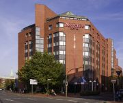
Mercure Hotel Hamm
Stockumer Hof
Stadt Hamm
Herzog
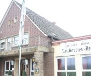
Hubertus Hof
King´s Bootshaus
Langerbein
Mc Games Casino
Kautz Gasthaus
Dietrich
Videos from this area
These are videos related to the place based on their proximity to this place.
Hyosung SF 50 Racing www.dees-scooter-shop.de Hamm
wurde geschlachtet.. Teile davon gibt es hier: www.dees-scooter-shop.de.
Ost colliery in the city of Hamm (Germany) / Bergwerk Ost in Hamm
The view from the roof of Ost colliery's processing plant in the city of Hamm (Germany) showing the winding towers of Heinrich and Robert shaft. / Der Blick vom Dach der Aufbereitung des Bergwerks...
Bergwerk Ost / Ost colliery
This video was taken in the winding tower of Ost colliery's Robert shaft in the city of Hamm (Germany). It shows the winding machines that are situated about 50 metres above the surface and...
Abschlussfeier Falkschule Hamm 1993 Hundeplatz Teil 01 - MixClip
Abschlussfeier Falkschule Hamm Herringen 23.06.1993 Hundeplatz.
Abschlussfeier Falkschule Hamm 1993 Hundeplatz Teil 03
Abschlussfeier Falkschule Hamm Herringen 23.06.1993 Hundeplatz.
Herringer Maifest 2011
An jedem dritten Sonntag im Mai veranstaltet die Herringer Interessengemeinschaft - HIG das Maifest mit verkaufsoffenem Sonntag. Die Geschäfte öffnen von 13:00 Uhr bis 18:00 Uhr. Ein umfangreiche ...
Abschlussfeier Falkschule Hamm 1993 Hundeplatz Teil 05
Abschlussfeier Falkschule Hamm Herringen 23.06.1993 Hundeplatz.
Abschlussfeier Falkschule Hamm 1993 Hundeplatz Teil 06
Abschlussfeier Falkschule Hamm Herringen 23.06.1993 Hundeplatz.
Piaggio Fly 50 www.dees-scooter-shop.de Hamm NRW
Wurde geschlachtet,, Teile davon gibt es im Shop www.dees-scooter-shop.de.
Gemeinsame Sanitätsübung amerikanischer, britischer und deutscher Streitkräfte
Im Mai 2010 übten amerikanische, britische und deutsche Soldaten gemeinsam auf dem Gelände der ehemaligen Zeche Heinrich-Robert in Hamm. Hier einige Eindrücke und Stimmen von der Übung.
Videos provided by Youtube are under the copyright of their owners.
Attractions and noteworthy things
Distances are based on the centre of the city/town and sightseeing location. This list contains brief abstracts about monuments, holiday activities, national parcs, museums, organisations and more from the area as well as interesting facts about the region itself. Where available, you'll find the corresponding homepage. Otherwise the related wikipedia article.
Unna (district)
The Unna district is a Kreis (district) in central North Rhine-Westphalia, Germany. Neighboring authorities are the district of Coesfeld, the city of Hamm, the districts of Soest and Märkischer Kreis, the cities of Hagen and Dortmund, and the district of Recklinghausen.
County of Mark
The County of Mark (German: Grafschaft Mark, French: Comté de La Marck colloquially known as Die Mark) was a county and state of the Holy Roman Empire in the Lower Rhenish-Westphalian Circle. It lay on both sides of the Ruhr River along the Volme and Lenne Rivers. The Counts of the Mark were among the most powerful and influential Westphalian lords in the Holy Roman Empire.
Luftfahrtgesellschaft Walter
LGW is a German regional airline officially known as Luftfahrtgesellschaft Walter mbH . Since 2007, LGW has been owned by Air Berlin. The Dortmund based airline transported about 50,000 passengers in 2003 The company has approximately 75 employees who are working in flight operations, maintenance, ground operations, booking, flight-school and administration.
Werl Prison
Werl Prison has about 900 inmates, and is one of the largest prisons in Germany. It is located in the town of Werl in the state of North Rhine-Westphalia, east of Dortmund. After World War II, several high-ranking Nazi officials were imprisoned there.
Dortmund Airport
Dortmund Airport, is the international airport located 10 km east of Dortmund, Germany. Its slogan is Näher als man denkt (Closer than you think). Since 2006 it has been carrying the name "Dortmund Airport 21", in reference to the fact that Dortmund's utility company, DSW21, is its major shareholder. The airport has a maximum capacity of around 2.5 million passengers and served approximately 2.3 million passengers in 2008.
Bausenhagen
Bausenhagen, is a former village that is part of the city of Fröndenberg in Germany. It has about 600 inhabitants.
Kamener Kreuz
The Kamener Kreuz was formerly a full cloverleaf interchange near Dortmund in North Rhine-Westphalia Germany where the Autobahnen A1 and A2 meet. It lies between the towns of Kamen and Bergkamen in the west and the city of Hamm and the municipality Bönen in the east. The Kamener Kreuz, opened in 1937, was the second interchange between two Reichsautobahnen, the first one being the Schkeuditzer Kreuz. It is used by 160000 vehicles per day.
Wersestadion
Not to be confused for the Weserstadion, in Bremen. Wersestadion is a multi-use stadium in Ahlen, Germany. It is currently used mostly for football matches and is the home stadium of Rot Weiss Ahlen. The stadium is able to hold 15,000 people and was built in 1997.
Hamm (Westfalen) station
Hamm (Westfalen) (often abbreviated Hamm or simply Hamm) is a railway station situated in the city of Hamm in the German state of North Rhine-Westphalia. It is notable for its station building inspired by art deco and Gründerzeit building styles. The station is one of the important InterCityExpress rail hubs in the eastern Ruhr area and is among the high-profile buildings of Hamm. Until the decline of rail freight after the Second World War, it featured one of Europe's largest marshalling yards.
Lenningsen
Lenningsen is a local part in the South of Bönen and belongs to the district of Unna in North Rhine-Westphalia.
Ahlen Water Tower
The Ahlen water tower is an industrial monument and landmark in the Ahlen, Germany. The spherical water tank is 44 metres high and has a capacity of 1,000 cubic metres . From 1915 to 1917, the water tower served as the sole water supply for the Westphalia mine and the miners colony built in 1892 by Gelsenwasser AG. Today the distinctive blue water tower is monument and is a historical example of the early development of riveting at the beginning of the 20th century.
Datteln-Hamm Canal
The Datteln-Hamm Canal, or Datteln-Hamm-Kanal in German, is a canal in the German state of North Rhine-Westphalia. It links the Dortmund-Ems Canal at Datteln to the city of Hamm. The canal is 47.2 kilometres long and has two locks, at Hamm and Werries, with a total rise of 6.8 metres .
Dortmund-Wickede station
Dortmund-Wickede is a railway station on the Welver–Sterkrade railway situated in Dortmund in western Germany. It is served by the S4 line of Rhine-Ruhr S-Bahn. A Dortmund Stadtbahn station is located next to the station.
Heessen station
Heessen station is a passenger station in Heessen, a suburb of the Westphalian city of Hamm in the German state of North Rhine-Westphalia. It lies on the Hamm–Minden railway, one of the most heavily trafficked lines in Germany.
Ahlen (Westfalen) station
Ahlen (Westfalen) station—abbreviated to Ahlen (Westf)—serves the town of Ahlen in the German state of North Rhine-Westphalia. It is situated on the electrified, four-track Hamm–Minden railway, which connects the Ruhr region to Hanover. It was originally part of the network of the former Cologne-Minden Railway Company and is now part of the Deutsche Bahn network.
Kamen station
Kamen station is a station in the city of Kamen in the German state of North Rhine-Westphalia. It is on the Dortmund–Hamm railway. The line has only two tracks through Kamen, although quadruplication is planned, but its realisation is far away. Kamen station is an architectural monument built by the Cologne-Minden Railway Company in 1847.
Unna station
Unna station is the main passenger station in the Westphalian city of Unna in the German state of North Rhine-Westphalia. The other stations in the city that are served by regular passenger services are Unna-Königsborn, Unna West, Massen, Lünern and Hemmerde.
Dortmund-Kurl station
Dortmund-Kurl station is in the Dortmund suburb of Kurl in the German state of North Rhine-Westphalia on the Dortmund–Hamm line. The station has two platform tracks and an overtaking track for long-distance trains and a freight track without platforms, which is no longer used.
Unna-Königsborn station
Unna-Königsborn station is located in the city of Unna in the German state of North Rhine-Westphalia. It is at the end of the remaining section of the line from Dortmund. Line S 4 trains of the Rhine-Ruhr S-Bahn reverse here on their way to and from Unna station. It is classified by Deutsche Bahn as a category 6 station. The station is served by S 4 services between Unna and Dortmund-Lütgendortmund station via Dortmund Stadthaus and Dortmund-Dorstfeld.
Ahse
Ahse is a river of North Rhine-Westphalia, Germany.
Geinegge
Geinegge is a river of North Rhine-Westphalia, Germany.
Teufelsbach (Rhynerscher Bach)
Teufelsbach (Rhynerscher Bach) is a river of North Rhine-Westphalia, Germany.


