Safety Score: 3,0 of 5.0 based on data from 9 authorites. Meaning we advice caution when travelling to Germany.
Travel warnings are updated daily. Source: Travel Warning Germany. Last Update: 2024-04-27 08:23:39
Discover Schmerhövel
Schmerhövel in Regierungsbezirk Arnsberg (North Rhine-Westphalia) is a city in Germany about 249 mi (or 401 km) west of Berlin, the country's capital city.
Local time in Schmerhövel is now 02:32 PM (Saturday). The local timezone is named Europe / Berlin with an UTC offset of 2 hours. We know of 9 airports in the vicinity of Schmerhövel, of which 4 are larger airports. The closest airport in Germany is Dortmund Airport in a distance of 9 mi (or 14 km), South-West. Besides the airports, there are other travel options available (check left side).
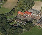
There are several Unesco world heritage sites nearby. The closest heritage site in Germany is Zollverein Coal Mine Industrial Complex in Essen in a distance of 31 mi (or 49 km), West. We discovered 2 points of interest in the vicinity of this place. Looking for a place to stay? we compiled a list of available hotels close to the map centre further down the page.
When in this area, you might want to pay a visit to some of the following locations: Bonen, Unna, Holzwickede, Ascheberg and Nordkirchen. To further explore this place, just scroll down and browse the available info.
Local weather forecast
Todays Local Weather Conditions & Forecast: 17°C / 63 °F
| Morning Temperature | 7°C / 44 °F |
| Evening Temperature | 18°C / 64 °F |
| Night Temperature | 12°C / 54 °F |
| Chance of rainfall | 0% |
| Air Humidity | 52% |
| Air Pressure | 1007 hPa |
| Wind Speed | Moderate breeze with 10 km/h (6 mph) from North |
| Cloud Conditions | Overcast clouds, covering 100% of sky |
| General Conditions | Light rain |
Sunday, 28th of April 2024
17°C (63 °F)
11°C (53 °F)
Overcast clouds, moderate breeze.
Monday, 29th of April 2024
12°C (53 °F)
12°C (53 °F)
Light rain, light breeze, overcast clouds.
Tuesday, 30th of April 2024
21°C (70 °F)
15°C (59 °F)
Light rain, light breeze, scattered clouds.
Hotels and Places to Stay
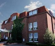
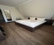
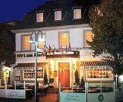
Designhotel Im Südfeld
Mercure Kamen Unna
Ringhotel Katharinen Hof
Stockumer Hof
Stadt Kamen
Hotel Gut Höing
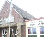
Hubertus Hof
Kautz Gasthaus
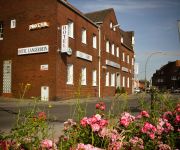
Langerbein
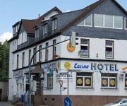
Mc Games Casino
Videos from this area
These are videos related to the place based on their proximity to this place.
Ost colliery in the city of Hamm (Germany) / Bergwerk Ost in Hamm
The view from the roof of Ost colliery's processing plant in the city of Hamm (Germany) showing the winding towers of Heinrich and Robert shaft. / Der Blick vom Dach der Aufbereitung des Bergwerks...
Bergwerk Ost / Ost colliery
This video was taken in the winding tower of Ost colliery's Robert shaft in the city of Hamm (Germany). It shows the winding machines that are situated about 50 metres above the surface and...
Abschlussfeier Falkschule Hamm 1993 Hundeplatz Teil 01 - MixClip
Abschlussfeier Falkschule Hamm Herringen 23.06.1993 Hundeplatz.
Abschlussfeier Falkschule Hamm 1993 Hundeplatz Teil 03
Abschlussfeier Falkschule Hamm Herringen 23.06.1993 Hundeplatz.
Herringer Maifest 2011
An jedem dritten Sonntag im Mai veranstaltet die Herringer Interessengemeinschaft - HIG das Maifest mit verkaufsoffenem Sonntag. Die Geschäfte öffnen von 13:00 Uhr bis 18:00 Uhr. Ein umfangreiche ...
Abschlussfeier Falkschule Hamm 1993 Hundeplatz Teil 05
Abschlussfeier Falkschule Hamm Herringen 23.06.1993 Hundeplatz.
Abschlussfeier Falkschule Hamm 1993 Hundeplatz Teil 06
Abschlussfeier Falkschule Hamm Herringen 23.06.1993 Hundeplatz.
Gemeinsame Sanitätsübung amerikanischer, britischer und deutscher Streitkräfte
Im Mai 2010 übten amerikanische, britische und deutsche Soldaten gemeinsam auf dem Gelände der ehemaligen Zeche Heinrich-Robert in Hamm. Hier einige Eindrücke und Stimmen von der Übung.
Videos provided by Youtube are under the copyright of their owners.
Attractions and noteworthy things
Distances are based on the centre of the city/town and sightseeing location. This list contains brief abstracts about monuments, holiday activities, national parcs, museums, organisations and more from the area as well as interesting facts about the region itself. Where available, you'll find the corresponding homepage. Otherwise the related wikipedia article.
Kamener Kreuz
The Kamener Kreuz was formerly a full cloverleaf interchange near Dortmund in North Rhine-Westphalia Germany where the Autobahnen A1 and A2 meet. It lies between the towns of Kamen and Bergkamen in the west and the city of Hamm and the municipality Bönen in the east. The Kamener Kreuz, opened in 1937, was the second interchange between two Reichsautobahnen, the first one being the Schkeuditzer Kreuz. It is used by 160000 vehicles per day.


