Safety Score: 3,0 of 5.0 based on data from 9 authorites. Meaning we advice caution when travelling to Germany.
Travel warnings are updated daily. Source: Travel Warning Germany. Last Update: 2024-05-14 08:25:02
Discover Dubkevitz
Dubkevitz in Mecklenburg-Vorpommern is a town in Germany about 133 mi (or 214 km) north of Berlin, the country's capital city.
Current time in Dubkevitz is now 07:43 PM (Tuesday). The local timezone is named Europe / Berlin with an UTC offset of 2 hours. We know of 10 airports near Dubkevitz, of which 4 are larger airports. The closest airport in Germany is Barth Airport in a distance of 23 mi (or 36 km), West. Besides the airports, there are other travel options available (check left side).
There are several Unesco world heritage sites nearby. The closest heritage site in Germany is Historic Centres of Stralsund and Wismar in a distance of 11 mi (or 18 km), South-West. We discovered 4 points of interest in the vicinity of this place. Looking for a place to stay? we compiled a list of available hotels close to the map centre further down the page.
When in this area, you might want to pay a visit to some of the following locations: Stralsund, Greifswald, Zingst, Neubrandenburg and Trelleborg. To further explore this place, just scroll down and browse the available info.
Local weather forecast
Todays Local Weather Conditions & Forecast: 17°C / 62 °F
| Morning Temperature | 12°C / 54 °F |
| Evening Temperature | 15°C / 58 °F |
| Night Temperature | 13°C / 56 °F |
| Chance of rainfall | 0% |
| Air Humidity | 68% |
| Air Pressure | 1016 hPa |
| Wind Speed | Fresh Breeze with 14 km/h (9 mph) from West |
| Cloud Conditions | Clear sky, covering 5% of sky |
| General Conditions | Sky is clear |
Wednesday, 15th of May 2024
18°C (64 °F)
14°C (58 °F)
Sky is clear, fresh breeze, clear sky.
Thursday, 16th of May 2024
16°C (60 °F)
14°C (57 °F)
Scattered clouds, fresh breeze.
Friday, 17th of May 2024
15°C (59 °F)
13°C (55 °F)
Sky is clear, fresh breeze, clear sky.
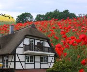
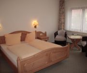
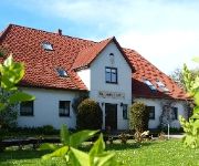
Hotels and Places to Stay
GreenLine Rügen Park
Hof Kranichstein
Landhotel Schafshorn
Störtebeker Sporthotel Rügen
Gutshaus Strobel Landurlaub & Wellness
Videos from this area
These are videos related to the place based on their proximity to this place.
solarchopper.wmv
man nehme einen fahrradchopper, spendiere ihm einen elektroantrieb und baue ein solardach darüber, schon kann man während der fahrt und insbesondere bei längeren pausen die akkus durch die.
Renault Avantime - 2.Meeting Samtens-Rügen
Am 1.Mai 2010 fand unser 2. Avantime Deutschland Meeting in Samtens auf der Insel Rügen statt. Die Fahrt ging von Samtens zur Wittower Fähre weiter nach Kap Arkona (Fernlüttkewitz-Strand),...
Negast bei Samtens
Negast bei Samtens mit der GoPro HERO 3 - Zeitraffer - ziehende Wolken - ein Käfer im Flug vor der Kamera.
Fußball Samtens - Putbus 1 : 1 (25.05.2013)
Fußball Samtens - Putbus 1 : 1 am 25.05.2013 in Samtens mal mit der GoPro in Zeitraffer.
Samtens (2) - Frühlingswinter 2013
Frühlingswinter 2013 wenige Tage vor Ostern, also es kommt ein weißes Osterfest. Im Film das Amt Westrügen, Freiwillige Feuerwehr, an der Landstraße nach Garz, der Bahnhof Samtens und...
Videos provided by Youtube are under the copyright of their owners.
Attractions and noteworthy things
Distances are based on the centre of the city/town and sightseeing location. This list contains brief abstracts about monuments, holiday activities, national parcs, museums, organisations and more from the area as well as interesting facts about the region itself. Where available, you'll find the corresponding homepage. Otherwise the related wikipedia article.
Udarser Wiek
The Udarser Wiek is a bay on Germany's Baltic Sea coast, about 8 km² in area, between the islands of Rügen in the north and Ummanz in the south. In the west, the bodden transitions into the Schaproder Bodden and in the southeast to the Gahlitz in the lake of Koselower See. At the northeast end of the bay lies the island of Öhe. The Udarser Wiek is very shallow (generally below 1.5 metres deep). The bay was named after the village of Udars in the municipality of Schaprode on Rügen.
Möwenstein (Ummanz)
The Möwenstein is a glacial erratic that was transported south from the area of the present-day island of Bornholm by the ice sheet during the last glaciation. It is located on the island of Ummanz in the west of Rügen within the Western Pomerania Lagoon Area National Park. Erratics are relatively uncommon here, most of them lie east of the island of Rügen. The rock is damaged by boreholes and it is feared that further damage could be caused by frost shattering.
Liebitz
The German island of Liebitz lies in the lagoon of Kubitzer Bodden about 700 metres west of Germany's largest island, Rügen, in the state of Mecklenburg-Vorpommern. It belongs to the municipality of Dreschvitz. The island is about 1,000 × 700 metres across and has an area of about 64 ha. In the west of this low island, only a few metres high, is the island's Pleistocene core, which is increasingly being eroded by the water. In the east there are flat salt meadows.
Landow Village Church
The village church of Landow is the Evangelical parish church of the parish of Rambin in the south of the German island of Rügen. It is located in the village of Landow in the municipality of Dreschvitz. It was built as a Wegekirche in Landow around the year 1312. A Wegekirche is a church which is designed such that the location of the priest and congregation gives the impression that they are on their way to the Lord, facing the Christ, usually in the symbolic form of a cross or painting.
Liebes
The small, uninhabited island of Liebes lies in the Baltic Sea, in the lagoon of Varbelvitzer Bodden between the islands of Rügen and Ummanz. It is a good 1,000 metres long, up to 200 metres wide and its highest point lies just 1.5 metres above sea level. The name of the island could be derived from the Slavic word Lipa = "lime tree".
Mährens
The German Baltic Sea island of Mährens is uninhabited and lies between the islands of Rügen and Ummanz off the coast of Mecklenburg-Western Pomerania. It is only around 150 × 100 metres across and up to 3 metres above sea level. Together with its two, rather larger, neighbours, Liebes and Urkevitz, as well as the smaller Wührens, the island lies within the Western Pomerania Lagoon Area National Park and, as a bird reserve, it is out-of-bounds to unauthorised persons.
Urkevitz
Urkevitz is an uninhabited German island in the West Pomeranian Lagoon Area National Park. It lies in the Baltic Sea between the islands of Rügen and Ummanz, and is less than 100 metres from the latter. The island is about 1,000 metres long, up to 300 metres wide and up to 5 metres above sea level. Like its neighbours, Liebes, Mährens and Wührens, it is a bird reserve. A bridge runs from Ummanz to Urkevitz, but the island is out-of-bounds to the public
Wührens
The German Baltic Sea island of Wührens lies between the much larger islands of Rügen and Ummanz. Its maximum extent measures 230 by 80 metres and it has an area of 1.73 hectares, rising just about sea level. It is uninhabited and only grass-covered. It is surrounded by the neighbouring islands of Liebes to the west, Urkevitz to the east and Mährens to the north. It is the smallest of the four islands in the channels of Wittenberger and Focker Strom.


