Safety Score: 3,0 of 5.0 based on data from 9 authorites. Meaning we advice caution when travelling to Germany.
Travel warnings are updated daily. Source: Travel Warning Germany. Last Update: 2024-04-29 08:03:39
Delve into Langeleben
Langeleben in Lower Saxony is located in Germany about 112 mi (or 180 km) west of Berlin, the country's capital town.
Current time in Langeleben is now 09:17 AM (Tuesday). The local timezone is named Europe / Berlin with an UTC offset of 2 hours. We know of 12 airports close to Langeleben, of which 5 are larger airports. The closest airport in Germany is Braunschweig Wolfsburg Airport in a distance of 13 mi (or 22 km), North-West. Besides the airports, there are other travel options available (check left side).
There are several Unesco world heritage sites nearby. The closest heritage site in Germany is Collegiate Church, Castle and Old Town of Quedlinburg in a distance of 33 mi (or 53 km), South-East. If you need a hotel, we compiled a list of available hotels close to the map centre further down the page.
While being here, you might want to pay a visit to some of the following locations: Kneitlingen, Rabke, Dahlum, Supplingen and Frellstedt. To further explore this place, just scroll down and browse the available info.
Local weather forecast
Todays Local Weather Conditions & Forecast: 20°C / 69 °F
| Morning Temperature | 11°C / 51 °F |
| Evening Temperature | 21°C / 70 °F |
| Night Temperature | 15°C / 60 °F |
| Chance of rainfall | 0% |
| Air Humidity | 66% |
| Air Pressure | 1017 hPa |
| Wind Speed | Gentle Breeze with 6 km/h (3 mph) from West |
| Cloud Conditions | Overcast clouds, covering 86% of sky |
| General Conditions | Overcast clouds |
Wednesday, 1st of May 2024
20°C (68 °F)
16°C (60 °F)
Sky is clear, moderate breeze, few clouds.
Thursday, 2nd of May 2024
20°C (68 °F)
15°C (59 °F)
Broken clouds, moderate breeze.
Friday, 3rd of May 2024
12°C (53 °F)
11°C (51 °F)
Light rain, gentle breeze, overcast clouds.
Hotels and Places to Stay
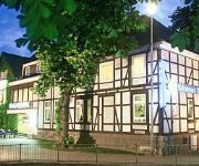
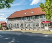
Markt Eins Gästezimmer
Avalon Hotelpark Königshof
Kärntner Stub`n
Bei Meiers Zum weissen Ross
Videos from this area
These are videos related to the place based on their proximity to this place.
A B F A H R T GoPro Hero 3 White Edition ( edit )
Teilstrecken-Mitschnitt der Abfahrt vom Tetzelstein/Elm - Klein Veltheim. Gesamt-km dieser Tour: 63,59km in 3std:21min:29sek. Diese ca 12km lange Abfahrt ist wirklich eine tolle Belohnung wenn...
Driebenberg-Viertel in Königslutter (Fassung 2012)
Mit dem Driebenberg-Viertel wurde die Domstadt Königslutter erweitert. Über 80 Familien leben schon hier, darunter viele mit Kindern. Für das Bau- und Wohnungsgebiet engagieren sich die...
Vielsaitig: Little wing (Cover)
Die Lehrerband der Musikschule Vielsaitig aus Schöppenstedt im Landsknecht Königslutter.
Train BMX
Training Verkauf Museum Dirk Brandes Hauptstr. 2, 38170 Klein Vahlberg 05332 / 937 405, info@bmx-brandes.de S.c. Walhalla Braunschweig.
Warberger Seeplatten
Hi das ist ein video von Warberg aufgenommen am 6.7.2012. Das viedo zeigt das schwerste Unwetter Warbergs.
Videos provided by Youtube are under the copyright of their owners.
Attractions and noteworthy things
Distances are based on the centre of the city/town and sightseeing location. This list contains brief abstracts about monuments, holiday activities, national parcs, museums, organisations and more from the area as well as interesting facts about the region itself. Where available, you'll find the corresponding homepage. Otherwise the related wikipedia article.
Schunter
The Schunter is a river in Lower Saxony, Germany, with a length of 58 km, right tributary of the Oker. It originates in the Elm hills near Räbke west of Helmstedt, flows northward to Süpplingenburg, then turns westward and joins the Oker at Schwülper, downstream of Braunschweig (Brunswick). Another municipality on the Schunter is Lehre. The river was first mentioned as Schuntra in a 781 deed. The name may be of Slavic origin as sukątora means "with many angles".
Elm-Lappwald Nature Park
The Elm-Lappwald Nature Park is a nature park in southwest Lower Saxony, east of Brunswick in central Germany. It is dominated by the forested hill ranges of the Elm, Lappwald and Dorm as well as the region known as the Helmstedt Bowl (Helmstedter Mulde). Reitling valley in the Elm


