Safety Score: 3,0 of 5.0 based on data from 9 authorites. Meaning we advice caution when travelling to Germany.
Travel warnings are updated daily. Source: Travel Warning Germany. Last Update: 2024-05-02 08:23:34
Delve into Döhrenkamp
Döhrenkamp in Lower Saxony is a city located in Germany about 182 mi (or 293 km) west of Berlin, the country's capital town.
Current time in Döhrenkamp is now 05:30 PM (Thursday). The local timezone is named Europe / Berlin with an UTC offset of 2 hours. We know of 9 airports closer to Döhrenkamp, of which 3 are larger airports. The closest airport in Germany is Hannover Airport in a distance of 27 mi (or 44 km), East. Besides the airports, there are other travel options available (check left side).
There are several Unesco world heritage sites nearby. The closest heritage site in Germany is Town Hall and Roland on the Marketplace of Bremen in a distance of 34 mi (or 55 km), North. In need of a room? We compiled a list of available hotels close to the map centre further down the page.
Since you are here already, you might want to pay a visit to some of the following locations: Binnen, Estorf, Pennigsehl, Landesbergen and Marklohe. To further explore this place, just scroll down and browse the available info.
Local weather forecast
Todays Local Weather Conditions & Forecast: 22°C / 72 °F
| Morning Temperature | 15°C / 58 °F |
| Evening Temperature | 24°C / 75 °F |
| Night Temperature | 16°C / 61 °F |
| Chance of rainfall | 0% |
| Air Humidity | 59% |
| Air Pressure | 1001 hPa |
| Wind Speed | Moderate breeze with 13 km/h (8 mph) from North-West |
| Cloud Conditions | Few clouds, covering 14% of sky |
| General Conditions | Light rain |
Friday, 3rd of May 2024
12°C (53 °F)
10°C (51 °F)
Light rain, moderate breeze, overcast clouds.
Saturday, 4th of May 2024
16°C (62 °F)
10°C (49 °F)
Light rain, gentle breeze, overcast clouds.
Sunday, 5th of May 2024
12°C (53 °F)
7°C (45 °F)
Light rain, moderate breeze, overcast clouds.
Hotels and Places to Stay
Waldhotel Süllhof
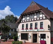
Zum Deutschen Hause
Videos from this area
These are videos related to the place based on their proximity to this place.
Crazy christmas lightshow
wustet Ihr schon, daß ich mich jedes Jahr auf die Weihnachtszeit freue? Nun habe ich mir ein kleines Lichterset gekauft um den Gedanken der stillen Nacht auch ein wenig an unserem Hause...
Bauernhof mit Tierhaltung ( Resthof) in Pennigsehl
Bauernhof mit Tierhaltung ( Resthof) - Bauernhof in Pennigsehl - ObjNr: 8488-213 Am Rande der " Geest ", in der Gemeinde Liebenau, kurz vor den Toren von Nienburg/Weser liegt dieses Bauernhaus.
Powertrail - HD Trailer (720p) - Geocaching
Zweisamkite, Smokymcpott und Norman.R auf Geocaching-Tour zum Fitness Cache bei Nienburg.
KTM EXC-F 350 Mod.2015 MX-Track/Schinna/Stolzenau 24.09.2014
KTM EXC-F 350 Mod.2015 MX-Track/Schinna/Stolzenau mit GoPro Chesty(Brustgurt-Halterung)
MX Track Schinna vs Honda CRF 250 RAW
LIKE US ON FACEBOOK TK Racing Crew: https://www.facebook.com/pages/TK-Racing-Crew/1553370334933776.
DJI Phantom 2 Vision plus V3.0, Schneelandschaft Marklohe 01 02 2015
Ein kurzer Überflug am 01 Februar 2015 über das verschneite Dorf Marklohe.
Marklohe Feuerwerk Silvester 01.01.2015 С новым 2015 годом
С новым годом 2015 Marklohe Германия Silvester Feuerwerk.
Videos provided by Youtube are under the copyright of their owners.
Attractions and noteworthy things
Distances are based on the centre of the city/town and sightseeing location. This list contains brief abstracts about monuments, holiday activities, national parcs, museums, organisations and more from the area as well as interesting facts about the region itself. Where available, you'll find the corresponding homepage. Otherwise the related wikipedia article.
Liebenau (Samtgemeinde)
Liebenau is a Samtgemeinde ("collective municipality") in the district of Nienburg, in Lower Saxony, Germany. Its seat is in the village Liebenau. The Samtgemeinde Liebenau consists of the following municipalities: Binnen Liebenau
Reese, Germany
Reese is a hamlet (Bauernschaft) in the Nienburg District (Kreise) of Lower Saxony in northwestern Germany, between Steyerberg and the town of Liebenau on the River Aue. It is part of the Liebenau municipality.
Middle Weser Region
The Middle Weser Region includes, in its fullest sense, the land along the Middle Weser between Minden and Bremen. It lies within the federal states of North Rhine-Westphalia, Lower Saxony and Bremen. However, the term is often used just to refer to the Lower Saxon part, because of the different political development of the three states and the cooperative associations formed in Lower Saxony some years ago (see below).


