Safety Score: 3,0 of 5.0 based on data from 9 authorites. Meaning we advice caution when travelling to Germany.
Travel warnings are updated daily. Source: Travel Warning Germany. Last Update: 2024-05-03 08:06:06
Discover Richelsdorf
Richelsdorf in Regierungsbezirk Kassel (Hesse) is a place in Germany about 181 mi (or 291 km) south-west of Berlin, the country's capital city.
Current time in Richelsdorf is now 08:47 AM (Saturday). The local timezone is named Europe / Berlin with an UTC offset of 2 hours. We know of 12 airports near Richelsdorf, of which 5 are larger airports. The closest airport in Germany is Fritzlar Airport in a distance of 33 mi (or 53 km), West. Besides the airports, there are other travel options available (check left side).
There are several Unesco world heritage sites nearby. The closest heritage site in Germany is Wartburg Castle in a distance of 13 mi (or 21 km), East. If you need a hotel, we compiled a list of available hotels close to the map centre further down the page.
While being here, you might want to pay a visit to some of the following locations: Dankmarshausen, Grossensee, Gerstungen, Dippach and Nentershausen. To further explore this place, just scroll down and browse the available info.
Local weather forecast
Todays Local Weather Conditions & Forecast: 10°C / 50 °F
| Morning Temperature | 9°C / 49 °F |
| Evening Temperature | 11°C / 52 °F |
| Night Temperature | 8°C / 46 °F |
| Chance of rainfall | 1% |
| Air Humidity | 91% |
| Air Pressure | 1017 hPa |
| Wind Speed | Calm with 3 km/h (2 mph) from West |
| Cloud Conditions | Overcast clouds, covering 100% of sky |
| General Conditions | Light rain |
Sunday, 5th of May 2024
12°C (54 °F)
9°C (48 °F)
Light rain, gentle breeze, overcast clouds.
Monday, 6th of May 2024
15°C (59 °F)
11°C (52 °F)
Moderate rain, light breeze, overcast clouds.
Tuesday, 7th of May 2024
11°C (51 °F)
10°C (50 °F)
Light rain, gentle breeze, overcast clouds.
Hotels and Places to Stay
Hohenhaus
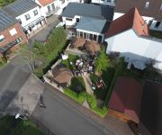
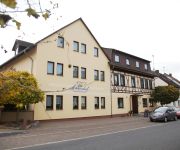
Thüringer Hof
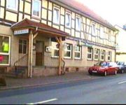
Zur Krone
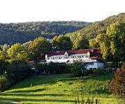
Land-gut-Hotel Sonnenhof
Johanneshof
Waldschlösschen
Videos from this area
These are videos related to the place based on their proximity to this place.
Burg- und Mittelalterfest 2012 auf der Tannenburg
Das 18. Burg- und Mittelalterfest 2012 auf der Tannenburg in Nentershausen. Nentershausen im Kreis Hersfeld-Rotenburg, eine der schönsten Wohn-, Urlaubs- und Erholungsregionen Deutschlands,...
Ritterkampf auf der Tannenburg
Dieser Ritterkampf fand am 01.06.2013 auf der Tannenburg in Nentershausen im Rahmen eines Rollenspiels statt.
Event-Trailer 2012
Renaissance Burgenfreunde e.V. präsentiert das 5. MittelalterEvent auf der Tannenburg vom 07.06. - 10.06. 2012. Alle Infos, Preis, Karten auf http://www.renaissance-burgenfreunde.de.
Tannenburg: Seelenheil am Tage des Herrn - SALVATION ON THE DAY OF THE LORD
Anno domini 1375 - autumn, somewhere in the centre of german speaking nations: Salvation being sold by this beggar Blessed be your name for donating any coins to enabble this skinny poor...
Eine kleine sache die sich hinaus zog | Minecraft # 5 (German | Deutsch
Die nächsten Videos sind erneut sehr veraltet und werden leider nicht nach euren Wünschen ablaufen ich bitte euch erneut um Verständnis danke euer Mayoo Und wünsche euch auf jeden Fall...
Werra Kanutour Kanu-Verleih Berka/Werra
Freizeit- und Kanuspass in der Werra , Freizeitcamp & Kanuverleih Berka-Werra. (www.freizeitcamp-werra.eu) Infos zu Werratours: Weitere Infos: www.freizeitcamp-werra.eu - Wir bieten Ihnen...
Angeln in der Werra bei Berka - Freizeitcamp Berka / Werra - Thüringen - Germany
Angeln Sie bei uns Hechte, Aale, Welse, Zander, Weißfische und Forellen - Weitere Infos: www.freizeitcamp-werra.eu - Wir bieten Ihnen im wunderschönen Werratal ein umfangreiches Freizeit-,...
Freizeitcamp & Kanuverleih - Berka / Werra - Thüringen - Germany - ImageClipNew - Werratours
Weitere Infos: www.freizeitcamp-werra.eu - Wir bieten Ihnen im wunderschönen Werratal ein umfangreiches Freizeit-, Sport-, und Erholungsangebot. Kanufahrten, Radwandern, Wandern, Angeln,...
Videos provided by Youtube are under the copyright of their owners.
Attractions and noteworthy things
Distances are based on the centre of the city/town and sightseeing location. This list contains brief abstracts about monuments, holiday activities, national parcs, museums, organisations and more from the area as well as interesting facts about the region itself. Where available, you'll find the corresponding homepage. Otherwise the related wikipedia article.
Weihe Viaduct
The Weihe Viaduct is a bridge of the A 4 motorway near Richelsdorf, Germany. It is located in the stretch of the A 4 between Bad Hersfeld and Eisenach, between the exits Wildeck-Obersuhl and Gerstungen. It crosses the valley of the small river Weihe. The bridge was intended to have been built at the beginning of the 1940s, but it wasn't finished then: only a few columns were built. Instead for the motorway a provisional route through the valley was constructed.
Geography of Germany
Germany is a country in west-central Europe, that stretches from the Alps, across the North European Plain to the North Sea and the Baltic Sea. Germany has the second largest population in Europe and is seventh largest in area. The territory of Germany covers 357,021 km, consisting of 349,223 km of land and 7,798 km of waters.


