Safety Score: 3,0 of 5.0 based on data from 9 authorites. Meaning we advice caution when travelling to Germany.
Travel warnings are updated daily. Source: Travel Warning Germany. Last Update: 2024-05-11 07:34:58
Touring Sand
The district Sand of Emstal in Regierungsbezirk Kassel (Hesse) is a subburb located in Germany about 198 mi south-west of Berlin, the country's capital place.
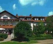
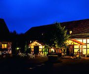
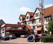
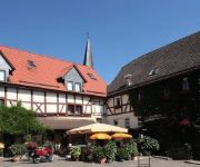
Need some hints on where to stay? We compiled a list of available hotels close to the map centre further down the page.
Being here already, you might want to pay a visit to some of the following locations: Wabern, Breuna, Calden, Fuldabruck and Guxhagen. To further explore this place, just scroll down and browse the available info.
Local weather forecast
Todays Local Weather Conditions & Forecast: 19°C / 66 °F
| Morning Temperature | 10°C / 50 °F |
| Evening Temperature | 18°C / 64 °F |
| Night Temperature | 12°C / 53 °F |
| Chance of rainfall | 0% |
| Air Humidity | 58% |
| Air Pressure | 1019 hPa |
| Wind Speed | Gentle Breeze with 7 km/h (5 mph) from West |
| Cloud Conditions | Clear sky, covering 3% of sky |
| General Conditions | Sky is clear |
Monday, 13th of May 2024
21°C (71 °F)
13°C (55 °F)
Sky is clear, gentle breeze, clear sky.
Tuesday, 14th of May 2024
21°C (70 °F)
14°C (58 °F)
Sky is clear, gentle breeze, clear sky.
Wednesday, 15th of May 2024
20°C (67 °F)
12°C (54 °F)
Light rain, gentle breeze, overcast clouds.
Hotels and Places to Stay
Parkhotel Emstaler Höhe
Der Grischäfer Landhotel
Kraft Gasthaus
Fritz'es Goldener Stern
Erpetal Pension
Schwalbennest
Landhotel & Gasthaus Altenburg
Videos from this area
These are videos related to the place based on their proximity to this place.
Zeltlager 2014 Niedenstein
Videoimpressionen vom Zeltlager der Kreisjugendfeuerwehr Fritzlar-Homberg in Niedenstein 2014.
König Drosselbart - Krönungszeremonie in Niedenstein
Anno 2012 (= 29. April 2012, Sonntag) fand die Krönungszerermonie von König Drosselbart an der Niedensteiner Teichanlage statt. Für märchenhafte und mittelalterliche Musik sorgten die...
Niedenstein: Einweihung Obertorplatz
Der Obertorplatz wurde nach erfolgreicher Neugestaltung am 19. August 2012 feierlich eingeweiht. Die Stimmung war gut und die Sonne schien heftig.
Brandserie Weißenthalsmühle: Freispruch für Betreiber vor Gericht
http://www.youtube.com/hnaonline - Kassel/Niedenstein, 25.1.13: Das Landgericht hat den Besitzer der Weißenthalsmühle in Niedenstein-Kirchberg am Freitag vom Vorwurf freigesprochen, seine...
Burg Falkenstein. In Hessen. Was davon übrig ist.
Burgruine Falkenstein. In der Nähe von Niedenstein, Schauenburg Elmshagen.
Im Bann der Chatten! - Wanderung der GRÜNEN Schwalm-Eder
Im " Bann der Chatten" war das Motto der von BÜNDNIS 90/DIE GRÜNEN im Schwalm-Eder-Kreis organisierten Wanderung am letzten Sonntag im August 2012. Entlang der bewaldeten Berge des ...
Landleben mit Zukunft - Landwirt Stefan Itter
Landwirt Stefan Itter aus Niedenstein-Kirchberg berichtet über den Anbau und Einsatz seines Einkorn Getreides. © Hessischer Rundfunk – www.hr.de.
Die Mühle wurde Angesteckt
Ein schönes Fleckchen. Der Campingplatz liegt mitten im Wald. Über den Platz fließt die Ems Leider wurde hier schon 3 mal Feuer gelegt. Aber der Neubau der Mühle steht schon wieder. Das...
Hessencourrier - Fahrt zum Apfelmarkt Naumburg (Nov/2014) B/W
Untertitel: "Du hast den Farbfilm vergessen, mein M..." (nach einem Lied von Nina Hagen) Zur Farbversion:http://youtu.be/iP8ed2HJzy0 Leider hatte das nordhessische Bergland an diesem Tag bei...
Hessencourrier und Bahnhofsfest in Naumburg mit Zeckenalarm 2014
Am 15. Juni veranstaltete das Eisenbahnmuseum in Naumburg zusammen mit dem Hessencourrier Kassel ein Bahnhofsfest in Naumburg am Rande des Naturparks Habichtswald. Neben der obligatorischen...
Videos provided by Youtube are under the copyright of their owners.
Attractions and noteworthy things
Distances are based on the centre of the city/town and sightseeing location. This list contains brief abstracts about monuments, holiday activities, national parcs, museums, organisations and more from the area as well as interesting facts about the region itself. Where available, you'll find the corresponding homepage. Otherwise the related wikipedia article.
Hasungen Abbey
Hasungen Abbey (Kloster Hasungen) was a monastery of the Benedictine Order located at Burghasungen, now a part of Zierenberg in Hesse in Germany. The site is at the top of a 480 metre high basalt mountain, the Hasunger Berg. In 1074 a monastery was built, on the authority of Siegfried I, Archbishop of Mainz, over the grave of the hermit Heimerad (d. 1019), who had had a little chapel and hermitage here. The historian Lambert of Hersfeld (d.
Züschen (megalithic tomb)
The Züschen tomb (German: Steinkammergrab von Züschen, sometimes also Lohne-Züschen) is a prehistoric burial monument, located between Lohne and Züschen, near Fritzlar, Hesse, Germany. Classified as a gallery grave or a Hessian-Westphalian stone cist (hessisch-westfälische Steinkiste), it is one of the most important megalithic monuments in Central Europe. Dating to the late 4th millennium BC (and possibly remaining in use until the early 3rd), it belongs to the Late Neolithic Wartberg culture.
Bergpark Wilhelmshöhe
The Bergpark Wilhelmshöhe is a unique park in Kassel, Germany. Art historian Georg Dehio (1850–1932), inspirator of the modern discipline of historic preservation, described the park as "possibly the most grandiose combination of landscape and architecture that the Baroque dared anywhere" ("vielleicht das Grandioseste, was irgendwo der Barock in Verbindung von Architektur und Landschaft gewagt hat. ").
Großer Bärenberg
Großer Bärenberg is a mountain of Hesse, Germany.
Burgberg (Baunatal)
Burgberg (Baunatal) is a mountain of Hesse, Germany.
Burgberg (Schauenburg)
Burgberg (Schauenburg) is a mountain of Hesse, Germany.
Burghasunger Berg
Burghasunger Berg is a mountain of Hesse, Germany.
Essigberg
Essigberg is a mountain of Hesse, Germany.
Falkenstein Castle (Bad Emstal)
Falkenstein Castle near Bad Emstal is a castle in Hesse, Germany.
Hohes Gras
Hohes Gras is a mountain of Hesse, Germany.
Heiligenberg (Naumburg)
Heiligenberg (Naumburg) is a mountain of Hesse, Germany.
Hundsberg
The Hundsberg is a mountain of Hesse, Germany. It is a northeastern peak of the Wattenberg massif.
Isthaberg
Isthaberg is a mountain of Hesse, Germany.
Kaulenberg
Kaulenberg is a mountain of Hesse, Germany.
Lindenberg (Habichtswald)
Lindenberg (Habichtswald) is a mountain of Hesse, Germany.
Schützeberg
Schützeberg is a mountain of Hesse, Germany.
Altenburg (Niedenstein)
Altenburg (Niedenstein) is a mountain of Schwalm-Eder-Kreis, Hesse, Germany.
Bilstein (Langenberge)
Bilstein (Langenberge) is a mountain of Schwalm-Eder-Kreis, Hesse, Germany.
Eckerich (Fritzlar)
Eckerich (Fritzlar) is a mountain of Schwalm-Eder-Kreis, Hesse, Germany.
Johanneskirchenkopf
Johanneskirchenkopf is a mountain of Schwalm-Eder-Kreis, Hesse, Germany.
Laufskopf
Laufskopf is a mountain of Schwalm-Eder-Kreis, Hesse, Germany.
Niedensteiner Kopf
Niedensteiner Kopf is a mountain of Schwalm-Eder-Kreis, Hesse, Germany.
Sengelsberg (Niedenstein)
Sengelsberg (Niedenstein) is a mountain of Schwalm-Eder-Kreis, Hesse, Germany.
Wartberg (Niedenstein)
Wartberg (Niedenstein) is a mountain of Schwalm-Eder-Kreis, Hesse, Germany.
Matzoff
Matzoff is a river of Hesse, Germany.


