Safety Score: 3,0 of 5.0 based on data from 9 authorites. Meaning we advice caution when travelling to Germany.
Travel warnings are updated daily. Source: Travel Warning Germany. Last Update: 2024-04-26 08:02:42
Delve into Georgenborn
Georgenborn in Regierungsbezirk Darmstadt (Hesse) is a city located in Germany about 283 mi (or 456 km) south-west of Berlin, the country's capital town.
Current time in Georgenborn is now 06:04 PM (Friday). The local timezone is named Europe / Berlin with an UTC offset of 2 hours. We know of 12 airports closer to Georgenborn, of which 5 are larger airports. The closest airport in Germany is Mainz-Finthen Airport in a distance of 8 mi (or 14 km), South. Besides the airports, there are other travel options available (check left side).
There are several Unesco world heritage sites nearby. The closest heritage site in Germany is Upper Middle Rhine Valley in a distance of 20 mi (or 32 km), West. We saw 1 points of interest near this location. In need of a room? We compiled a list of available hotels close to the map centre further down the page.
Since you are here already, you might want to pay a visit to some of the following locations: Schlangenbad, Walluf, Kiedrich, Bad Schwalbach and Budenheim. To further explore this place, just scroll down and browse the available info.
Local weather forecast
Todays Local Weather Conditions & Forecast: 11°C / 53 °F
| Morning Temperature | 2°C / 35 °F |
| Evening Temperature | 10°C / 50 °F |
| Night Temperature | 6°C / 43 °F |
| Chance of rainfall | 0% |
| Air Humidity | 64% |
| Air Pressure | 1006 hPa |
| Wind Speed | Gentle Breeze with 6 km/h (3 mph) from North |
| Cloud Conditions | Broken clouds, covering 56% of sky |
| General Conditions | Light rain |
Saturday, 27th of April 2024
16°C (60 °F)
13°C (56 °F)
Broken clouds, gentle breeze.
Sunday, 28th of April 2024
15°C (58 °F)
10°C (50 °F)
Overcast clouds, gentle breeze.
Monday, 29th of April 2024
17°C (63 °F)
13°C (56 °F)
Overcast clouds, light breeze.
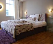
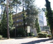
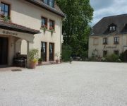
Hotels and Places to Stay
Eltvinum
Kronenschlößchen
Parkhotel Sonnenberg
Nassauer Hof
Aparthotel Mainz Am Mainzer Golfclub
Berghotel Hill Nichtraucherhotel
Waldhotel
Kaiserhof
Park-Hotel Tillmanns
Diedert Landhaus
Videos from this area
These are videos related to the place based on their proximity to this place.
Parkhotel Schlangenbad - First Class Komfort im historischen Ambiente
In der reizvollen Landschaft des Rhein-Main-Gebiets befindet sich das 4 Sterne-Superior Hotel Parkhotel Schlangenbad. Idyllisch ruhig direkt an der Tür zum Rheingau gelegen, aber doch zentral...
09.09.09 Fliegeralarm in Schlangenbad
5 Militärflugzeuge im Tiefflug aus Richtung Rheingau kommend über Bärstadt, Wambach in Richtung Taunusstein! Was war das wird sich so mancher gefragt haben! Antwort darauf habe ich nicht....
Bärstadt nach Schlangenbad
Impressionen! Eine rasante Fahrt mit dem Rad, auf indirektem Wege ans Ziel! Um die Landschaft um Schlangenbad zu erleben, sollte man nicht immer den kürzesten Weg zum Ziel suchen, denn ...
Mühle mit verschiedenen Gebäudeteilen und riesigem Grundstück (Rheingau)
Schlangenbad (Wiesbaden). Mit viel Geschmack und ohne Kosten zu scheuen wurde ein altes Juwel aufwenig neu geschliffen. Wer alte Gemäuer mag, wird diese Mühle lieben.
Nacht der langen Züge (1) - Modellbahn-Nacht in Taunusstein
(Zeil 1 von 2)Am 19.12.2009 fand in Taunusstein-Bleidenstadt im Gemeindezentrum von St. Ferrutius wieder die "Nacht der langen Züge" statt. Als Modellbahnanlage waren ca. 140 Meter Märklin...
Star der Redaktion Junge hat Spaß im Taunus Wunderland sehr lustig
Eingefangen von Hessen-TV für Taunus Wunderland www.hessen-tv.eu.
Freunde der Nacht!
Ein heimischer Feuersalamander genießt das Ereignis, in einer warmen Hand und unter sanfter sowie rücksichts-voller Behandlung, die Aussicht aus über 150cm Höhe zu erleben!
Wiesbaden-Frauenstein Herbstanfang
Die letzten Tage,ließen die Laubbäume langsam gelb werden.Die Sonne versprach,einen "Goldenen Oktober",der sich bis jetzt auch so zeigt.Um die ersten Anzeichen des beginnenden Herbstes...
Videos provided by Youtube are under the copyright of their owners.
Attractions and noteworthy things
Distances are based on the centre of the city/town and sightseeing location. This list contains brief abstracts about monuments, holiday activities, national parcs, museums, organisations and more from the area as well as interesting facts about the region itself. Where available, you'll find the corresponding homepage. Otherwise the related wikipedia article.
Georgenborn
Georgenborn is a village of 2000 inhabitants in the municipality of Schlangenbad, Germany. The village is located in the Taunus mountains between Schlangenbad and Wiesbaden and was founded in 1694 by Fürst Georg of Nassau-Idstein.
Rhine-Taunus Nature Park
The Rhine Taunus Nature Park, located in the Rheingau-Taunus-Kreis and Wiesbaden district of Hesse, Germany was founded in 1968. It includes the western part of the Taunus and extends over the Idsteiner Becken to the Rhine. It is characterized by a roughly 60 percent forested low mountain landscape, which falls away steeply toward the Rhine Gorge. \t\t \t\t\tErlenbachtal-01s. jpg \t\t\t Erlenbachtal near Wiesbaden-Frauenstein \t\t\t \t\t \t\t \t\t\tHonigberg-wald-1s. jpg \t\t\t Honigberg near Kiedrich
Burg Frauenstein (Wiesbaden)
The Burg Frauenstein is a ruined castle in the town of Wiesbaden-Frauenstein in Hesse, Germany. It is not known who built Frauenstein Castle, but, based on dendrochronological evidence, its construction has been dated to around 1184. Built on a quartzite outcropping of the Spitzen Stein the castle was not intended as a defensive fortress, but rather as a watch-tower. It also served the tower guards as a dwelling.
Hohe Wurzel (Taunus)
Hohe Wurzel (Taunus), at 618 m, is the highest peak in the Rheingau-Taunus-Kreis mountain range and the 2nd highest mountain near Wiesbaden, Hesse, Germany. A 133m reinforced concrete telecommunications tower is located on the peak, which supplies the Rhine Main area and other locations with digital television service. DAB and UKW sound broadcasts also originate from this tower. In 1883 the Gustav Vietor Tower was built on the peak. It was last used for amateur radio purposes.
Schläferskopf
Schläferskopf is a mountain in Hesse, Germany.
Walluf (Rhine)
Walluf is a river of Hesse, Germany.


