Safety Score: 3,0 of 5.0 based on data from 9 authorites. Meaning we advice caution when travelling to Germany.
Travel warnings are updated daily. Source: Travel Warning Germany. Last Update: 2024-04-27 08:23:39
Explore Springen
Springen in Free State of Thuringia is a city in Germany about 182 mi (or 293 km) south-west of Berlin, the country's capital.
Local time in Springen is now 06:10 PM (Saturday). The local timezone is named Europe / Berlin with an UTC offset of 2 hours. We know of 13 airports in the vicinity of Springen, of which 5 are larger airports. The closest airport in Germany is Erfurt Airport in a distance of 38 mi (or 61 km), East. Besides the airports, there are other travel options available (check left side).
There are several Unesco world heritage sites nearby. The closest heritage site in Germany is Wartburg Castle in a distance of 11 mi (or 18 km), North-East. If you need a place to sleep, we compiled a list of available hotels close to the map centre further down the page.
Depending on your travel schedule, you might want to pay a visit to some of the following locations: Dorndorf, Frauensee, Tiefenort, Martinroda and Dippach. To further explore this place, just scroll down and browse the available info.
Local weather forecast
Todays Local Weather Conditions & Forecast: 16°C / 61 °F
| Morning Temperature | 4°C / 40 °F |
| Evening Temperature | 16°C / 61 °F |
| Night Temperature | 9°C / 47 °F |
| Chance of rainfall | 0% |
| Air Humidity | 54% |
| Air Pressure | 1009 hPa |
| Wind Speed | Gentle Breeze with 9 km/h (5 mph) from North-East |
| Cloud Conditions | Overcast clouds, covering 95% of sky |
| General Conditions | Light rain |
Sunday, 28th of April 2024
18°C (64 °F)
10°C (50 °F)
Overcast clouds, moderate breeze.
Monday, 29th of April 2024
12°C (54 °F)
10°C (50 °F)
Overcast clouds, gentle breeze.
Tuesday, 30th of April 2024
20°C (68 °F)
14°C (57 °F)
Light rain, gentle breeze, broken clouds.
Hotels and Places to Stay
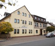
Land-gut-Hotel Sonnenhof
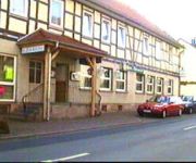
Zur Krone
Videos from this area
These are videos related to the place based on their proximity to this place.
Kirmes Abschluss in Tiefenort 2012
Einmarsch der Kirmesgesellschaft vor der Kirmes Verbrennung. Tiefenort 22.10.2012.
Schwarze Gewitterwolken ueber Tiefenort Thüringen - Black Clouds over Tiefenort
Schwarze Gewitterwolken ueber Tiefenort Thüringen - Black Clouds over Tiefenort YouTube: http://www.youtube.com/user/ceekay22 Website: www.travelgurutv.com Facebook: ...
Wartburg-Rallye 2010 - WP 3: Porsche 911 GT3 Dobberkau SOUND
Wartburg-Rallye 2010 - WP 3: Porsche 911 GT3 Dopperkau SOUND: Olaf Dobberkau mit seiner verlobten Alexandra König, sowie Maik Stölzel mit Helmar Hinneberg kurz nach dem Start der WP 3 -...
Monuments Men at work - Looted Art at Merkers Salt Mine 1945
On April 10 1945 American soldiers of the 3rd army under General George S. Patton found looted art and the Reichsbank gold at the Merkers salt mine in Thuringia. This newsreel shows the soldiers...
8/4/13 - Salt Crystal Grotto
We went over 2400 feet underneath the earth at Merkers Salt Mine to see some beautiful salt crystal caves.
PamperPole Helmkamera
Unser 9 Meter hoher Pamper Pole ist nicht in der Erde verankert sondern steht auf Aluminium-Teleskopbeinen, was das Ganze durch eine gewisse "Eigendynamik" noch spannender macht.
Werra Kanutour Kanu-Verleih Berka/Werra
Freizeit- und Kanuspass in der Werra , Freizeitcamp & Kanuverleih Berka-Werra. (www.freizeitcamp-werra.eu) Infos zu Werratours: Weitere Infos: www.freizeitcamp-werra.eu - Wir bieten Ihnen...
Angeln in der Werra bei Berka - Freizeitcamp Berka / Werra - Thüringen - Germany
Angeln Sie bei uns Hechte, Aale, Welse, Zander, Weißfische und Forellen - Weitere Infos: www.freizeitcamp-werra.eu - Wir bieten Ihnen im wunderschönen Werratal ein umfangreiches Freizeit-,...
Freizeitcamp & Kanuverleih - Berka / Werra - Thüringen - Germany - ImageClipNew - Werratours
Weitere Infos: www.freizeitcamp-werra.eu - Wir bieten Ihnen im wunderschönen Werratal ein umfangreiches Freizeit-, Sport-, und Erholungsangebot. Kanufahrten, Radwandern, Wandern, Angeln,...
Videos provided by Youtube are under the copyright of their owners.
Attractions and noteworthy things
Distances are based on the centre of the city/town and sightseeing location. This list contains brief abstracts about monuments, holiday activities, national parcs, museums, organisations and more from the area as well as interesting facts about the region itself. Where available, you'll find the corresponding homepage. Otherwise the related wikipedia article.
Krayenburg
The Krayenburg was a castle situated on the Krayenberg, having the townships of Tiefenort and Merkers-Kieselbach at its foot, and overlooking an extensive section of the Werratal. The history of the Krayenburg castle began on 31 August 786 when Charlemagne gave the village of Dorndorf, including all of its belongings, to Hersfeld Abbey. The abbey built the Krayenburg to protect its newly gained property.
Krayenberg
The Krayenberg is a 431-metre hill near Tiefenort, Germany. Since 500 BCE it was a rampart and served as a refuge for the central part of the Werratal. It became important for German history due to the Krayenburg, which was built on its top after 786, and destroyed starting with the Thirty Years' War. Today, the well-maintained ruins, a restaurant and a hotel define a tourist location in the Werratal.


