Safety Score: 3,0 of 5.0 based on data from 9 authorites. Meaning we advice caution when travelling to Germany.
Travel warnings are updated daily. Source: Travel Warning Germany. Last Update: 2024-05-20 08:01:38
Discover Schnepfenthal
The district Schnepfenthal of Ibenhain in Free State of Thuringia is a district in Germany about 166 mi south-west of Berlin, the country's capital city.
Looking for a place to stay? we compiled a list of available hotels close to the map centre further down the page.
When in this area, you might want to pay a visit to some of the following locations: Sonneborn, Friedrichswerth, Haina, Bruheim and Herrenhof. To further explore this place, just scroll down and browse the available info.
Local weather forecast
Todays Local Weather Conditions & Forecast: 20°C / 68 °F
| Morning Temperature | 10°C / 51 °F |
| Evening Temperature | 19°C / 67 °F |
| Night Temperature | 12°C / 54 °F |
| Chance of rainfall | 1% |
| Air Humidity | 61% |
| Air Pressure | 1010 hPa |
| Wind Speed | Light breeze with 4 km/h (3 mph) from North |
| Cloud Conditions | Scattered clouds, covering 41% of sky |
| General Conditions | Light rain |
Tuesday, 21st of May 2024
20°C (69 °F)
14°C (57 °F)
Moderate rain, moderate breeze, overcast clouds.
Wednesday, 22nd of May 2024
12°C (54 °F)
12°C (54 °F)
Heavy intensity rain, moderate breeze, overcast clouds.
Thursday, 23rd of May 2024
18°C (64 °F)
12°C (53 °F)
Light rain, gentle breeze, broken clouds.
Hotels and Places to Stay
Ratsherberge Waltershausen
H+ Hotel & SPA Friedrichroda
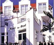
Akzent Hotel Zur Post
Frauenberger
AHORN Berghotel
Am Kloßtheater
Am Burgholz
Waldhotel Friedrichroda
Tannhäuser Hotel Rennsteigblick
Rodebachmühle
Videos from this area
These are videos related to the place based on their proximity to this place.
Quadfreunde Inselsberg e.V. 29.03.14 TMR on Tour
TMR-Radio.de on Tour bei den Quadfreunden Inselsberg e.V. am 29.03.14 in Hörselgau www.quadfreunde-inselsberg.de www.tmr-radio.de.
Ferrari F2004 von DeAgostini
Dies ist mein ferngesteuerter Ferrari F2004 mit einem GX-15 Motor. Ist aber leider ohne Sound Sorry.
#HobbitChallenge - DoS: Hide and Seek with Smaug GERMAN/deutsch w/ eng subs
HobbitChallenge ENGLISH DESCRIPTION: This is our contribution from Germany to the #HobbitChallenge ! If you like our clip, please vote for our video on https://fanchallenge.thehobbit.com/...
Dirk Adams auf Energietour: maxx | Solar & Energie in Waltershausen
Teil 3: 07.08.2014 bei maxx | Solar & Energie in Waltershausen Dirk Adams besucht im Rahmen seiner Energietour 2014 verschiedene Unternehmen in Thüringen.
Schienenbusse der OBS am Multikar-Werk in Waltershausen
175 Jahre Kurort Friedrichroda 772er der Oberweißbacher Berg- und Schwarzatalbahn im Planeinsatz zwischen Fröttstedt - Friedrichroda; historischer Zug auf der Thüringerwaldbahn 772 140...
Waltershausen Thüringen
Geschichte auf Reklamemarken & Siegelmarken aus veikkos-archiv Schon vor 100 Jahren wurde für Konsumprodukte geworben. Damals nannte man die Werbung jedoch Reklame und jede Firma ...
Mitteldeutsche Meisterschaften im Ringen
270 Nachwuchsringerinnen und Nachwuchsringer der C und D Jugend und die weiblichen Schülerinnen aus den Bundesländern, Thüringen, Sachsen, Sachsen Anhalt, Baden Würtemberg, Schleswig ...
Historischer Zug der Thüringerwaldbahn bei Wahlwinkel
175 Jahre Kurort Friedrichroda 772er der Oberweißbacher Berg- und Schwarzatalbahn im Planeinsatz zwischen Fröttstedt - Friedrichroda; historischer Zug auf der Thüringerwaldbahn ThWB-Wagen...
Oscar am Freitag-TV: 9. Ehrenamtsgala in Friedrichroda
Im Ahorn Berghotel trafen sich am 21. November 2014 über 200 Ehrenamtliche, politische Vertreter und Gäste zur Ehrenamtsgala. In diesem Rahmen wurden Friedrichrodaer Ehrenamtliche und ...
Friedrichroda / Thüringen, Berghotel & Stadt HD 4k
ein kurzer Flug Richtung Berghotel & Stadt Friedrichroda Sie wünschen Sich auch Aufnahmen aus der Luft? Sprechen Sie uns an: www.my-skyfly.de.de.
Videos provided by Youtube are under the copyright of their owners.
Attractions and noteworthy things
Distances are based on the centre of the city/town and sightseeing location. This list contains brief abstracts about monuments, holiday activities, national parcs, museums, organisations and more from the area as well as interesting facts about the region itself. Where available, you'll find the corresponding homepage. Otherwise the related wikipedia article.
Ohrdruf concentration camp
Ohrdruf concentration camp was a Nazi forced labor and concentration camp located near Weimar, Germany. It was part of the Buchenwald concentration camp network and the first Nazi concentration camp liberated by U.S. troops.
Sender Inselsberg
The Sender Inselsberg (transmitter Inselsberg) is a FM and television-transmission facility on the Big Inselsberg in Thuringia, Germany. It has two aerial towers, which were built in 1939 and 1974. The transmission tower built in 1939 is a 43.31 metre high free-standing cylindrical tower built of steel concrete, which carried until the beginning of the nineties similar to Gerbrandy Tower a guyed steel tube mast on its top. This mast carried the FM- and TV-broadcasting aerials.
Schnepfenthal Salzmann School
The Schnepfenthal Institution (Salzmannschule Schnepfenthal) is a school in Schnepfenthal, a section of Waltershausen, Germany, founded in 1784 by Christian Gotthilf Salzmann, originally for the purpose of raising the children of his large family and testing new educational theories. The curriculum borrowed ideas from John Locke, Jean-Jacques Rousseau, and especially Johann Bernhard Basedow, the founder of the first Philanthropinum, a progressive experimental school in Dessau.
Michaeliskirche (Ohrdruf)
The Michaeliskirche (St. Michael's Church) in the Thuringian town of Ohrdruf was the site of Johann Sebastian Bach's first employment. J. S. Bach was orphaned at the age of 10 and went to live with his eldest brother, Johann Christoph Bach, who was the organist at the Michaeliskirche. It contained a three-manual German baroque organ in a historic case of Austrian origin. It was here that Bach learned about organ building.
Reinhardsbrunn
Reinhardsbrunn in Friedrichroda near Gotha, in Thuringia in Germany, is the site of a formerly prominent Benedictine abbey extant between 1085 and 1525, and, from 1827, of a royal castle and park of the Saxe-Coburg-Gotha family.
Fröttstädt station
Fröttstädt is a railway station situated in Fröttstädt in the German state of Thuringia. It is situated on the Bebra to Erfurt main line, with another line branching off to Friedrichroda. A unique feature of the station is its warm water supply - the water is provided by a nearby residential building, using surplus boiler capacity.
Kleinschmalkalden
Kleinschmalkalden is a small village in the Thuringian Forest of Germany, situated high in the valley of the Schmalkalden river. The stream which passes through the heart of the village was, for several hundred years, until the end of the Second World War, also a political boundary creating two distinct villages separated by only a few metres of water. Population, as of 2006, is about 1500 persons. Its recorded history can be traced back to at least 1378, the year regarded as its establishment.
Apfelstädtaue
Apfelstädtaue is a Verwaltungsgemeinschaft ("collective municipality") in the district of Gotha, in Thuringia, Germany. The seat of the Verwaltungsgemeinschaft is in Georgenthal. The Verwaltungsgemeinschaft Apfelstädtaue consists of the following municipalities: Emleben Georgenthal Herrenhof Hohenkirchen
Mittleres Nessetal
Mittleres Nessetal is a Verwaltungsgemeinschaft ("collective municipality") in the district of Gotha, in Thuringia, Germany. The seat of the Verwaltungsgemeinschaft is in Goldbach. The Verwaltungsgemeinschaft Mittleres Nessetal consists of the following municipalities: Ballstädt Brüheim Bufleben Friedrichswerth Goldbach Haina Hochheim Remstädt Sonneborn Wangenheim Warza
Reinhardsbrunn (Verwaltungsgemeinschaft)
Reinhardsbrunn was a Verwaltungsgemeinschaft ("collective municipality") in the district of Gotha, in Thuringia, Germany. The seat of the Verwaltungsgemeinschaft was in Friedrichroda. It consisted of the following municipalities: Ernstroda Finsterbergen Friedrichroda The Verwaltungsgemeinschaft was disbanded on 1 December 2007. The municipalities Ernstroda and Finsterbergen were incorporated by Friedrichroda.
Oberhof bobsleigh, luge, and skeleton track
The Oberhof bobsleigh, luge, and skeleton track is a venue used for bobsled, luge and skeleton located in Oberhof, Germany.
Schwarzhausen
Schwarzhausen is a village incorporated into the municipality Emsetal in the district of Gotha, in Thuringia, Germany since 1996.
Spitter Waterfall
The Spitter Waterfall is the highest natural waterfall in the German state of Thuringia, with a drop of 19 metres. The Spitter Waterfall is located below the hillwalking trail of the Rennsteig and tumbles down four cascade steps, 19 metres in overall height, through a notch in the floor of an ice-age hollow on the northern side of the Thuringian Forest. The waterfall is part of the Spitter stream.
Ebertswiese
The Ebertswiese, is a boggy area of grassland in the Thuringian Forest in central Germany. It has been a nature conservation area since 1936 and is a recreation area in the municipality of Floh-Seligenthal on the Rennsteig trail. The River Spitter has its source within the reserve. In addition to the Ebertswiese mountain hotel, the Bergseebaude guest house and various walking huts the main destination is the Bergsee lake, which was created in 1900 from a disused quarry.
Spitter (river)
The Spitter is a stream near Tambach-Dietharz in the Thuringian Forest in Germany. It flows through the Spitter Valley and has the highest waterfall in Thuringia..
Schmalwasser
The Schmalwasser is a large heath stream on the southern edge of the Lüneburg Heath. The brook rises near Blickwedel, winds southwards, is joined from the left by the Räderbach and discharges into the Lutter in the village of Bargfeld (in the municipality of Eldingen). The story Die Wasserstraße by Arno Schmidt (1964) is about a walk up the Schmalwasser.
Falkenstein (Thuringia)
The Falkenstein lies southeast of the small town of Tambach-Dietharz in Schmalwasser bottom (Schmalwassergrund) and is the most important rock formation in the Thuringian Forest in central Germany. It consists of porphyry. On the valley side the crags are 96 metres high. Because of its situation on the side of a hill (the uphill side has a height of about 25 metres) it appears most striking when one stands immediately in front of it.
Kilianstein
The Kilianstein is a free-standing pinnacle of rock in the eastern part of the Sembach valley in central Germany. It stands about 800 m east of the (upper) village of Winterstein on the northern slopes of the Thuringian Forest. The pinnacle is about 15 m high and some 500 m above sea level. It consists of relatively crumbly quartz porphyry and is visited, albeit rarely, by sports climbers.
Gotha station
Gotha station is the main station of Gotha in the German state of Thuringia. It is served by InterCity trains and every two hours by Intercity-Express trains on the Thuringian Railway. Services on the Ohra Valley Railway to the south and the Gotha–Leinefelde line to the north also serve the station.
Trams in Gotha
The Gotha tramway network forms part of the public transport system in Gotha, in the federal state of Thuringia, Germany. Opened in 1894, the network is currently operated by Thüringerwaldbahn und Straßenbahn Gotha GmbH (TWSB).
Emse (river)
Emse is a river of Thuringia, Germany.
Leina (river)
Leina is a river of Thuringia, Germany.
Erbstrom
Erbstrom is a river of Thuringia, Germany.
Nesse (Hörsel)
Nesse (Hörsel) is a river of Thuringia, Germany.


