Safety Score: 3,0 of 5.0 based on data from 9 authorites. Meaning we advice caution when travelling to Germany.
Travel warnings are updated daily. Source: Travel Warning Germany. Last Update: 2024-05-05 08:24:42
Discover Roth
Roth in Regierungsbezirk Unterfranken (Bavaria) is a city in Germany about 199 mi (or 321 km) south-west of Berlin, the country's capital city.
Local time in Roth is now 09:55 PM (Sunday). The local timezone is named Europe / Berlin with an UTC offset of 2 hours. We know of 12 airports in the vicinity of Roth, of which 5 are larger airports. The closest airport in Germany is Erfurt Airport in a distance of 50 mi (or 80 km), North-East. Besides the airports, there are other travel options available (check left side).
There are several Unesco world heritage sites nearby. The closest heritage site in Germany is Wartburg Castle in a distance of 34 mi (or 55 km), North. Looking for a place to stay? we compiled a list of available hotels close to the map centre further down the page.
When in this area, you might want to pay a visit to some of the following locations: Hausen, Melpers, Birx, Erbenhausen and Oberweid. To further explore this place, just scroll down and browse the available info.
Local weather forecast
Todays Local Weather Conditions & Forecast: 14°C / 57 °F
| Morning Temperature | 9°C / 48 °F |
| Evening Temperature | 14°C / 57 °F |
| Night Temperature | 9°C / 48 °F |
| Chance of rainfall | 8% |
| Air Humidity | 73% |
| Air Pressure | 1010 hPa |
| Wind Speed | Moderate breeze with 9 km/h (6 mph) from East |
| Cloud Conditions | Broken clouds, covering 61% of sky |
| General Conditions | Moderate rain |
Monday, 6th of May 2024
13°C (56 °F)
10°C (50 °F)
Moderate rain, light breeze, overcast clouds.
Tuesday, 7th of May 2024
11°C (51 °F)
8°C (46 °F)
Moderate rain, light breeze, overcast clouds.
Wednesday, 8th of May 2024
9°C (48 °F)
6°C (43 °F)
Light rain, light breeze, overcast clouds.
Hotels and Places to Stay
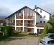
Hubertus Landhotel
Dreiländereck Pension
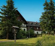
Eisenacher Haus Berghotel
Videos from this area
These are videos related to the place based on their proximity to this place.
Bergwiesen 1 Birx/Rhön HD
Die Vegetation der Rhön ist sehr vielseitig. Nur wenige Gegenden Deutschlands sind auf vergleichbarem Raum so reich an Pflanzenarten und Pflanzengesellschaften. Hierzu tragen vor allem die...
Ballonfahrt von Birx/Rhön zur Milseburg Teil 3 HD
Inhalt: Von der Milseburg bis Kleinsassen. Eine perfekte Landung mit anschließender Taufe. 01.08.2011 Die abwechslungsreiche Mittelgebirgslandschaft der bayerischen, hessischen und thüringisc...
Motorradtour Hohe Rhön
Eine Motorradtour von Birx zum Schwarzen Moor. Streckenlänge: ca. 5 km Pension "Dreiländereck" Am Sportplatz 7 98634 Birx/Rhön Tel.: 036946/31455 www.Pension-Dreilaendereck.de.
Blick von der Hohen Rhön HD
02.06.2011 28.06.2011 Vom Schnitzersberg, mit 815,5 m der höchste Berg in der Thüringer Rhön, zum Thüringer Wald und zur Wasserkuppe blicken. Einfach die Ruhe in der Natur genießen. Am...
Böllerkanone 60 mm HD
21.12.2013 Geböllert wird mit einer 60 mm Böllerkanone. Der Feuerstrahl ist in der Zeitlupe und in den Standbildern sehr schön zu sehen. http://www.Pension-Dreilaendereck.de/ http://www.sg-gers...
Böllerkanone 34 mm HD
24.08.2013 Geböllert wird mit einer 34 mm Böllerkanone. Der Feuerstrahl ist in der Zeitlupe und in den Standbildern sehr schön zu sehen. http://www.Pension-Dreilaendereck.de/ http://www.sg-gers...
Young football Talent from Germany/Frankenheim [Skills]
Es ist vielleicht nicht ganz perfekt, aber auch nicht schlecht.
Über den Wolken - Auf der Hohen Rhön HD
12.12.2013 Blick vom Grabenberg (796 m) nach Frankkenheim/Rhön und zum Thüringer Wald. http://www.pension-dreilaendereck.de/
Videos provided by Youtube are under the copyright of their owners.
Attractions and noteworthy things
Distances are based on the centre of the city/town and sightseeing location. This list contains brief abstracts about monuments, holiday activities, national parcs, museums, organisations and more from the area as well as interesting facts about the region itself. Where available, you'll find the corresponding homepage. Otherwise the related wikipedia article.
Gangolfsberg
Gangolfsberg is a mountain of Bavaria, Germany.
Rother Kuppe
Rother Kuppe is a mountain in Bavaria, Germany.


!['Young football Talent from Germany/Frankenheim [Skills]' preview picture of video 'Young football Talent from Germany/Frankenheim [Skills]'](https://img.youtube.com/vi/oFEKHWMr5kk/mqdefault.jpg)

