Safety Score: 3,0 of 5.0 based on data from 9 authorites. Meaning we advice caution when travelling to Germany.
Travel warnings are updated daily. Source: Travel Warning Germany. Last Update: 2024-04-28 08:22:10
Touring Schlattstall
Schlattstall in Regierungsbezirk Stuttgart (Baden-Württemberg) is a town located in Germany about 325 mi (or 523 km) south-west of Berlin, the country's capital place.
Time in Schlattstall is now 09:13 PM (Sunday). The local timezone is named Europe / Berlin with an UTC offset of 2 hours. We know of 11 airports nearby Schlattstall, of which 5 are larger airports. The closest airport in Germany is Stuttgart Airport in a distance of 17 mi (or 27 km), North-West. Besides the airports, there are other travel options available (check left side).
There are several Unesco world heritage sites nearby. The closest heritage site in Germany is Maulbronn Monastery Complex in a distance of 45 mi (or 73 km), North-West. We collected 4 points of interest near this location. Need some hints on where to stay? We compiled a list of available hotels close to the map centre further down the page.
Being here already, you might want to pay a visit to some of the following locations: Grabenstetten, Erkenbrechtsweiler, Bissingen an der Teck, Neidlingen and Hulben. To further explore this place, just scroll down and browse the available info.
Local weather forecast
Todays Local Weather Conditions & Forecast: 18°C / 64 °F
| Morning Temperature | 9°C / 48 °F |
| Evening Temperature | 13°C / 55 °F |
| Night Temperature | 10°C / 49 °F |
| Chance of rainfall | 0% |
| Air Humidity | 58% |
| Air Pressure | 1014 hPa |
| Wind Speed | Gentle Breeze with 7 km/h (5 mph) from South |
| Cloud Conditions | Overcast clouds, covering 85% of sky |
| General Conditions | Light rain |
Monday, 29th of April 2024
17°C (62 °F)
11°C (52 °F)
Overcast clouds, light breeze.
Tuesday, 30th of April 2024
21°C (70 °F)
14°C (58 °F)
Sky is clear, light breeze, clear sky.
Wednesday, 1st of May 2024
21°C (69 °F)
14°C (57 °F)
Light rain, gentle breeze, overcast clouds.
Hotels and Places to Stay
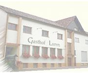
Lamm Gasthof
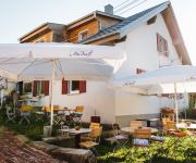
Alte Kass Schwäbisches Caféhaus
Videos from this area
These are videos related to the place based on their proximity to this place.
Motovlog 57 Rundfahrt von Stuttgart um die Burg Teck Teil2
So genug Gelabert, jetzt geht es nach einer kurzen Pause auf die geplante kurvenreiche Runde. Die ungefähre Route: Dettingen unter Teck, Nabern, Ochsenwang, Schopfloch, Gutenberg, ...
Vulkanwelten 12: Der Schwäbische Vulkan / The Swabian Volcano
( English Subtitle) An den Beispielen von Limburg, Randecker Maar und Schopflocher Moor werden Entstehung und Relikte des Schwäbischen Vulkans aufgezeigt, der im Miozän aktiv war und bis...
Biosphärengebiet Schwäbische Alb - Ausblicke vom Rauber
Eine Oase der Ruhe am Albtrauf bei Kirchheim/Teck.
Burg Teck 775m - Teckberg bei Owen (Okt. 2007)
zeigt Burg Teck am Albtrauf bei Owen und Bissingen/Teck. Ausblick vom Burghof, Burgturm und Albtrauf bei einer Wanderung im Herbst 2007 Location: Burg Teck und Gelber Fels bei Owen und...
Schwäbische Alp bei Ochsenwang
An einem schönen, sonnigen August-Sonntag haben Heiko und ich beschlossen eine kleine Wanderung auf die Alp hoch zu machen...
Burg Teck | Castle Teck | Winter Impressions with Phantom 2 | GoPro Hero 3+ Black
Die Burg Teck ist eine 773 Meter hoch gelegene Gipfelburg oberhalb der Stadt Owen Teck. Gefilmt wurde mit dem Quadrocopter Phantom 2. Teck was a ducal castle in the kingdom of Württemberg,...
Am Gelben Fels - Klettern bei der Burg Teck
Die ersten Anzeichen des Frühlings locken zu einem Kletterausflug am Gelben Fels bei der Burg Teck (oberhalb von Owen, Schwäbische Alb, Baden-Württemberg). Die Route "Kamin" am oberen Fels.
Videos provided by Youtube are under the copyright of their owners.
Attractions and noteworthy things
Distances are based on the centre of the city/town and sightseeing location. This list contains brief abstracts about monuments, holiday activities, national parcs, museums, organisations and more from the area as well as interesting facts about the region itself. Where available, you'll find the corresponding homepage. Otherwise the related wikipedia article.
Lauter (Neckar)
The Lauter is a right tributary of the Neckar and arises on the Albtrauf escarpment of the Swabian Alb.
White Lauter
The White Lauter is the right hand source of the river Lauter. It rises southeast of Lenningen below the state road B465. Near Lenningen it joins the Black Lauter, forming the Lauter.
Black Lauter
The Black Lauter is the left hand source of the river of the Lauter. It rises in Schlatstall from the Lauterquelle well and the Golden hole. Within Lenningen it joins the White Lauter, forming the Lauter.


