Safety Score: 3,0 of 5.0 based on data from 9 authorites. Meaning we advice caution when travelling to Germany.
Travel warnings are updated daily. Source: Travel Warning Germany. Last Update: 2024-05-10 08:04:54
Delve into Deggingen
Deggingen in Regierungsbezirk Stuttgart (Baden-Württemberg) with it's 5,623 habitants is a town located in Germany about 316 mi (or 508 km) south-west of Berlin, the country's capital town.
Time in Deggingen is now 03:24 AM (Saturday). The local timezone is named Europe / Berlin with an UTC offset of 2 hours. We know of 12 airports closer to Deggingen, of which 5 are larger airports. The closest airport in Germany is Stuttgart Airport in a distance of 24 mi (or 38 km), West. Besides the airports, there are other travel options available (check left side).
There are several Unesco world heritage sites nearby. The closest heritage site in Germany is Maulbronn Monastery Complex in a distance of 50 mi (or 80 km), North-West. We saw 1 points of interest near this location. In need of a room? We compiled a list of available hotels close to the map centre further down the page.
Since you are here already, you might want to pay a visit to some of the following locations: Bad Ditzenbach, Schlat, Eschenbach, Gruibingen and Hohenstadt. To further explore this place, just scroll down and browse the available info.
Local weather forecast
Todays Local Weather Conditions & Forecast: 17°C / 62 °F
| Morning Temperature | 8°C / 47 °F |
| Evening Temperature | 16°C / 60 °F |
| Night Temperature | 10°C / 50 °F |
| Chance of rainfall | 0% |
| Air Humidity | 62% |
| Air Pressure | 1020 hPa |
| Wind Speed | Gentle Breeze with 6 km/h (4 mph) from West |
| Cloud Conditions | Overcast clouds, covering 88% of sky |
| General Conditions | Overcast clouds |
Sunday, 12th of May 2024
17°C (63 °F)
11°C (52 °F)
Overcast clouds, gentle breeze.
Monday, 13th of May 2024
17°C (62 °F)
11°C (52 °F)
Light rain, light breeze, overcast clouds.
Tuesday, 14th of May 2024
19°C (65 °F)
10°C (50 °F)
Light rain, gentle breeze, overcast clouds.
Hotels and Places to Stay
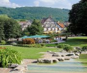
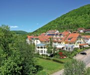
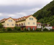
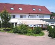
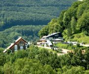
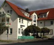
Bad Hotel
Vitalhotel Sanct Bernhard
Hotel Altes Pfarrhaus
Talblick
Rommentaler Burgstüble Landgasthof
AKZENT Hotel Restaurant Höhenblick
Bodoni
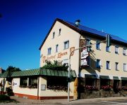
Löwen
Alb Inn
Hotel Krone
Videos from this area
These are videos related to the place based on their proximity to this place.
Trail Paradies Schwäbische Alb: Leimberg II
Zweite Trailvariante von der Kreuzkapelle aufm Leimberg nach Mühlhausen GoPro Hero 3+ Silver Edition.
Trail Paradies Schwäbische Alb: Alte Steige Trail (Aimer)
Trail vom Aimer in Gosbach GoPro Hero3+ Silver Edition Bike: Cheetah Enduro Mountain Spirit.
Wildflug.eu auf dem Fuxeg in Schlat bei Göppingen
Wildflug.eu auf dem Fuxeg in Schlat bei Göppingen inkl. Senkrechtstart eines WOW von Hype.
WILDFLUG.eu in Schlat bei Göppingen geflogen mit dem Trainer und Gemini
WILDFLUG.eu in Schlat bei Göppingen geflogen mit dem Graupner Trainer S+ und dem Multiplex Gemini S++.
Obstwiese Schlat FPV
Obstwiese Schlat FPV Graupner Junior S Flycam 1080p mit 5,8 Übertragung auf AcMe Videobrille.
Flug über dem Voralbgebiet Salach, Süßen, Eislingen
Flug über dem Voralbgebiet Salach, Süßen, Eislingen.
Wildflug.eu mit dem WOW von Hype vor der Schwäbischen Alb bei Eislingen
Wildflug.eu mit dem WOW von Hype vor der Schwäbischen Alb bei Eislingen.
Videos provided by Youtube are under the copyright of their owners.
Attractions and noteworthy things
Distances are based on the centre of the city/town and sightseeing location. This list contains brief abstracts about monuments, holiday activities, national parcs, museums, organisations and more from the area as well as interesting facts about the region itself. Where available, you'll find the corresponding homepage. Otherwise the related wikipedia article.
Aufi Tower
Aufi or Funkturm Aufhausen is the name of the police radio tower in Aufhausen, Germany. The Aufi is a 132 metre high radio tower in steel and concrete, with a diameter of 6 metres. It is one of the thinnest steel and concrete towers in the world. In the 1960s and 70s measurements of static were made on this tower. It is not accessible to the public. {{#invoke:Coordinates|coord}}{{#coordinates:48|35|17|N|9|44|51|E|type:landmark |primary |name= }}
Wasserberg (Swabian Alb)
Wasserberg (Schwäbische Alb) is a mountain of Baden-Württemberg, Germany.


