Safety Score: 3,0 of 5.0 based on data from 9 authorites. Meaning we advice caution when travelling to France.
Travel warnings are updated daily. Source: Travel Warning France. Last Update: 2024-04-27 08:23:39
Discover Saulnes
Saulnes in Meurthe et Moselle (Grand-Est) with it's 2,529 citizens is a place in France about 164 mi (or 264 km) east of Paris, the country's capital city.
Current time in Saulnes is now 11:23 PM (Saturday). The local timezone is named Europe / Paris with an UTC offset of 2 hours. We know of 11 airports near Saulnes, of which 5 are larger airports. The closest is airport we know is Luxembourg-Findel International Airport in Luxembourg in a distance of 18 mi (or 30 km). The closest airport in France is Verdun-Le Rozelier Airport in a distance of 33 mi (or 30 km), East. Besides the airports, there are other travel options available (check left side).
There are several Unesco world heritage sites nearby. The closest heritage site is City of Luxembourg: its Old Quarters and Fortifications in Luxembourg at a distance of 15 mi (or 24 km). The closest in France is Place Stanislas, Place de la Carrière and Place d'Alliance in Nancy in a distance of 60 mi (or 24 km), East. Also, if you like playing golf, there is an option about 13 mi (or 21 km). away. If you need a hotel, we compiled a list of available hotels close to the map centre further down the page.
While being here, you might want to pay a visit to some of the following locations: Petange, Differdange, Bascharage, Sanem and Garnich. To further explore this place, just scroll down and browse the available info.
Local weather forecast
Todays Local Weather Conditions & Forecast: 13°C / 55 °F
| Morning Temperature | 5°C / 41 °F |
| Evening Temperature | 13°C / 55 °F |
| Night Temperature | 10°C / 50 °F |
| Chance of rainfall | 2% |
| Air Humidity | 70% |
| Air Pressure | 1006 hPa |
| Wind Speed | Moderate breeze with 12 km/h (8 mph) from North |
| Cloud Conditions | Overcast clouds, covering 94% of sky |
| General Conditions | Light rain |
Sunday, 28th of April 2024
11°C (51 °F)
8°C (46 °F)
Light rain, fresh breeze, overcast clouds.
Monday, 29th of April 2024
9°C (48 °F)
9°C (48 °F)
Light rain, gentle breeze, overcast clouds.
Tuesday, 30th of April 2024
17°C (63 °F)
11°C (52 °F)
Moderate rain, gentle breeze, overcast clouds.
Hotels and Places to Stay
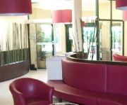
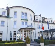
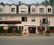
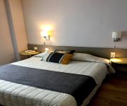
Threeland
ibis Longwy Mexy
Gulliver
Carpini
Hôtel du Nord
Premiere Classe
Videos from this area
These are videos related to the place based on their proximity to this place.
Carnaval vénitien de Longwy (France) 2014
A l'occasion du carnaval vénitien de Longwy (France) une séance photo a été organisée à la chapelle et dans le parc de Mont St Martin.
Aikido Longlaville - Stage Enfant Paul MATTHIS - 11/01/2014
video reportage RIV54 pour le stage d'Aikido Enfant et Adulte animé par Paul MATTHIS à Longlaville le 11 Janvier 2014.
Faire un sac avec une jupe en jeans Partie 2
2 ème partie du tuto "comment faire un sac avec une vieille jupe3 N'oubliez pas de regarder mes autres vidéos! BYE BYE.
d'Gemeng Péiteng informéiert - September 2009 (2. Deel)
d'Gemeng Péiteng informéiert (La Commune de Pétange informe) Editioun September 2009 (2. Deel) Thema: Ofschlossfest vun der Vakanzaktioun zu Rodange um Stade Jos. Philippart (7. August...
d'Gemeng Péiteng informéiert - September 2009 (3. Deel)
d'Gemeng Péiteng informéiert (La Commune de Pétange informe) Editioun September 2009 (2. Deel) Thema: Ofschlossfest vun der Vakanzaktioun zu Rodange um Stade Jos. Philippart (7. August...
Met CFL 907 en Prince Henri-rijtuigen naar Fond-de-Gras
In 2006 bestond de vereniging Spoorgroep Luxemburg 20 jaar. Om dit heugelijke feit te vieren werd er o.a. een speciale trein ingelegd tussen Pétange en Fond-de-Gras. De trein was samengesteld...
Train 1900 Luxembourg, 27th July 2003
A preserved line in Luxembourg. It runs from Fond-de-Gras to Petange with a branch to Rodange. First we see Locomotive Cockerill 503 leaving Fond-de-Gras for Rodange as we depart behind No...
Videos provided by Youtube are under the copyright of their owners.
Attractions and noteworthy things
Distances are based on the centre of the city/town and sightseeing location. This list contains brief abstracts about monuments, holiday activities, national parcs, museums, organisations and more from the area as well as interesting facts about the region itself. Where available, you'll find the corresponding homepage. Otherwise the related wikipedia article.
Lasauvage
Lasauvage is a small town in the commune of Differdange, in south-western Luxembourg.
Lamadelaine
Lamadelaine is a town in the commune of Pétange, in south-western Luxembourg. As of 2005, the town has a population of 2,335.
Rodange
Rodange is a town in the commune of Pétange, in south-western Luxembourg. It lies next to the border with Belgium, across which is the town of Athus. The town is to the south-west of the town of Pétange and to the west of the smaller town of Lamadelaine. As of 2010, Rodange has a population of 5,505, making it the 18th-most populous town in Luxembourg. The town has a railway station served by CFL trains.
Stade Municipal, Pétange
Stade Municipal is a football stadium in Pétange, in south-western Luxembourg. It is currently the home stadium of CS Pétange. The stadium has a capacity of 2,400.
Athus
Athus is a town in the Aubange municipality of the province of Luxembourg, in south-eastern Belgium. It is located in the far south of the country, just near the borders with France and Luxembourg. It is a French speaking city, though the traditional language is Luxembourgish but that is less and less used nowadays. The city was famous during the 19th and 20th century because of its steelworks factory which was bankrupt in 1977.
Rodange railway station
Rodange railway station is a railway station serving Rodange, in the commune of Pétange, in south-western Luxembourg. It is operated by Chemins de Fer Luxembourgeois, the state-owned railway company, and served by both CFL trains and those of the Belgian state operator, SNCB. The station is situated on Line 70, which connects the south-west of the country to Luxembourg City; at Rodange, the line branches, and connects to both the Belgian town of Athus and the French town of Longuyon.
Titelberg
Titelberg is the site of a large Celtic settlement or oppidum in the extreme south west of Luxembourg. In the 1st century BC, this thriving community was probably the capital of the Treveri people. The site thus provides telling evidence of urban civilization in what is now Luxembourg long before the Roman conquest.
Industry and Railway Park Fond-de-Gras
The Industry and Railway Park Fond-de-Gras is a museum in south west Luxembourg near to the towns of Pétange and Rodange. It is linked to Pétange by a 6 km heritage railway operated by AMTF.


