Safety Score: 3,0 of 5.0 based on data from 9 authorites. Meaning we advice caution when travelling to Austria.
Travel warnings are updated daily. Source: Travel Warning Austria. Last Update: 2024-05-09 08:23:21
Delve into Hernals
The district Hernals of Vienna in Wien Stadt (Vienna) is a district located in Austria and is a district of the nations capital.
In need of a room? We compiled a list of available hotels close to the map centre further down the page.
Since you are here already, you might want to pay a visit to some of the following locations: Klosterneuburg, Purkersdorf, Mauerbach, Langenzersdorf and Gablitz. To further explore this place, just scroll down and browse the available info.
Local weather forecast
Todays Local Weather Conditions & Forecast: 17°C / 63 °F
| Morning Temperature | 10°C / 49 °F |
| Evening Temperature | 18°C / 64 °F |
| Night Temperature | 12°C / 54 °F |
| Chance of rainfall | 0% |
| Air Humidity | 44% |
| Air Pressure | 1024 hPa |
| Wind Speed | Gentle Breeze with 8 km/h (5 mph) from South |
| Cloud Conditions | Few clouds, covering 10% of sky |
| General Conditions | Sky is clear |
Friday, 10th of May 2024
18°C (65 °F)
12°C (54 °F)
Overcast clouds, light breeze.
Saturday, 11th of May 2024
19°C (67 °F)
15°C (59 °F)
Scattered clouds, light breeze.
Sunday, 12th of May 2024
18°C (65 °F)
14°C (57 °F)
Overcast clouds, light breeze.
Hotels and Places to Stay
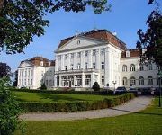
Austria Trend Hotel Schloss Wilhelminenberg Wien
Cortina
Austria Trend Parkhotel Schönbrunn Wien
Novum Hotel Kavalier Wien
Fleger Appartements
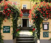
Jäger
Gallitzinberg
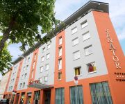
Senator
Schild
Landhaus Fuhrgassl Huber
Videos from this area
These are videos related to the place based on their proximity to this place.
Europahaus (Vienna - Austria)
One room of Hotel Europahaus (Vienna - Austria). Video shot before check-out (December 2010). + rooms are comfortable - no internet, no Wi-Fi - located almost outside the city. You are far...
Kugla,Kugel,Balls :stainless steel,brass,messing,edelstahl 20-250mm
www.prohrom-enterijer.biz We are a company stainless steel interior,producing a range of stainless steel (INOX) and brass. For more information see the website : www.prohrom-enterijer.biz...
6thMTB2014
Wilhelminenberg, Sophienalpe, Hameau... diverser Abfahreten 0:00 - 0:36 ... PROPAIN Tyee 2 2014 - M - 650B 0:36 - 3:38 ... Abfahrt vom Heuberg zur Marswiese 3:38 - 6:36 ... Abfahrt...
Lauf Wienfluss Hochwasser am 18.05.2014
Es hätte ein langsamer 20km Lauf mit den schweren Nike Vomero +7 (310 Gramm) werden sollen (und mit Radio Wien im Ohr), doch wegen Hochwasser bei KM 5,8 (nicht 6,5 - die Aussage war ...
Leberkäsesemmel POV-Line - Wien Hütteldorf
POV-Line-Time: Samuel macht ein paar Skateboardtricks und Sebi genießt seine Jause, während er durch den Pool in Hütteldorf rollt. Subscribe for more videos: http://www.youtube.com/subscription...
Straßenbahn Trolley Trams Streetcars Vienna Austria 2009
New and old Trolley/Tram activity from the capital of Austria.
H-Dorf Locals - Skatepark Goodlands - Wien Hütteldorf
Samuel, Sebi und Anne tricksen mit ihren Planken im Goodlands Skatepark in Hütteldorf. Am Besten in HD anschauen!
Skatepark Auhof - Living on the Ledge - Skateboarding Vienna
Ein ortsansässiger Skateboarder macht ein paar Tricks auf den Ledges im Skatepark Auhof in Wien.
Lefty 2013: Cannondale's F26 Crb 2 in a snowy autumn test-ride - GoPro HD Hero 3 Black Edition
Ridin' by Johannes Tschohl Rockin' by Soundjunk Mot/Fear&Loathing Riding the brandnew Lefty 2013 equipped Cannondale Flash Carbon out of Vienna, surprisingly I rode this bike into a colourful,...
Videos provided by Youtube are under the copyright of their owners.
Attractions and noteworthy things
Distances are based on the centre of the city/town and sightseeing location. This list contains brief abstracts about monuments, holiday activities, national parcs, museums, organisations and more from the area as well as interesting facts about the region itself. Where available, you'll find the corresponding homepage. Otherwise the related wikipedia article.
Baumgarten, Vienna
Baumgarten was an independent town until the late 19th century and is an area of Vienna's fourteenth district, Penzing, today. It can be subdivided in Oberbaumgarten (in the west, close to Hütteldorf), and Unterbaumgarten. Artist Gustav Klimt was born in Baumgarten.
Hermannskogel
The Hermannskogel is a hill in Vienna. At 542 metres above sea level, it is the highest natural point in the city of Vienna. It lies on the border to Lower Austria. The Habsburgwarte, which stands atop the Hermannskogel marked until 1918 the kilometre zero in cartographic measurements used in Austria-Hungary.
Hütteldorf
Hütteldorf is a part of Vienna's 14th district, Penzing. It is located in the west of Vienna, but roughly in the geographical center of the district, stretching roughly from Deutschordenstraße (which forms the border to Baumgarten) in the east to Wolf in der Au in the west, where Hütteldorf borders Hadersdorf-Weidlingau. Hütteldorf is well known throughout Austria and beyond as the site of the Gerhard-Hanappi-Stadion, the stadium in which Rapid Vienna hosts its home games.
Kirche am Steinhof
The Kirche am Steinhof (also called the Church of St. Leopold) in Vienna is the Roman Catholic oratory of the Steinhof Psychiatric Hospital. The building designed by Otto Wagner is considered one of the most important Art Nouveau churches in the world.
Währing
Währing is the 18th district of Vienna and lies in northwestern Vienna on the edge of the Vienna Woods. It was formed in 1892 from the unification of the older suburbs of Währing, Weinhaus, Gersthof, Pötzleinsdorf, Neustift am Walde and Salmannsdorf. In 1938 Neustift am Walde and Salmannsdorf were annexed to the neighbouring 19th District (Döbling). Because of several wealthy neighbourhoods (e.g.
Hernals
Hernals is the 17th district of Vienna, Austria . Hernals is in northwest Vienna. It was annexed in 1892 out of the townships of Hernals, Dornbach, and Neuwaldegg.
Ottakring
Ottakring is the 16th District in the city of Vienna, Austria (German: 16. Bezirk, Ottakring). It is located west of the central districts, north of Penzing and south of Hernals. Ottakring has some heavily populated urban areas with many residential buildings. It was formed from the independent villages of Ottakring and Neulerchenfeld in 1892.
Steinhof (Vienna)
Steinhof is a hospital in Vienna, Austria. It was originally a psychiatric hospital and center for pulmonology. The hospital lies in the 14th district of Vienna, Penzing, and was built according to the plans of architect Otto Wagner and opened in 1907. The building is made up of 60 pavilions that were designed by Carlo von Boog. The Kirche am Steinhof is located at the center of the compound. An art nouveau theater is found further in.
Gerhard Hanappi Stadium
The Gerhard Hanappi Stadion is a football stadion in Hütteldorf, in the west of Vienna, Austria. It is the home ground of Rapid Vienna. It was officially opened in 1977 as "Weststadion" (Western stadium). In 1980 it was renamed, to honor its architect, Austrian football player Gerhard Hanappi. Among fans the stadium is also known as "Sankt Hanappi" (Saint Hanappi), which relates to the fans' slogan Rapid ist uns're Religion ("Rapid is our religion").
Meridian circle
The meridian circle is an instrument for timing of the passage of stars across the local meridian, an event known as a transit, while at the same time measuring their angular distance from the nadir. These are special purpose telescopes mounted so as to allow pointing only in the meridian, the great circle through the north point of the horizon, the zenith, the south point of the horizon, and the nadir.
Schloß Pötzleinsdorf
Schloß Pötzleinsdorf or Schloss Pötzleinsdorf is a former palace in Pötzleinsdorf, Vienna. The palace was a nobleman's residence in the mid-17th century, but in the next century the building became known as Ricci'scher Freihof, after a merchant called Ricci who used it for cloth manufacture and silk dying. The estate was bought by Countess Philippina von Herberstein toward the end of the 18th century.
Schloss Neuwaldegg
Schloss Neuwaldegg is a Baroque palace with an English garden in the Hernals borough of Vienna, Austria. It is currently privately owned and rented out for a variety of private and public events.
Sisi Chapel
The Sisi Chapel is located in Sievering part of in the Viennese District of Döbling near the Vienna Woods (Wienerwald).
De Lacy
de Lacy (Laci, Lacie, Lascy, Lacey) is the surname of an old Norman noble family originating from Lassy (Calvados). The first records are about Hugh de Lacy (1020–1049). Descendent of Hugh de Lacy left Normandy and travelled to England along with William the Conqueror. Walter and Ilbert de Lacy fought in the battle of Hastings. The family took a major role in the Norman conquest of England and Ireland.
Penzing (Vienna)
Penzing is the 14th District of Vienna and consists of the boroughs of Penzing, Breitensee, Baumgarten, Hütteldorf and Hadersdorf-Weidlingau. In the west, it shares a border with Purkersdorf and Mauerbach. A large portion of the district is made up of greenery, including the Steinhof park, the Dehnepark and a portion of the Wienerwald.
Exelberg Telecommunication Tower
Exelberg Telecommunication Tower is a 109 metre tall tower built of reinforced concrete on Exel mountain at Vienna, Austria. Exelberg Telecommunication Tower is used for directional radio services.
Schloss Wilhelminenberg
Castle Wilhelminenberg, an imperial palace dating from the early 20th century which is now a four-star hotel, restaurant and conference facility, is situated on the Eastern slopes of the Gallitzinberg, in the Wienerwald Western parts of the Austrian capital, Vienna.
Gaugefechtsstand Wien
The Gaugefechtsstand Wien (regional combat command center Vienna) was a World War II subterranean command bunker situated in the densely forested Wienerwald western parts of Ottakring, the 16th district of Vienna. Commonly known as the Schirach-Bunker (named after the Nazi governor for the Reichsgau Wien, Baldur von Schirach), the facilities were constructed between 1942 and 1945 as a massive underground extension to barracks that had been established in 1940.
Gallitzinberg
The Gallitzinberg (449 m) is a forested hill in the West of Austria's capital, Vienna. While it is relatively unconspicous in the broader context of the Northeastern end of the Wienerwald mountain range, it is nevertheless remarkable because of its multifaceted history, and because it functions as an important recreational area in the Western uphill part of the densely populated Ottakring district.
Kuffner observatory
The Kuffner observatory is one of two telescope-equipped public observatories situated in Austria's capital, Vienna. It is situated in the West of the city's Ottakring district, on the slope of the Gallitzinberg at 302 m altitude. Originally a private scientific institution, it was converted into an educational astronomy facility after World War II as buildings and city lights had encroached to a degree that severely hampered scientific nightsky observations.
Hackenberg, Vienna
The Hackenberg is a hill in the suburb of Sievering in the 19th district of Vienna, Döbling. It is 306 metres tall. Hackenberg is covered in sand and gravel. The Arbesbach flows around the hill’s north-eastern flank, while the Krottenbach flows around its south-western flank, although both rivers have been enclosed in canals in this area. The hill extends as far as the Krim (an area in Unterdöbling) in the west.
Arbesbach (river)
The Arbesbach, also known as the Erbsenbach and Sieveringerbach, is a stream in the 19th district of Vienna, Döbling. The stream, partially enclosed in a canal, is the most important tributary of the Krottenbach. Almost all of its 4.3 kilometres lie within the suburb of Sievering.
Habsburgwarte
The Habsburgwarte is a 27 metre-tall tower that stands on Hermannskogel hill in Vienna. It was built by architect Franz von Neumann to resemble a medieval tower. The construction of the Habsburgwarte was funded by the Österreichische Touristenklub (Austrian Tourist Club) to mark the Emperor Franz Joseph I’s 40th jubilee in 1888. It was completed in 1889. In 1972, the tower was listed. Today, it is used as a lookout.
Rufer House
The Rufer House was designed by architect Adolf Loos (Adolf Franz Karl Viktor Maria Loos) in 1922 for Joseph and Marie Rufer. It is considered to be the first example of the new style of Raumplan. Raumplan was very different from its predecessor Free Plan in its internal spatial organization. While not as well known as some of other of Loos’ houses, this set the precedent for his later designs.
Steiner House
Steiner House is a building in Vienna, Austria. It is considered one of the major works of architect Adolf Loos.


