Safety Score: 3,0 of 5.0 based on data from 9 authorites. Meaning we advice caution when travelling to Austria.
Travel warnings are updated daily. Source: Travel Warning Austria. Last Update: 2024-05-09 08:23:21
Touring Josefsdorf
The district Josefsdorf of Vienna in Wien Stadt (Vienna) is a subburb located in Austria and is a district of the nations capital.
Need some hints on where to stay? We compiled a list of available hotels close to the map centre further down the page.
Being here already, you might want to pay a visit to some of the following locations: Langenzersdorf, Klosterneuburg, Bisamberg, Korneuburg and Hagenbrunn. To further explore this place, just scroll down and browse the available info.
Local weather forecast
Todays Local Weather Conditions & Forecast: 17°C / 63 °F
| Morning Temperature | 9°C / 49 °F |
| Evening Temperature | 18°C / 64 °F |
| Night Temperature | 12°C / 54 °F |
| Chance of rainfall | 0% |
| Air Humidity | 43% |
| Air Pressure | 1024 hPa |
| Wind Speed | Gentle Breeze with 8 km/h (5 mph) from South |
| Cloud Conditions | Clear sky, covering 9% of sky |
| General Conditions | Sky is clear |
Friday, 10th of May 2024
19°C (66 °F)
13°C (55 °F)
Scattered clouds, light breeze.
Saturday, 11th of May 2024
20°C (68 °F)
15°C (60 °F)
Scattered clouds, light breeze.
Sunday, 12th of May 2024
19°C (66 °F)
12°C (54 °F)
Light rain, gentle breeze, broken clouds.
Hotels and Places to Stay
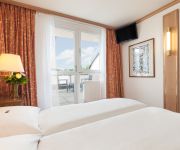
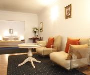
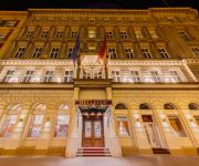
Derag Livinghotel Kaiser Franz Joseph
Arthotel ANA Gala
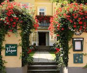
Jäger
Gabriele´s Apartment
Marthas Veranda Apartment
Apartment Annabelle
Bellevue
Mondial Appartement Hotel
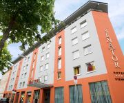
Senator
Schild
Videos from this area
These are videos related to the place based on their proximity to this place.
KOMMT KLITSCHKO NACH KLOSTERNEUBURG ZUR ORCHIDEENAUSSTELLUNG? GR. RIEBER, FPÖ hofft: JA.
GEMEINDERAT RIEBER: IN DIESEM VIDEOFORUM WERDEN SIE MONATLICH EIN NEUES VIDEO FINDEN. AKTUELLE THEMEN UND IHRE PERSÖNLICHEN ANLIEGEN, WERDEN HIER VON GR.
Westernreiten in Klosterneuburg
www.zwoelfer.name Seit kurzem wird im Reitstall Sankt Leopold (Fam. Doskar) in Klosterneuburg bei Wien auch Westernreiten angeboten. Für das Training und den Unterricht sind Nina Zwölfer...
Wirnsberger Andrea, Dr. Tierärztin in Klosterneuburg, Niederösterreich
Zu Wirnsberger Andrea, Dr. Tierärztin aus Klosterneuburg finden Sie ein ausführliches Porträt unter http://firmenabc.at/wirnsberger-andrea-dr-tieraerztin_EpGn Seit wann gibt es das Unternehmen...
Lerndiagnostik mit der LIP App in der Sekundaria (Montessorischule Klosterneuburg, 2014)
Was bringt die Lerndiagnostik-App "Lernen ist Persönlich" in der Sekundaria? Hier die das Erlebnis einer involvierten Lehrerin aus einer privaten Montessorischule GaLeMo in Klosterneuburg....
Beautysalon Magic Moments nails & more in Klosterneuburg - Nagelstudio und Kosmetikstudio
Anders als alle anderen“! So lautet das in jeder Hinsicht zutreffende Motto des Beauty-Salons Magic Moments nails & more in Klosterneuburg. Was hier so anders ist als in „normalen“...
Hochwasser Donau Wehr Langenzersdorf 05-06-2013 danube flooding
Einlaufbauwerk Neue Donau, Wehr Langenzersdorf am 5. Juni 2013.
Splash Grill-Restaurant-Cocktails in Langenzersdorf, Niederösterreich
Zu Splash Grill-Restaurant-Cocktails aus Langenzersdorf finden Sie ein ausführliches Porträt unter http://firmenabc.at/splash-grillrestaurantcocktails_BSpu Seit wann gibt es das Unternehmen?...
Autobus Wien - MAN NL 273 T3 8608 (Linie 38A Wagenwiese - Kahlenberg)
Mitfahrt im NL 273 T3 (Lion's City) 8608 der Wiener Linien auf der Linie 38A von der Haltestelle Wagenwiese über die Höhenstraße zur Endstation Kahlenberg.
River Princess Rheinfelden - Donau bei Wien (Uniworld)
Uniworld River Princess auf der Donau, stromaufwärts Grenze Wien und Niederösterreich (Langenzersdorf).
Entlastungsgerinne rinnt - Neue Donau - Wien
Einlaufbauwerk Langenzersdorf 2013-06-03 19h; 5 Schleusentore je 3m offen; Donau 9250m³/s; aktueller Pegel siehe: ...
Videos provided by Youtube are under the copyright of their owners.
Attractions and noteworthy things
Distances are based on the centre of the city/town and sightseeing location. This list contains brief abstracts about monuments, holiday activities, national parcs, museums, organisations and more from the area as well as interesting facts about the region itself. Where available, you'll find the corresponding homepage. Otherwise the related wikipedia article.
First Vienna FC
First Vienna FC is an Austrian association football club based in the Döbling district of Vienna. Established on 22 August 1894, it is the country's oldest team and has played a notable role in the history of the game there. It is familiarly known to Austrians by the English name Vienna.
Kahlenberg
Kahlenberg is a mountain located in the 19th District within Vienna, Austria.
Döbling
Döbling is the 19th District in the city of Vienna, Austria . It is located on the north end from the central districts, north of the districts Alsergrund and Währing. Döbling has some heavily populated urban areas with many residential buildings, and borders the Vienna Woods. It hosts some of the most expensive residential areas such as Grinzing, Sievering, Neustift am Walde and Kaasgraben and is also the site of a large number of Heurigen restaurants.
Kahlenberg Transmitter
The Kahlenberg Transmitter is a facility for FM- and TV on the Kahlenberg near Vienna. It was established in 1953 and used until 1956 an antenna on the observation tower Stefaniewarte. From 1956 to 1974 a 129 metre high guyed mast built of lattice steel was used. Since 1974 a 165 metre high guyed steel tube mast has been used, which is equipped with rooms of technical equipment.
Sisi Chapel
The Sisi Chapel is located in Sievering part of in the Viennese District of Döbling near the Vienna Woods (Wienerwald).
Leopoldsberg
The Leopoldsberg (425 m, 1,394 ft) is perhaps Vienna’s most famous hill, towering over the Danube and the city. Leopoldberg’s most prominent landmark is the church which stands at the top, and which is clearly visible from Vienna below. The construction of Saint Leopold's Church on Leopoldsberg began in 1679; an expansion following a design by Antonio Beduzzi was undertaken from 1718 to 1730. Other renovations were to follow.
Wien-Umgebung District
Bezirk Wien-Umgebung is a district of the state of Lower Austria in Austria. The district comprises four non-contiguous districts on the outer fringes of Vienna: these are Klosterneuburg and Gerasdorf to the north of the city, Schwechat to its south-east and Purkersdorf on Vienna's western side. Vienna International Airport, the headquarters of Austrian Airlines, and the headquarters of Niki are in the city of Schwechat, in the district.
Hohe Warte Stadium
Hohe Warte Stadium is a multi-purpose stadium in Vienna, Austria. It is located on the Hohe Warte hill in Heiligenstadt, a northern suburb in the 19th Viennese district of Döbling. Primarily a football venue and the home of First Vienna FC, it has also occasionally played host to Austrian international rugby union matches and the Vienna Vikings American Football team.
MODUL University Vienna
MODUL University Vienna (MU Vienna) is a private university established in 2007 in Vienna, Austria, focusing on social and economic development, particularly in the areas of tourism, new media information technology, sustainability, business management, and public governance. The university consists of four departments which reflect the core competences, educational, and research focii of the university.
Hohe Warte, Vienna
The Hohe Warte is a hill in the 19th district of the city of Vienna, Döbling between Heiligenstadt and Unterdöbling. There is also a street with the same name. In the 19th century, a number of villas were built on the Hohe Warte because it offered good views of the surrounding areas.
Hackenberg, Vienna
The Hackenberg is a hill in the suburb of Sievering in the 19th district of Vienna, Döbling. It is 306 metres tall. Hackenberg is covered in sand and gravel. The Arbesbach flows around the hill’s north-eastern flank, while the Krottenbach flows around its south-western flank, although both rivers have been enclosed in canals in this area. The hill extends as far as the Krim (an area in Unterdöbling) in the west.
Arbesbach (river)
The Arbesbach, also known as the Erbsenbach and Sieveringerbach, is a stream in the 19th district of Vienna, Döbling. The stream, partially enclosed in a canal, is the most important tributary of the Krottenbach. Almost all of its 4.3 kilometres lie within the suburb of Sievering.
Kaasgrabenkirche
The Kaasgrabenkirche, also known as the Wallfahrtskirche “Mariä Schmerzen”, is a Roman Catholic parish and pilgrimage church in the suburb of Grinzing in the 19th district of Vienna, Döbling. The church has been managed since 1903 by the order of the Oblates of St. Francis de Sales and is equally the seat of the branch of the order covering Austria and Southern Germany. It has had the status of a parish church since 1939.
Meiselberg
The Meiselberg is a hill in the 19th district of Vienna, Döbling. It is 291 metres tall
Schenkenberg, Vienna
The Schenkenberg is a hill in the 19th district of Vienna, Döbling. It is 345 metres tall.
Döbling Carmelite Nunnery
The Döbling Carmelite Monastery (Karmelitenkloster Döbling) is a monastery belonging to the Teresian Carmelites, a reformed branch of the Carmelites that arose out of the reform of the Carmelite Order by two Spanish saints, St. Teresa of Ávila and St. John of the Cross; the Teresian Carmelites thus belong to the Discalced Carmelites (Ordo Carmelitarum Discalceatorum). The monastery stands next to a Roman Catholic church in the suburb of Unterdöbling in the 19th district of Vienna, Döbling.
Zacherlfabrik
The Zacherl factory (Zacherlfabrik) is a former factory in the 19th district of Vienna, Döbling. It was built in an oriental style.
Schwimmtor
The Schwimmtor (Floating gate), also known as the Sperrschiff (Blocking ship), was a floating barrier designed to protect the areas along the Donaukanal in Vienna from flooding and ice. It was built by Wilhelm von Engerth, entered service on 13 December 1873, and was scrapped following World War II.
Kahlenbergerdorf Parish Church
The Kahlenbergerdorf Parish Church (Kahlenbergerdorfer Pfarrkirche) is a Roman Catholic parish church in the suburb of Kahlenbergerdorf in the 19th district of Vienna, Döbling. It is dedicated to Saint George.
Döbling Parish Church
The Döbling Parish Church (Döblinger Pfarrkirche) is a Roman Catholic parish church in the suburb of Oberdöbling in the 19th district of Vienna, Döbling.
Glanzing Parish Church
The Glanzing Parish Church (Glanzinger Pfarrkirche) is a Roman Catholic parish church in the suburb of Glanzing in the 19th district of Vienna, Döbling.
Heiligenstadt Parish Church St. Michael
The Heiligenstadt Parish Church St. Michael (Heiligenstädter Pfarrkirche St. Michael) is a Roman Catholic parish church in the suburb of Heiligenstadt in the 19th district of Vienna, Döbling. It is dedicated to the Archangel Michael.
Heiligenstadt St. James's Church
St. James’s Church, Heiligenstadt (Heiligenstädter Kirche St. Jakob) is one of two Roman Catholic churches in the parish of Heiligenstadt in the 19th district of Vienna, Döbling. It stands at the Pfarrplatz and is dedicated to James, son of Zebedee (Saint James). The church is sometimes wrongly called St. Jacob's. The confusion arises because German, like many other languages, uses the same word for both James and Jacob.
Weinbergkirche, Vienna
The Weinbergkirche is a Lutheran parish church in the Börnergasse in the suburb of Sievering in the 19th district of Vienna, Döbling.
Heiligenstädter Friedhof
Heiligenstädter Friedhof is a cemetery in Döbling, the 19th district of Vienna, Austria. It is named after the Heiligenstadt neighbourhood of Döbling. The cemetery is among the oldest of the Austrian capital, with an ossuary existing at the site from approx. 1500 and the first walls around the yard being erected in 1831. It comprises an area of 20,315 square metres, with 2,655 grave sites.


