Safety Score: 3,0 of 5.0 based on data from 9 authorites. Meaning we advice caution when travelling to Austria.
Travel warnings are updated daily. Source: Travel Warning Austria. Last Update: 2024-05-08 08:04:21
Delve into Grinzing
The district Grinzing of Vienna in Wien Stadt (Vienna) is a district located in Austria and is a district of the nations capital.
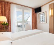
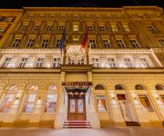
In need of a room? We compiled a list of available hotels close to the map centre further down the page.
Since you are here already, you might want to pay a visit to some of the following locations: Langenzersdorf, Klosterneuburg, Bisamberg, Korneuburg and Hagenbrunn. To further explore this place, just scroll down and browse the available info.
Local weather forecast
Todays Local Weather Conditions & Forecast: 17°C / 63 °F
| Morning Temperature | 9°C / 49 °F |
| Evening Temperature | 18°C / 64 °F |
| Night Temperature | 12°C / 54 °F |
| Chance of rainfall | 0% |
| Air Humidity | 43% |
| Air Pressure | 1024 hPa |
| Wind Speed | Gentle Breeze with 8 km/h (5 mph) from South |
| Cloud Conditions | Clear sky, covering 9% of sky |
| General Conditions | Sky is clear |
Friday, 10th of May 2024
19°C (66 °F)
13°C (55 °F)
Scattered clouds, light breeze.
Saturday, 11th of May 2024
20°C (68 °F)
15°C (60 °F)
Scattered clouds, light breeze.
Sunday, 12th of May 2024
19°C (66 °F)
12°C (54 °F)
Light rain, gentle breeze, broken clouds.
Hotels and Places to Stay
Derag Livinghotel Kaiser Franz Joseph
Gabriele´s Apartment
Bellevue
Hotel Exe Vienna
Schild
Mondial Appartement Hotel
Park Villa
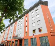
Senator
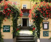
Jäger
Marthas Veranda Apartment
Videos from this area
These are videos related to the place based on their proximity to this place.
Autobus Wien - MAN NL 273 T3 8608 (Linie 38A Wagenwiese - Kahlenberg)
Mitfahrt im NL 273 T3 (Lion's City) 8608 der Wiener Linien auf der Linie 38A von der Haltestelle Wagenwiese über die Höhenstraße zur Endstation Kahlenberg.
Weingut Feuerwehr Wagner GesmbH in Wien, Wien
Zu Weingut Feuerwehr Wagner GesmbH aus Wien finden Sie ein ausführliches Porträt unter http://firmenabc.at/weingut-feuerwehr-wagner-gesmbh_oId Seit wann gibt es das Unternehmen? Seit 1683...
Meisen (Paridae)
haben sich eine Vase als Familiendomizil ausgesucht. Dank meiner unendlichen Erfahrung als Tierfilmer ist mir diese einzigartige Aufnahme gelungen.
Wien Museum Beethoven Eroicahaus
Ludwig van Beethoven (1770 - 1827) wohnte im Sommer 1803 im Wiener Vorort Oberdöbling, der damals von Feldern, Gärten und Weinbergen umgeben war. Wie viele wohlhabende Wiener Bürger ...
Friseur Frisiersalon Tomek Michael Terlitza in Wien - Friseursalon Wien-Döbling
http://www.friseur-tomek.at http://www.friseursalon-tomek.at http://www.firmenabc.at Zu Frisör Frisiersalon Tomek Michael Terlitza aus Wien-Döbling finden Sie ein ausführliches Porträt...
USA - Hymne A CAPELLA (3D Video)
Nationalhymne USA a capella gesungen. wien hymne wienhymne wiener landeshymne star spangled banner anthem usa "wiener landeshymne" "hymne wien" National "National Anthem" "United ...
Long Way From Georgia
An interpretation of the same title written by Ryan Bingham, which can be found on his album "Mescalito" (2007). (one take record)
Wie putze ich meine Zähne richtig? Radio Energy
wieso hat man seine füllungen vorwiegend im seitzahnbereich? das muss man einmal verstehen https://www.youtube.com/watch?v=N920uOXpsvI dann - kaufen sie sich eine munddusche ...
Videos provided by Youtube are under the copyright of their owners.
Attractions and noteworthy things
Distances are based on the centre of the city/town and sightseeing location. This list contains brief abstracts about monuments, holiday activities, national parcs, museums, organisations and more from the area as well as interesting facts about the region itself. Where available, you'll find the corresponding homepage. Otherwise the related wikipedia article.
University of Natural Resources and Life Sciences, Vienna
The University of Natural Resources and Life Sciences, Vienna, or simply BOKU (derived from its German name, Universität für Bodenkultur Wien, literally Vienna University for Soil Culture), founded in 1872, is an "an education and research centre for renewable resources" in Vienna. There are currently around 10,500 students enrolled at BOKU.
Döbling
Döbling is the 19th District in the city of Vienna, Austria . It is located on the north end from the central districts, north of the districts Alsergrund and Währing. Döbling has some heavily populated urban areas with many residential buildings, and borders the Vienna Woods. It hosts some of the most expensive residential areas such as Grinzing, Sievering, Neustift am Walde and Kaasgraben and is also the site of a large number of Heurigen restaurants.
Vienna Observatory
Universitäts-Sternwarte Wien (Vienna Observatory) is an astronomical observatory in Vienna, Austria. It is part of the University of Vienna. The first observatory was built in 1753–1754 on the roof of one of the university buildings. A new observatory was built between 1874 and 1879, and was finally inaugurated by Emperor Franz Joseph I of Austria in 1883. The main dome houses a refractor with a diameter of 68 centimetres and a focal length of 10.5 metres built by the Grubb Telescope Company.
Czartoryski-Schlössel
Czartoryski-Schlössel (Schlössel is roughly translatable as "small palace") was a palace in the Währing district of Vienna, Austria. It was built in 1807 for the banker Friedrich Jakob van der Nüll, the father of architect Eduard van der Nüll. The palace was subsequently put up for sale and purchased by Prince Czartoryski; it remained in possession of the Czartoryski family until shortly after World War I. The three-storey-high palace was designed in the Empire style.
Sisi Chapel
The Sisi Chapel is located in Sievering part of in the Viennese District of Döbling near the Vienna Woods (Wienerwald).
Hohe Warte Stadium
Hohe Warte Stadium is a multi-purpose stadium in Vienna, Austria. It is located on the Hohe Warte hill in Heiligenstadt, a northern suburb in the 19th Viennese district of Döbling. Primarily a football venue and the home of First Vienna FC, it has also occasionally played host to Austrian international rugby union matches and the Vienna Vikings American Football team.
Jewish cemetery in Währing
The Jewish Cemetery in Währing, opened in 1784, was the main burial site for members of the Israelitische Kultusgemeinde Wien. Besides the St. Marx Cemetery it is the last remaining cemetery of Vienna in the Biedermeier style. After its closure in the 1880s, it was partially destroyed during the time of the Third Reich, and is now only partly accessible due to its deteriorating condition.
MODUL University Vienna
MODUL University Vienna (MU Vienna) is a private university established in 2007 in Vienna, Austria, focusing on social and economic development, particularly in the areas of tourism, new media information technology, sustainability, business management, and public governance. The university consists of four departments which reflect the core competences, educational, and research focii of the university.
Lauder Business School
Lauder Business School is a business school in Vienna, Austria, operating as a Fachhochschule in the Austrian education system. It is currently headed by Rabbi Jacob Biderman who is the most senior Chabad Rabbi in Austria. There are currently 240 students enrolled in the School in two undergraduate and one graduate programs. The language of instruction is English.
Hohe Warte, Vienna
The Hohe Warte is a hill in the 19th district of the city of Vienna, Döbling between Heiligenstadt and Unterdöbling. There is also a street with the same name. In the 19th century, a number of villas were built on the Hohe Warte because it offered good views of the surrounding areas.
Hackenberg, Vienna
The Hackenberg is a hill in the suburb of Sievering in the 19th district of Vienna, Döbling. It is 306 metres tall. Hackenberg is covered in sand and gravel. The Arbesbach flows around the hill’s north-eastern flank, while the Krottenbach flows around its south-western flank, although both rivers have been enclosed in canals in this area. The hill extends as far as the Krim (an area in Unterdöbling) in the west.
Arbesbach (river)
The Arbesbach, also known as the Erbsenbach and Sieveringerbach, is a stream in the 19th district of Vienna, Döbling. The stream, partially enclosed in a canal, is the most important tributary of the Krottenbach. Almost all of its 4.3 kilometres lie within the suburb of Sievering.
Kaasgrabenkirche
The Kaasgrabenkirche, also known as the Wallfahrtskirche “Mariä Schmerzen”, is a Roman Catholic parish and pilgrimage church in the suburb of Grinzing in the 19th district of Vienna, Döbling. The church has been managed since 1903 by the order of the Oblates of St. Francis de Sales and is equally the seat of the branch of the order covering Austria and Southern Germany. It has had the status of a parish church since 1939.
Meiselberg
The Meiselberg is a hill in the 19th district of Vienna, Döbling. It is 291 metres tall
Schenkenberg, Vienna
The Schenkenberg is a hill in the 19th district of Vienna, Döbling. It is 345 metres tall.
Döbling Carmelite Nunnery
The Döbling Carmelite Monastery (Karmelitenkloster Döbling) is a monastery belonging to the Teresian Carmelites, a reformed branch of the Carmelites that arose out of the reform of the Carmelite Order by two Spanish saints, St. Teresa of Ávila and St. John of the Cross; the Teresian Carmelites thus belong to the Discalced Carmelites (Ordo Carmelitarum Discalceatorum). The monastery stands next to a Roman Catholic church in the suburb of Unterdöbling in the 19th district of Vienna, Döbling.
Zacherlfabrik
The Zacherl factory (Zacherlfabrik) is a former factory in the 19th district of Vienna, Döbling. It was built in an oriental style.
Döbling Cemetery
The Döbling Cemetery (Döblinger Friedhof) is a cemetery in the 19th district of Vienna, Döbling.
Döbling Parish Church
The Döbling Parish Church (Döblinger Pfarrkirche) is a Roman Catholic parish church in the suburb of Oberdöbling in the 19th district of Vienna, Döbling.
Glanzing Parish Church
The Glanzing Parish Church (Glanzinger Pfarrkirche) is a Roman Catholic parish church in the suburb of Glanzing in the 19th district of Vienna, Döbling.
Heiligenstadt Parish Church St. Michael
The Heiligenstadt Parish Church St. Michael (Heiligenstädter Pfarrkirche St. Michael) is a Roman Catholic parish church in the suburb of Heiligenstadt in the 19th district of Vienna, Döbling. It is dedicated to the Archangel Michael.
Weinbergkirche, Vienna
The Weinbergkirche is a Lutheran parish church in the Börnergasse in the suburb of Sievering in the 19th district of Vienna, Döbling.
Döbling Synagogue
The Döbling Synagogue (Synagoge Döbling) stood in the Dollingergasse in the suburb of Oberdöbling in the 19th district of Vienna, Döbling. It was opened in 1907 but was ruined and partially destroyed in the Kristallnacht pogrom in November 1938. Later, the synagogue was deconsecrated and in 1995, it was replaced with a modern apartment tower.
Heiligenstädter Friedhof
Heiligenstädter Friedhof is a cemetery in Döbling, the 19th district of Vienna, Austria. It is named after the Heiligenstadt neighbourhood of Döbling. The cemetery is among the oldest of the Austrian capital, with an ossuary existing at the site from approx. 1500 and the first walls around the yard being erected in 1831. It comprises an area of 20,315 square metres, with 2,655 grave sites.
Semmelweis Frauen-Klinik
The Semmelweis-Frauenklinik is a women's clinic in the 18th district of Vienna known as Währing. It is named after Ignaz Semmelweis. The clinic is registered as an historically significant place and is to be found at Bastiengasse 36–38 in Vienna. It encompasses six five-story pavilions surrounded by a park. In the complex there is a statue commemorating Kaiser Franz Joseph I of Austria, completed in 1910 by sculptor Georg Leisek.


